Our Rides in Words, Photos & Videos

Is the time shown 6:45 am correct?
Art…
The photo was taken near Brisbane Airport at approximately 34 minutes after sunrise.
Screen Shot 2021-05-05 at 14.53.24.jpg

2021-05-05-map.jpg


screenshot-2021-05-05-135920.jpg


Right click a photo in our EBR forum and choose "Open in new window."

In the address bar you'll see the photo's file name:
  • 2021-05-04-064812-2400.jpg
  • YYYY-MM-DD-hhmmss-pixels.jpg
When I show time of day in a photo's caption, I choose increments of five minutes (6:45 rather than 6:48 am).

Of course, photo files can be named anyway one chooses but the truth will still be recorded in the metadata:

Screen Shot 2021-05-05 at 14.15.08.jpg


The GPS data (courtesy of my iPhone) indicates that where the photo was taken (very close to Brisbane Airport) is just over 3º east of the line of longitude (150ºE) for Australian Eastern Time (UTC+10). In effect Brisbane has 12 minutes of 'daylight-losing' or 'winter time' all year round.

Old Curmudgeon's Gripe: I detest Apple's insistence on replacing numerical dates with yesterday, today and tomorrow. In a week from now anyone who looks at the predominantly black screenshot above won't have a clue what date was being referred to as 'Today'. Stop it, Apple!
 
Last edited by a moderator:
1620216820403.png


@Prairie Dog Loved your videos, that looked like a lot of fun! Quite a workout even on an e bike! ;) I wouldn't enjoy it on my road bike, I was in pain watching you!🤣

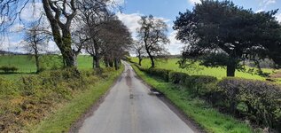
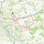
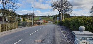
I decided to get a little more ambitious today and tackle more climbs than I normally would on a non e bike, I got a serious workout and loved it for the most part! With roads like this its worth climbing to enjoy those lovely descents!;) I didn't meet a single car on these roads, it was pure bliss!:D

1620217126853.jpeg

1620217156501.jpeg


Some nice views on this route also, I can't wait to get my motor back and enjoy these awesome roads even more!

1620217365253.jpeg

1620217388145.jpeg


1620217428097.jpeg


I'm sure my legs will be tired tomorrow but it will be a rest day anyway as the forecast isn't looking good at all...Friday is looking promising though but the weekend is going to be awful! I got lucky today as we got hit with a hail shower 10 mins after I got home, followed by rain sleet and light snow! May is normally a good month weather wise but its a different story this year, I will grab every opportunity I can of course! I had a real blast today, I will be spoiled when I get my e bike back on the road but I'm just glad to get out and enjoy cycling in any form!
 

Attachments

  • 1620217388676.jpeg
    1620217388676.jpeg
    665.4 KB · Views: 217
  • elevation_profile283.jpg
    elevation_profile283.jpg
    20.3 KB · Views: 204
  • trip-66683899-map-full198.png
    trip-66683899-map-full198.png
    449.1 KB · Views: 218
  • 20210505_092438.jpg
    20210505_092438.jpg
    636.7 KB · Views: 228
  • 20210505_092442.jpg
    20210505_092442.jpg
    571.7 KB · Views: 210
  • 20210505_093752.jpg
    20210505_093752.jpg
    408.1 KB · Views: 200
  • 20210505_093825.jpg
    20210505_093825.jpg
    302.5 KB · Views: 201
  • 20210505_094249.jpg
    20210505_094249.jpg
    436 KB · Views: 215
  • 20210505_094353.jpg
    20210505_094353.jpg
    518.1 KB · Views: 209
  • 20210505_102346.jpg
    20210505_102346.jpg
    472.2 KB · Views: 211
  • 20210505_102353.jpg
    20210505_102353.jpg
    595.4 KB · Views: 206
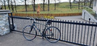
That’s a really nice looking Giant there, by the way. Obviously very well cared for, an elegant machine. Maybe doesn’t look like the greatest climbing bike in the world by that rear cluster, but what a beauty!
Its not bad for 12 years old Dave, it does have a few battle scars but its a very competent bike! It only has a 12x26 cassette but it has a 48x36x26 triple chaining so its capable of climbing!
 
An All-Mountain Kind of a Day

It turned out to be spectacular spring day for a ride as a couple of buddies and I got together yesterday for an outing on the local trails. Both of my companions were riding Specialized Turbo Levos. Kelvin on his CC and Ryan with his ride of choice, a svelt Turbo Levo SL in Battleship Blue. In a little over 2 hours, we tackled five consecutive trails starting at Mackenzie Bluff which runs along the east side of the Red Deer River. Since we had arranged to meet up on the east side of the city, the flow of the intended route would take a counter clockwise heading which was opposite of what I was normally ride. Naturally, I’m always up for a bit of a challenge and still had a blast with the guys regardless of which direction we opted for. As it worked out, the flow was actually better than I imagined.

I was only able to document the first half of our chosen route as I had forgotten to pack an extra battery for the GoPro and was almost depleted by the time we completed the run through the Pines. From Mackenzie Bluff we proceeded to round the wide-open stretch of hills at Riverbend, before making our way over the MTB park where we played on the boardwalk like a trio of juveniles. Then it was off to the Pines Single track which almost felt like it had better flow when approached from the other end of the trail. We finished our ride off with a fast blow through the Heritage Ranch and then from there we doubled back on a smaller loop at the Ranch towards our starting point in Garden Heights.

All of the trails were in exceptional conditions and the recent spell of warm temperatures and longer days helped dry out even the most stubborn damp sections. 👍
View attachment 86556
View attachment 86557
MacKenzie Bluff
View attachment 86558
View attachment 86559
MTB Park - We passed on the nearby jumps and opted instead to try our luck on the boardwalk.
View attachment 86560

View attachment 86561View attachment 86562View attachment 86563
The Pines Single Track
View attachment 86564View attachment 86565View attachment 86566
None of us were able to complete the 23% grade dirt climb up at the final forested singletrack near the completion of the ride so it was up to our bike’s walk modes to push us over the top.
View attachment 86567
Would love to see a video of you all attempting to climb the 23 % hill (-:
 
Would love to see a video of you all attempting to climb the 23 % hill (-:
It sure would have been nice to have done the climb as a finishing touch to the ride as that section of trail was bone dry but I think fatigue was also setting in with the group. Ryan appeared to struggle the most as his Levo SL delivered the least amount of torque @ 35NM. There is a MUP (in blue) just off the trail that we could have easily ridden all the way to the top but where’s the fun in that. ;)
 
Remembering those lost without trace…

Submariners' Heritage Trail : Brisbane River, Teneriffe

Submariners' Heritage Trail
Brisbane River, Teneriffe
For a time during WW2 Brisbane, with direct access to the Coral Sea, was both Generral Douglas MacArthur's GHQ and a major submarine port with around 800 US service personnel stationed near where this photo was taken on the city's major cycleway.

Plaques commemorate the thousands of submariners lost when their vessels either did not reach Brisbane or were lost, often without trace, after leaving.

Flags:
  • AU, NZ, UK, US
  • Australia's flag has the Commonwealth Star (representing the federation of states) below the Union Jack.
  • Australia's Southern Cross has white stars.
  • New Zealand's Southern Cross has red stars outlined in white.
 
Last edited by a moderator:
Today I took a robust ride to the Lost Dutchman State Park ( https://azstateparks.com/lost-dutchman/ ) at the NW base of the Superstation Mountains. The Purion controller said 66 miles but to me it felt much further. When I started my house, thermometer was reading 72ºF, got home five hours later and the house thermometer was reading 94ºF, my feet were burning up.

51160495838_ae3968bbf8_c.jpg


This is the basic route I used to get to Lost Dutchman’s State Park, with my poor navigational skills I managed to change it but in general it’s the route, I saw things that were not planned. So, I abandoned the route altogether on the return and managed to find the worst road for riding a road bike on, nearly 15 miles of it, even with a full suspension bike I think it would have been uncomfortable.

51159592762_99827288ba_k.jpg
Every thing opened up half way to my turnaround destination – through the haze you can see the south west edge of the Superstition Mountains, the center of the picture, the park is at the base just left of the vertical parts.

51161364635_00c3432634_b.jpg


I need to invest in a GPS; this is where I started to get lost, my rally notes can be seen taped to the top tube, they did not help, but got me lost, nearly ten miles. It didn’t seem at the time I would get lost – the mountain it straight ahead, but I was heading to a point nearly ten miles south of where I needed to go.

51160497813_6c88fdad79_k.jpg


Finally got to the entrance.

51161365580_b3b7450643_o.jpg


Why I rode there
 
New saddle and seat post shakedown. My first impression of the Kinekt is I thought I had a flat rear tire.

Screen Shot 2021-05-05 at 5.04.38 PM.png

Stopped off at a campground and made some adjustments: the adjustments I made did not improve things very much. So I'm going to continue to fiddle around and see if I can dial it in -- failing that, I know some people who do bike fits and can help me next week.

That thing in the pannier is a whole seat post + saddle assembly, so if things aren't working or the whole contraption falls apart on me I can still ride home if I am uninjured.

tempImageRMbYv8.jpg


What I've learned so far is that the "sweet spot" on that saddle is indeed very sweet. However, finding it and staying in it is taking some work.
 
New saddle and seat post shakedown. My first impression of the Kinekt is I thought I had a flat rear tire.

Stopped off at a campground and made some adjustments: the adjustments I made did not improve things very much. So I'm going to continue to fiddle around and see if I can dial it in -- failing that, I know some people who do bike fits and can help me next week.

That thing in the pannier is a whole seat post + saddle assembly, so if things aren't working or the whole contraption falls apart on me I can still ride home if I am uninjured.

What I've learned so far is that the "sweet spot" on that saddle is indeed very sweet. However, finding it and staying in it is taking some work.
Flat tire feel? That doesn’t sound like fun. I don’t know a thing about it but it sounds like you might have the wrong spring in there.
 
Flat tire feel? That doesn’t sound like fun. I don’t know a thing about it but it sounds like you might have the wrong spring in there.
I have the preload set maximally loose and need to tighten it a bit. That's made more complicated by the fact that after adjusting the preload I need to readjust the saddle position. So it just is going to take some fiddling to get right.
 
Today I took a robust ride to the Lost Dutchman State Park ( https://azstateparks.com/lost-dutchman/ ) at the NW base of the Superstation Mountains. The Purion controller said 66 miles but to me it felt much further. When I started my house, thermometer was reading 72ºF, got home five hours later and the house thermometer was reading 94ºF, my feet were burning up.

51160495838_ae3968bbf8_c.jpg


This is the basic route I used to get to Lost Dutchman’s State Park, with my poor navigational skills I managed to change it but in general it’s the route, I saw things that were not planned. So, I abandoned the route altogether on the return and managed to find the worst road for riding a road bike on, nearly 15 miles of it, even with a full suspension bike I think it would have been uncomfortable.

51159592762_99827288ba_k.jpg
Every thing opened up half way to my turnaround destination – through the haze you can see the south west edge of the Superstition Mountains, the center of the picture, the park is at the base just left of the vertical parts.

51161364635_00c3432634_b.jpg


I need to invest in a GPS; this is where I started to get lost, my rally notes can be seen taped to the top tube, they did not help, but got me lost, nearly ten miles. It didn’t seem at the time I would get lost – the mountain it straight ahead, but I was heading to a point nearly ten miles south of where I needed to go.

51160497813_6c88fdad79_k.jpg


Finally got to the entrance.

51161365580_b3b7450643_o.jpg


Why I rode there
Glad you didn't get heat stroke-- or not too bad, anyway! I totally understand getting lost even when it seems impossible to get lost, even when there are two or thee roads.

My sense of direction has improved a lot since the days when I drank and smoked weed, but it's still hit or miss. A couple of years ago, I bird-dogged a series of icy back roads to my local ski resort flawlessly, was so proud of myself. A month later, I got hopelessly lost taking a much simpler route, and only got to ski for three hours.

One of the logical fallacies I am struggling with: I really thought that having a new bike with roughly three times the range would mean I wouldn't worry about getting lost as much, because on my first bike, if I made a wrong turn and ran out of juice, I'd usually come up a mile or two short.

Man, was I wrong. More range means more opportunities to get lost-- and get lost much further from home.

Like I did last week by the L.A. river. Oh, and update: I did get a slow flat from riding on all that broken glass.
 
No Cakes At Marta's!

The weather forecast promised dry and relatively warm weather (silly me!) I got tempted to try legendary cakes to be found "At Marta's" in Secymin Polski, located between the northern edge of the Kampinos Forest and River Vistula. When starting from Leszno (south and centre location relative to the Kampinos National Park), I decided to use the larger (625 Wh) battery. And now @RandallS would laugh: the Giant Ride Control App demanded updating my Trance E+ prior to the ride! I was not that stupid to brick my Monster, so I rode out without real battery level measurement (save five white LEDs on the Ride Control One remote).

1620268553835.png

Near Zamczysko, or ruins of 13 c. burgh (I've actually never approached the actual site). As you can see, I put pretty lightweight clothes on (with some spares in my backpack). And then it started raining... :D

1620268861135.png

At the Kampinos Forest Museum. (Kampinos is a village southwards of the Forest, and it only gave its name to the forest and the national park). Now: most of forests in Poland are state-run. Forestry Service are uniformed people of hierarchy, and different forester's lodges are of different importance. Here, Forestry "Kampinos" in Granica, which is high in the status (centre photo). The buildings of a forest farm (top) belong to the Museum. The "Kampinos Hut" (bottom) is a site of Kampinos Forest enthusiasts.

1620269412044.png

Wet and tired, I reached the "Store At Marta's". It looks like a typical Polish countryside store, only somewhat bigger. The real asset is Marta herself. She's a nice looking young woman, talkative, and extremely friendly toward strangers. Bad luck! Famous cakes are only delivered on Thursdays and might last till Sunday, waiting for the hungry crowd of roadies! :D And that was Wednesday: no cakes! Luckily, Marta had some very tasty pączki, so I was saved. We have talked about the weather. Marta's father is a farmer, and he had said the Spring seemed to be delayed by a month this year; then we're in June, and that would be a short summer... (Father's mare foaled just the night before: the newborn colt was shaking from cold!)

1620270157591.png

Riding the Northern Ridge Bike Trail made me very tired. For some reason, the area is infested with equestrians. Horse hooves make the trail damaged, and riding such fire-roads is painful, even with a full-suspension e-MTB. Riding e-bikes on bike trails is allowed in Europe; it is the horses that make the damage to bike trails! (At least it stopped raining there).

1620270463904.png

Riding the Wilków Road was very pleasant. A brand new asphalt road (equipped with very subtle speed bumps) is empty, safe, and allows fast riding. (The pothole at the junction was the only imperfection I could spot there!)
1620270786594.png

There are several very long West-East sand dunes in the Park (remnants of an ancient glacier that stopped moving there). Of course, ages of vegetation made the hills hardened. As we really miss hills in Mazovia, the rare hills in the Park have been (rather ironically) named "Carpathians". The bike trail is very easy, save one spot, in which you need to make a jump and descend in deep sand one way, or climb a steep sandy hill the other way. (I admit I panicked and stopped just before reaching the summit on the climb) :D

1620271165818.png

Surprise! Instead of following bike paths only, I rode onto a hiking trail: to just enter a bog :D (The Kampinos Forest is made of sand dunes with marshes between them: it explains very few roads there). I got scared. Well, my e-MTB made passing the marsh feasible. I was scared, though.

1620271402959.png

I reached Leszno with my Monster running on the empty :) The flashing orange LED meant "less than 3% battery left". Normally, the large battery is good for 80 km (50 mi). Here, it lasted 40 miles only (indicating a demanding ride). I admit I gently fell on my back when unsuccessfully dismounting the bike! :D

1620271682197.png

Well, that was a good workout. And done on the day most of cyclists were scared off by raining! ;)
 

Attachments

  • 1620270651126.png
    1620270651126.png
    3.1 MB · Views: 217
  • 1620270699462.png
    1620270699462.png
    3.1 MB · Views: 224
Last edited:
There wasn't much time between the retreat of the day's relentless rain and thunderstorms and the oncoming cold front with some heavy duty winds determined to downgrade the busy hot humid breezeless morning into a jacket worthy shivering cold windy late afternoon. I think I had a 15 minute window at 3pm to do a quick cruise around the block before Ma Nature flipped the temperature gauge from hot to cold, and sent in the rushing winds to speed the transaction.

Those 15 minutes were, arguably, the most relaxing part of my extremely busy day. I did carry my jacket on the bike with me, just in case, and towards the end of my ride, when the chill winds began blowing with a vengeance over the mountain range, was seriously contemplating putting said jacket on. But the majority of the 9 mile ride-around-the-damp-block was under sunny skies with a light warm breeze. Just perfect for pedaling and daydreaming.

00001IMG_00001_BURST1620242299095_COVER_copy_1305x497.jpg


Not surprised to find some wind damaged tree limb and branches debris still piled on the sides of the roads awaiting the state road crew pick up. Now comingled with the end result of the day's rainy deluge.
IMG_20210505_151745_6_copy_612x816.jpg


I passed the entrance to this vineyard before changing my mind and circling back to get a closer look at the vines. This is still a fairly new vineyard with the grape vines in various state of overall growth. It's amazing to take stock of the enormous amount of work it takes to make a vineyard profitable. Years of nurturing vines, setting up the infrastructure for the grapes to grow, fencing against deer, fighting the annual growth of grass and weeds, fighting an army of bugs and plant diseases - all before ever seeing a dime out of years of work. Years before ever capping the first bottle of homegrown vintage.
IMG_20210505_151411_4_copy_1284x574.jpg


Someone's daydream that, over the years, has translated into reality. I'm impressed. Truly.

Since this view is on my around-the-block ride, I'll have to keep an eye open during the year for when the first grapes turn ripe enough to harvest.

The increasing winds and dropping temps finally encouraged me to stop dilly dallying on the ride and put some speed into the pedals for the final miles home before the winds got any worse. Fortunately most of my route was semi protected by surrounding woodlands and trees, and it wasn't until I crested the final hill within sight of the Blue Ridge mountains, and home, that the abruptly fierce westerly winds hit me full in the face. At least the final stretch was downhill. Downhill and cold. Far too close to home to
consider putting on my jacket for warmth ...but I did think about it.

Tomorrow the summer shorts and t-shirt will give way to warmer long pants and a sweatshirt for the ride with G and L.
 
Last edited:
Glad you didn't get heat stroke-- or not too bad, anyway! I totally understand getting lost even when it seems impossible to get lost, even when there are two or thee roads.

My sense of direction has improved a lot since the days when I drank and smoked weed, but it's still hit or miss. A couple of years ago, I bird-dogged a series of icy back roads to my local ski resort flawlessly, was so proud of myself. A month later, I got hopelessly lost taking a much simpler route, and only got to ski for three hours.

One of the logical fallacies I am struggling with: I really thought that having a new bike with roughly three times the range would mean I wouldn't worry about getting lost as much, because on my first bike, if I made a wrong turn and ran out of juice, I'd usually come up a mile or two short.

Man, was I wrong. More range means more opportunities to get lost-- and get lost much further from home.

Like I did last week by the L.A. river. Oh, and update: I did get a slow flat from riding on all that broken glass.
No heat stroke but we are soon entering the dreaded hot weather so shorter rides.
I used to ski many years ago, the lift and runs are so clear on the maps but in reality they are easy to get mixed up.
 
We do have winter but nothing like you all have, I do complain about the heat but the reality of it I don't like the cold either. I admire you and the other cold weather riders.
The Superstation Mountains once or twice in the winter are covered in snow, not lasting more than a day or two, a striking contrast to what we normally see.
 
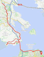
Yesterday I took advantage of the very gradual return to the “office” for a lunchtime out and back to a bike shop in nearby Larkspur, with a diversion through the headlands.

44.6mi, 2,500 feet of elevation, average speed a touch under 14 mph and 83 wH used. Weather varied from EXTREMELY windy and foggy over the bridge to warm and sunny within a distance covered in minutes!

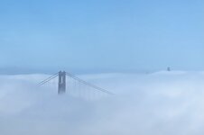
Just one picture taken on the ride, the fog and clouds which I had momentarily before ridden through.

5742E166-8E43-474B-B590-E321ABE6A54F.jpeg

at the office, ready to go.
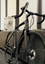
AB5A185D-D8CD-4FCE-B6D8-9B6752605ADB.jpeg

scant evidence of the city beyond...
90E9FC27-B1F6-4049-ACD3-500255641799.jpeg
 
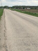
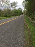
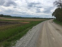
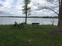
Our typical May weather has arrived. Mostly rain, wind and cool temperatures. I did 65 miles (104 Km) on Sunday and 70 miles (112 Km) today. Todays ride was west as there was not much wind, maybe 5-10 mph from the west. I rode to one of our local state parks and back. 100% roads, no bike paths but all rural. For the most part, the hills are not to bad, I got some pictures in the park and some pictures in route. I even stopped to take a picture of a bunch of buzzards. (turkey vultures).

I have gotten use to riding at 20 mph on roads. It seems slow as the bike is so stable. Used 1,410 watt hours for a mileage of 20 watt hours per mile average. That is with me pedaling the whole way. I did not start out at 100% on battery and had about 40% left. total range was probably about 95 miles. With a big battery its range or speed, take your pick. With an ultra stable bike and less than 90 miles, I choose speed.IMG_1998.JPGIMG_1999.JPGIMG_2001.JPGIMG_2002.JPGIMG_2003.JPGIMG_2004.JPGIMG_2005.JPG
 
Back