Stefan Mikes
Gravel e-biker
- Region
- Europe
- City
- Mazovia, PL
HAHAHA!Good grief: what a coincidence!
I know David's potential but Steve made me surprised with his effort!
HAHAHA!Good grief: what a coincidence!
David is the king... Long live the King!HAHAHA!
I know David's potential but Steve made me surprised with his effort!
Wow, what a gorgeous backdrop! Nice ride!Homeward bound. This was my first bike trip here and I have never found a better place to ride. View attachment 87568
It is a deal ! By the way, I found this trip in this book ,page 78 ride # 51 https://www.letsgobiking.net/Wow! David and Steve must have some unspoken connection!
Steve, once the pandemic is done, I'd love to join you on a ride.
Hey tomorrow is the Preakness...you going? take your drone!View attachment 87587
That was the hardest tire removal I have ever done! Wow, did it have some factory seal on that puppy
Finally got 'er done and went for a little ride to make sure everything was good to go.
View attachment 87588
Does this new hammock make my butt look big? HAHAHAHAHAHA
Stefan, couldn't load up these for the message so here you go.
View attachment 87589View attachment 87590
Tomorrow will be a big ride with some drone footage!
thanks for the lets go biking reference, definitely going to pursue those books, I have toured the Kettle Valley rail road trails extensively, the Naramata wine tour is even better if you can get dropped off on the mountain at the trail head near Kelowna and pedal to Penticton and work up that thirst, a nice easy ride with amazing scenery, and when the better half meets you in Naramata to tour the wineries even better! (Stefan's lead up to the cookiesz is fine but a nice pinot gris would pair up nicely)It is a deal ! By the way, I found this trip in this book ,page 78 ride # 51 https://www.letsgobiking.net/
My most exciting encounter on yesterday's ride barely matches Steve's…It was a rare two-bear sighting as we encountered them in different locations.

No couldn't get ticketsHey tomorrow is the Preakness...you going? take your drone!
The last time I was at Loch Ness this was the scariest thing I came across!1 x Magic Dragon ≠ 2 x Berry-munching Bears…
My most exciting encounter on yesterday's ride barely matches Steve's…
View attachment 87613
Puff the Magic Dragon
The Grotto Playground, Brisbane
Rab, any chance of your heading over to Loch Ness?
You are becoming a park ranger yourself , at least an ambassador. Ii seems incredible that they went hiking without a phone between them?I am combining a few short (10-15 mile) rides last week in one post, and no maps today. As Stefan would say, all my rides are "chimney" rides-- I love that! I am not 100% sure that I am supposed to be in one of these areas, but the rare times I venture there -- at twilight or shortly after-- I'm always prepared to yield to hikers or equestrians, and it's always totally deserted. It's a delight to find these pretty spots about a half hour from where I live.
None of the data from these rides is particularly remarkable, except max downhill speed with the new Maxxis Ikons on Vermont Canyon was 34 MPH or 36 if you believe Strava-- at least 2 MPH faster than on the WTB Riddlers or on the Trek kit bike, and I wasn't pushing any harder-- in fact, I think I was holding back just a little bit. The Ikons really go like hell downhill, the difference is very noticeable, almost felt a little too fast.
These were taken with a cheap-o Sony DSC-W800 point-and-shoot because it's no worse than my mobile camera, the touch-screen shutter on my mobile drives me crazy and the camera is tiny and weighs nothing. This is one of my favorite windswept trees descending Mt. Hollywood Drive...
View attachment 87593View attachment 87594
...And the shot above is the only gravel track I know of in the park. The color is only slightly exaggerated, the gravel really does have a bluish cast to it. As you can see from the tracks, other cyclists come here, but I've never seen any of them. Below is one of the few dirt roads I ride on. Only a few horseshoe prints, a few spots of horse crap that were very old. The trail seems well maintained but rarely used...
View attachment 87597
This climbs from the gravel track to Vista del Valle again... you crest the hill, round a few bends, and wind up at a nice overlook. I actually like the cheap little Sony, at max zoom in low light and around 3400 ISO, it can BARELY capture an image at all, but when I try to add the light back in my shareware editing software, it pixellates, and the digital noise breaks up into a kind of abstract impressionist pointillism. Maybe I should just stop even trying to get a realistic looking image, and reconcile myself to having all my shots having this psychedelic toy camera quality, it's not unpleasant. Here's how a view of downtown came out...
View attachment 87603
Descend a bit further.... you can see the observatory on the hilltop on the right...
View attachment 87602
And descend another mile or two down the road, and you'd reach the spot where I rescued two lost hikers earlier this week! They flagged me down, asking, "This leads back to the parking lot, doesn't it?" "Well, yes, eventually, but that's about five miles from here, and it's well after sunset." It took about five minutes to convince them to turn around. I didn't push too hard, they seemed tired, a little cranky, had no water, of course, and I figured a lighter touch would be more effective. "It's not really that dangerous, of course, but you are walking much deeper into the park, it is nearly full dark, and occasionally there are incidents here, even though they are very rare." (I did not want to patronize or stereotype them as helpless females, and in fact, would have said the same thing if they had been guys.)
They did agree to turn back, but then reported they had no phone and no idea which parking lot they had started from! They did have the phone number of their friend who had brought them, so I called him on my phone (on other days I've ridden without one, but never again!) and I figured out a rendezvous point they could both find. I offered to lead them out, but they politely refused, and of course I did not insist, just wished them luck, promised them I'd turn around if their friend couldn't find them, and resumed my trip home.
I'd gone about 3.5 miles, descended 200 feet and ascended another 300 when the phone rang again-- the guy could not find the girls. I sighed. I said I couldn't imagine how they made a wrong turn, but would he feel more comfortable if I turned around and went back and hunted for them? (Car traffic isn't allowed on Vista del Valle, and it made more sense for him to stay at the rendezvous point.) He apologized and said that yes, he would appreciate it if I did that. So I turned around, rode back, and we played phone tag until he called to let me know that he'd found them a few hundred feet down the road. Phew!
Our job done, my trusty steed and I returned, both running low on energy-- and climbed the hill AGAIN. I gave it a little more leg power the second time around, and the Moto squeezed a few more electrons from the tank, and I got home just short of reserve-- range was showing 0 miles High, 0 miles Norm, and 1 mile Eco, but wasn't blinking and didn't lock me into Eco, so Norm was available for the last part of the last hill.
If I do ever stray a quarter mile or so from roads where I am 100% permitted, and a ranger ever does stop me, I can truthfully say, "Well, I did rescue some lost hikers here a few weeks back..."
I know! It's hard to imagine two young women walking ANYwhere who did not have at least one phone! They were from out of town, dressed in what might have been tennis whites... What was even weirder was that even though they didn't have a phone, they had the phone number of their friend-- on a piece of paper in one girl's purse.seems incredible that they went hiking without a phone between them?
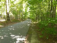
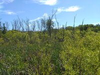
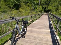
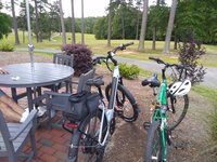
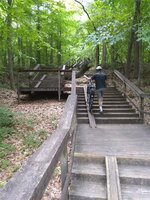
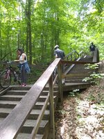
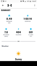
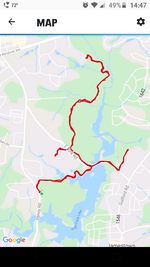
You are such a lucky dog, being able to wag your tail in such a setting and being able to ride it from your front door with no auto or rack needed.Homeward bound. This was my first bike trip here and I have never found a better place to ride. View attachment 87568
Perhaps when the border opens again you and I and Capt Slow can all go for a ride there together Alaskan old chum?You are such a lucky dog, being able to wag your tail in such a setting and being able to ride it from your front door with no auto or rack needed.
I would really enjoy that. May that day come sooner, not later.Perhaps when the border opens again you and I and Capt Slow can all go for a ride there together Alaskan old chum?