Show us pictures of where you ride your ebikes!

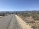
In the Okanogan Valley, Washington. I took off from my house and did a loop. North of the border it is spelled Okanagan--a bit of trivia.

OK, got ya now. Just looked it up, so you're stateside, how far from the border? Looks wonderful.
 
40 miles south. The Okanagan flourishes, the Okanogan gets by. We haven't been "discovered" yet. That can be a good thing.
 
The wind was blowing pretty good today. I had slow going up the valley, but was flying on the way back south. Made two local characters who were holding down a bench on the porch of a little store laugh and wheeze after I explained I was wearing sealed off motorcycle glasses because the spruce trees were having wild sex (clouds of pollen flying around). A mostly pleasant ride was had--19 miles on county roads. We don't have no stinkin' bike trails 'round here.....yet.

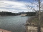
The first picture is of the Tiffanies or is it Tiffanys? They are to the west of here.View attachment 33005

The white blob is a fire safe concrete house. View attachment 33007

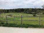
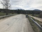
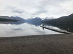
More valley scenery on the other side of the river. View attachment 33008
What is a fire safe concrete house? Is it a shelter should a bush fire break out where you might find yourself stranded?
 
What is a fire safe concrete house? Is it a shelter should a bush fire break out where you might find yourself stranded?

Somebody built a concrete and metal geodesic dome house. No shrubbery around it--nothing. A brush fire went through the area a few years ago. That house had fire burn around it, but flames were low and the house survived. Some people have pointed it out as "the" way to build. Most, including me, think it to be an ugly house with no trees or lawn or landscaping around it. This area is fire prone and the town I live in make a top ten most likely to burn list for our state. I can't figure out the latter. We've got irrigated orchards and farms on the outskirts, not a lot of conifers, we have lawns and many, including me have metal roofs. Oh well. If things got really bad, I'd grab the dog, hop on the bike, and head to the giant, irrigated rodeo grounds.
 
Last edited:
Somebody built a concrete and metal geodesic dome house. No shrubbery around it--nothing. A brush fire went through the area a few years ago. That house had fire burn around it, but flames were low and the house survived. Some people have pointed it out as "the" way to build. Most, including me, think it to be an ugly house with no trees or lawn or landscaping around it. This area is fire prone and the town I live in make a top ten most likely to burn list for our state. I can't figure out the latter. We've got irrigated orchards and farms on the outskirts, not a lot of conifers, we have lawns and many, including me have metal roofs. Oh well. If things got really bad, I'd grab the dog, hop on the bike, and head to the giant, irrigated rodeo grounds.

... except for the fact that in the 2014 fires just to the south of you over 300 homes were destroyed, 111 in Pateros and 58 in Brewster. Both were surrounded by irrigated orchards and largely treeless sagebrush. Given that the two largest fires in the history of the state have been within a few dozen miles of you it is reasonable to be a bit paranoid. I know I am.
 
... except for the fact that in the 2014 fires just to the south of you over 300 homes were destroyed, 111 in Pateros and 58 in Brewster. Both were surrounded by irrigated orchards and largely treeless sagebrush. Given that the two largest fires in the history of the state have been within a few dozen miles of you it is reasonable to be a bit paranoid. I know I am.

We had the Pennines and Moors burning in February? We ain't had much rain since.
 
... except for the fact that in the 2014 fires just to the south of you over 300 homes were destroyed, 111 in Pateros and 58 in Brewster. Both were surrounded by irrigated orchards and largely treeless sagebrush. Given that the two largest fires in the history of the state have been within a few dozen miles of you it is reasonable to be a bit paranoid. I know I am.

I am aware of that. The Carlton Complex was fueled by the wind and Yes, that could happen here, but probably won't. I am from Wenatchee and couldn't believe that they were building houses on the hills that burned every couple of years there. That is part of the equation too. "Grass fires" are part of the ecosystem here.

I did get a kick out of a facebook post when Twisp was threatened. A guy I used to work with posted that he was staying put and that he and the other old smokejumpers would save the town.

Anyway, should the unthinkable head this way and if I can't get out with travel trailer and truck, the bike evacuation route to the Stampede Grounds is a good alternative. Must remember to throw in the charger. :)
 
Alaskan, this is great! What bike do you have and what is this software?
23 mile ride up the Skagit River and then another 23 back down again. 78 degrees, dry and sunny...perfection. I For the last ten miles, I put it in Turbo and started pushing the pedals to cadence of around 90 and me to a 130 BPM heart rate, bringing the speed up to the mid-twenties. I his 20% on the first battery at mile 40 and swapped in a second battery and used 30% doing the 7 miles sprint to the finish.


View attachment 22795
 
Hi I was just wondering, How do you post a picture on this thing? I can attach a file and it shows up as a thumb nail on my post but how do you get an actual picture to show up on the post all nice and pretty-like? Thank you
Hiya;
Thumbnails are actually the preferred choice, per Court's own posting in the forum Rules / How To -- particularly because they consume less bandwidth for Forum users who are viewing the site on mobile/cellular devices, when not connected to wifi.
(Any thumbnail in a post can then be clicked on by a viewing Member, to open the larger version of the image.)
 
Alaskan, this is great! What bike do you have and what is this software?
I have a couple of Riese & Muller bikes. They have Bosch drive systems. The print out that I posted is from Bosch's Ebike connect website for owners of the Nyon display, data, gps and ride computer that was an option in Europe but never supported in North America.

Here are links to a couple of threads I posted about the different Bosch display options and how to do a Nyon retrofit on a Bosch powered bike in the USA

https://electricbikereview.com/forums/threads/5-bosch-display-choices-good-bad-and-ugly.27035/
https://electricbikereview.com/forums/threads/nyon-retrofit.16260/
 
Wenatchee on the long way to the airport to pick up a rental car...

gxOl3sL+SJSct4OTv1Mnyw.jpg
R1O8VCX0TT+3HHQuO5yEmw.jpg

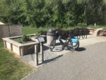
Love the bike pump at the trailhead. Now that is bike infra!
 
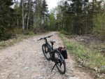
A little warmer today, maybe 15°C/59°F, so I went for a ride in the afternoon.
It’s 10 days now since I picked up my new bike. After the ride home from shop I gave it a full charge as per instruction in the owners manual. This was Tuesday 30th April. 8 days later it was time for charging again. Battery was at 21% and due to low temperatures I hadn’t ridden as much as I wanted but I got 75 miles (120km) using 79% of a full battery. I’m satisfied with that even if I know I didn’t ride fast.
Today’s ride was 35km. It started as a 2 layer ride but at the turning point I added 1 layer between my wool t-shirt and the windbreaker jacket. Also put on a cap and gloves. Then I was fine.
8D1DC430-CC2B-4E44-B6CE-C11FDEA06018.jpeg 7AE72DEF-B06C-4D28-BD61-56B38B3656F5.jpeg A4A1FBCD-4DA4-4817-A38C-93F91804FC68.jpeg
AD5FE901-AEA5-4723-A60A-B3428F6A07B8.jpeg 131227AC-86A5-4385-95BD-2ACC94765548.jpeg D13551C9-4DB7-4AFA-85EA-58B4954E59C4.jpeg

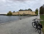
All pictures are from the island Lovön. The green dot is where last photo was taken. The kings castle is about 6 miles from where I live.
 
Last edited:
On the way to Glacier National Park:

xjySNxiyT1yhGSE8ZSWkKA.jpg

2IiDihD7RWGHaa50NFXE9Q.jpg

T%+GSlu+TIKcIu0HdPWTaQ.jpg

I'm finding snow patches around 3000 feet or so. That might make things sporty as my planned routes through the Purcells and Selkirks are on roads that are much higher than that. Perhaps a rethink is in order...
 
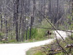
Today's ride was special. I had a first. I've never seen a moose in the woods before. I've seen their tracks but no moose. I even missed seeing the moose that wandered up our street last year. So, today's ride was dubbed Le Tour De Moose. We took off from the snowpark/camping area on the South Summit of Loup Loup Pass (hwy 20) in Warshington, the state. This road soon enters an area that was fried pretty good during the Carlton Complex fire a few years ago. We noticed a lot of willow growing in the area and after seeing moose number one, decided they must be munching on that. Moose number one was quite shy and trotted off before I could get my camera out. Farther down the road, moose number two appeared in the road. Moose 2 stayed put and stared at us while we tried to get pictures. This picture is as close as I could get. My little camera was zoomed as much as it would go. We rode 22 miles total on a road that was like our own bike path. Maybe 5 vehicles went by? The Sunflowers (local term for Balsam) were at peak. I felt like I was back in the Mt St Helens blast area while we were in the burn. The moose sightings made it a very special ride.
 

Attachments

  • DSC00768.JPG
    DSC00768.JPG
    7.8 MB · Views: 24
Back