Our Rides in Words, Photos & Videos

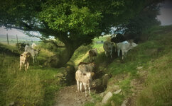
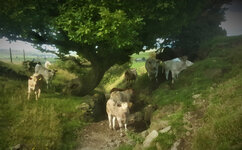
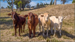
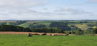
Brueghal I thought looking at the bucolic scene. Also I thought Charolais cattle…which I have found to be dangerous in the confines of the stockyard
Yes, that painter does come to mind. Thanks.
 
That picture of the cows/bulls could be an 18th century painting in a museum. The colors and lighting and composition. I really like it.

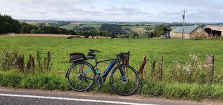
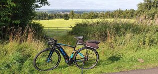
The muddy bike, not so much! (g)

On second look that darn ear tag ruins the 18th century mood - maybe they had ear tags back then?
It did feel like that at the time, like stepping back to a bygone age; Old Oak tree, Spring water trough and baby bulls, awww.
 
Torque to the animals …

The ride that ended near the golf course invaded by kangaroos (previous page), started 123 km away. For me this is unusual: normally my rides ended at the same place that they started, but this ride was different. I took the train from a quieter station near Ipswich (to the west of Queensland's capital city) to Petrie to its north.

Riverview Station, Ipswich

6:15 am, near Ipswich
Petrie to Riverview — Map


It was a long ride home and I became so disorientated that I ended up on the savannahs of Tanzania… or so it seemed.

Giraffe beside Moreton Bay Cycleway, Rothwell

Moreton Bay Cycleway
Rothwell, Redcliffe Peninsula

You starin' at me, Ms Funny Neck?

2021-08-20-142932-2000.jpg

Royal Spoonbill (Platalea regia)
Kedron Brook Wetlands Reserve

But back to family values:

Black Swan, Cygnus atratus

Black Swan
Cygnus atratus

Black Swan & Cygnets

Black Swan & Cygnets
Schulz Canal / Jim Soorley Bikeway
Photos were taken from the Moreton Bay Cycleway. There was no need to 'go look' for the birds as they were as close to the cycleway as the giraffe (cycleway visible in that photo). Safari at home!
 
Last edited by a moderator:
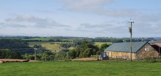
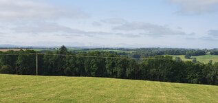
Another beautiful day for cycling, the second half of August has made up for the awful first half! There was a risk of fog this morning but when I set off it was looking good! See how calm the water is, very little wind once again!

View attachment 97749
View attachment 97750

A few miles further and the mist descended but none of the thick fog they were forecasting!

View attachment 97751

Thankfully it cleared up on my return journey!

View attachment 97752

Lots of climbing and descending once again, I was only intending to do around 35 miles but my return road was closed so I had to divert which turned out to be a blessing as the roads were very quiet and pretty awesome! I decided to slow down a bit today (well slow for me ;)) as my legs have been feeling it recently, I'm no spring chicken now!🤣 I do think I have been overdoing it a bit so I will try to resist the temptation to ride like a nutter!;) I was finding it more relaxing going a little slower, its very theraputic!:)
Those images of the lush countryside look amazing and the open roads are ostensibly a beckoning call to anyone fortunate enough to ride on them. Weather here has also been somewhat hit-and-miss. The past few weeks it was too hot and smoky to ride much of the time and more recently the rains have us scrambling to re-schedule outings. Fortunately, there’s still time before much cooler days are upon us and I look forward to making the most of it.
 
Unnerving though, i came around the corner and this was what greeted me, a further dozen or so came down the bank behind and blocked the gate :eek:

All bulls, the big ones are the black mass on the right they look like 3yo.

What you can't see is that there is a spring where the little ones are on the path, i give them 5 minutes to finish drinking then moved them on :)

Onwards and upwards....
Holy Cow! Sorry, that’s the first thing that came to mind. Wonderful scenes. Btw, Mudhuggers Rock!
 
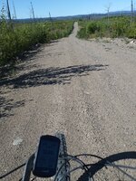
As Haystack avoids the 4 legged critters we are trying to keep track of ours out on open range - but it gives me all the excuse I need to pedal around the Bobtail Mountains and even finding some smooth dirt roads that I suspect have seen very little traffic of any sort, lots of blueberry bushes but I must say I prefer the huckle berries we pick in southern Alberta and BC20210824_103119.jpg
20210824_095612.jpg
 
We don't do 'bucolic' here…

Pine Mountain Cattle Property

Pine Mountain, Brisbane Hinterland
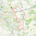
22 km on map
These youngsters reminded me of having class photos taken at school: arrange yourselves by height, look straight at the camera and don't move!

It was a cold and windy day so I kept close to home, riding the gravel roads through the sheltered valleys. Brrrr!

Pine Mountain : Ride from Home
 
Last edited by a moderator:
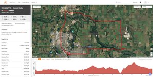
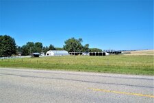
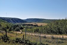
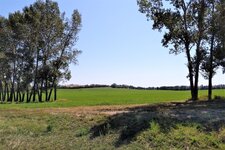
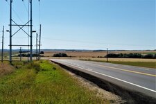
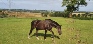
The days are becoming slightly cooler as we approach the end of August. Today’s rural outing, however, was particularly rewarding as there was barely a cloud in the sky and the winds were relatively calm though we did face a stiff southwesterly on the return leg. Even our four-legged friends seem to be relishing their time in the fields.
IMG_20210825_1136565.jpg

Web capture_25-8-2021_231519_ridewithgps.com.jpeg
Red Deer hasn’t experienced the urban sprawl as our more populated neighbors to the north and south have but encroaching development is quite evident as seen on this district of neighboring farmland on the eastern side of the city.
IMG_20210825_1152574.jpg

Fallen heads on this field of barley indicate that harvest season is upon us.
IMG_20210825_1224216.jpg

IMG_20210825_1229484-panorama.jpg

One of many small farming operations that dot the rural landscape.
IMG_20210825_1233087.jpg
A pastoral setting.
IMG_20210825_1236572.jpg

Carrying on with the bovine theme but as typically seen on the western prairies.
IMG_20210825_1311592.jpg


IMG_20210825_1206049.jpgIMG_20210825_1236497.jpgIMG_20210825_1256269.jpgIMG_20210825_1326387.jpg

 
How I Crossed The "Green Border" With Slovakia (and other stories)
(Saturday 21st of August 2021. Base: Krynica-Zdrój)

Sentimental again! Can't exactly remember the year (it could be 1983 again) when I set off for a mountain hike in Low Beskid with a group of students from my University faculty. We started from Krynica-Zdrój (a renowned spa), hiked wild paths, watched wooden Uniate churches, and lived in tents at simple camping sites, or in schools (empty on vacation time and made available to hikers). Of course, it was not possible to cross the Czechoslovak border in those times. I liked the green low mountains very much: everything was so beautifully climatic! We reached Wysowa-Zdrój on our hike. While Krynica-Zdrój has been a renowned spa since 1856, Wysowa-Zdrój, well, only had mineral water springs in 1980s.

We lived in tents in the camping site, taking a bath in River Ropa, and there I met a girl who I liked very much. We went for a stroll to what is called "Spa Park" nowadays. It was a grove then, with mineral water taps here and there, and small plates indicating the name of the spring. We were drinking water, enjoying ourselves, and when it was dark and we were walking by the back of the Border Protection Forces station, someone shot above our heads! We both fell down and kissed each other. That was so romantic! (Nothing developed from that relationship anyway, alas).

Around 9 am. on last Friday, I drove into the first met paid parking lot in Krynica-Zdrój. "Mr. Parkingowy" (parking lot attendant) wanted me to pay in advance (the prices there are hefty!). He softened when he saw my Vado. He was totally fascinated with my e-bike! He was touching it, observing the display, the dashboard of BLEvo on my smartphone, and asking numerous questions. He was shocked to learn the e-bike had no throttle! :D In the end, he agreed to calculate the parking price post-ride, based on actual number of hours used. I only had to be back before 6 pm. I was so dazed with his behaviour that I almost crashed when I first stamped on the pedals! :D

1629966180893.png

The highlander pictured here uses his britzka as a cab for tourists.
Krynica-Zdrój is located in Beskid Sądecki Mts., and the streets are very steep there (actually, you need to climb hard to leave the city. RideWithGPS tells me the max grade of that street was 10%).

1629966881404.png

I made route-planning wrongly again by selecting "MTB" as the route type :D To leave Beskid Sądecki for Beskid Niski (Low Beskid), I was directed onto the "road" made from concrete slabs. That hurt. Yet what I could see in the end, rewarded me totally: Low Beskid as I remembered it from my youth.

1629967085502.png

Mt. Lackowa (997 m.a.s.l.), or, the highest summit of Polish Low Beskid. Yes, the "Low" in the mountain range name is true! A hiker I met was just pulling a pair of good boots on and told me the climb wouldn't be easy though (I knew it, I hiked there in the past).

1629967324925.png

Some part of my ride included a mild but long climb on a totally straight road. Here, a recent Łemko tombstone (Łemkos are still living there as that area was not the subject to the mass deportation post-WW2).


1629968240048.png

On my way right to Wysowa-Zdrój, I was stopped by a motorcade :D Several hundred of motorbikes (assisted by the police) took the whole road width!

1629968447459.png

Another romantic couple on the River Ropa in Wysowa-Zdrój.

1629968511424.png

Oh no! My romantic wild grove has been groomed since! And you cannot drink mineral water right from the spring anymore! (Bye-bye, my remembrances...)

1629968715308.png

So I wept, and then bought me a cup of "Anna" mineral water. Just after having had paid, I read an information table; I shouldn't drink that specific water! It could harm me because of my specific illnesses! I drank it anyway. Then I felt I got enormous increase of my energy! "Anna" must've really done a harm to me because I got a crazy idea to cross the Slovak border over a hiking trail! With my Vado! :D

Before I went on that insane ride, I queried several hikers: "Easy trail. Steep though" was a typical answer. A rough gravel road, then asphalt, then gravel again, steeper and steeper... I rode in low gear, Turbo mode on. "Are we there yet?" -- I smiled to a passer-by. The hiking party were totally shocked seeing me climbing on my e-bike -- "You're almost there!" -- an attractive lady smiled back. And I was there.

1629969004649.png

Holy Mt. Yavor. The holiest place for Łemkos.

I drank some (holy) water from the well and got even more insane :) There was a group of girls descending from the hill. "Are you coming from Slovakia?" -- "No, we've just been at the Slovak border!" -- "Hard trail?" -- "No, very easy! And very close!" -- so I rode into the woods.

1629969641665.png

A beautiful sight appeared in front of me. I rode along the border, got into forest. Negotiated mud and puddles. Walked. Rode. Walked. To reach the summit of Mt. Cigeľka (Little Brick) with the border sign and direction signs.

It is very interesting how few people understand the concept of freedom, and of border-less European Union. No-one I talked with thought they might cross the border! Please... As long you have a "vaccination passport" on your smartphone, you are free to go wherever you please here. It is some mental block preventing people to cross borders. As if some invisible barrier was there. I had no such objections, and rode/walked in Slovakia.

1629970379446.png

What a view! Left: Busov Massif. Right: Lackowa Massif. Far forward: Beskid Sądecki. Near forward: The mountains I had to ride soon. Small hill in the foreground hides the village of Cigeľka.

1629970425181.png

I took that photo only to prove I was to Slovakia :D

1629970488888.png

Although Slovakia sports wonderful landscapes, I am not fond of her inhabited areas. My GPS navigation told me to cross the hills by MTB trail. No way! (Only now I could discover my route-planning mistake). So I quickly re-planned my route and zoomed southwards by roads. (I should be at the parking lot in Krynica before 6 pm!)


A sad social note
There is a huge population of Roma (Gypsy) people in Slovakia. I passed their settlement (or should I better call it "slums") twice. The level of poverty was depressing there: wooden houses made of reclaimed planks, no windowpanes, collapsed roofs. And a lot of young children. That sight made me very, very sad... I'm not ready to discuss the Roma/Gypsy issues here though.

1629970959221.png

Mt. Busov (1002 m), the highest Slovak Low Beskid summit. I could watch it from all world directions (except of east). There was a murderous climb from Sveržov just before. Later, Strava told me that was a popular KOM segment. I recorded 10th place overall there :D If I knew it before! (View from the south).

1629971198038.png

Mt. Busov, view from the southwest. See the road and village below: I was riding there some time earlier.

1629971830390.png

On the main road again! 4.4 km to the Polish border, and 16.7 km to Krynica-Zdrój. Slovakia has an excellent system of bike trails (road and MTB, separately), and the directions signs are very useful. (The hard climbs were ahead again).

1629972002402.png

It's good to ride an e-bike... ;) I reached the Polish border, singing :)

1629972161879.png

Detailed ride map.

1629974212628.png

3D Ride Map.


Back to the parking lot. Mr. Parkingowy instantly looked at my display to find out over 70 km ridden there :) And I tell you what: He gave me one hour of parking free. The final price was PLN 40 (US$ 10). After that, I relocated to another spa, Piwniczna-Zdrój, to an excellent hotel "Majerzanka" (more on that in the next, and last report).
 
Last edited:
We don't do 'bucolic' here…

View attachment 97843
Pine Mountain, Brisbane Hinterland
22 km on map
These youngsters reminded me of having class photos taken at school: arrange yourselves by height, look straight at the camera and don't move!

It was a cold and windy day so I kept close to home, riding the gravel roads through the sheltered valleys. Brrrr!

View attachment 97827
They are also arranged by shades of beige to brown.
 
The Three Crowns Ride (via Slovakia)
(Sunday 22nd of August 2021. Base: Piwniczna-Zdrój)

The route
There is no direct road between two spas (Piwniczna-Zdrój and Szczawnica-Zdrój), as they are separated by the huge Radziejowa Range of Beskid Sądecki. Possible options are:
  • A 60-km (one-way) trip via dangerous and boring main highway in Poland
  • A 30-km MTB ride if you own an MTB and can ride it over technical terrain...
  • Or, a 45-km exciting road ride via Slovakia. The two-way trip requires six demanding climbs, though :) That was the route I selected for the Sunday ride.
1629999540285.png

This is how border-free Europe looks like. You just select the most convenient route for you. (East view).

At 8:48 am. on Sunday, I started my ride from the "Majerzanka" hotel (more on the hotel later).

1630000546455.png

In five minutes, I crossed the River Poprad Bridge and found myself in the Slovak Republic. Two Slovak policemen looked at me riding the Vado with interest, no other action. That road was historically named "The Hungarian Tract". For me, it meant constant climbing with the growing level of difficulty until I reached the Vabec Pass.

1630000769291.png

Then, there was a long descent down to Stará Ľubovňa along a farming valley. The mountain range as seen was what I had to negotiate soon.


1630001012614.png

The Slovak harvest: The foreman came in his truck followed by two combine harvesters and the work commenced :)

1630001234381.png

The harvest in its full. Necessary to mention, there was a long roadworks area on my northern leg of the ride, regulated by traffic lights. There was a countdown timer that indicated the time left to cross the roadworks segment. It was four minutes maximum, and that was not very much for an e-bike. I had to negotiate that segment in the Turbo mode, and to muster possibly high speed while riding uphill!

1630001793393.png

I managed to climb up the Stráňany Pass to see that magnificent sight. See a triple peak at the right hand side: that's the Trzy Korony (Mt. Three Crowns), the pride of Poland's Pieniny Mts.


It is something funny about the Three Crowns. While located on our side of the River Dunajec, the summit is invisible from the Polish side! :D There are only two option for a Pole to see our Triple Crown:
  • Go to Slovakia, for instance from the side of the Lake Czorsztyn, or
  • Do river rafting over the River Dunajec.
And the latter is what most of Poles used to do, and what they still do. I chose the "Slovak view" :)

1630002521590.png


A Slovak roadie energetically climbing the Stráňany Pass from the harder side. E-bikes are a rare thing there (I couldn't spot a single one there; so different compared to the Czech Republic!)

1630002673631.png

When I was hoping the hardest part was behind me, the most difficult climb started. Here, a Slovak MTB school. I noticed the instructor had taught the youth how to use brakes very well, as the group was descending at reasonable speed.

1630002836328.png

Views from the Lesnica Pass. The village in the valley is Veľký Lipník, which is the westernmost of Łemko settlements.

1630002997955.png

There was a kiosk atop the Lesnica Pass. The Slovak owner could speak good Polish (and yes, you could pay with a card there). There were many Slovak and Polish tourist there. Most of the Polish were cyclists, by the way (you cannot drive up with your car directly from Poland there, and it is too long way to hike). The international relaxed atmosphere was fantastic! People of both nations talking to one another, taking group pictures, and joking. I bought me coffee (EUR 1.80) and a small bottle of Slovak mead for EUR 4.70. (Of course I didn't drink alcohol on that trip!)

1630003417848.png

Mt. Three Crowns (at the left) as seen from the Lesnica Pass.

1630003489764.png

Lesnica and Szczawnica are connected by some 4-5 km MUP along River Dunajec. I hated that. Crowds! Festivity! Hard to ride through the crowd, and the number of bikes and britzkas there was enormous. The worst of all were 4-people pedal operated cabs that were taking the whole width of the MUP at the narrowest places.
In this picture, the right hand side is flanked by (invisible here) cliffs of Pieniny (of hard limestone).

1630003814551.png

Want to see the Three Crowns? Take a guided tour on a wooden raft from the Lake Czorsztyn, or rent a pontoon. Strangely enough, I have never been on such a trip even if these are greatly popular.

1630004048423.png

Tired with the crowds, I rode in Szczawnica-Zdrój, and climbed up to the Upper Spa Park, where I had a cup of "Stefan" mineral water :)

1630004135371.png

On my return on the MUP along the River Dunajec. I was riding on the last electrons of the battery #1. It died just before the return Lesnica Pass climb.

1630004251871.png

Back to Stráňany Pass. Like in the Alps, the cows were equipped with cowbells, making terrible noise. Yet, MORE COWBELL! :D


A Slovak Roadie Chase
During my descent from the Stráňany Pass, I was overtaken by a roadie. "Oh you..." I started chasing him. As the descent became mild, I needed to pedal. Guess what? I hit the 45 km/h limiter but he rode faster than I... He got slowed down by roadworks, and I entered that segment when the traffic light was just turning red. I continued the chase and caught up with the roadie at a road junction in Hniezdne. I congratulated him, we shook our hands, he asked me for the distance ridden so far, and then he said: -- Why don't you go there for some whiskey? -- and he pointed at an interesting place opposite.

Some Slovak person has built an " American Old West" farm there, with a whiskey distillery :D Oh no, I excused myself with the lack of time.

Now, I wanted to take a photo of an impressive Stará Ľubovňa Castle. What a surprise. The castle was totally invisible from the road, hidden by tall trees. Honestly, the Slovak could just cut several of those worthless trees to make a panorama of the castle visible. What a strange nation....

1630005083000.png

Exhausted after the last significant climb onto the Vabec Pass. Fortunately, all the way ahead was downhill :)

1630005177065.png

I returned to Hotel "Majerzanka" for lunch in its restaurant. There was a grill & beer garden as well. The band consisted of highlanders who not only played good music but also were telling witty jokes :) Necessary to mention their music was not Tatra style (I hate the latter).

Hotel Majerzanka Praise
After having had stayed for two nights at the "overnight accommodation", and a night at a mediocre spa hotel, I found a family owned hotel "Majerzanka" in Piwniczna-Zdrój to be just fabulous:

  • All conveniences available
  • The owner always on guard, and extremely helpful
  • Perfect location, just five minutes of a bike ride to Slovakia, by bridge over River Poprad
  • Privately owned free parking lot.
Mr Robert Franczak created the hotel first in 2018 by wisely using EU regional development money to extend his existing restaurant with a hotel, and he could survive the grim times of the pandemic lockdown successfully.

1630001641473.png

Detailed Ride Map with POI.

1630005421865.png

Then I relocated to Maniowy on the Lake Czorsztyn. See the Tatra Mountains (the highest we have in Poland).

And then it started heavily raining throughout Poland. My vacation was over.

Thank you for your patience!
 
Last edited:
HI Team,

I just came across this thread (thanks David Berry) and thought I'd share my ride from back in February as I can only reminisce about those freedoms as New Zealand finds itself back in lockdown at the moment!

I wrote a blog post about it with all the details here:


But I'll include a few photos and video here too:


2021-02-05-13.16.06-rotated.jpg


2021-02-05-16.40.11-rotated.jpg
2021-02-05-18.38.13-rotated.jpg
2021-02-05-21.28.19-rotated.jpg

EtgfPXtUUAIGhop
2021-02-06-15.23.37-rotated.jpg
Day-1.png

Day-2.png


Again, the full blog is here: https://samuelmcneill.com/adventures/waitangi-weekend-ebike-wandering-february-2021/

It was a wonderul overnight trip and I loved every bit of it!

Cheers
Sam @ New Zealand
 
Back