How I Crossed The "Green Border" With Slovakia (and other stories)
(Saturday 21st of August 2021. Base: Krynica-Zdrój)
Sentimental again! Can't exactly remember the year (it could be 1983 again) when I set off for a mountain hike in Low Beskid with a group of students from my University faculty. We started from Krynica-Zdrój (a renowned spa), hiked wild paths, watched wooden Uniate churches, and lived in tents at simple camping sites, or in schools (empty on vacation time and made available to hikers). Of course, it was not possible to cross the Czechoslovak border in those times. I liked the green low mountains very much: everything was so beautifully climatic! We reached Wysowa-Zdrój on our hike. While Krynica-Zdrój has been a renowned spa since 1856, Wysowa-Zdrój, well, only had mineral water springs in 1980s.
We lived in tents in the camping site, taking a bath in River Ropa, and there I met a girl who I liked very much. We went for a stroll to what is called "Spa Park" nowadays. It was a grove then, with mineral water taps here and there, and small plates indicating the name of the spring. We were drinking water, enjoying ourselves, and when it was dark and we were walking by the back of the Border Protection Forces station, someone shot above our heads! We both fell down and kissed each other. That was so romantic! (Nothing developed from that relationship anyway, alas).
Around 9 am. on last Friday, I drove into the first met paid parking lot in Krynica-Zdrój. "Mr. Parkingowy" (parking lot attendant) wanted me to pay in advance (the prices there are hefty!). He softened when he saw my Vado. He was totally fascinated with my e-bike! He was touching it, observing the display, the dashboard of BLEvo on my smartphone, and asking numerous questions. He was shocked to learn the e-bike had no throttle!

In the end, he agreed to calculate the parking price post-ride, based on actual number of hours used.
I only had to be back before 6 pm. I was so dazed with his behaviour that I almost crashed when I first stamped on the pedals!
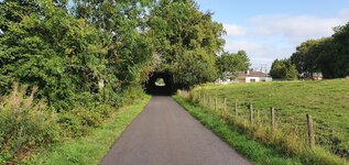
The highlander pictured here uses his britzka
as a cab for tourists.
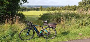
Krynica-Zdrój is located in Beskid Sądecki Mts., and the streets are very steep there (actually, you need to climb hard to leave the city. RideWithGPS tells me the max grade of that street was 10%).
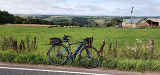
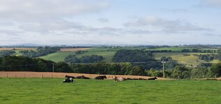
I made route-planning wrongly again by selecting "MTB" as the route type To leave Beskid Sądecki for Beskid Niski (Low Beskid), I was directed onto the "road" made from concrete slabs. That hurt. Yet what I could see in the end, rewarded me totally: Low Beskid as I remembered it from my youth.
Mt. Lackowa (997 m.a.s.l.), or, the highest summit of Polish Low Beskid. Yes, the "Low" in the mountain range name is true! A hiker I met was just pulling a pair of good boots on and told me the climb wouldn't be easy though (I knew it, I hiked there in the past).
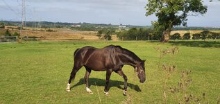
Some part of my ride included a mild but long climb on a totally straight road. Here, a recent Łemko tombstone (Łemkos are still living there as that area was not the subject to the mass deportation post-WW2).

On my way right to Wysowa-Zdrój, I was stopped by a motorcade Several hundred of motorbikes (assisted by the police) took the whole road width!
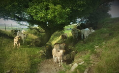
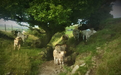
Another romantic couple on the River Ropa in Wysowa-Zdrój.
Oh no! My romantic wild grove has been groomed since! And you cannot drink mineral water right from the spring anymore! (Bye-bye, my remembrances...)
So I wept, and then bought me a cup of "Anna" mineral water. Just after having had paid, I read an information table; I shouldn't drink that specific water! It could harm me because of my specific illnesses! I drank it anyway. Then I felt I got enormous increase of my energy! "Anna" must've really done a harm to me because I got a crazy idea to cross the Slovak border over a hiking trail! With my Vado!
Before I went on that insane ride, I queried several hikers: "Easy trail. Steep though" was a typical answer. A rough gravel road, then asphalt, then gravel again, steeper and steeper... I rode in low gear, Turbo mode on. "Are we there yet?" -- I smiled to a passer-by. The hiking party were totally shocked seeing me climbing on my e-bike -- "You're almost there!" -- an attractive lady smiled back. And I was there.
Holy Mt. Yavor. The holiest place for Łemkos.
I drank some (holy) water from the well and got even more insane
There was a group of girls descending from the hill. "Are you coming from Slovakia?" -- "No, we've just been at the Slovak border!" -- "Hard trail?" -- "No, very easy! And very close!" -- so I rode into the woods.
A beautiful sight appeared in front of me. I rode along the border, got into forest. Negotiated mud and puddles. Walked. Rode. Walked. To reach the summit of Mt. Cigeľka (Little Brick) with the border sign and direction signs.
It is very interesting how few people understand the concept of freedom, and of border-less European Union. No-one I talked with thought they might cross the border! Please... As long you have a "vaccination passport" on your smartphone, you are free to go wherever you please here. It is some mental block preventing people to cross borders. As if some invisible barrier was there. I had no such objections, and rode/walked in Slovakia.
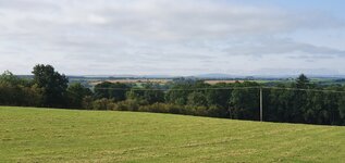
What a view! Left: Busov Massif. Right: Lackowa Massif. Far forward: Beskid Sądecki. Near forward: The mountains I had to ride soon. Small hill in the foreground hides the village of Cigeľka.
I took that photo only to prove I was to Slovakia
Although Slovakia sports wonderful landscapes, I am not fond of her inhabited areas. My GPS navigation told me to cross the hills by MTB trail. No way! (Only now I could discover my route-planning mistake). So I quickly re-planned my route and zoomed southwards by roads. (I should be at the parking lot in Krynica before 6 pm!)
A sad social note
There is a huge population of Roma (Gypsy) people in Slovakia. I passed their settlement (or should I better call it "slums") twice. The level of poverty was depressing there: wooden houses made of reclaimed planks, no windowpanes, collapsed roofs. And a lot of young children. That sight made me very, very sad... I'm not ready to discuss the Roma/Gypsy issues here though.

Mt. Busov (1002 m), the highest Slovak Low Beskid summit. I could watch it from all world directions (except of east). There was a murderous climb from Sveržov just before. Later, Strava told me that was a popular KOM segment. I recorded 10th place overall there If I knew it before! (View from the south).
Mt. Busov, view from the southwest. See the road and village below: I was riding there some time earlier.
On the main road again! 4.4 km to the Polish border, and 16.7 km to Krynica-Zdrój. Slovakia has an excellent system of bike trails (road and MTB, separately), and the directions signs are very useful. (The hard climbs were ahead again).
It's good to ride an e-bike... I reached the Polish border, singing
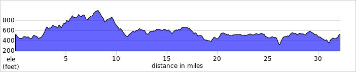
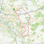
Detailed ride map.
3D Ride Map.
Back to the parking lot. Mr. Parkingowy instantly looked at my display to find out over 70 km ridden there
And I tell you what: He gave me one hour of parking free. The final price was PLN 40 (US$ 10). After that, I relocated to another spa, Piwniczna-Zdrój, to an excellent hotel "Majerzanka" (more on that in the next, and last report).


 I do think I have been overdoing it a bit so I will try to resist the temptation to ride like a nutter!