Our Rides in Words, Photos & Videos

Screenshot_20210731-175231_Strava.jpg

20210731_162906.jpg

Finally caught the new pedal powered Trolley Pub in action!

Screenshot_20210731-222921_Fitbit.jpg

Burned through some calories today :oops:
20210731_195249 1.jpg
20210731_193847 1.jpg
So I had some freshly shucked oysters and crabcake and fries. Man oh Man were they good.

Screenshot_20210731-180100_Strava.jpg

I surprised myself getting 11,144 meters of climbing here in Baltimore, we are almost at sea level :oops:

Later Taters...
 
https://merlin.allaboutbirds.org/ Download this FREE app to your phone and use the Sound ID feature to find rare birds on your trips...it is a great deal of fun! I am really enjoying finding birds that have the little gold " uncommon" medallion on my rides. So far I have found 6 uncommon birds in my area in 3 days as well as dozens of others that seems special to me. Today I found a Hairy Woodpecker , Golden -crowned Kinglet , Coopers Hawk , and Western Wood-Peewee . Yesterday the app found a Merlin. It even picks up bird calls while you are riding ,but best if you can stop and be quiet for 30 seconds.
I've used the Merlin app for awhile, but not the sound feature - can't wait to try it!
 
Hour by hour by hour…

Shorncliffe Pier and Bramble Bay, Brisbane

Shorncliffe Pier, Bramble Bay
Brisbane, Queensland
Usually my first glimpse of the bay is from the Shorncliffe Cliffs, 22 km or one hour into the ride.

It was 7:30 am this morning when I reached Shorncliffe, meaning that I had left the car at 6:30 and in turn left home at 5:30 which, of course, necessitated having the alarm set for 4:30 am… and after all that I was greeted with haze as far as the eye could see, which wasn't very far at all. Grump!

I phoned Tom, our son, who lives somewhere in the distant murk: "I'll be with you in an hour!"

I knew there would be a cup of tea waiting… to clear my mind, if not the sky.
 
Last edited by a moderator:
one last ride yesterday to finish off july! longest ride in a while, with a lot of climbing. had some drivetrain issues - derailleur adjustment and lube will fix it, i think - so i tried to climb in my 2nd gear rather than 1st, necessitating a bit more motor to keep the cadence up. nonetheless, a big effort. one 950ml bottle of half gatorade half ice consumed, and felt pretty good afterwards!

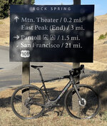
20210731-pantoll.jpg


no pictures from the first or last segments of the ride, which are familiar ground by now, for sure. the weather was very interesting, with chilly windy wet fog in spots and bright clear skies in others. overall very favorable cycling weather, i was never particularly hot or cold.

the first climb starts. there is a bit of a flat spot in the middle, but it's basically a 2,000 foot climb all at once. my route plan included a road which doesn't exist (wut!?) and the detour included a short section at 18% or something, which was unwelcome. but quickly i was into familiar climbing hills and enjoying the rhythm.
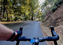
6030-climb.jpg

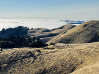
near the top, the forest opens up to rolling hills and classic golden hillsides. aside from the metal they pulled out of the ground in the 1800s, this is why it's the "golden state!"
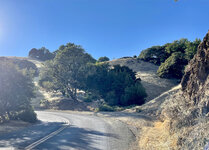
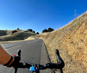
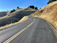
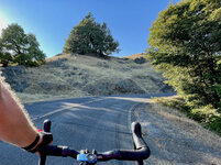
6038-sun.jpg 6053-openingup.jpg 6060-almostDoneClimbing.jpg 6070-riding.jpg


at the top of the climb, views open up to the marine layer over the bay and lowlands. 21 miles from home, around 7 miles to go before turning around the loop.
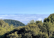
6083-fog.jpg6089-top.jpg

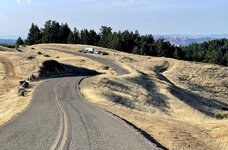
this road along the ridgeline, pan toll road, is an incredible experience. relatively smooth, very little traffic, fast with some small rollers, and constantly changing vistas. i would ride it back and forth all day if time permitted.
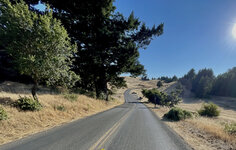
6100-pastTop.jpg6104-crestFog.jpg6106-pantollWinding.jpg

as we approach the forest again, fog is starting to blow across the road, making for spectacular light effects, which i wasn't really able to capture while riding.
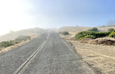
6108-fogComing.jpg

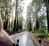
into the forest, for a complete change of climate and ecosystem. fully shaded, with mist dripping from the trees, this is a continuous 2,000 foot descent. i saw one vehicle, but caution is still required at these speeds (25-40mph) as drivers can't be trusted to stay on one side or the other.
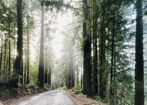
6122-forest.jpg6125-forest.jpg6130-descendingBoFax.jpg

flat land, a long flat stretch along the edge of the lagoon, with a bit of a headwind. it was nice to get into a smooth fast cadence, sustaining around 19mph into the headwind with the motor off on the drops of the bars.
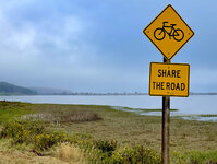
6133-lagoonFlat.jpg

climbing back over the last couple hills on the pacific coast highway, great views of the misty coast below.
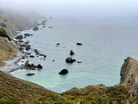
6147-pacific.jpg

almost home! beautiful skies over the wetlands around sausalito.
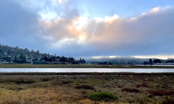
6152-sausalito.jpg
 
1627845640383.png


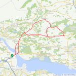
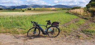
I got a bonus ride today as I wasn't intending to use the bike to go to the motorcycle racing due to time constraints, luckily I came up with a master plan to include the bike! I decided to put the bike in the back of the car and drive to within 16 miles of the racing circuit and cycle from there, I arrived just before the first race so my plan worked to perfection! 👍 During the lunch break I was feeling a little chilly so I went for a 10 mile loop outside the circuit and it warmed me up nicely, on returning to the circuit the sun came out and it was just perfect to enjoy the racing! The ride back to the car from the circuit was almost all downhill so that was a real blast!:D

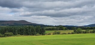
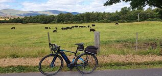
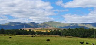
Some lovely scenery today!
1627846347772.jpeg

1627846377280.jpeg


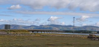
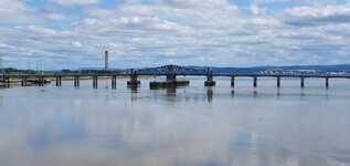
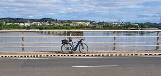
This is the view of the Kincardine Bridge which was opened in 1936 and looking its age, the photo was taken from the Clackmannanshire Bridge which was built in 2008 to take the bulk of the traffic away from the old bridge!

1627846551048.jpeg


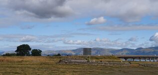
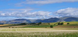
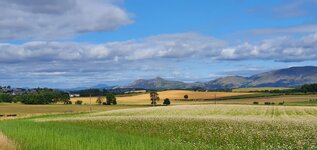
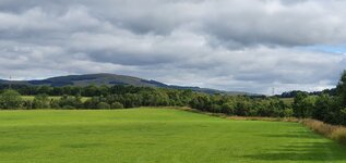
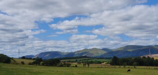
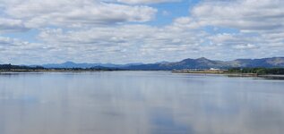
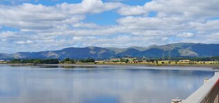
This is the view of the Ochil Hills taken from the new bridge!

1627846819253.jpeg


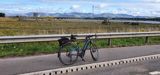
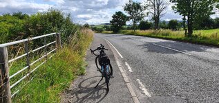
What a great day that was, two of my passions rolled into one!:D I was brave enough to cross the new bridge on my way back to the car, very few trucks around on a Sunday thankfully! There is a narrow lane (around 3 ft wide) which keeps you safe from the fast flowing traffic, the road has a 60mph speed limit! I wouldn't go anywhere near this road during the week...
 

Attachments

  • elevation_profile316.jpg
    elevation_profile316.jpg
    21.6 KB · Views: 218
  • trip-72394868-map-full231.png
    trip-72394868-map-full231.png
    311.2 KB · Views: 218
  • 20210801_091851.jpg
    20210801_091851.jpg
    272.1 KB · Views: 229
  • 20210801_091856.jpg
    20210801_091856.jpg
    233.1 KB · Views: 225
  • 20210801_091910.jpg
    20210801_091910.jpg
    601.1 KB · Views: 224
  • 20210801_093200.jpg
    20210801_093200.jpg
    785.5 KB · Views: 237
  • 20210801_093208.jpg
    20210801_093208.jpg
    369.8 KB · Views: 232
  • 20210801_093210.jpg
    20210801_093210.jpg
    378.4 KB · Views: 225
  • 20210801_100111.jpg
    20210801_100111.jpg
    275.1 KB · Views: 203
  • 20210801_100114.jpg
    20210801_100114.jpg
    284.5 KB · Views: 208
  • 20210801_100123.jpg
    20210801_100123.jpg
    831.1 KB · Views: 215
  • 20210801_145855.jpg
    20210801_145855.jpg
    708.9 KB · Views: 229
  • 20210801_145906.jpg
    20210801_145906.jpg
    211.4 KB · Views: 201
  • 20210801_145910.jpg
    20210801_145910.jpg
    269.2 KB · Views: 200
  • 20210801_152313.jpg
    20210801_152313.jpg
    187.1 KB · Views: 205
  • 20210801_152354.jpg
    20210801_152354.jpg
    153.5 KB · Views: 203
  • 20210801_152409.jpg
    20210801_152409.jpg
    202.5 KB · Views: 208
  • 20210801_152416.jpg
    20210801_152416.jpg
    480 KB · Views: 209
Last edited:
View attachment 95092

I got a bonus ride today as I wasn't intending to use the bike to go to the motorcycle racing due to time constraints, luckily I came up with a master plan to include the bike! I decided to put the bike in the back of the car and drive to within 16 miles of the racing circuit and cycle from there, I arrived just before the first race so my plan worked to perfection! 👍 During the lunch break I was feeling a little chilly so I went for a 10 mile loop outside the circuit and it warmed me up nicely, on returning to the circuit the sun came out and it was just perfect to enjoy the racing! The ride back to the car from the circuit was almost all downhill so that was a real blast!:D

Some lovely scenery today!
View attachment 95093
View attachment 95094

This is the view of the Kincardine Bridge which was opened in 1936 and looking its age, the photo was taken from the Clackmannanshire Bridge which was built in 2008 to take the bulk of the traffic away from the old bridge!

View attachment 95095

This is the view of the Ochil Hills taken from the new bridge!

View attachment 95098

What a great day that was, two of my passions rolled into one!:D I was brave enough to cross the new bridge on my way back to the car, very few trucks around on a Sunday thankfully! There is a narrow lane (around 3 ft wide) which keeps you safe from the fast flowing traffic, the road has a 60mph speed limit! I wouldn't go anywhere near this road during the week...
I've always wanted to visit Scotland, my step-dad grew up near Aberdeen, (oh yes, years after he passed I still check to see how their football team makes out but really "Celtic" is always in the way) your pictures make that magnet stronger, let's get over this covid obstacle!
 
Screenshot_20210801-222136_Strava.jpg

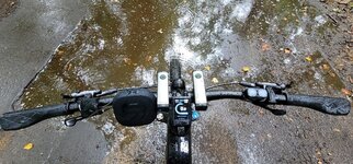
Wow, it was a very cool 16 C this morning, then the rain moved in, so naturally I went out for a ride hahaha. It was wonderful, no traffic, no tourists walking/driving aimlessly around not paying any attention to their surroundings. I did find out that my waterproof phone is not quite so waterproof, got home and dried it off and is working fine. So, limited photos today.

20210801_124846.jpg
20210801_115529.jpg
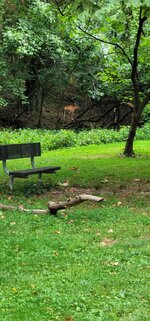
Hello Deer :)
20210801_115028.jpg
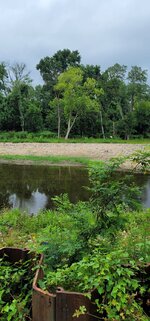
The little white spot right above the shore line is a big egret, took off flying as I was trying to photo him.
20210801_121638.jpg
They were headed straight for me, guess they thought I was going to feed them. I was the only one out on the lake today.
20210801_120106.jpg
There was another deer drinking from the creek, wanted to get a selfie with him, missed :(

Buh Bye...
 
Like many of you I wanted to get in one last good ride for July. Probably my last ride for a few weeks due to travel, so I wanted to make it a good one.
Screenshot 2021-08-01 8.50.37 PM.png

Screenshot 2021-08-01 8.38.30 PM.png

I started off in the town of Snoqualmie where I parked and rode a couple miles to pick up the Snoqualmie Valley Trail in this convenient spot:
IMG_20210731_102315.jpg

Sometimes there are small details you miss from just looking at a trail map :) I guess a little upper body workout to get the blood going is a nice way to start the ride.

Lots of other bridges and trestles (without stairs !) along here, including this one with a nice concrete top, but the bottom looked like it may still have some of the original 1911 timbers.
IMG_20210731_105447.jpg
IMG_20210731_105426.jpg

About 11 miles into the ride at Rattlesnake Lake I picked up the Palouse to Cascades Trail AKA the Iron Horse Trail AKA the John Wayne Pioneer Trail depending on the age of the map you're looking at. From there it's a long gradual climb along the south side of the river valley high above I-90.

Lots of trestles here also, but these are a little newer.
IMG_20210731_114305.jpg
IMG_20210731_150553.jpg

Finally, you get to the 2.5 mile long Hyak tunnel which goes under Snoqualmie Pass. It's very cool in the tunnel which generates fog on the upper west entrance with the cold air blowing out and meeting the warm summer air.
IMG_20210731_141906.jpg

After coming out on the east side I still had a decent amount of battery left so I rode the 8 mile length of Lake Keechelus to the dam on it's SE corner.

view looking back towards the pass
IMG_20210731_135350.jpg

After swapping batteries I turned around and headed back. I used about 85% of the first battery going up, but only about 60% of the second battery on the way down, so I should have plenty of battery for a hundred miler when I decide my legs are up for it.

PS: navigation apps don't know what to do with tunnels. RWPGS said my elevation gain was almost 7400 ft, when it was closer to 2250-2300. COBI on my bike had it at 1 mile. Komoot and Strava build their rides on the data pushed from COBI. Komoot had my climbs at 4650 ft while Strava came in at 2295 ft.

PPS: No pickles were consumed on this ride. But I did take a couple baby cucumbers to snack on !
 
that’s a very cool ride @BlackHand ! i’ve never seen such a long gradual ascent. the slope must be very subtle over that distance going up, but really fun going down! or is it actually lots of little rollers up and down, just masked by the scale of the chart?
 
Haibike Trekking S 9.0 with a spare 500wh powertube.

The gravel and gradual climb kept my speed down lower than usual so I got better mileage than I'm used to. I think the second battery was still reading somthing like 70 mile range when I got down to Rattlesnake Lake again. I burned some up riding in Tour mode the last 11 miles or so.

Most of the climb up the incline is just a steady 1- 2% with occasional level spots. The tunnel is dead level and the trail along the lake has maybe 50ft of elevation change over 8 miles.

It was weird going up because it didn't feel like climbing but I knew I was because I could look down at the I-90 on the valley floor and in the car you can tell you're climbing. Once I came back down and was cruising at 20 mph without working I could tell I was descending for sure!
Long tunnels can definitely mess with your perceptions.
 
Back