mschwett
Well-Known Member
- Region
- USA
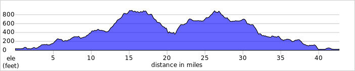
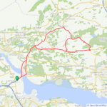
one last ride yesterday to finish off july! longest ride in a while, with a lot of climbing. had some drivetrain issues - derailleur adjustment and lube will fix it, i think - so i tried to climb in my 2nd gear rather than 1st, necessitating a bit more motor to keep the cadence up. nonetheless, a big effort. one 950ml bottle of half gatorade half ice consumed, and felt pretty good afterwards!

no pictures from the first or last segments of the ride, which are familiar ground by now, for sure. the weather was very interesting, with chilly windy wet fog in spots and bright clear skies in others. overall very favorable cycling weather, i was never particularly hot or cold.
the first climb starts. there is a bit of a flat spot in the middle, but it's basically a 2,000 foot climb all at once. my route plan included a road which doesn't exist (wut!?) and the detour included a short section at 18% or something, which was unwelcome. but quickly i was into familiar climbing hills and enjoying the rhythm.

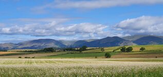
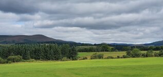
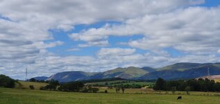
near the top, the forest opens up to rolling hills and classic golden hillsides. aside from the metal they pulled out of the ground in the 1800s, this is why it's the "golden state!"


at the top of the climb, views open up to the marine layer over the bay and lowlands. 21 miles from home, around 7 miles to go before turning around the loop.


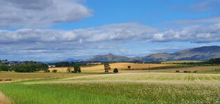
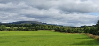
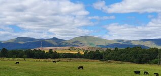
this road along the ridgeline, pan toll road, is an incredible experience. relatively smooth, very little traffic, fast with some small rollers, and constantly changing vistas. i would ride it back and forth all day if time permitted.


as we approach the forest again, fog is starting to blow across the road, making for spectacular light effects, which i wasn't really able to capture while riding.

into the forest, for a complete change of climate and ecosystem. fully shaded, with mist dripping from the trees, this is a continuous 2,000 foot descent. i saw one vehicle, but caution is still required at these speeds (25-40mph) as drivers can't be trusted to stay on one side or the other.


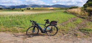
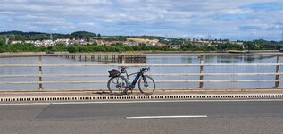
flat land, a long flat stretch along the edge of the lagoon, with a bit of a headwind. it was nice to get into a smooth fast cadence, sustaining around 19mph into the headwind with the motor off on the drops of the bars.

climbing back over the last couple hills on the pacific coast highway, great views of the misty coast below.

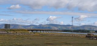
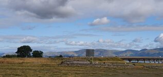
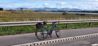
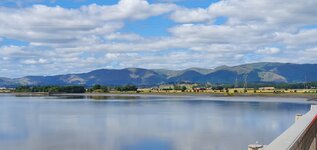
almost home! beautiful skies over the wetlands around sausalito.

no pictures from the first or last segments of the ride, which are familiar ground by now, for sure. the weather was very interesting, with chilly windy wet fog in spots and bright clear skies in others. overall very favorable cycling weather, i was never particularly hot or cold.
the first climb starts. there is a bit of a flat spot in the middle, but it's basically a 2,000 foot climb all at once. my route plan included a road which doesn't exist (wut!?) and the detour included a short section at 18% or something, which was unwelcome. but quickly i was into familiar climbing hills and enjoying the rhythm.
near the top, the forest opens up to rolling hills and classic golden hillsides. aside from the metal they pulled out of the ground in the 1800s, this is why it's the "golden state!"
at the top of the climb, views open up to the marine layer over the bay and lowlands. 21 miles from home, around 7 miles to go before turning around the loop.
this road along the ridgeline, pan toll road, is an incredible experience. relatively smooth, very little traffic, fast with some small rollers, and constantly changing vistas. i would ride it back and forth all day if time permitted.
as we approach the forest again, fog is starting to blow across the road, making for spectacular light effects, which i wasn't really able to capture while riding.
into the forest, for a complete change of climate and ecosystem. fully shaded, with mist dripping from the trees, this is a continuous 2,000 foot descent. i saw one vehicle, but caution is still required at these speeds (25-40mph) as drivers can't be trusted to stay on one side or the other.
flat land, a long flat stretch along the edge of the lagoon, with a bit of a headwind. it was nice to get into a smooth fast cadence, sustaining around 19mph into the headwind with the motor off on the drops of the bars.
climbing back over the last couple hills on the pacific coast highway, great views of the misty coast below.
almost home! beautiful skies over the wetlands around sausalito.


 During the lunch break I was feeling a little chilly so I went for a 10 mile loop outside the circuit and it warmed me up nicely, on returning to the circuit the sun came out and it was just perfect to enjoy the racing! The ride back to the car from the circuit was almost all downhill so that was a real blast!