Our Rides in Words, Photos & Videos

Loop to Golden Gardens Park, Seattle. Shots taken at the park, and Shilshole Marina
 

Attachments

  • Golden Gardens.jpg
    Golden Gardens.jpg
    373.3 KB · Views: 163
  • PXL_20210715_212822387.jpg
    PXL_20210715_212822387.jpg
    857.7 KB · Views: 156
  • PXL_20210715_212753532.jpg
    PXL_20210715_212753532.jpg
    746.3 KB · Views: 160
  • PXL_20210715_212749438.jpg
    PXL_20210715_212749438.jpg
    614.1 KB · Views: 149
  • PXL_20210715_212745212.jpg
    PXL_20210715_212745212.jpg
    746.9 KB · Views: 155
  • PXL_20210715_214032580.jpg
    PXL_20210715_214032580.jpg
    537.1 KB · Views: 159
  • PXL_20210715_214237410.jpg
    PXL_20210715_214237410.jpg
    332.1 KB · Views: 155
1626415551971.png


-- "Gentlemen, the heat is pouring down from the sky!"
-- "This heat in the city is hell."
-- "Miss Jola is certainly going for an outing this weekend?"
-- "If I were you Miss Jola I would take part in the PTTK Hiking Rally for the Lowland Badge. It is good to combine something useful with pleasure, and it is good to get a badge".
/Hydrozagadka (Hydroriddle), a Polish 1971 cult-following B movie, a funny parody of Superman. The feature of the movie are stiff, pompous dialogues, mimicking official Party and media language of the era/


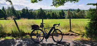
I didn't want to suffer in my hot flat on Thursday, so I went on a ride; air flow would certainly help in the open space, and after that I would be in the woods.

1626424607558.png

Top: The chapel in Mariew is a known landmark at the south edge of the Kampinos National Park. Exactly 13.5 km from the place I live if the shortest route is taken. Upon leaving Mariew you hit a gravel road, full of potholes.
Centre: Truskaw is another access point to the KPN. The (very recent) mural commemorates a battle fought by Polish Home Army partisans against the German and Russian Nazi in 1944.
Bottom: At the crossroads. The terrible cobblestone/sand Palmiry Connecting Road (right), and the entry onto a MTB trail (left).

1626425330756.png

"Tiger Hill" (which is an unofficial name given it by MTBers) doesn't look gnarly in the picture.

1626425454966.png

I think any person riding at least an XC bike would have made that hill. The point is, Vado SL is very far from calling it an off-road e-bike, and its motor is of low power. Yet I made it on last Tuesday, which only proves how good the SL is, and I'm also proud of my own achievement, as I am a person totally not in the technical trail riding :)

1626425895631.png

There are bike trails, hiking trails and fire-roads in the KPN. The hiking trails are mostly unsuitable for cycling because they consist of white, fine sand.
Top: Along a sand dune. Wherever possible, cyclist have created own single-tracks along the hiking trails.
Centre: It is good to own a Super Lightweight e-bike :) (I can remember riding similar trails with the heavy Trance E+; it was painful to carry that e-bike over an obstacle).
Bottom: At a point named Karczmisko ("A Huge Inn").

1626426196604.png

Left to the Nature now, Kampinos Forest teemed with human activities in the long past. There were trade roads leading through the primeval forest. The crossroads I stopped at hosted the Niepust Inn ("No-Let-Go") in 19th c. According to a legend, the inn-keeper didn't let his guests go until they spent their last penny. That made Jan Feliks Piwarski paint the "Last Penny Inn" in 1845.

1626427207798.png

I was painfully aware of hordes of mosquitoes and flies waiting for you in the forest: Stop and you're eaten alive. So I smartly took a repellent with me.

1626427405206.png

On my way back, I hit a trail I haven't been to before. KPN consists of sand dunes and morasses. The new trail sported an extremely long walkway over the morass. And if I say walkway I mean it is not a cycleway :) There is not only a cycling ban on the gangway but also the structure is indeed unstable (it was apt for resonance with bike wheels!) So I walked, walked, and walked...


After I left the walkway, I was confronted with a long narrow single-track consisting of mud and deep & wide puddles. I gave up and was just riding ahead! Again, my Bike could make it. Soon before leaving the forest, the first droplets of rain fell on my face. I put the Turbo on and zoomed out of the forest and to the next shelter in Zaborów. When I found myself under the roof, it poured :) How lucky I am... The downpour was intensive but short lived. And I could ride home dry.

1626428124662.png

Notice low average speed.
 
Last edited:
1626435652532.png


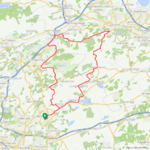
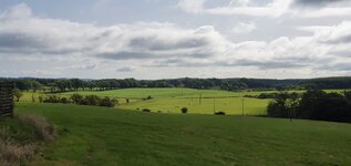
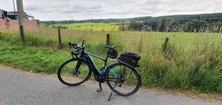
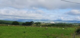
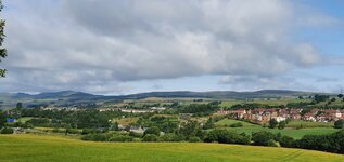
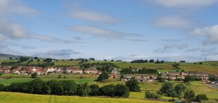
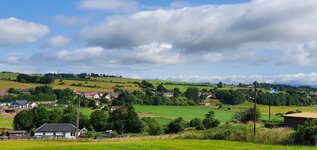
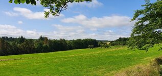
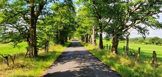
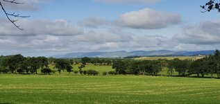
Yet another lovely day for a ride and it was such a joy to ride on quiet back roads for the most part, although I decided to try a new road and found myself on a dual carriageway oops! Thankfully it was quiet with no trucks and it only took me a few minutes to get back to the traffic free roads! I tried a road I have ridden a few times but this time in the opposite direction and I couldn't believe my luck when I came across this beautiful sight! It was totally hidden from the other direction!

1626436054162.jpeg


Its on a very narrow road but thankfully I never met any cars at all which would have meant stopping, this nice descent is just after a big climb!

1626436252207.jpeg


I might cycle to the motor racing on Sunday as the weather is looking good once again, with a nice temp of 20C and hopefully no rain! I hate taking the car but sometimes I have no choice...
 

Attachments

  • elevation_profile309.jpg
    elevation_profile309.jpg
    21 KB · Views: 138
  • trip-71304606-map-full224.png
    trip-71304606-map-full224.png
    428.9 KB · Views: 156
  • 20210716_085931.jpg
    20210716_085931.jpg
    230.9 KB · Views: 149
  • 20210716_090001.jpg
    20210716_090001.jpg
    645.2 KB · Views: 162
  • 20210716_090021.jpg
    20210716_090021.jpg
    289.4 KB · Views: 148
  • 20210716_092816.jpg
    20210716_092816.jpg
    305.2 KB · Views: 154
  • 20210716_092819.jpg
    20210716_092819.jpg
    316.5 KB · Views: 156
  • 20210716_092821.jpg
    20210716_092821.jpg
    374.5 KB · Views: 152
  • 20210716_101432.jpg
    20210716_101432.jpg
    540.6 KB · Views: 164
  • 20210716_101440.jpg
    20210716_101440.jpg
    840.7 KB · Views: 162
  • 20210716_101449.jpg
    20210716_101449.jpg
    370.9 KB · Views: 157
  • 20210716_101508.jpg
    20210716_101508.jpg
    673.9 KB · Views: 157
The Icefields Parkway

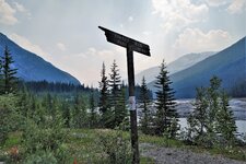
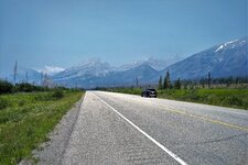
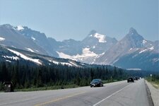
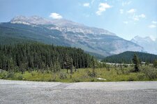
Wednesday’s ride would take us out along a section of the Icefields Parkway (Hwy 93) heading north towards the Columbia Ice Fields. We drove to our starting off point at the Sunset Pass Staging Area and would culminate the ride at the Columbia Discovery Center before reversing course and returning to our vehicle.

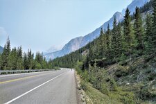
Smoke from the BC fires was ever present throughout the ride and was most noticeable up at the Ice Fields. It made taking any decent photos/video footage of it very difficult.

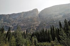
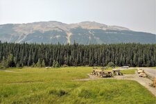
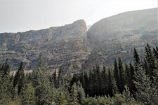
With that said, there were a number of stunning vistas along the way that captured our attention as we cycled a section of this spectacular corridor that runs between the resorts of Banff and Jasper. We’ve driven this stretch of highway numerous times but I can honestly say that nothing can compare to viewing the towering massifs and glacial land forms up close. Our Creos performed flawlessly and excelled on this day both at climbing and descending. Truly rock-solid machines.
Web capture_14-7-2021_205052_ridewithgps.com.jpeg

Web capture_14-7-2021_205533_ridewithgps.jpg

Screenshot 2021-07-14 at 20-47-49 Garmin Connect.jpg

We started our drive out of the prairies just like others before. The canola fields were in full bloom every where that you looked. This particular field was planted just outside of Rocky Mountain House.

IMG_20210714_1738182.jpg


Further out from RMH along Hwy 11, the color of this fireweed colony provides a striking contrast to the lifeless trees that remain standing from an earlier fire.

IMG_20210714_1023077.jpg


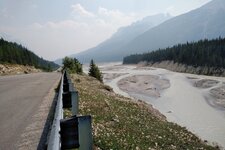
Once we hit the Parkway on our bikes, the scenery drastically changed. The glacial melt waters of this stream along the Icefields Parkway looked like milk flowing down from the mountains.

IMG_20210714_1238515.jpg


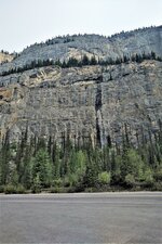
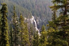
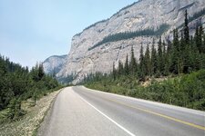
Cirrus Mountain aka the Weeping Wall.

IMG_20210714_1144517.jpg


IMG_20210714_1414560.jpgIMG_20210714_1137469.jpgIMG_20210714_1145033.jpg

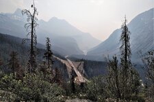
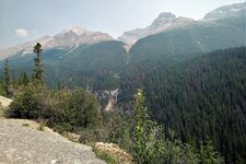
The start of the climb towards Sunwapta Pass and views along the way.

IMG_20210714_1204213.jpg

IMG_20210714_1211009.jpgIMG_20210714_1211437.jpgIMG_20210714_1216441.jpg

A shot of Athabasca Glacier taken from the Columbia Ice Fields Discovery Center. It was particularly smoky up top and so we stayed just long enough to have a quick snack before heading back down the Parkway. There were plenty of tour buses and of out of province visitors on this day.

IMG_20210714_1303212.jpg


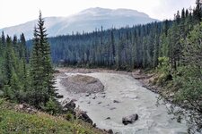
Glacial valley and streams

IMG_20210714_1413466.jpg


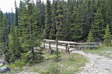
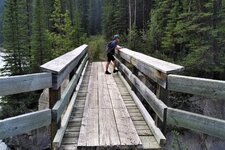
On the return leg, we came across this pristine setting that was hidden away from the main parkway. It's an area that one would likely miss if driving by in a car. We walked our bikes down to a pathway near a wooden bridge where we marveled at the sights before us.

IMG_20210714_1427453 (2).jpg

IMG_20210714_1427126.jpgIMG_20210714_1428100.jpgIMG_20210714_1427003.jpg

Our video tribute to the Ice Fields Parkway. Truly a world-class ride and a national treasure.


Our goal to cycle to the Columbia Ice Fields meant that we had to reach Sunwapta Pass (2035 meters) to get there. The pass signifies the demarcation boundary between Banff and Jasper National Parks. My Garmin actually recorded an elevation higher than that on the way back down. Go figure. Anyways, here’s yet another tribute to the second highest point on the Parkway.


More images from this memorable outing.
IMG_20210714_1023360.jpgIMG_20210714_1125226.jpgIMG_20210714_1134401.jpgIMG_20210714_1137469.jpgIMG_20210714_1233509.jpgIMG_20210714_1322334.jpgIMG_20210714_1410144.jpgIMG_20210714_1446205.jpgIMG_20210714_1507523.jpg
 
The Icefields Parkway

Wednesday’s ride would take us out along a section of the Icefields Parkway (Hwy 93) heading north towards the Columbia Ice Fields. We drove to our starting off point at the Sunset Pass Staging Area and would culminate the ride at the Columbia Discovery Center before reversing course and returning to our vehicle.

Smoke from the BC fires was ever present throughout the ride and was most noticeable up at the Ice Fields. It made taking any decent photos/video footage of it very difficult.

With that said, there were a number of stunning vistas along the way that captured our attention as we cycled a section of this spectacular corridor that runs between the resorts of Banff and Jasper. We’ve driven this stretch of highway numerous times but I can honestly say that nothing can compare to viewing the towering massifs and glacial land forms up close. Our Creos performed flawlessly and excelled on this day both at climbing and descending. Truly rock-solid machines.
View attachment 93438
View attachment 93439
View attachment 93440
We started our drive out of the prairies just like others before. The canola fields were in full bloom every where that you looked. This particular field was planted just outside of Rocky Mountain House.

View attachment 93441

Further out from RMH along Hwy 11, the color of this fireweed colony provides a striking contrast to the lifeless trees that remain standing from an earlier fire.

View attachment 93442

Once we hit the Parkway on our bikes, the scenery drastically changed. The glacial melt waters of this stream along the Icefields Parkway looked like milk flowing down from the mountains.

View attachment 93443

Cirrus Mountain aka the Weeping Wall.

View attachment 93444

View attachment 93446View attachment 93445View attachment 93447

The start of the climb towards Sunwapta Pass and views along the way.

View attachment 93448
View attachment 93449View attachment 93450View attachment 93451

A shot of Athabasca Glacier taken from the Columbia Ice Fields Discovery Center. It was particularly smoky up top and so we stayed just long enough to have a quick snack before heading back down the Parkway. There were plenty of tour buses and of out of province visitors on this day.

View attachment 93452

Glacial valley and streams

View attachment 93454

On the return leg, we came across this pristine setting that was hidden away from the main parkway. It's an area that one would likely miss if driving by in a car. We walked our bikes down to a pathway near a wooden bridge where we marveled at the sights before us.

View attachment 93464
View attachment 93465View attachment 93466View attachment 93468

Our video tribute to the Ice Fields Parkway. Truly a world-class ride and a national treasure.


Our goal to cycle to the Columbia Ice Fields meant that we had to reach Sunwapta Pass (2035 meters) to get there. The pass signifies the demarcation boundary between Banff and Jasper National Parks. My Garmin actually recorded an elevation higher than that on the way back down. Go figure. Anyways, here’s yet another tribute to the second highest point on the Parkway.


More images from this memorable outing.
View attachment 93455View attachment 93457View attachment 93458View attachment 93459View attachment 93460View attachment 93461View attachment 93462View attachment 93469View attachment 93470
WOW and double WOW. What an adventure! 👍 👍👍👍
 
The Icefields Parkway

Wednesday’s ride would take us out along a section of the Icefields Parkway (Hwy 93) heading north towards the Columbia Ice Fields. We drove to our starting off point at the Sunset Pass Staging Area and would culminate the ride at the Columbia Discovery Center before reversing course and returning to our vehicle.

Smoke from the BC fires was ever present throughout the ride and was most noticeable up at the Ice Fields. It made taking any decent photos/video footage of it very difficult.

With that said, there were a number of stunning vistas along the way that captured our attention as we cycled a section of this spectacular corridor that runs between the resorts of Banff and Jasper. We’ve driven this stretch of highway numerous times but I can honestly say that nothing can compare to viewing the towering massifs and glacial land forms up close. Our Creos performed flawlessly and excelled on this day both at climbing and descending. Truly rock-solid machines.
View attachment 93438
View attachment 93439
View attachment 93440
We started our drive out of the prairies just like others before. The canola fields were in full bloom every where that you looked. This particular field was planted just outside of Rocky Mountain House.

View attachment 93441

Further out from RMH along Hwy 11, the color of this fireweed colony provides a striking contrast to the lifeless trees that remain standing from an earlier fire.

View attachment 93442

Once we hit the Parkway on our bikes, the scenery drastically changed. The glacial melt waters of this stream along the Icefields Parkway looked like milk flowing down from the mountains.

View attachment 93443

Cirrus Mountain aka the Weeping Wall.

View attachment 93444

View attachment 93446View attachment 93445View attachment 93447

The start of the climb towards Sunwapta Pass and views along the way.

View attachment 93448
View attachment 93449View attachment 93450View attachment 93451

A shot of Athabasca Glacier taken from the Columbia Ice Fields Discovery Center. It was particularly smoky up top and so we stayed just long enough to have a quick snack before heading back down the Parkway. There were plenty of tour buses and of out of province visitors on this day.

View attachment 93452

Glacial valley and streams

View attachment 93454

On the return leg, we came across this pristine setting that was hidden away from the main parkway. It's an area that one would likely miss if driving by in a car. We walked our bikes down to a pathway near a wooden bridge where we marveled at the sights before us.

View attachment 93464
View attachment 93465View attachment 93466View attachment 93468

Our video tribute to the Ice Fields Parkway. Truly a world-class ride and a national treasure.


Our goal to cycle to the Columbia Ice Fields meant that we had to reach Sunwapta Pass (2035 meters) to get there. The pass signifies the demarcation boundary between Banff and Jasper National Parks. My Garmin actually recorded an elevation higher than that on the way back down. Go figure. Anyways, here’s yet another tribute to the second highest point on the Parkway.


More images from this memorable outing.
View attachment 93455View attachment 93457View attachment 93458View attachment 93459View attachment 93460View attachment 93461View attachment 93462View attachment 93469View attachment 93470
Breathtaking!!!
 
@reed scott Thanks Reed. The adventure isn’t over yet as we still would like to cover sections of the Parkway south of the Saskatchewan River Crossing. Then there is Jasper National Park in the fall.

@kahn Not knowing whether or not we would need them, we brought our extenders along just in case. My wife ended up with 54% charge remaining on her internal and I still had 66% on mine so we had plenty of juice to make the return leg back to the vehicle.

I thought of you and your overnight trip as we rode by the turnoff to Nigel Pass.

@RabH Thanks RH. The smoke played a major role with respect to image and video quality. I didn’t even bother taking any video footage at the Ice Fields center.
When my friend and I finally made it to Glacier National Park a number of years ago, there were also forest fires. I have been to many of our National Parks and most more than once. But this was the first time for Glacier and it was sad with the smoke. Most views were pretty poor. We did a few hikes but on one I really should not have been out as breathing was awful. My friend wisely passed and she stayed at the campground and read! (g)

As I said, Nigel Pass in 2001 and now YIKES - that was 20 years ago!!! Which explains why I am tending to use the Range Extender on my Creo.
 
Havent been on for a bit..the poor old missus got an infection and had to get it sorted at hospital.
Doesnt she pick up covid and now were isolating for 10 days.
Not too bad, bit of a cough and feeling tired.
Im ok so far, double jabbed so should see it off if I do get it.

The heat is unbearable here at the moment...just so humid and we dont have aircon..practically no one does, because, well its England.
Went for a drive to use the car aircon!!
Friend went for a 60 mile charity ride to Chester and one of the group dropped down dead in the Mersey Tunnel, very traumatic for everyone.
64 with no health issues, what a strange place to end your days.

Anyway..anyone got any good news :)
 
Anyway..anyone got any good news :)

Charge…Yes I do. I found My new physical therapist (Dept. Head) a roadie who spent our first ten minutes talking about our mods. He lifted my restriction on cycling. He commutes to work crossing the city (Richmond Va). He Also had an interesting experience with an ebike, and had enlightened view on these new contraptions.
Sorry Charge for you present difficulties…the US will soon be in our own Covid stew again thanks to a juvenile resistance to doing what they should (Vax)
 
Back