You are using an out of date browser. It may not display this or other websites correctly.
You should upgrade or use an alternative browser.
You should upgrade or use an alternative browser.
Show us pictures of where you ride your ebikes!


m@Robertson
Merciless (on the inside)
- Region
- USA
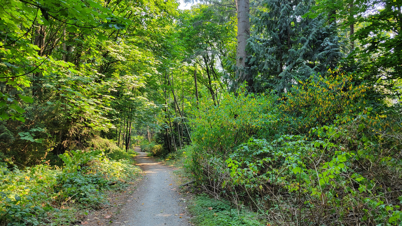
Coming home from a 6:30 pm grocery pickup at Walmart and the fog was rolling in hard. I'm acclimated so no need for a jacket but had to keep wiping off my glasses.

PCeBiker
No-Hands No-Pedaling No-Credentials
- Region
- Canada
Coming home from a 6:30 pm grocery pickup at Walmart and the fog was rolling in hard. I'm acclimated so no need for a jacket but had to keep wiping off my glasses.
You need a fog horn.

Be sure to adjust the frequency according to the size of your vessel,..


DaveMatthews
Dave's not here. Cheating since 2018
- Region
- Canada
You need a fog horn.
View attachment 161105
Be sure to adjust the frequency according to the size of your vessel,..
View attachment 161106

Jeremy McCreary
Bought it anyway
- Region
- USA
- City
- Carlsbad, CA
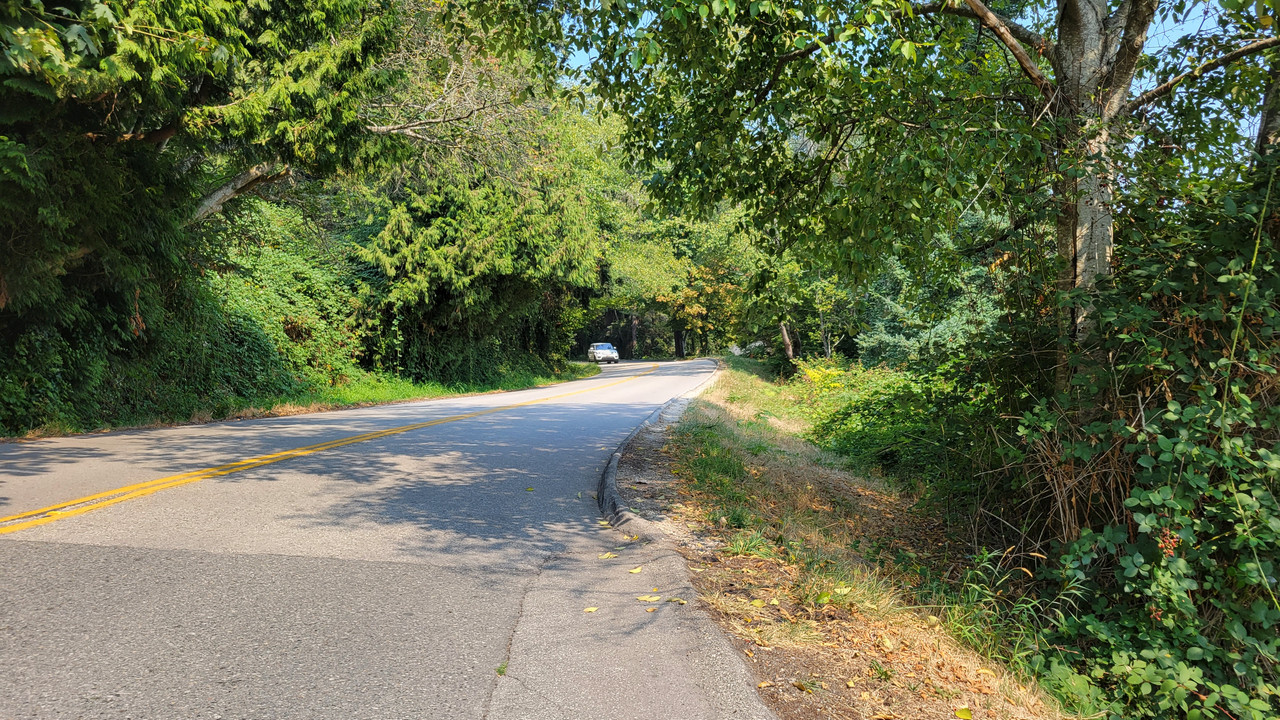
A rare treat from tropical cyclone Hilary — the gorgeous 1.6-mile bluff-top road through Carlsbad State Beach Campground all to myself on a summer day!


Rangers emptied the campground on Saturday, the day before Hilary's dash through SoCal, and kept them empty through Monday, the day after.

By mid-morning Monday, nothing left of the storm but these unseasonal mid- and upper-level clouds. Forecasters talked about straggling rain bands and thundershowers, but they never materialized.
It did cloud- and haze-up again later in the day, as you can see in the first 2 photos. But at least the clouds had some interesting structure — unlike the boring low marine-layer cloud decks we've had for most of "Fogust".

The Carlsbad campground is 7 minutes down the hill from my house. It's often deserted in the winter, and that's when I use the not-quite-flat campground road to either escape Coast Highway traffic or turn 3.2-mile laps with entertaining ocean views the whole way. This photo was from an exceptionally clear February afternoon.

While I was out, rode the coast from the campground to Carlsbad Village to see what Hilary had wrought. Short answer: Not much. Some palm litter here and there and minor gullying where Coast Highway runoff took a shortcut to the ocean at North Ponto Beach.
Also saw minor sand loss at North Ponto but none at Tamarack Beach just 2 mi north. Oddly, the surf stayed low the whole time.

The mountains and deserts to our east got record one-day rainfalls and some flash flooding but no major damage or loss of life. Here on the coast, we got half a day of mostly light wind and rain — a yawn compared to some of last winter's Pacific storms and atmospheric rivers. This despite the eye having passed less than 30 mi inland.

Our unlikely savior was that huge high-pressure dome parked over the central US. While it was busy scorching half the country on Sunday, the upper-level winds running clockwise around it were sweeping Hilary along to the north at nearly 25 mph. If Hilary had pulled a Hurricane Harvey and crawled by instead, I might be telling a very different story.
Rangers emptied the campground on Saturday, the day before Hilary's dash through SoCal, and kept them empty through Monday, the day after.
By mid-morning Monday, nothing left of the storm but these unseasonal mid- and upper-level clouds. Forecasters talked about straggling rain bands and thundershowers, but they never materialized.
It did cloud- and haze-up again later in the day, as you can see in the first 2 photos. But at least the clouds had some interesting structure — unlike the boring low marine-layer cloud decks we've had for most of "Fogust".
The Carlsbad campground is 7 minutes down the hill from my house. It's often deserted in the winter, and that's when I use the not-quite-flat campground road to either escape Coast Highway traffic or turn 3.2-mile laps with entertaining ocean views the whole way. This photo was from an exceptionally clear February afternoon.
While I was out, rode the coast from the campground to Carlsbad Village to see what Hilary had wrought. Short answer: Not much. Some palm litter here and there and minor gullying where Coast Highway runoff took a shortcut to the ocean at North Ponto Beach.
Also saw minor sand loss at North Ponto but none at Tamarack Beach just 2 mi north. Oddly, the surf stayed low the whole time.
The mountains and deserts to our east got record one-day rainfalls and some flash flooding but no major damage or loss of life. Here on the coast, we got half a day of mostly light wind and rain — a yawn compared to some of last winter's Pacific storms and atmospheric rivers. This despite the eye having passed less than 30 mi inland.
Our unlikely savior was that huge high-pressure dome parked over the central US. While it was busy scorching half the country on Sunday, the upper-level winds running clockwise around it were sweeping Hilary along to the north at nearly 25 mph. If Hilary had pulled a Hurricane Harvey and crawled by instead, I might be telling a very different story.
Last edited:
JedidiahStolzfus
Well-Known Member
- Region
- USA
- City
- Lancaster, PA
A couple weeks ago I went for a ride on the Enola Low Grade trail. I did 13.5 miles out and back. Fun and easy trail to ride in the southern part of the county. Runs from the base of Turkey Hill and goes to Christiana PA, I think 42 miles.
Recent rock slide.


Back side of the Safe Harbor Dam, I used to fish here as a kid.


Front side of the dam from the bridge over the Conestoga River where it enters the Susquehanna

This is a bridge that was set on fire a few years ago and has since been rebuilt. It's an old railroad trestle bridge. Buddy of mine went across it on his motorcycle back when it was still a rail bridge. I think it's 210 feet over the road below.

Saw this bike tool stand at around 12 miles out. Looks like someone's Eagle Scout Project.

This is the downhill of 272 coming out of Buck and heading towards Willow Street, it's the only part of the road I could see from the top of the tunnel.

Next time I go down, I'm going to start at the lot where the tool stand was and get into Quarryville.
Recent rock slide.
Back side of the Safe Harbor Dam, I used to fish here as a kid.
Front side of the dam from the bridge over the Conestoga River where it enters the Susquehanna
This is a bridge that was set on fire a few years ago and has since been rebuilt. It's an old railroad trestle bridge. Buddy of mine went across it on his motorcycle back when it was still a rail bridge. I think it's 210 feet over the road below.
Saw this bike tool stand at around 12 miles out. Looks like someone's Eagle Scout Project.
This is the downhill of 272 coming out of Buck and heading towards Willow Street, it's the only part of the road I could see from the top of the tunnel.
Next time I go down, I'm going to start at the lot where the tool stand was and get into Quarryville.
DaveMatthews
Dave's not here. Cheating since 2018
- Region
- Canada
Nice!A couple weeks ago I went for a ride on the Enola Low Grade trail. I did 13.5 miles out and back. Fun and easy trail to ride in the southern part of the county. Runs from the base of Turkey Hill and goes to Christiana PA, I think 42 miles.
Recent rock slide.
Back side of the Safe Harbor Dam, I used to fish here as a kid.
Front side of the dam from the bridge over the Conestoga River where it enters the Susquehanna
This is a bridge that was set on fire a few years ago and has since been rebuilt. It's an old railroad trestle bridge. Buddy of mine went across it on his motorcycle back when it was still a rail bridge. I think it's 210 feet over the road below.
Saw this bike tool stand at around 12 miles out. Looks like someone's Eagle Scout Project.
This is the downhill of 272 coming out of Buck and heading towards Willow Street, it's the only part of the road I could see from the top of the tunnel.
Next time I go down, I'm going to start at the lot where the tool stand was and get into Quarryville.
I've seen a couple of those tool stands as well.


Rome
Well-Known Member
- Region
- USA
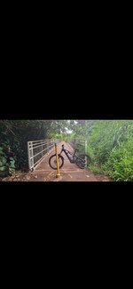
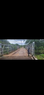
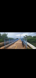
Counting bridgeway on my test ride after doing owner performed maintenance. On my ebike , 5 mile jaunt. End of the month maintenance.
Balls to the wall ride I gave it all my weight on the pedals.
Balls to the wall ride I gave it all my weight on the pedals.
Attachments
DaveMatthews
Dave's not here. Cheating since 2018
- Region
- Canada
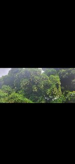
I wanted to ride on Saturday, but thought the fire smoke was a bad idea. So I did some chores and checked my bike over.
Today is/was similar but I couldn't help myself, so went out for a quickie down to the Mud Bay parking lot and back.
At first glance, it seems OK...
The big picture shows too much smoke. My throat and lungs agree...
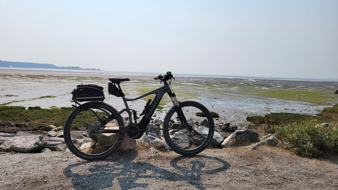
On the way home I tackled this hill which peaks around 13%...
Need water... the smoke taste is... disturbing...

Love this short downhill dirt track...

Only 23kms today. I did not want to push it while sucking in smoke...
Today is/was similar but I couldn't help myself, so went out for a quickie down to the Mud Bay parking lot and back.
At first glance, it seems OK...
The big picture shows too much smoke. My throat and lungs agree...
On the way home I tackled this hill which peaks around 13%...
Need water... the smoke taste is... disturbing...
Love this short downhill dirt track...
Only 23kms today. I did not want to push it while sucking in smoke...
Prairie Dog
Well-Known Member
- Region
- Canada
- City
- Red Deer
Bummer Dave. That will definitely compromise your breathing. Hopefully the skies will clear up long enough for you to head out for a longer ride. If it’s any consolation, I got coal rolled again today.Only 23kms today. I did not want to push it while sucking in smoke...

DaveMatthews
Dave's not here. Cheating since 2018
- Region
- Canada
THAT TOTALLY SUCKS!!!Bummer Dave. That will definitely compromise your breathing. Hopefully the skies will clear up long enough for you to head out for a longer ride. If it’s any consolation, I got coal rolled again today.
Did you get it on vid?
Prairie Dog
Well-Known Member
- Region
- Canada
- City
- Red Deer
Unfortunately not. Same stretch of road, different truck. I usually don't have the camera turned on during the entire ride but I may do so from now on when riding along that range. I wouldn't be surprised if the two were related likely due to inbreeding among family members.THAT TOTALLY SUCKS!!!
Did you get it on vid?
DaveMatthews
Dave's not here. Cheating since 2018
- Region
- Canada
What a sick "you know what"...Unfortunately not. Same stretch of road, different truck. I usually don't have the camera turned on during the entire ride but I may do so from now on when riding along that range. I wouldn't be surprised if the two were related likely due to inbreeding among family members.
I haven't experienced this idiotic behaviour yet. Pee me off!
Prairie Dog
Well-Known Member
- Region
- Canada
- City
- Red Deer
…and let's hope that you never have to.What a sick "you know what"...
I haven't experienced this idiotic behaviour yet. Pee me off!
WildPaul
Active Member
- Region
- USA
Western Connecticut (right near upstate NY.)
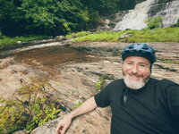
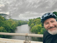
(Also - apologies for all the selfies! Browsing other photos on the thread, it seems like the more common thing is to just take a photo of the bike by itself in the scenery… but I originally took these photos to send to my family so… )


(Also - apologies for all the selfies!
Browsing other photos on the thread, it seems like the more common thing is to just take a photo of the bike by itself in the scenery… but I originally took these photos to send to my family so… )Attachments
DaveMatthews
Dave's not here. Cheating since 2018
- Region
- Canada
Awesome!
Similar threads
- Replies
- 27
- Views
- 3K
- Replies
- 57
- Views
- 8K
- Replies
- 1
- Views
- 2K
- Question
- Replies
- 4
- Views
- 411