Our Rides in Words, Photos & Videos

Other people having fun…

One of the perks of train travel is being able to eavesdrop on other people's lives! So it is also when travelling along a disused, sorry 'repurposed', rail line.

My local rail trail, the country's longest (at 161 km), follows the old Brisbane Valley branch line which passes just a few hundred metres from our home. Although it usually takes two minutes to reach the rail trail, I persuaded myself (because the sky looked 'ominous') that today's ride required an initial trip by car to the small country town of Esk from which I would ride to the village of Toogoolawah and on to Harlin which is too small to qualify as a hamlet.

Away from the road, all was quiet… until there came a droning from the leaden sky. Must be a plane. (One that I couldn't see!) And then, there it was, emerging from the clouds. Who'd want to be up there of all places!

Dropping in from the Clouds


That they needed a mug of coffee as much as I did became apparent as their craft circled round and came right down to my level, just clearing the rail trail, and touched down as lightly as a feather, although decidedly more noisily, on a gravel runway I had failed to notice before. What fun!

Toogoolawah Airstrip


Toogoolawah Airstrip

Toogoolawah, Brisbane Valley, Queensland

Toogoolawah : Ride with GPS map


As usual, add the two distances (54 km total so far + 21 km outward journey) to get the total for the ride (75 km). Whether this is actually correct will depend on riding the same route out and back, which is usual on a rail trail.

Toogoolawah : Ride with GPS map
 
Last edited by a moderator:
Speaking of corn, I didn’t ride my bike last Wednesday because I was doing more important stuff. The pic is some of my in-laws shucking corn. You then boil it to cook it about halfway, then cool it, cut it off the cob, put it in freezer brags, then freeze it. There were 8 of us and we did about 500 pint and quart freezer bags of it split between 5 families.
52E9DD70-6643-4DFE-8F84-342C64525673.jpeg
 
Other people having fun…

One of the perks of train travel is being able to eavesdrop on other people's lives! So it is also when travelling along a disused, sorry 'repurposed', rail line.

My local rail trail, the country's longest (at 161 km), follows the old Brisbane Valley branch line which passes just a few hundred metres from our home. Although it usually takes two minutes to reach the rail trail, I persuaded myself (because the sky looked 'ominous') that today's ride required an initial trip by car to the small country town of Esk from which I would ride to the village of Toogoolawah and on to Harlin which is too small to qualify as a hamlet.

Away from the road, all was quiet… until there came a droning from the leaden sky. Must be a plane. (One that I couldn't see!) And then, there it was, emerging from the clouds. Who'd want to be up there of all places!

That they needed a mug of coffee as much as I did became apparent as their craft circled round and came right down to my level, just clearing the rail trail, and touched down as lightly as a feather, although decidedly more noisily, on a gravel runway I had failed to notice before. What fun!

View attachment 130855

View attachment 130854
Toogoolawah, Brisbane Valley, Queensland

View attachment 130857

As usual, add the two distances (54 km total so far + 21 km outward journey) to get the total for the ride (75 km). Whether this is actually correct will depend on riding the same route out and back, which is usual on a rail trail.

View attachment 130858
Nice contrast of the bright yellow plane against the stormy sky and rugged countryside. It’s great to see what others do in lands far from home, (or sometimes, close to home).
 
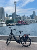
View attachment 130862

After 4 days resting my legs it was time to get back out for a recovery ride, I was around 2 miles into my ride when I spotted all the lights flashing on my Wahoo...I forgot to start it oops! I don't recall ever doing this before but onwards and upwards, yes I said upwards...4000ft of climbing on a recovery ride isn't recommended! 🤣 What can I say, I just got carried away and decided to explore some new roads! I found some gems and will revisit them again soon, I love trying out new roads I find in the opposite direction at a later date! I will have some big climbs and some lovely descents to look forward to!

When I set off I decided to see what progress they were making on a new cycle path they are constructing close to home, they still have quite a bit to build but some parts are now open and looking pretty good!

View attachment 130864

I have been neglecting some of my favourite local roads recently so I put that right today, this road is so much fun in both directions! It takes you from the village of Blackridge to the village of Avonbridge and is single track most of the way, its great fun when you meet a huge tractor on one of the many inclines! I got lucky today;)

View attachment 130865
View attachment 130866

I was now heading for Beecraigs Country Park near Linlithgow where I was intending to try a road they recently resurfaced! This is part way up the climb to the country park!

View attachment 130867
View attachment 130868

The top of the climb looking over to the Ochil hills!

View attachment 130869
View attachment 130870

I reached my destination and discovered they had finished the resurfacing job but they decided to cover it in surface dressing...:rolleyes: So I continued on to the next road which takes you down into Linlithgow and I rememebered about a route I descended fairly recently so it was time to climb it, it passes over the canal and there were quite a few canal boats parked today!

View attachment 130878
View attachment 130882

The road I was taking leads back to the road at the country park, I stopped part way up to grab another few photos and noticed the Forth Bridges in the distance!

View attachment 130884
View attachment 130885

Back at the country park I turned off down one of the many side roads, with big descents and big climbs all around! As I was climbing the steepest part I spotted my Wahoo showing a gradient of 19.8% but once again Ridewithgps was showing my maximum gradient as 13.8%:rolleyes:

I finally reached a road junction where I had the option to turn left or right, the last time I turned right so I thought it would be fun to try the left turn and see what the roads would be like going this way! I wasn't disappointed, some lovely descents with loads of twists and turns ensued and I came across this field full of horses! I don't think I have ever seen so many in one field before, it would be quite a job looking after all those!

View attachment 130863

Eventually I was back on a familiar road, at the village of Dechmont! I knew this road would have lots of trucks and buses on it so I took to the cycle path which goes all the way to Bathgate and I only encountered 2 walkers and one cyclist on the near 3 mile stretch! That was quite a result as I was expecting many dog walkers, it sure was my lucky day! I was about 15 miles from home now and decided I would just stick to familiar roads and crank the assist up into the 15-20mph headwind!

After last weeks epic this seemed like a short trip around the block, although I was glad I took 2 batteries and was able to turn the assist up all the way home as my legs were starting to feel it after all the climbing...yet another great ride though!:D

Great pictures. I would love to ride that area in person some day. It looks like a nice day. Sometimes you don’t want a day like that to end.

A little tip on recovery, (from personal experience, for whatever it is worth. I have ridden over 100 miles in a day on twelve different occasions on “acoustic” bikes). My advice is to hydrate after the ride and take a relatively short and easy ride the day after with a good warm up and cool down, then take a day off. One hour or so on the bike is generally good for a recovery ride.
 
Finally got a video of this great cemetery ride. as you see all uphill I think the steepest part is about 16% I was freaked out when google directed us to this the first time. but they have bike lanes and its the most practical way over the hill. a lot of great views from it of the sellwood bridge and the Willamette river. this is Riverview cemetery. no clue why the woman were jogging in place.
 
Last edited:
We were able to fit in our daily ride this morning but hunkered down the rest of the day due to a massive storm that passed through the area. Tornado warnings were posted throughout the rest of the afternoon and reports of severe hail damage to vehicles that occurred just outside the city along the QE2 as drivers had no place to take shelter from the storm.

FZHw3ssVUAEWnlg.jpg


Size of hail near Markerville, AB.

FZHTYBIUEAEazcJ.jpg
 
We were able to fit in our daily ride this morning but hunkered down the rest of the day due to a massive storm that passed through the area. Tornado warnings were posted throughout the rest of the afternoon and reports of severe hail damage to vehicles that occurred just outside the city along the QE2 as drivers had no place to take shelter from the storm.

View attachment 130971

Size of hail near Markerville, AB.

View attachment 130972
Wow... that'll knock you out!
 
Great pictures. I would love to ride that area in person some day. It looks like a nice day. Sometimes you don’t want a day like that to end.

A little tip on recovery, (from personal experience, for whatever it is worth. I have ridden over 100 miles in a day on twelve different occasions on “acoustic” bikes). My advice is to hydrate after the ride and take a relatively short and easy ride the day after with a good warm up and cool down, then take a day off. One hour or so on the bike is generally good for a recovery ride.
I'm sure you would love it, we are being blessed by some good weather at the moment but its all change today with 40mph winds! Good advice there but more so for a standard bike, although the e bike can be hard work if you want it to, its easy to just crank the assist up and have an easy ride to recover! I decided to have 4 days off (not that I was sitting on my butt of course, still did plenty walking) and challenge myself with some climbing which I just love on this bike! If you start to struggle there is plenty juice in this thing to climb almost anything with ease!

I thought I would have a look to see how many century rides I have done on my e bike in the 4 years I have owned it, I'm currently at 17! I don't have a count on my standard bikes over the years but it will be around 50 I would think, I have 23 logged on my gps going back to the end of 2011!
Looked at the photos and really wanted to leave as soon as possible.
I do hope you meant leave on your bike? and not leave the thread never to return... 🤣 Welcome fellow Robert, I only get called that when I have done something wrong!🤣
 
Be gone! Sun dispels the early fog…

Fog Rising over Story Bridge, Brisbane River

Story Bridge, Brisbane River
Queensland, Australia

Tuesday's ride was preceded by a train trip: fog had brought the motorway traffic to a crawl so I abandoned my easy option of dawdling up the Moreton Bay Cycleway which would have required almost an hour chasing someone else's taillights. Much better on the train: things don't go bump when one travels by train (shouldn't, anyway).

Near the city centre, I piled off—not that easy with an R&M Homage—and pedalled downstream beside the Brisbane River. By then the fog had lifted but still lingered around the upper storeys of the new apartment blocks but the Story Bridge was clear. (Anyone familiar with its Canadian sibling in Montreal, the Jacques Cartier Bridge?)

Surely, Stefan will have noticed the old warehouses are now in the care of Felon's Brewing Company (6 km on map)!

Appearing at the bottom of the photograph is a section of the New Farm Riverwalk—for cyclists as well as pedestrians!

Story Bridge: Location
 
Last edited by a moderator:
Back