Our Rides in Words, Photos & Videos

My friend Bogusław (who I met in Płock last week) seems to have been infected with the "bacillus gravelosa" :)

1657055366384.png

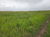
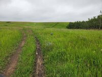
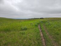
He is a good photographer, too. In addition to his many other skills. (A group gravel MTB ride outside Toruń/Thorn Poland).
 
Last edited:
I got into the trap of "just a bit farther" today. We had a heck of a thunderstorm yesterday. My area of the world was under one of those blobs on the radar shown in yellow and orange for two hours. Our area is not built for that much rain. Reports came in about roads being washed out and the little former mining community, now a tourist trap, was flooded. I rode up my favorite road and saw a little bear shaking a bush. Because it looked young, I worried about mama bear being around so I rang my bell and the baby took off.
DSC01807.JPG

Salmon Creek is very muddy today.

I wasn't planning on it, but I continued on up to Conconully, the flooded town. I was hoping that at least the store might be open, but it wasn't. I found a newly placed porta potty to use, took some pictures, and then pedaled home the less scenic, but quicker highway route. Because of the flood, there wasn't much traffic on the road.

DSC01812.JPG

There is pavement under that dirt.

DSC01815.JPG

Conconully State Park camping area. Normally, it would be full of campers.
DSC01810.JPG

What was I thinking? Of course, the water was shut off and all the businesses were closed. There would be no ice cream or even beer today in Conconully. I had provisions with me so headed home the quicker way.

Many of the houses and businesses are built right on this creek so they do flood when the creek rises. It's a poorly designed place, but back in the day, nobody thought about that.

Now I recover. It was 40 miles and I haven't been riding a whole lot lately.
 
Beautiful morning for a ride today, but ran into a few issues...

First, I was late to the meeting point with my Italy ride buddy because I did too much standing over the holiday weekend attending to our large family crowd. My ankles were terribly swollen, and so had to struggle into a pair of compression socks before setting out.

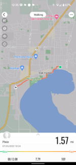
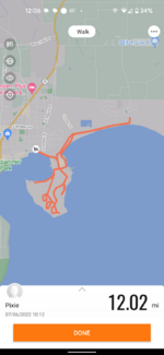
I had my tracking app set on walking instead of cycling - again! No way to change during a work out, so had to start over.

Then, about a third of the way through the ride, my friend thought she had a stone stuck in her brand new bike tire tread, which turned out to be a good sized nail 🤬. She decided to call for a lift and take the bike back to the LBS for repair (my PM was disappointed that, 1 - she didn't attempt to repair it herself - or have me do it - and, 2 - she took it to the shop instead of having HIM do it!).

I waited by the side of the road with her until her husband showed up, then continued on the route myself.

The rest of the ride was lovely!

One more jaunt tomorrow, then I'm off the bike for at least a week while attending to family matters back east.

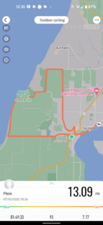
"Walking" and riding:

Screenshot_20220705-123501.png
Screenshot_20220705-123530.png

14.66 miles total

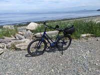
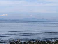
Bike at a rocky beach:

PXL_20220705_183657850.jpg

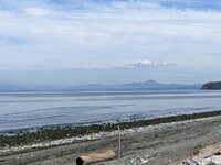
Looking North to Fidalgo and Orcas Islands - the San Juans were a little hazy today:

PXL_20220705_183717717.jpg
PXL_20220705_183741455.MP.jpg

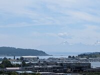
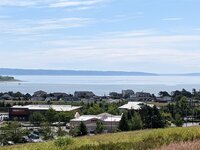
City and Cascade Mountains view on the approach back down to town:

PXL_20220705_191023845.MP.jpg
PXL_20220705_191014020.MP.jpg

And, that's a wrap for today 😉!
 
Last edited:
(something weird - tried replying, Patricia, and wound up with about four copies of your post!)

I am getting less patient with flats these days and probably would rather be bailed out but got new tires which seem less prone (have I now jinxed things????) Looks good after you got sorted out.

I got out yesterday. And as I left the house heading toward Discovery Park - what is that? RAIN! But it was only a few drops but remained cloudy for the first third of the ride. Then pretty pleasant at Discovery and Myrtle Edwards. Then Seattle Center and home - becoming a rather regular urban route. 22/23 miles. This morning I drove to Discovery Park and walked the 3 mile loop.

Smith Cove Park which is adjacent to the Cruise ship piers/docks.

PXL_20220704_224542491.jpg


PXL_20220704_224539448-.jpg


Decided I never have liked that breakwater so used Pixel Magic Eraser on it:

PXL_20220704_224539448~3-.jpg


A cruise ship leaving for Alaska. It was docked as I passed it about twenty minutes earlier. With a slew of passenger along the rails and its horn was sounding.

PXL_20220704_231304917-.jpg


And the "adult" statue when the fountains are not screening one figure or the other. The fountains generally cover either the man or the boy and shift the water flow.

PXL_20220704_231050770.jpg
 
(something weird - tried replying, Patricia, and wound up with about four copies of your post!)

I am getting less patient with flats these days and probably would rather be bailed out but got new tires which seem less prone (have I now jinxed things????) Looks good after you got sorted out.

I got out yesterday. And as I left the house heading toward Discovery Park - what is that? RAIN! But it was only a few drops but remained cloudy for the first third of the ride. Then pretty pleasant at Discovery and Myrtle Edwards. Then Seattle Center and home - becoming a rather regular urban route. 22/23 miles. This morning I drove to Discovery Park and walked the 3 mile loop.

Smith Cove Park which is adjacent to the Cruise ship piers/docks.

View attachment 128098

View attachment 128099

Decided I never have liked that breakwater so used Pixel Magic Eraser on it:

View attachment 128100

A cruise ship leaving for Alaska. It was docked as I passed it about twenty minutes earlier. With a slew of passenger along the rails and its horn was sounding.

View attachment 128101

And the "adult" statue when the fountains are not screening one figure or the other. The fountains generally cover either the man or the boy and shift the water flow.

View attachment 128102
Beautiful pictures! Hmmm...I have a pixel, maybe I'll try that magic eraser thing.

Very strange about the reply!
 
Been a bit busy the last week or so, so haven’t been able to get out.

This weeks a bit better and been out both days so far, but hoping to get out each day.

These are the rides so far.
486D1E39-96DF-42A5-87A8-1BC2A179643D.jpeg
D64D5603-0DA8-4C01-845B-68B2597E1727.jpeg


Mrs DG has Friday off and the weather looks promising so planning a day out with a couple of picnics of course…
 
A little cloudy and cool, but got out on the trails today for a change.
I've been getting some therapy on my neck and have supposed to be taking it easy so have been sticking to MUPs for the last month.

Today I have been given the green light to rejoin my golf team in our competitive league play (for 9 holes) and also some light duty trial riding.
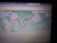
As I hit a 24% uphill grade at one point (bottom right of map), I guess I didn't entirely stick to the brief!


Strava July 6_1.JPG

Strava July 6_2.JPG


Had the middle part of the park to myself but it was nice to see the seasonal lake replenished again.
This weekend it will be a big doggy waterpark as it's supposed to be 26C and sunny.

20220706_112824.jpg


Like I said - had the middle of park to myself. I was following a trail where I often see deer on the edge of one of the larger ravines, but no such luck today.

20220706_115645.jpg 20220706_115650.jpg 20220706_115703.jpg

It was nice to get out on some old routes, and some new.
20220706_112843.jpg
 
^ It seems to me the torque the neck experiences in a golf drive should be more dangerous than riding a bike…though your riding is a little different than my sedate country by ways.
 
Did a little over 25 miles today. A picture of a regular farm house and the roads I ride on in my area. Also a turkey that got within about 10 yards of me, pretty sure it’s a domesticated turkey that got loose. This is the first ride I have done where my pace was under 4 minutes, I averaged 15.2 mph. It was a good day for speed, winds less than 5 mph but the heat index was 94.
214C157A-B6F6-4814-9191-9ED8D3B5D3C6.png

334027BF-A552-4C54-A254-8F36580F807C.jpeg
31968EAC-DD2A-46D4-84C8-4229E74A927E.jpeg
 
1657204835483.png


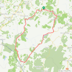
I think I made the right choice changing this ride from Tuesday to today, everything about it was just perfect! :D I parked the car in Peebles at 7am and set off on a wonderful ride that had me beaming from ear to ear! The last time I cycled the route in an anticlockwise direction so I decided to do it in the clockwise direction today which was going to be tougher due to the wind direction!

The centre of Peebles at 7am!

1657205028649.png

1657205084301.png


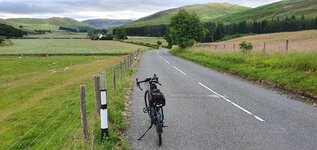
Now I was heading for the town of Innerleithing where I would turn off and head into the hills, well away from the busy roads and I had the roads pretty much to myself for the most part!

The River Tweed on the road down to Innerleithing!

1657205299673.png

1657205362456.png


The climb was now starting, all the way up to almost 1200ft and into a 20mph headwind! Eventually I reached the summit and enjoyed a nice descent into the valley, the wind was really blowing up here and I didn't even manage 30mph on the descent!

1657206635208.png


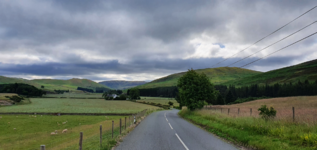
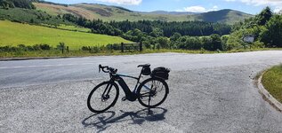
Into the valley now and the roads are just awesome!

1657206794474.png


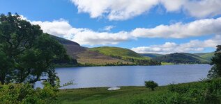
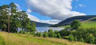
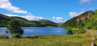
I was now heading for St Mary's Loch, where I got soaked and had a puncture 3 years ago! I was more successful today thankfully and the loch was looking lovely in the sunshine!

1657206171279.png

1657206237586.png


After passing the loch I enjoyed the descent down into Moffat which was my turning point today, as soon as I got into the town the climb begins again! Its known as the Devils Beef Tub (Google it if you want to know more ;)) locally and it climbs all the way up to almost 1400ft!

This is part way up the climb!

1657207321845.png


Getting near the top now!

1657207574167.png


My first battery was getting close to 20% now which was pretty good going considering I had almost covered 45 miles at this point and mostly into the 20mph headwind! It was finally time for the descent back towards Peebles with 25 miles still to go and now I had the wind at my back!

Starting the descent in lovely sunshine!

1657207834026.png


A lone fisherman on the River Tweed in the valley!

1657207946723.png


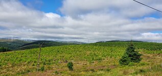
I had beautiful views like this all the way through the valley!

1657208039240.png


Back into Peebles at 1pm and it was a little brighter than 7am!

1657208208182.png


I got back to the car with 60% still left of my second battery, I was tempted to continue but thought it would be best to call it a day here and get home for a much needed shower! I will need a couple of days to recharge my own batteries now after today and a tough ride last Tuesday! This was cycling at its best, I will be on a high for quite some time!😁
 

Attachments

  • 1657205924321.png
    1657205924321.png
    2.6 MB · Views: 116
  • elevation_profile89.jpg
    elevation_profile89.jpg
    19.2 KB · Views: 120
  • trip-95717413-map-full89.png
    trip-95717413-map-full89.png
    293.2 KB · Views: 119
  • 20220707_081240.jpg
    20220707_081240.jpg
    634.4 KB · Views: 118
  • 20220707_084736.jpg
    20220707_084736.jpg
    384.8 KB · Views: 104
  • 20220707_085420.jpg
    20220707_085420.jpg
    557.5 KB · Views: 120
  • 20220707_085602.jpg
    20220707_085602.jpg
    539 KB · Views: 111
  • 20220707_104627.jpg
    20220707_104627.jpg
    458.7 KB · Views: 107
  • 20220707_124559.jpg
    20220707_124559.jpg
    717.8 KB · Views: 109
Last edited:
I did the Edmonds Loop from near Greenlake in Seattle. Up to Edmonds partially (only a few miles) on the Interurban Trail. Hit the coffee shop in Edmonds but only picked up a few nuggets for my PICNIC (he and his can't be the only ones who picnic). I don't generally do coffee and when I do it is decaf to avoid losing a night's sleep. Can't do caffeine anymore at all. Waterfront where the ferry was just leaving. A long climb out of Edmonds to an intersection called Perrinville. Around an south and then east down an exquisite Perkins Way - along a babbling brook to Lake Washington and the world renown Burke Gilman Trail (BGT) which has more roots than a mangrove swamp! South toward the Univ of Washington and then back home. Only a few photos. About 38 miles and 1,700 feet of climbing.

Edmonds Loop1.jpg

Garmin Varia Radar showing not traffic on Edge
PXL_20220707_202808445.jpg


Varia with RED margins showing traffic and one vehicle (top right) just about passing)
PXL_20220707_202805637.jpg


Edmonds Ferry and Puget Sound
PXL_20220707_181545256-.jpg


PXL_20220707_181556174-.jpg


My rather elaborate picnic ;) And darn, no convenient graveyard!!!
PXL_20220707_191607025-.jpg


The world renown BGT (which actually starts south of here in Seattle proper). And this portion has good pavement whereas Seattle's section is quite rooty.
PXL_20220707_193507419-.jpg


And on potentially longer rides I use a Range Extender battery.
Screenshot_20220707-140641.png
 
Back