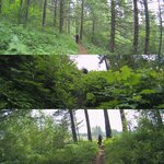
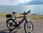
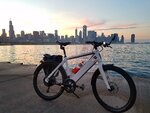
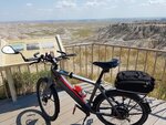
Show us pictures of where you ride your ebikes!

1529429552506.png
1529429570233.png

Katy Trail - Missouri
 
Back on an island in the Pacific...

Cowichan Valley Trail:

IMG_8756.JPG


Kinsol Trestle, Cowichan Valley Trail:

IMG_8758.JPG


What real bicycling infrastructure is. Near Esquimalt, BC:

IMG_8760.JPG


Back to the mainland. On board the MV Coho arriving in Port Angeles, WA:

IMG_8794.JPG
 
More PNW forest riding. Tarbell Trail to Hidden Falls, WA State.

9C6C5099-109B-4281-AB25-8160EBD28425.jpg

Lot's of single track in them thar hills! And clear cuts. And green stuff and flowers this time of year are off the charts to the point where sometimes you had to guess where the trail was.

The bike in front of me crapped out 14 miles in and I had to shortcut 13 miles back to the car, mainly on logging roads. He made it back about 4 miles before I got to him and was worked due to lot's of uphill which didn't effect me much as I kept a steady pace and ran out of my 10ah battery about 100' from the car.
 
The point where the Erie Canal leaves the Mohawk for the final connection to the Hudson along Flight Lock Road, a quarter mile from my house.

Interestingly enough, Erie Canal riders following the normal route never see this or the three locks and one guard gate along Flight Lock Road. You have to deviate from the route and know how to find the spot, but it allows you to stay with the canal the entire Flight of Five locks that raise the level 165 feet, the biggest change on the whole canal system. I get to ride this section all the time, but have never encountered a single touring cyclist on it.
089554D2-976E-4BC2-B2F4-76B17C352EEF.jpeg
 
Last edited:
Sunflowers in Nebraska.

Nebraska sun flowers.jpg


Mount Rushmore.


Mt Rushmore.jpg


Badlands National park.

Badlands -1.jpg


Panoramic view of the canyons and dunes.

Badlands panorama 1.jpg


Badlands panorama.jpg


Air pollution is a threat to Badlands national park as it deposits carbon on the white sand and alters the ecosystem.
Solution = E-bikes :)

Grand teton National park.

Grand Tetons.JPG


Grand tetons 1.jpg


Pacific coast, Big sur & Klamath California.

Big Sur.jpg


Tour thru.jpg


Washington DC - cherry blossoms.

Washington memoria.jpg
 

Attachments

  • Badlands -1.jpg
    Badlands -1.jpg
    666.3 KB · Views: 629
Last edited:
The point where the Erie Canal leaves the Mohawk for the final connection to the Hudson along Flight Lock Road, a quarter mile from my house.

Interestingly enough, Erie Canal riders following the normal route never see this or the three locks and one guard gate along Flight Lock Road. You have to deviate from the route and know how to find the spot, but it allows you to stay with the canal the entire Flight of Five locks that raise the level 165 feet, the biggest change on the whole canal system. I get to ride this section all the time, but have never encountered a single touring cyclist on it.
View attachment 22933
Dave, great pics! Slightly nostalgic for me. I'm originally from Amsterdam New York and spent my youth and early adulthood traveling the area including Saratoga and Lake George. Sent my kids to Colgate and Cornell. So stayed connected. Now 62 and been living in Connecticut for last 30 years. Just getting into e-mountain biking!
 
Sunflowers in Nebraska.

View attachment 22948

Mount Rushmore.


View attachment 22949

Badlands National park.

View attachment 22950

Panoramic view of the canyons and dunes.

View attachment 22951

View attachment 22952

Air pollution is a threat to Badlands national park as it deposits carbon on the white sand and alters the ecosystem.
Solution = E-bikes :)

Grand teton National park.

View attachment 22956

View attachment 22955

Pacific coast, Big sur & Klamath California.

View attachment 22957

View attachment 22958

Washington DC - cherry blossoms.

View attachment 22959[/QUOTE
Ravi, you get more than most! Beautiful bike(s) too. Stromers, right? How have they been for you? Any major issues?
 
Today's ride: Lancaster River Trail, just a couple miles down stream of Three Mile Island. Face The Fire. I wanted to be near an outlet in the event I needed a top-up on my pack.

Screenshot_20180624-194145_Gallery.jpg


Screenshot_20180624-194233_Gallery.jpg

Point Rock Tunnel

Screenshot_20180624-194328_Gallery.jpg

Chickies Rock. Popular with climbers.

Screenshot_20180624-194421_Gallery.jpg

White Cliffs of Conoy

Screenshot_20180624-194512_Gallery.jpg

Shocks Mill RR Bridge. 28 arch bridge, opened 1903.
 
Who wants EMTB? 60km on trails of the width of a person ........

60km of earth, mud, stones and many many branches and trunks,

There are NO jumps because this is not done to jump.


Attachments

  • 20180510_182149.jpg
    20180510_182149.jpg
    2.2 MB · Views: 632
  • Despues de 60km,pista de tierra,barro,piedras.jpg
    Despues de 60km,pista de tierra,barro,piedras.jpg
    1.5 MB · Views: 682
  • rio miño.jpg
    rio miño.jpg
    2.4 MB · Views: 670
Back