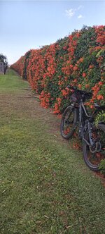
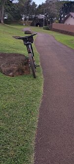
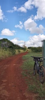
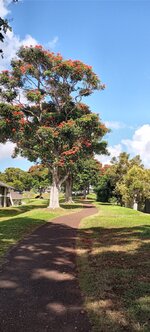
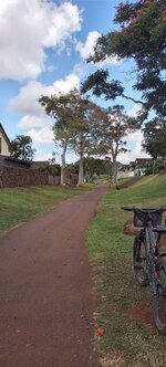
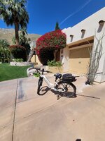
Show us pictures of where you ride your ebikes!

Buy an emtb with throttle just to get out .
I'm 59 years old and I find it very helpful just to get on the trail and explore. My bike is fast Be advised bafang ultra M620 are fast 30mph plus fast if you push it. I'm monkey pedaling most times to keep rpm maintain 25mph.
 

Attachments

  • Screenshot_20230314_064348_Photos.jpg
    Screenshot_20230314_064348_Photos.jpg
    365 KB · Views: 81
  • Screenshot_20230314_064100_Photos.jpg
    Screenshot_20230314_064100_Photos.jpg
    240.9 KB · Views: 74
  • Screenshot_20230314_064327_Photos.jpg
    Screenshot_20230314_064327_Photos.jpg
    260.4 KB · Views: 70
Couple of miles from the house an hour ago, the Champlain Canal heading up from the Erie Canal to Lake Champlain. Now I hear we’re looking at another six inches of snow in a few days… the foot we had last week just melted! I was surprised the ground on this path was as hard as it is, thought it might just be all mud today. My tires actually stayed clean! An excellent “from home” ride.

1712001254165.jpeg
 
Couple of miles from the house an hour ago, the Champlain Canal heading up from the Erie Canal to Lake Champlain. Now I hear we’re looking at another six inches of snow in a few days… the foot we had last week just melted! I was surprised the ground on this path was as hard as it is, thought it might just be all mud today. My tires actually stayed clean! An excellent “from home” ride.

View attachment 173451
Another 6 inches of snow? Maybe that's why they call it "April Fools Day"...
 
The exceptionally clear air left behind by last weekend's Pacific storm prompted a steep ride to the top of a nearby ridge with commanding mountain views from NNE to SSE.

20240402_151036.jpg

I knew the views up here would be good, but I never expected to see San Gorgonio Mountain and Mt. San Jacinto (see below) from a spot less than 3 mi from the coast!

20240402_150911.jpg

In the distance, snow-covered San Gorgonio Mountain (11,805 ft), 71 mi NNE. This highest point in SoCal is at the SE end of the San Bernardino Mountains at the SE end of California's young, rugged, and still rapidly rising Transverse Ranges. In the foreground, Calavera Volcano, an eroded volcanic neck ~15 million years old.

20240404_104748.jpg

In the distance, snow-capped Mt. San Jacinto (10,834 ft), 61 mi NE. Jacinto is the northernmost summit of the Peninsular Ranges, which also form most of San Diego County and all of Mexico's Baja Peninsula. Its northern and eastern flanks are giant fault scarps with some of the steepest mountain front relief in all of North America. The Coachella Valley, home to Palm Springs, is on the other side.

20240404_104322.jpg

Palomar Mountain (6,142 ft), 31 mi away on the ENE skyline, still showing a little snow from last weekend's storm. Palomar's east and west flanks are also extremely steep, and for the same reason.

20231006_143427.jpg

From a Palomar road trip last fall. Much of modern cosmology rests on discoveries made at the Palomar Observatory, just behind the skyline in the previous photo.

20231006_144106.jpg

If you're a science buff, the observatory tour is a must. Important astronomy still goes on there.

The San Bernardinos, San Jacintos, and Palomar are all giant fault-bounded blocks of crust squeezed up by conflicting motions within the San Andreas Fault System — a broad swath of mostly cooperative faults, large and small, that collectively get the Pacific Plate past this part of the North American Plate.

20240404_104557.jpg

The San Elijo Hills (1,340 to 1,736 ft), 6-9 mi SSE. This prominent coastal San Diego County landmark is held up by highly resistant volcanic rocks erupted 120-108 million years ago in a geologic setting much like present-day Japan.

The apparent summit from this angle is Double Peak (1,646 ft), but the true summit, Mt. Whitney (1,736 ft) is to its left. This Mt. Whitney (not to be confused with the Sierra Nevada fourteener) is the highest point in Carlsbad and for many miles around. My steepest ebike ride ever was to the top of Double Peak.

20240404_104650.jpg

In the distance, Woodson Mountain (2,901 ft), 21 mi SE, near Poway, CA. This prominent local landmark looks like a volcanic cone from this angle, but its actually made of ~90 million year old granitic rock from the frozen underground plumbing system of another Japan-like volcanic island an Andes-like volcanic chain.
 
Last edited:
Last weekend's cold Pacific storm brought 2 days of rain from a dense blanket of low stratus clouds. On the 3rd day, the steady west winds turned to gusty south winds, the stratified marine air turned unstable, and visibly convecting cumulus clouds large and small took over the sky.

20240331_130529.jpg

Marine advisories warned of rare offshore thunderstorms potentially dangerous to small craft. Since I still miss the wild thunderstorms we had in Denver, I rode to the beach to see what I could see despite the intermittent showers.

20240331_140332.jpg

20240331_140329.jpg

No thunder or lightning from my vantage, but the dramatic skies did NOT disappoint. Towering anvil clouds were lined up offshore, their feathery drawn-out tops telling of severe wind shear and icy conditions aloft. Some obscured the otherwise sharp horizon with dark rain shafts.

20240331_140151.jpg

And to top it all off, the pelicans, my favorite birds, were out in force. Flight after flight glided by on cliff-face updrafts, seldom flapping their wings as they all headed south in diagonals and vees.

20240331_135324.jpg

To my good fortune, the day was cold and blustery enough to clear out the Camp Store area at the nearby South Carlsbad State Beach Campground.

20240331_140200.jpg

20240331_140158.jpg

The updrafts are strongest right at bluff edge, and with no one there but me, that's where the pelicans chose to fly this day. What a thrill to see them so close without binocs!

20240331_140153.jpg

These massive birds may look awkward when they're perching and diving, but they're nothing but mastery and grace on the wing. Pelican video coming soon.
 
Last edited:
Last weekend's cold Pacific storm brought 2 days of rain from a dense blanket of low stratus clouds. On the 3rd day, the steady west winds turned to gusty south winds, the stratified marine air turned unstable, and visibly convecting cumulus clouds large and small took over the sky.

View attachment 173594
Marine advisories warned of rare offshore thunderstorms potentially dangerous to small craft. Since I still miss the wild thunderstorms we had in Denver, I rode to the beach to see what I could see despite the intermittent showers.

View attachment 173588
View attachment 173589
No thunder or lightning from my vantage, but the dramatic skies did NOT disappoint. Towering anvil clouds were lined up offshore, their feathery drawn-out tops telling of severe wind shear and icy conditions aloft. Some obscured the otherwise sharp horizon with dark rain shafts.

View attachment 173593
And to top it all off, the pelicans, my favorite birds, were out in force. Flight after flight glided by on cliff-face updrafts, seldom flapping their wings as they all headed south in diagonals and vees.

View attachment 173592
To my good fortune, the day was cold and blustery enough to clear out the Camp Store area at the nearby South Carlsbad State Beach Campground.

View attachment 173590
View attachment 173597
The updrafts are strongest right at bluff edge, and with no one there but me, that's where the pelicans chose to fly this day. What a thrill to see them so close without binocs!

View attachment 173591
These massive birds may look awkward when they're perching and diving, but they're nothing but mastery and grace on the wing. Pelican video coming soon.
I never really noticed pelicans untill this year on a beach in Florida. The transformation from awkward and goofy looking on the pier to graceful and handsome in the sky is one of the most striking things from that trip.
 
I never really noticed pelicans untill this year on a beach in Florida. The transformation from awkward and goofy looking on the pier to graceful and handsome in the sky is one of the most striking things from that trip.
Yes, quite remarkable. Kind of an ugly duckling story, but pelicans don't need to grow up, they just need to take off.

Pelicans are also masters of efficiency and precision in the air. When they're not riding cliff-face updrafts for some free lift, they're often riding wave-face updrafts for the same — sometimes dragging the very tip of one flight feather against the moving wave face to stay in the sweet spot. (Talking swell here, not breakers.)

When the wave crest starts to peter out or break, they pull up and bank over to take up the same position in front of the wave behind. When a whole line of pelicans does this, one after another, at the same spot on the wave crest, a wave of pelicans is formed.

I could watch them do this for hours, wishing I could join in the whole time. They also spend a lot of flying time in ground effect (well, water effect), just inches above the water.

This nice video shows the maneuver at 1:12 and 2:00. But the whole thing is worth watching, as it captures most aspects of pelican flight in slow motion.
 
Last edited:
Yes, quite remarkable. Kind of an ugly duckling story, but pelicans don't need to grow up, they just need to take off.

Pelicans are also masters of efficiency and precision in the air. When they're not riding cliff-face updrafts for some free lift, they're often riding wave-face updrafts for the same — sometimes dragging the very tip of one flight feather against the moving wave face to stay in the sweet spot. (Talking swell here, not breakers.)

When the wave crest starts to peter out or break, they pull up and bank over to take up the same position in front of the wave behind. When a whole line of pelicans does this, one after another, at the same spot on the wave crest, a wave of pelicans is formed.

I could watch them do this for hours, wishing I could join in the whole time. They also spend a lot of flying time in ground effect (well, water effect), just inches above the water.

This nice video shows the maneuver at 1:12 and 2:00. But the whole thing is worth watching, as it captures most aspects of pelican flight in slow motion.
Lovely. Such graceful creatures. I’ll swap saddles with you any day of the week. It sure beats looking at snow, dirt, and slough water which aptly describes the landscape around here. We stopped 10km short on our ride today being that it was a bit too cold. The sun made a brief appearance as we left the house but faded into the clouds for the duration of the ride. :(

GH013182 - frame at 0m15s.jpg
 
Just a shorty today...
Headed out to the very North entrance of the Delta Greenway, but had to stop and take this picture.

I mean, what were they sinking?


Entering the Greenway...


Boggy creek...


Bleak?


Not sure what these yellow plants are...


Home on the upper path...

As usual, I'm green with envy. ;) Wife tells me those are skunk cabbage.
 
I don't know what kind of flowering vine is this creating what looks to me like lava flowing. It's in full bloom now.
My usual Sunday ride on shared pathways.
 

Attachments

  • IMG_20220219_115721.jpg
    IMG_20220219_115721.jpg
    337.1 KB · Views: 71
  • IMG_20220219_112921.jpg
    IMG_20220219_112921.jpg
    401.2 KB · Views: 67
  • IMG_20220219_111630.jpg
    IMG_20220219_111630.jpg
    198.9 KB · Views: 67
  • IMG_20220219_113501.jpg
    IMG_20220219_113501.jpg
    337.8 KB · Views: 72
  • IMG_20220219_113143.jpg
    IMG_20220219_113143.jpg
    307.7 KB · Views: 61
The Devil's Tower was built in 1910 by a millionaire sugar importer named Manuel Rionda. Before it received the name Devil's Tower, it was formally known as Rio Vista. According to reporting from Forbes, the tower was built and dedicated to Rionda’s wife, Harriet Rionda, who was buried on nearby land but later moved to Brookside Cemetery, Englewood. Rumor has it that Mr. Rionda built the tower for his wife so she could look out at the New York City skyline. Others believe he built it as a mausoleum or for religious purposes. But, even with Mrs. Rionda’s death and later Mr. Rionda’s death in the mid 1900’s, many believe Harriet Rionda’s spirit still lives on at the tower.
PXL_20240409_221945359.NIGHT.jpg
 
Last edited:
So last Thursday started with me strapping my wedge and driver to the back of Level 2 and heading to the golf course for some practice. I took a pic outside of our house probably around noon before I departed. The next picture is from the ER after a motorist with road rage cut me off and apparently punched me in the mouth. I don't remember anything after the guy either cut me off or ran me off the road until I came to in the ER. Level 2 spent the weekend in the property room of the local PD and fortunately, I got back everything including my earbuds, golf clubs and sunglasses. Oh, yeah, and my helmet too. Probably saved my life. I have no idea who hit me. I am supposed to get a police report within 10 days...
 

Attachments

  • Level to G.jpg
    Level to G.jpg
    328.8 KB · Views: 86
  • ER.jpg
    ER.jpg
    158.1 KB · Views: 84
Back