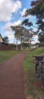
The exceptionally clear air left behind by last weekend's Pacific storm prompted a steep ride to the top of a nearby ridge with commanding mountain views from NNE to SSE.
I knew the views up here would be good, but I never expected to see San Gorgonio Mountain and Mt. San Jacinto (see below) from a spot less than 3 mi from the coast!
In the distance, snow-covered San Gorgonio Mountain (11,805 ft), 71 mi NNE. This highest point in SoCal is at the SE end of the San Bernardino Mountains at the SE end of California's young, rugged, and still rapidly rising Transverse Ranges. In the foreground, Calavera Volcano, an eroded volcanic neck ~15 million years old.
In the distance, snow-capped Mt. San Jacinto (10,834 ft), 61 mi NE. Jacinto is the northernmost summit of the Peninsular Ranges, which also form most of San Diego County and all of Mexico's Baja Peninsula. Its northern and eastern flanks are giant fault scarps with some of the steepest mountain front relief in all of North America. The Coachella Valley, home to Palm Springs, is on the other side.
Palomar Mountain (6,142 ft), 31 mi away on the ENE skyline, still showing a little snow from last weekend's storm. Palomar's east and west flanks are also extremely steep, and for the same reason.
From a Palomar road trip last fall. Much of modern cosmology rests on discoveries made at the Palomar Observatory, just behind the skyline in the previous photo.
If you're a science buff, the observatory tour is a must. Important astronomy still goes on there.
The San Bernardinos, San Jacintos, and Palomar are all giant fault-bounded blocks of crust squeezed up by conflicting motions within the San Andreas Fault System — a broad swath of mostly cooperative faults, large and small, that collectively get the Pacific Plate past this part of the North American Plate.
The San Elijo Hills (1,340 to 1,736 ft), 6-9 mi SSE. This prominent coastal San Diego County landmark is held up by highly resistant volcanic rocks erupted 120-108 million years ago in a geologic setting much like present-day Japan.
The apparent summit from this angle is Double Peak (1,646 ft), but the true summit, Mt. Whitney (1,736 ft) is to its left. This Mt. Whitney (not to be confused with the Sierra Nevada fourteener) is the highest point in Carlsbad and for many miles around. My steepest ebike ride ever was to the top of Double Peak.
In the distance, Woodson Mountain (2,901 ft), 21 mi SE, near Poway, CA. This prominent local landmark looks like a volcanic cone from this angle, but its actually made of ~90 million year old granitic rock from the frozen underground plumbing system of
another Japan-like volcanic island an Andes-like volcanic chain.