Our Rides in Words, Photos & Videos

I rode to a nearby city park today called Spring Lake, 21 miles round trip. Also a couple of barns that had escaped my iPhone camera until today. A small one with a little graffiti on it and one that is actively used as part of the nearby colleges ag program.
7BD00DC5-A1E9-4652-B50E-60537955C385.jpeg
6DE5DAD3-6E8D-49D8-9891-CE3CEB15281B.jpeg
9022E00D-0648-4BB6-9E4A-B76CD172D7D4.jpeg

35DF7950-E4E1-4BE4-9A7E-7ECB81E2CDEE.jpeg
 
1665424256601.png


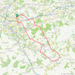
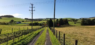
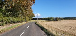
As I thought the roads were soaking wet this morning and the supposed dry weather hadn't materialised! Another look at the forecast on many different apps and I decided to wait until later in the morning and take a chance with heavy rain showers expected, it was a case of weather avoidance once again! I waited until just before midday and the roads had all dried up and the sky looked promising by now! I decided to head southeast and my turnaround point was going to be Biggar, after a full week of heavy rain I didn't want to chance the back roads due to flooding! I reached Carstairs village with the weather still playing ball and as you can see I had nice roads to enjoy! I had the strong breeze at my back for the first 33 miles and I was flying along and having a ball!

1665424665035.png

1665424923555.png


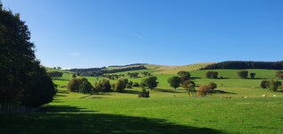
I reached the main A73 road which leads to Biggar, this road can be very busy with trucks and cars but it was my lucky day as the road wasn't that busy! With more amazing roads and the strong breeze pushing me along I was in cycling heaven and absolutely loving it! The Tinto and Pentland hills can be seen in the distance, its such a beautiful part of the country!

1665425188696.png

1665425251886.png


When I was a youngster (long time ago 🤣 ) my dad had his own haulage business, just 2 trucks but he was also working his main job which was a fleet engineer! Many times me and my siblings would join him and this road was one he used a lot as there were many sand and gravel quarries in the area! As soon as we arrived at the quarry we headed straight for the sand dunes and had an absolute blast messing about in the sand! This was one of the old quarries we used to visit at Thankerton, it looks very different these days but the main building still exists! I don't think there is any sand these days though so I'm not sure what they are mining now!

1665425698575.png


The view of the Pentalnd hills just past the quarry!

1665425778474.png


Another cyclist enjoying the awesome roads and the view!

1665425854874.png


I passed over the River Clyde just before reaching Biggar and was pleased to see the water levels have risen quite a bit, they had really fallen dangerously low in recent months! There used to be a railway bridge here dating back to 1858, exactly 100 years before I was born!

1665426018242.png


I passed through Biggar and turned north towards Carnwath, I now had a strong crosswind to deal with but there is a lot of tree cover so it wasn't that bad! A little more open here but with views like these I'm very glad!

1665426358019.png

1665426427227.png

1665426505132.png


I continued north with the weather still looking lovely and the nice views kept coming! The Tinto hills in the distance which I cycled past earlier!

1665430277713.png

1665430381827.png

1665430462938.png


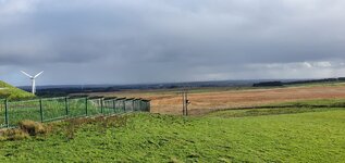
I was now almost at Carnwath and the clouds had started rolling in, I could see big squalls everywhere! Now I was on exposed roads and the rain arrived, as soon as it started the wind really picked up! I had the option of jumping on to the back roads with a lot of tree cover but I was worried about flooding so I stuck it out and thankfully the strong wind blew the clouds away! I just turned the assist up and soldiered on and the clouds were forming all around, I was sure I was going to get really soaked! Eventually I reached the road to Salsburgh and the sky had cleared here so I grabbed a photo of the squalls I had passed through from the top of the hill!

1665432114488.png


Thankfully I got home dry and very happy with my days cycling, it was so good to get out again!:D
 

Attachments

  • elevation_profile114.jpg
    elevation_profile114.jpg
    23.5 KB · Views: 114
  • trip-105198844-map-full114.png
    trip-105198844-map-full114.png
    421.4 KB · Views: 129
  • 20221010_141710.jpg
    20221010_141710.jpg
    559.2 KB · Views: 122
  • 20221010_142020.jpg
    20221010_142020.jpg
    341.3 KB · Views: 123
  • 20221010_143922.jpg
    20221010_143922.jpg
    656.2 KB · Views: 118
  • 20221010_143939.jpg
    20221010_143939.jpg
    709.6 KB · Views: 122
  • 20221010_154848.jpg
    20221010_154848.jpg
    437.9 KB · Views: 122
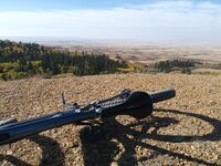
Charl and I are camping and biking in the interprovincial park of Cypress Hills on the Saskatchewan side. The colors of the changing poplar and aspen trees signalling our Fall season are truly amazing. After yesterday's invite to farming friends in the area for our Canadian Thanksgiving dinner both of us felt the need to work off the turkey 🦃 stuffing (or was it the never empty wine glasses) - the first picture Charl took of me while I had to summit the hiking trail while she happily stayed back and out of trouble on the main trail. The 2nd picture is from that bald knoll capturing the colors of the Cypress Hills that join the prairie abruptly. In the far west distance the Rocky mountains were pretty hazy from some still lingering forest fires.
 

Attachments

  • 20221010_135606.jpg
    20221010_135606.jpg
    820.6 KB · Views: 143
This happens when you ride together with a competing gravel cyclist...

...And you both are pedalling very hard! On that part of the ride, my riding mate actually sped up! I had to use the 70/70% of my Vado 5.0 assistance to keep up with him! And my legs turned into jelly :D

1665441758141.png

Average speed of 28.2 km/h, max speed of 35.7 km/h, all in rough terrain!

 
Last edited:
Who wouldn’t love a ride on something called the Snickersville Turnpike? But that last picture of the sweeping gravel turn leading into that long straight through the trees is pretty much my definition of a perfect afternoon. Looks like a great day.
It is funny that this little country paved road still clings to its glory days of 100 years ago. It lost stature as a main thoroughfare in 1916 and nowadays is a simple public 2 lane road. It is, however, one of very few paved roads surrounded by the protected gravel roads of the Historic Roads District, so it does get a few more cars traveling on it, but not near as many cars as most other paved roads in other areas.

Here is the road described by a webpage devoted to traveling the quiet roads in my area: The Snickersville Turnpike (SR 734) is a quiet, two-lane road, that passes farms and fields, and preserves much of its early character. George Washington traveled the road as a surveyor. By 1786 it was the first operating turnpike in America, praised by Thomas Jefferson as a success.

Snickersville-Turnpike-historical-sign.jpg

It is a sweet road to ride an analog road bike on the western stretch with its gentle rolling terrain. It's an ebiker's dream (and a road biker's sweat-and-tears) to ride the very tough, steep and persistent hills on the eastern end. Fortunately, I live near the western end.😁
 
Last edited:
What I Did On Tuesday

First, rode my Vado SL to see my daughter. Nice 20 km; the headwind was unpleasant though.
Second, rode to Jacek the Mechanic for yet another fix...

Several days ago, I was trying to ride onto a bike path at night. Because I didn't carry a strong external light, I rode onto a curb... My "crash survival technique" was as effective as to almost completely protect my body (a single bruise did not count!) but the e-bike took the whole impact! My brother had found the right crank arm got bent inwards, making the pedal "float" on the ride; he could straighten the crank arm in several minutes! He also noticed the rack being bent, and he straightened it, too!

I also got me O-Synce remote (eventually!) The O-Synce store in Germany had addressed the first shipment wrongly; I got the remote on the second attempt only. O-Synce and the BLEvo app are the equivalent of Micro Tune found on the new Mastermind Specialized e-bikes; the combo allows precision tuning of the e-bike motor as you ride. While it makes a little sense on the low power Vado SL, I think it will be very useful with the full-power Vado. One of my objectives on the ride was learning to use the O-Synce.

When I was returning at night, the temperature dropped dramatically (down to 3 C!) I had adequate clothes on me, only I could have worn thicker gloves...

As I was riding a bike path reasonably slowly, I could spot a police car parked on the wrong side of the road. Something must have happened there! I slowed my e-bike very much to see what that was. There was a crashed bike and the rider was lying on his back, unable to move. From what the policemen were asking him for, I could determine the guy must have been totally drunk! He was lucky someone called the police as the guy could die from hypothermia!

I happily reached home. Oh, ninety-one kilometres on a low power e-bike this cold Autumn was a demanding workout for me!

1665540671539.png

I took a forest ride to avoid a massive traffic jam on the road.
 
Last edited:
It is funny that this little country paved road still clings to its glory days of 100 years ago. It lost stature as a main thoroughfare in 1916 and nowadays is a simple public 2 lane road. It is, however, one of very few paved roads surrounded by the protected gravel roads of the Historic Roads District, so it does get a few more cars traveling on it, but not near as many cars as most other paved roads in other areas.

Here is the road described by a webpage devoted to traveling the quiet roads in my area: The Snickersville Turnpike (SR 734) is a quiet, two-lane road, that passes farms and fields, and preserves much of its early character. George Washington traveled the road as a surveyor. By 1786 it was the first operating turnpike in America, praised by Thomas Jefferson as a success.

View attachment 137614

It is a sweet road to ride an analog road bike on the western stretch with its gentle rolling terrain. It's an ebiker's dream (and a road biker's sweat-and-tears) to ride the very tough, steep and persistent hills on the eastern end. Fortunately, I live near the western end.😁
Snickersville Turnpike is the most beautiful, pastoral road in Loudoun County, about 15 minutes from me by car. Everytime I drive that road it evokes the Scottish and Irish countryside.
 
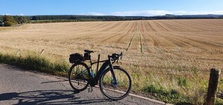
I did 14 miles today of which 3 or 4 miles was on gravel, which I don’t do often. Found a couple of barns, one of which was really bad and the other one was headed that way with some roofing coming off. I also shot a picture of a windmill that appears to be an old one that is restored on a much shorter tower.
72416249-B338-46E4-BF96-7EEE1C65B104.jpeg
2C2A5488-7649-4C51-9D9F-02C96FF9C027.jpeg
6269CD9C-1FC3-4C74-A241-196712046E05.jpeg
673D1066-E883-4F94-90E3-DF5651D52770.jpeg
 
@Djangodog - Beautiful videos. Hopefully we'll we seeing the colors change in our area of the Mid-Atlantic by next week.

Question: the banjo music is lovely - who is playing?
 
Finally got out for a decent ride this past Sunday. Our unseasonably warm dry weather has continued, but with it are hazy and sometimes smokey days. Headed over on the ferry to ride the Kitsap Peninsula.

Ended up doing 70 miles with over 6000 ft of climbing.
Screenshot_20221010-003707.pngScreenshot_20221010-003653.png
From the ferry dock at Kingston I headed down to Indianola where I took a few minutes to enjoy the tall pier. If you zoom in you can barely make out the Seattle skyline in the lower left. No Rainier today ...far too hazy.
PXL_20221009_185208283.jpg

From there a quick ride down to Suquamish where the 1866 gravesite of Chief Seattle (Si?ahl) is located. The gravestone dates to 1890, but the low wall surrounding the site is from a more modern renovation and carries this inscription ascribed to Chief Seattle from a speech in the 1850's:
Even the rocks thrill with memories of past events, The very dust beneath your feet respond(s) more lovingly to our footsteps, because it is the ashes of our ancestors. The soil is rich with the life of our kindred.
PXL_20221009_194244518.jpg

From there it was it was on around to Poulsbo and then across the Hood Canal Bridge to do a 25 mile loop up to Port Ludlow and then down to Shine-gra-la and back across the bridge to ride with the traffic on hwy 104 back to the ferry.

The road to Shine-gra-la:
PXL_20221009_224907024~2.jpg
Riding on the peninsula is always a mixed bag: some amazing roads and views, but if you have to go much distance you invariably end up on 1 or both of the busy state routes.
- saw a few seals and a sea lion at the Hood Canal Bridge but no orcas or submarines :)
- passed someone in Port Ludlow with the same model bike as me , that's a first.
-somewhere around 40 miles I passed a loaded down bikepacker going slow and steady in the opposite direction and we exchanged greetings across the road. A few hours later just about 5 blocks from the end of my ride, I caught up to the same fellow still going strong. Turns out, we were on the same ferry back to Edmonds but he was at the front whereas I was at the back ( with another ebiker on a Surley with a front hub- nice setup) so he had a 10 minute head start on me. He joked I needed to be carrying another 20-30 pounds like him to slow me down!
 

Attachments

  • PXL_20221009_193819118.jpg
    PXL_20221009_193819118.jpg
    462 KB · Views: 126
  • PXL_20221009_222800767.jpg
    PXL_20221009_222800767.jpg
    842 KB · Views: 134
  • PXL_20221009_211038642.jpg
    PXL_20221009_211038642.jpg
    311.8 KB · Views: 112
  • PXL_20221009_220656074.jpg
    PXL_20221009_220656074.jpg
    415.7 KB · Views: 127
  • PXL_20221009_224837547~2.jpg
    PXL_20221009_224837547~2.jpg
    329.6 KB · Views: 124
  • PXL_20221009_222728934.jpg
    PXL_20221009_222728934.jpg
    1 MB · Views: 131
  • PXL_20221009_212225705.jpg
    PXL_20221009_212225705.jpg
    703.6 KB · Views: 134
  • PXL_20221009_193906021.jpg
    PXL_20221009_193906021.jpg
    509.5 KB · Views: 118
  • strava6945300892969937593.jpg
    strava6945300892969937593.jpg
    1.2 MB · Views: 126
  • PXL_20221009_180735066.jpg
    PXL_20221009_180735066.jpg
    452 KB · Views: 122
  • PXL_20221009_224837547~2.jpg
    PXL_20221009_224837547~2.jpg
    329.6 KB · Views: 117
  • PXL_20221009_225331915.jpg
    PXL_20221009_225331915.jpg
    223.2 KB · Views: 127
@Djangodog - Beautiful videos. Hopefully we'll we seeing the colors change in our area of the Mid-Atlantic by next week.

Question: the banjo music is lovely - who is playing?

Thank you. I can’t take credit for the scenery.

Regarding the music, it has to be in the public domain for YouTube, so the editing software contains a selection of “generic” music. I try to make the music and video a good match.

I am still new to video editing, (I am a work in progress). I am finding it enjoyable.
yes video editing can get very addictive, I sometimes find myself in the car listening to music and thinking .
oooh, thats a perfect track for that scenery.
You can use any music on youtube, they just flag it as copyright and you cant monetize it , but they allow it.
Though you will have your vid banned in Russia 😄
 
Last edited:
Back