Our Rides in Words, Photos & Videos

Goodness! What’s that scraping on? Rocks?
I ride that e-bike in almost any terrain. As panniers are heavy, vibration makes the panniers shake and rub against the bike components. There's completely different situation with my SL where the single pannier I carry is lightweight (no need for a battery), and I have protected the delicate areas of that e-bike well in advance.
 
Remarkable Image Stabilization.
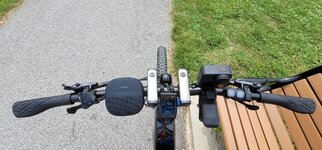
I have an ND filter attached to the camera lens for brighter shoots and it might compromise stabilization slightly. I forgot to remove it for this ride.
You could have done a few screen grabs from that video.
Here you go. I’ve never had very much luck with screenshots in terms of image quality. They always seem to turn out grainy.
GH010609_Moment(2).jpgGH010614_Moment(1).jpgGH010614_Moment(3).jpg
And watching, I know I'm too old for that kind of adventure.
I also thought that I wasn’t capable of taking on such trails but that all changed when I acquired the Trance. Here’s my take on the subject.
  1. Try to ride with those who have a higher skill set than you and better knowledge of the local trails.
  2. Get a bike with the largest battery and torque specs as possible relative to your budget.
  3. Set up the bike’s suspension in accordance to your own personal specs and objectives.
  4. Take on a few benign trails and work your way up gradually to more difficult/technical rides.
Road riding has also helped with my conditioning and provides a fresh change from riding the trails and vice versa.
 
Screenshot_20210807-155818_Strava.jpg

20210806_091745 1.jpg
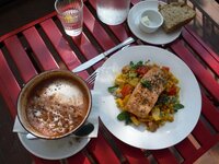
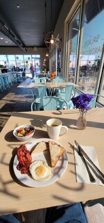
Light breakfast, so good!
20210807_111238.jpg
No room at the Inn.
20210807_191714.jpg
Supper after the ride today, pizza, fried chicken, leftover spaghetti, for dessert a banana, an apple fritter finished off with a pint of Coffee flavored ice cream with toffee bits, and then a hot cup of coffee. 🐷🐷🐷

Screenshot_20210806-120428_Maps.jpg
This woman will not get my vote for Mother of the Year! This chaps my buttt!

20210807_154427.jpg
Very excited, only used 62% of the battery going 123km!!!
I started out at 91%.

Sayonara ebbers...
 
awesome ride @PowerflyLee formerly known as CheetahLee ! we did similar distances today.

this was my longest ride yet, at 80.21 miles. not a huge amount of climbing for that distance - 3,920 feet. i'm happy that i did not use much battery, a total of only 57 watt hours, or just under 18% of the capacity. i felt very strong at the beginning, heart rate a bit higher than usual for the morning, and actually did the first part of the first climb with no motor at all and felt great. by the last 1.5 hours though, i was most certainly dragging!

20210807-prs.jpg


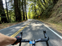
around the one quarter point, into the redwoods!
6208-spt.jpg

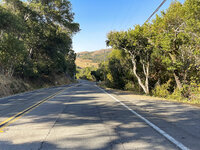
out of the forest and almost into the clearing around point reyes station, a small town around 35 miles north of san francisco.
6223-intoPRS.jpg

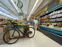
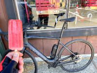
in town, a stop for water, gatorade, and popsicles.
6213-market.jpg6214-popsicle.jpg

i flipped my stem this week. feels pretty good, lower back a bit sore after 80 miles but i believe that would be the case no matter what.
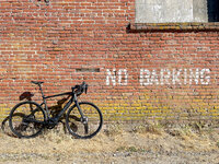
6218-creoBarking.jpg

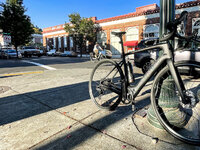
at the three quarter point, a quick stop to stretch out the back in san anselmo, another little suburb.
6233-sanAnselmo.jpg

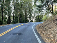
just starting the last real climb, now in the shade of early evening.
6237-caminoAlto.jpg
 
Making hay while…

Loading Lucerne, Wanora

Wanora, Brisbane Hinterland
11:35 am; 11.5 km
Today was the final day of lockdown, so I was still honour-bound not to exceed the ten kilometre from home limit. My ride took me up the rail trail (squiggly purple line on the map) before turning east along Pine Mountain Road and, after deviations along gravel roads, back to where I began (my coffee machine).

I suspect that the truck and trailer in the photo are a bit past their use-by dates, and perhaps a trifle overloaded, too!

Ride with GPS Map

  • 7 km : Brisbane Valley Highway : Look right; look left; look right again!
  • 9 km : Leschkes Road : Brahman cattle (Note to self: Take photo next ride!)
  • 10 km : Tallest tree in photo.
  • 11.5 km : Camera position; photo taken looking west.
  • 12 km : Near where photo in post #1 of this thread was taken (looking east).
  • 16 km : Where I was blinded by sun a few days ago (riding in opposite direction).
  • 17 km —> gravel roads aplenty!
  • 18 km : Bog Hole Reserve : snack time (not quite up to the standards set by Lee and Stefan).
 
Last edited by a moderator:
View attachment 95741
View attachment 95746
Light breakfast, so good!
View attachment 95747
No room at the Inn.
View attachment 95743
Supper after the ride today, pizza, fried chicken, leftover spaghetti, for dessert a banana, an apple fritter finished off with a pint of Coffee flavored ice cream with toffee bits, and then a hot cup of coffee. 🐷🐷🐷

View attachment 95745
This woman will not get my vote for Mother of the Year! This chaps my buttt!

View attachment 95749
Very excited, only used 62% of the battery going 123km!!!
I started out at 91%.

Sayonara ebbers...
I can't decide what's more amazing, the mileage that you've logged or those post-ride meals!! o_O Well done, LM!
 
This is Louka in her natural environs, prowling the Pennines for Vados, in this inclement weather her hunt will likely be unsuccessful as the Vado is a timid lowland creature found mainly on country lanes or hiding in garages, Louka goes anywhere, anytime.

On a bridge.jpg

Today we rode the ridge in the background to the big antenna in the distance and descended behind the hill on the left, this is at the mid section; a place to hydrate and let the adrenaline subside before a climb.

On the leeside.jpg


Hiding on the leeside having coffee and sandwich.

I've done 100km in a few days since completing the build, all in atrocious weather, all off road (this terrain is classified as 'expert' in MTB guides) and one was at midnight o_O this bike will take anything on and win, i'm using Eco 1&2 mainly and have not found anything that this struggles on.

All i need now is some pleasant weather, please, please, please.
 
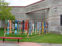
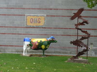
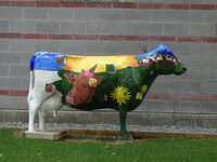
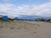
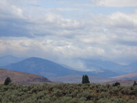
I could breathe today! The air was not smoky! It was cool outside! Here's what I saw on today's ride around the valley. Art!
DSC01544.JPGDSC01545.JPGDSC01546.JPG

Then, I checked a good indicator of the wildfire severity. Things aren't as bad as they seem. This supplier has about a third of their inventory left to go.
DSC01547.JPG
Saw this smoke to the west. I'm thinking it might be the Muckamuck Fire if it isn't a new one.DSC01551.JPG
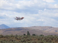
Rode closer to the airport and three of these were taking off and heading east to save the world. Out of four attempts, I got one non blurry shot. DSC01554.JPG
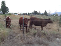
These wee beasties were watching me watch the planes.DSC01555.JPG
 
Sometimes if you want to ride you have to clear the trails yourself. This weekend I didn't get in much riding, but I started Friday by clearing a little used trail that was completely blocked with new growth and fallen trees, about a couple of meters of clearing needed at one point. I didn't think to record that, just needed to get it done, as I didn't want to turn back. That reminded me I needed to clear another trail closer to home that I'd partially cleared earlier this year, but left one large tree for another day since i could get around it. Went to clear it, but didn't get far and there was a new downed tree, much harder to get around and thought I might as well start here. Finally got top the original tree I had in mind and took care of that. Much resting involved, not in shape, I'm blaming the pandemic.

IMG_3958.jpeg
IMG_3963.jpeg
IMG_3967.jpeg
IMG_3970.jpeg
IMG_3992.jpeg
 
Sometimes if you want to ride you have to clear the trails yourself. This weekend I didn't get in much riding, but I started Friday by clearing a little used trail that was completely blocked with new growth and fallen trees, about a couple of meters of clearing needed at one point. I didn't think to record that, just needed to get it done, as I didn't want to turn back. That reminded me I needed to clear another trail closer to home that I'd partially cleared earlier this year, but left one large tree for another day since i could get around it. Went to clear it, but didn't get far and there was a new downed tree, much harder to get around and thought I might as well start here. Finally got top the original tree I had in mind and took care of that. Much resting involved, not in shape, I'm blaming the pandemic.

View attachment 95905View attachment 95907View attachment 95908View attachment 95914View attachment 95916
The newest must have ebike accessory is a chain saw. Very nice!
 
Making hay while…

View attachment 95761
Wanora, Brisbane Hinterland
11:35 am; 11.5 km
Today was the final day of lockdown, so I was still honour-bound not to exceed the ten kilometre from home limit. My ride took me up the rail trail (squiggly purple line on the map) before turning east along Pine Mountain Road and, after deviations along gravel roads, back to where I began (my coffee machine).

I suspect that the truck and trailer in the photo are a bit past their use-by dates, and perhaps a trifle overloaded, too!

View attachment 95770
  • 7 km : Brisbane Valley Highway : Look right; look left; look right again!
  • 9 km : Leschkes Road : Brahman cattle (Note to self: Take photo next ride!)
  • 10 km : Tallest tree in photo.
  • 11.5 km : Camera position; photo taken looking west.
  • 12 km : Near where photo in post #1 of this thread was taken (looking east).
  • 16 km : Where I was blinded by sun a few days ago (riding in opposite direction).
  • 17 km —> gravel roads aplenty!
  • 18 km : Bog Hole Reserve : snack time (not quite up to the standards set by Lee and Stefan).
Wow, round bales! They banned them here, cows couldn't get a square meal hahahahahahaha
 
Back