Our Rides in Words, Photos & Videos

A193DA7E-CD2F-4ACE-867D-B7B5FA5C2C55.jpeg
Rode 21 miles today. The pic is pretty typical of my area, Western Illinois. Some of the best farm ground in the world is in this area. It looks flat in this pic but I had an elevation gain of 1400 feet, lots of small hills add up.
 
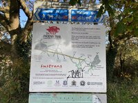
I imagine many of you read about the weather, flooding and landslides in Western Washington over the last two days. But then today it cleared. I combined two shots for the panorama and the arrow shows where it was taken - Sunset Park.

golden3.jpg


PXL_20211116_213129226_pan.jpg


This is one of my Go-To rides in the urban jungle. A bit over 15 miles and about 700 gain depending on variations on a theme.
 
We had another nice ride out today. This time out it was chilly but nice and sunny.

We cycled the Phoenix Trail, which is an old railway line between Thame in Oxfordshire and Princes Risborough in Buckinghamshire. It is also part of the Sustrans National Cycle Network, Route No. 57 and I’ve included some photos of some of the mile markers.

There we’re some lovely Autumnal colours on show and at one stage, we saw raining leaves, but I couldn’t capture it on film. But did get some sun glinting through the nice colours. However, there is a myriad of art along the way. Read the descriptions on them, but still not sure what they all mean. Apparently, the wooden sculpture with the Black disc represents Night and Day.

We had a nice picnic lunch in the church grounds of the St Mary‘s Parish Church in Princes Risborough.

This is the second time we’ve done this route, the first being in the Summer and we have made the decision to do it again in the wintertime and in the springtime, should be interesting to see the differences.

916A6EE4-B4C3-40BC-BBD6-7F386E8CC47B.jpeg
5F98966D-A83D-4B98-A704-E75CA7907B2D.jpeg
ECE282B8-E0F0-4485-BCAB-B6F69C4B3B81.jpeg
75787773-57B5-4DAC-A1F6-97C2F1661DC1.jpeg
6081BCDD-8BA3-47D0-9D99-D80907379BF4.jpeg
86B28039-CFED-4403-92F9-0BCD255B6F8F.jpeg
92CA9DA8-D284-4CA3-B2E5-242FA6F9B8C2.jpeg
B58FCE5D-EE4D-4635-AAC5-6AA0584CAB38.jpeg
57B3990A-CC86-4DE2-B1F0-9D9C64F51B7D.jpeg
23E8946D-8FE2-4B67-BDAD-4F57DC285B3F.jpeg
 

Attachments

  • FEAEE4AB-2499-48DB-802C-C256B3A24203.jpeg
    FEAEE4AB-2499-48DB-802C-C256B3A24203.jpeg
    839.3 KB · Views: 142
Hi folks!
Well I got my WattWagons Hydra yesterday and took her out for her first ride today. The power this thing has is crazy. I was able to do a MTB ride I have not been able to do in over 15 years. My soul is smiling!!!! I will write more about the bike and my adventures to get her in the WW forum. But for now I wanted to share my ride of a local park with MTB access (ebikes too!!). The Pleasanton Regional Park and Bernal Parks (The Ridge!). Click here for a PDF map and more park info. The park has expanded since my last visit. Lots to explore….
-BB
0B83A14C-ABBC-446B-806E-95E8A64D4BD6.jpegF9FCFF6B-76C9-4B7E-BEAA-A6AA318643CC.jpeg8C92AD76-CB7D-488C-8261-086419B79BF0.jpeg86863A08-5D10-4302-87A0-4734AE87D3E4.jpeg8AC2FEC2-C04D-4186-8EE3-C1168D91EE79.jpegCD40DFDD-3EBE-4108-8C33-073471689CE1.jpeg
Zoom in on the next and you will see a local kitty marking his territory (Bobcat! Fallen tree center)…
B6ED11A7-4483-4CC2-863D-EE2EF76CEC37.jpeg
 
Urban Jungle…

African Sausage Tree : Newstead, Brisbane

African Sausage Tree : Kigelia africana
Newstead, Brisbane
A long time ago, during the travel-the-world stage of my life, I became acquainted with Africa's 'sausage tree' from which the local people made their dugout canoes to venture out on the Rift Valley lakes. 'No hippos or crocodiles!' was their assurance. True?

The fruit can be eaten: just leave its preparation to someone with 'local knowledge' or suffer the consequences!

I doubt that I will ever again see those fascinating countries* with their inland seas, but the sausage tree growing beside the Brisbane River will always trigger memories as I ride by.
—————
* Ethiopia, Uganda, Kenya, Tanzania, Malawi, Moçambique.
Visited 1968 & 1970 : Right-click to open link without closing this page.
 
Took the Trance out on its first outing on the trails since it snowed. Not much to report along the way but quite a few sections of the trails were coated white and quite icy. I didn't take the cameras along with me on this trip so no photos/videos but I hope to add another submission tomorrow when we do it all over again. It was -2C when I left the house and might have ticked up a degree or two near the end of the ride.

Web capture_17-11-2021_17830_ridewithgps.com.jpeg

I did take a bit of time to prep the bike the night before. A fresh application of 3M film to the top/down and head tubes, installation of the rear mudhugger and more importantly, the addition of the dedicated winter wheels.

IMG_20211117_1257360.jpgIMG_20211117_1257169.jpgIMG_20211117_1257239.jpg

Post ride pic after shredding the 5 local trails. 16 casualties on the rear and 4 on the front. :(

IMG_20211117_1646015.jpg
 
Well I got my WattWagons Hydra yesterday
Congratulations, @BarnBoy! Out of curiosity: What is your ride's weight? What's the battery capacity in Wh?

Africa's 'sausage tree'
This picture has brought memories of the adventure books on Africa I read as a kid...

the addition of the dedicated winter wheels
Oh, winter's coming. I should think of preparing my e-bikes for winter rides!
--------------

My riding buddy Przemek The Gravelman has suggested a 58 km group ride for early Sunday's morning. (The colder it gets the shorter his rides become!) I'm excited to give my Vado SL a try this time: I would use the Range Extender battery and instruct Mission Control to provide automatic assist for the Distance To Be Ridden criterion. I hope I could match my buddies for speed! I was bitching about my recent addition to the e-bike being SQLabs Innerbarends 411: It has turned out in the longer run these grips could be quite useful to ride in the hunched position against the wind and for faster ride speed. My hands are closer apart -- some 45 cm compared to 69 cm with Ergon GP2 -- which is an interesting alternative resembling riding in hoods of a road bike handlebars. (The Innerbarends are only dramatically hard but wearing thick gloves makes the grips more acceptable).

Meanwhile, our riding friend Justyna "That Woman Who Beats Me" has found her own niche: It is gravel cycling at performance level! She's bought herself a high class Kross gravel bike, found a competing cyclist as her mentor, and she's winning Queen of Mountain titles on Strava on every single day! We're no match to her: I think she'll become a competing cyclist soon! :)
 
Hi folks!
Well I got my WattWagons Hydra yesterday and took her out for her first ride today. The power this thing has is crazy. I was able to do a MTB ride I have not been able to do in over 15 years. My soul is smiling!!!! I will write more about the bike and my adventures to get her in the WW forum. But for now I wanted to share my ride of a local park with MTB access (ebikes too!!). The Pleasanton Regional Park and Bernal Parks (The Ridge!). Click here for a PDF map and more park info. The park has expanded since my last visit. Lots to explore….
-BB
View attachment 107152View attachment 107153View attachment 107155View attachment 107156View attachment 107157View attachment 107159
Zoom in on the next and you will see a local kitty marking his territory (Bobcat! Fallen tree center)…
View attachment 107161
Congrats BB!. It’s a beaut! 😍 Look forward to hearing more about the bike and your upcoming MTB adventures. Ride on! 👍
 
Tomorrow's destination…

Deception Bay

Deception Bay
This is where I'll be heading to in morning, but it won't be quite the same! Tomorrow's high tide will be at 9:34 am which should be just when I arrive! The water will be in, not out. Forget the tides: what is unusual about this photo is the absence of a long bank of clouds over the Coral Sea.

Extreme Right: Moreton Bay Cycleway – just a sliver of it can be seen. The sea will be lapping the pathway when I arrive in the morning. On the beach next to the path are two tidemarks of decaying seagrass, the principal food for Deception Bay's dugongs (relatives of Florida's manatees – this area is strikingly similar to Tampa Bay).

Left Horizon: Coral Sea (Pacific Ocean); Moreton Island (a huge sand island 35 km away).

Left of Centre: northern end of the Redcliffe Peninsula (10 km across Deception Bay or 15 km by ebike around the bay).
The two photos below were taken here (five days later).

Right of Centre: largely undisturbed mangrove habitat (I'm sure there are some who'd like to 'develop' the area).
 
Last edited by a moderator:
When the long shadows of the evening escort one's bike along a solitary ramble down the gravel roads to visit the multiple pumpkin dressed driveway entrances of the local estates and the flanking shade trees decked out in their glorious autumn shades...yes, that is the finest time to enjoy the fragile bits of warm weather tentatively lingering in the air before the cold and dreary winter days muscle their way back to chase us all inside away from the sharp winds and bitter rains.

I will share below a few glimpses of the long shadows last night as I slowly cruised the local gravel roads for 12 beautifully scenic and utterly silent miles, savoring the gently disappearing sun slipping closer and closer in a colbolt blue sky to the mountainous horizon until those long shadows became a soft blanket of darkness.

Today I will make the most of this week's final remaining day of warmth to enjoy my bike and the roads for a full afternoon of deep-in-the-autumn-countryside cycling.

Tomorrow the bikes will be tucked away in the warm garage as we are slated to be in the cold wet clutches of early winter again.
20211117_153339_copy_750x1000.jpg

20211117_154322_copy_1000x750.jpg

20211117_153945_copy_1000x750.jpg
 
Last edited:
When the long shadows of the evening escort one's bike along a solitary ramble down the gravel roads to visit the multiple pumpkin dressed driveway entrances of the local estates and the flanking shade trees decked out in their glorious autumn shades...yes, that is the finest time to enjoy the fragile bits of warm weather tentatively lingering in the air before the cold and dreary winter days muscle their way back to chase us all inside away from the sharp winds and bitter rains.

I will share below a few glimpses of the long shadows last night as I slowly cruised the local gravel roads for 12 beautifully scenic and utterly silent miles, savoring the gently disappearing sun slipping closer and closer in a colbolt blue sky to the mountainous horizon until those long shadows became a soft blanket of darkness.

Today I will make the most of this week's final remaining day of warmth to enjoy my bike and the roads for a full afternoon of deep-in-the-autumn-countryside cycling.

Tomorrow the bikes will be tucked away in the warm garage as we are slated to be in the cold wet clutches of early winter again.
View attachment 107200
View attachment 107201
View attachment 107202
so good to hear from you again
 
A nice dry day today, so did a local ride as wifey at work.

Some of the roads have re-opened following months of being shut due to the East West Rail work, (re-opening of the old railway between Oxford and Cambridge that’s been shut for decades).

Part of my local route is the Sustrans National Cycle Network cycle path, No. 51. However, part of this has also been shut for many months as EWR have built a haul road across it. I have attached a photo of a Mile Marker that has been re-painted recently, but I’m still trying to decipher the disc on it.

ED7186F6-F410-4649-BF62-6D0765097EA7.jpeg
8FE788B1-4236-4AFC-A1A8-7325589D7212.jpeg
D46E35B5-BBE9-4FC2-8D2C-0D71D5FF960E.jpeg
8E42584D-42AF-4B0A-A763-82593EE86BFF.jpeg
EB04F9FA-FE30-4E7C-89B7-7DE1141C0995.jpeg
 
Back