Our Rides in Words, Photos & Videos

Finally got to the top of Verdugo Peak! (This was a week ago Friday, took me a while to post.) Yeah, I know, the photo is gratuitously iconic... but hey, I didn't plant the flag there. Verdugo Peak is "The Crown of Burbank and Glendale." (Ha!) My first ride over 30 miles, first summit over 3,000 feet, and first ride with over 4,000 feet of vertical. Took me 5 tries for Seeker and I to reach the top, and Friday was the last day to do it-- even so, the heat was brutal even at 7:00 PM. Of course, when I took these shots, I didn't realize the summit was actually behind me, at that radio tower.
IMG_0139.JPG
IMG_0127.JPG

I'll spare you the photos of the route, which you've seen before. Just a few from this spot right below the top, with the most unobstructed views,, looking over to the La Crescenta valley... you can see just about to the San Bernadino Mountains. That tiny toy village to the right of the telephone pole is Los Angeles.

IMG_0120.JPG

IMG_0121.JPG


I was so pissed the first four times I tried and didn't make it, but it turned out to be a great strategy, because I got to know the trail really well, and I started my descent much later than I planned. Again, most of the photos were taken at a peak just below and short of the summit, and when I put away my camera, I realized: The peak with the radio tower (which turns out to be KROQ, a legendary L.A. station) was actually the summit. It was nearly sunset, and I still had maybe a half mile and a hundred feet to climb!

So obviously I went for it-- and there was a gang of 50-60-70 something mountain bikers hanging out there! They were mostly riding non-motorized bikes, and at first, they were a bit reserved until they asked where I'd come from: "East Hollywood." Then they offered me a beer, and told me to come back any Friday night! I'll have to pack an NA beer and go up some Friday in the fall and see them again, but it was sobering to realize: There are guys in their 70s who do this with no motor.
Yow! Took only one shot from the real summit... but after shooting the photo below, I told the guys I had to bounce, and fast-- I was still 5.5 miles and 2,600 feet from any asphalt... only 15 minutes till sunset, but another 30 minutes after that to last light, so I figured I could get down the gnarliest parts of Brand Park Motorway without needing my light. And indeed, I had no problem, though it was a little hard to read the trail near the end.

IMG_0140.JPG


The ride down was a bit tricky-- very sandy, very tired, one panic stop when I chose the wrong line, but no crashes.

Stats for the ride:

Total Vertical = 4,300
Highest Elevation = 3,085
Total Distance = 32 miles
Max Speed = 36 MPH (per Bike computer, Strava says 34 MPH)
Screenshot_20210612-094047_Strava.jpg
 
today i overshot the mark a little bit. really wanted to check out some new roads, which i knew were a little far considering the weather and when i was starting out, but i did it anyway.

lessons learned: need a bigger bottle, or two bottles, need to stop sooner for a snack or bring snacks. around mile 40 i was starting to feel it, stopped around mile 50 and it was too late. didn't really recover which made the last 25 miles pretty rough. without the motor and turning it up well beyond what i normally do for the climbs, i'd definitely have been getting a lyft/uber. light-headed, nauseous, weak. overall though, some interesting scenery and good calibration lessons learned. i actually drank a lot and ate a decent amount of fruit at the refueling stop, but it was just too late, i think.

74.91 miles
average moving speed 15.1 mph
3,460 feet of elevation (not that much considering the length!)
105wh used (33% of creo built in battery.)

power stats were way down, understandably. normally i try and hit around 225-250w weighted avg power!

relive video: https://www.relive.cc/view/v8qV9RpNE76

image (23).png


and a handful of images. i've started a new experiment, carrying my "real" camera on a blackrapid strap at the small of my back. easy to reach around and pull a clip along the strap to slide the camera forward and take one-handed shots when conditions permit. still have some work to do on the camera settings - quite a few unsatisfactory results but i'm enjoying it. camera is a nikon z7.

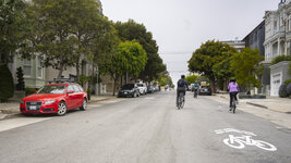
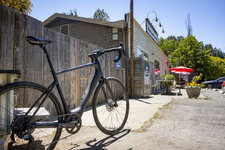
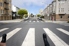
a foggy start, on one of the city's many "slow streets" which are closed to through traffic post-pandemic. nice warmup.
3784-clay-1920.jpg

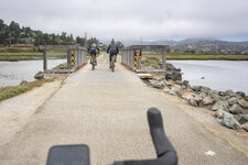
out of the city, across the bridge and on a flat MUP.
3802-sausPath-1920.jpg

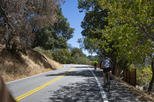
the first climb! camino alto.
3817-caminoAlto-1920.jpg

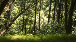
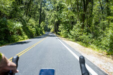
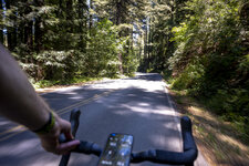
some miles later, into the redwoods. this image is interestingly blurred at full size, captures the feeling of riding through the redwood forest in the shady light.
3851-redwoods-1920.jpg

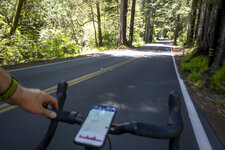
more climbing.
3859-redwoods-1920.jpg

elevation profiles in rideWithGPS are useful from time to time.
3865-sfd-1920.jpg

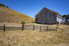
back out into the unreasonably hot sun, a picturesque barn.
3886-barn-1920.jpg

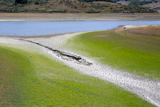
very low levels of water in the reservoir, but interesting colors and textures. all photos so far are taken from the bike, no stopping!
3923-reservoir-1920.jpg

the 10 miles-too-late pit stop.
3958-woodacre-1920.jpg

climb after the pit stop. grudgingly put her in sport.
3969-geronimo-1920.jpg

home is visible now, across the bay.
3993-sausSkyline-1920.jpg

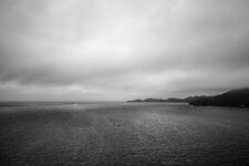
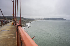
another change in weather, fog, clouds, and incredibly gusty winds. many were walking their bikes and i would not dare to remove a hand from the bars. leaned over perhaps 20 degrees into the wind, and then when passing an obstruction (like bridge tower or equipment), the bike violently lurches! exciting... sort of.
3997-pacific-1920.jpg

in the home stretch.
4007-towardsBaker-1920.jpg

just a few more blocks.
4020-francisco-1920.jpg
 
Sunday ride with friends…

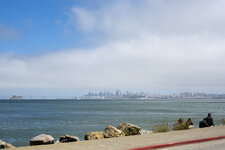
Moreton Bay seen from Shorncliffe Parade, Brisbane

View from Moreton Bay Cycleway
8:20 am; 24 km (total 131 km)
Midwinter at 27ºS and it was just about as cold as it ever gets. Brrr!

For some it was a day to take to their paddlebaords, but for us Tyred Old People (TOP Cyclists) on our ebikes it was the perfect opportunity to pedal rather than paddle. Bliss! (And afterwards, good company and endless coffee and scones with a few too many dollops of whipped double cream.)
 
today i overshot the mark a little bit. really wanted to check out some new roads, which i knew were a little far considering the weather and when i was starting out, but i did it anyway.

lessons learned: need a bigger bottle, or two bottles, need to stop sooner for a snack or bring snacks. around mile 40 i was starting to feel it, stopped around mile 50 and it was too late. didn't really recover which made the last 25 miles pretty rough. without the motor and turning it up well beyond what i normally do for the climbs, i'd definitely have been getting a lyft/uber. light-headed, nauseous, weak. overall though, some interesting scenery and good calibration lessons learned. i actually drank a lot and ate a decent amount of fruit at the refueling stop, but it was just too late, i think.

74.91 miles
average moving speed 15.1 mph
3,460 feet of elevation (not that much considering the length!)
105wh used (33% of creo built in battery.)

power stats were way down, understandably. normally i try and hit around 225-250w weighted avg power!

relive video: https://www.relive.cc/view/v8qV9RpNE76

View attachment 90928

and a handful of images. i've started a new experiment, carrying my "real" camera on a blackrapid strap at the small of my back. easy to reach around and pull a clip along the strap to slide the camera forward and take one-handed shots when conditions permit. still have some work to do on the camera settings - quite a few unsatisfactory results but i'm enjoying it. camera is a nikon z7.

a foggy start, on one of the city's many "slow streets" which are closed to through traffic post-pandemic. nice warmup.
View attachment 90929

out of the city, across the bridge and on a flat MUP.
View attachment 90930

the first climb! camino alto.
View attachment 90931

some miles later, into the redwoods. this image is interestingly blurred at full size, captures the feeling of riding through the redwood forest in the shady light.
View attachment 90932

more climbing.
View attachment 90933

elevation profiles in rideWithGPS are useful from time to time.
View attachment 90934

back out into the unreasonably hot sun, a picturesque barn.
View attachment 90935

very low levels of water in the reservoir, but interesting colors and textures. all photos so far are taken from the bike, no stopping!
View attachment 90936

the 10 miles-too-late pit stop.
View attachment 90937

climb after the pit stop. grudgingly put her in sport.
View attachment 90938

home is visible now, across the bay.
View attachment 90939

another change in weather, fog, clouds, and incredibly gusty winds. many were walking their bikes and i would not dare to remove a hand from the bars. leaned over perhaps 20 degrees into the wind, and then when passing an obstruction (like bridge tower or equipment), the bike violently lurches! exciting... sort of.
View attachment 90940

in the home stretch.
View attachment 90941

just a few more blocks.
View attachment 90942
Stunning photos, haven't been to NorCal in quite a while, you took me right there, and the Z5 is doing a great job! I'm thinking of trying some rides with my Fuji X-A5. Down here, we have some days that LOOK like this, I think that's advection fog, but here the fog actually has a lot of smog in it.

I'm not riding nearly as far as you are, but the steep vertical-- particularly the 3.5 mile stretch of trail at 9.5% grade which is supposedly intermediate/advanced, gave me bad stomach cramps on two occasions. Since I had serious GI problems in October, and my GI system really took a hit, I called my gastro and asked if this meant I had to slow down, or even go into the shop (groan - I'd love to stay out of hospitals for an entire year.) He said, basically, "Nah, doesn't sound like the infection is back, you MIGHT have to back off a bit. But another thing to try is just hydrate better," to which I added 'and stop a few times on the steep climbs, and add 5 minutes to your stops at the top of Griffith Park and at the base of Brand Park.' This really worked-- and the extra stopping time didn't have much impact on my average speed. I did most of my hydration before my ride, which worked well, but I may have to bite the bullet and get a hydration pack, or a sling for a second water bottle.

3.5 miles at 10% is no joke. it’s really surprising how much a quick stop helps various maladies. i get a consistent ache in my lower right back that progresses to a pretty high level of pain after a few hours, but a 5 minute stretch stop pretty much kicks it for another few hours. i need to learn to stop more, maybe every 1.5 hours, hydrate earlier, etc.

i’m liking the Z7 on the bike. going to try next with one of the DX lenses, and if i still have enough cropping and rotating latitude, maybe get a Z50 since it’s quite a bit lighter and cheaper if i crash on it.
you might take a Tylenol or two before you ride
 
Benefits From Meeting New Riding Companions :)

You might want to re-read my "Awesome Girls Ride" report; it is far better English right now there :) I taught That Woman how to benefit from higher cadence technique; I also re-inflated her bike's tyres etc. In turn, she inspected my English wording and written style. Justyna is not only an English teacher but also an American wife. After she corrected my English, I got red in my face to understand how many mistakes I've been making! Her comment: "You have helped me, and now I'm helping you" :) Great!
 
Last edited:
Benefits From Meeting New Riding Companions :)

You might want to re-read my "Awesome Girls Ride" report; it is far better English right now there :) I taught That Woman how to benefit from higher cadence technique; I also re-inflated her bike's tyres etc. In turn, she inspected my English wording and written style. Justyna is not only an English teacher but also an American wife. After she's corrected my English, I got red in my face to understand how many mistakes I've been making! Her comment: "You have helped me, and now I'm helping you" :) Great!
Stefan, I've always been impressed with your English language skills. You speak better English than many muricans.
 
Stefan, I've always been impressed with your English language skills. You speak better English than many muricans.
Reed, the thing that made me really ashamed was my "ill legs" (should have been "bad legs"). I cannot handle the sequence of tenses properly (her comment: Using Past Simple is actually better than misusing Past Perfect). And using "a" and "the" is nightmare to me (Polish doesn't use Articles).
 
Reed, the thing that made me really ashamed was my "ill legs" (should have been "bad legs"). I cannot handle the sequence of tenses properly (her comment: Using Past Simple is actually better than misusing Past Perfect). And using "a" and "the" is nightmare to me (Polish doesn't use Articles).
in the context of your commentary, "ill legs" was perfectly understandable!
 
1624363419488.png


Another perfect day for a ride, I decided to just ride my bike today with no distractions like taking photos! I picked a perfect route to enjoy cycling at its best, it was an absolute blast! Everything just clicked and the roads were in perfect condition and no idiots to spoil it! :D I'm so lucky we have such a great climate for cycling here, 93F would just kill me stone dead @PowerflyLee formerly known as CheetahLee you have my sympathies mate! 63F is our top temp today and thats considered warm here! ;)
 

Attachments

  • elevation_profile300.jpg
    elevation_profile300.jpg
    22.3 KB · Views: 141
  • trip-69755971-map-full215.png
    trip-69755971-map-full215.png
    434.6 KB · Views: 149
View attachment 90992

Another perfect day for a ride, I decided to just ride my bike today with no distractions like taking photos! I picked a perfect route to enjoy cycling at its best, it was an absolute blast! Everything just clicked and the roads were in perfect condition and no idiots to spoil it! :D I'm so lucky we have such a great climate for cycling here, 93F would just kill me stone dead @PowerflyLee formerly known as CheetahLee you have my sympathies mate! 63F is our top temp today and thats considered warm here! ;)
great ride! i just love it when everything clicks like that. and sometimes it's just right to turn everything off and roll/ride in the moment. 😍
 
Ride To Historic Markerville

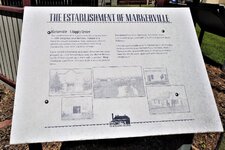
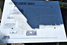
On Monday, my significant other and I rode to the historic hamlet of Markerville where homesteaders from Iceland first settled back in 1888. We’ve always wanted to travel there on two wheels and with such superb weather on our side we hit the road.

http://www.historicmarkerville.com/

Web capture_21-6-2021_21857_ridewithgps.com.jpeg

Along the C & E Trail. A nice tribute to our American, Canadian friends and fellow Albertans. I was hoping for a bit more wind to unfurl the ensigns but it wasn’t meant to be on this breeze-free day.
IMG_20210621_1215282.jpg

Along the way, we passed a large tract of farm land owned and operated by the PineHill Hutterite Bretheren Colony and couldn’t help but notice that their milking cattle seemed to take a special(ized) interest in our bikes. ;)
IMG_20210621_1252183.jpg

......as the sign says.
IMG_20210621_1316061.jpg

IMG_20210621_1320271.jpgIMG_20210621_1357109.jpgIMG_20210621_1358013.jpgIMG_20210621_1414110.jpgIMG_20210621_1416229.jpg

Fensala Hall.
- Apparently, this is the longest operating community hall in the province and still plays host to many concerts and banquets. If walls could talk.

IMG_20210621_1321050.jpg

Markerville Lutheran Church -
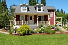
This beautiful structure was purchased by the Icelandic Society in 2007 and restored to provincial and municipal standard two years later.
IMG_20210621_1418081.jpg

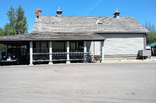
Markerville Creamery
-No doubt this is the most notable landmark for this small town. The creamery opened for business in 1902 and brought prosperity to the town until its closure in 1972. Unfortunately, the museum is closed until July 1, Canada Day.
IMG_20210621_1404223.jpg

IMG_20210621_1403529.jpgIMG_20210621_1329163.jpg

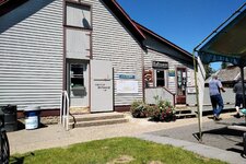
It now operates during the summer as a tourist attraction and many come to sample the fine dairy products and lunch items offered on their menu.
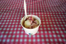
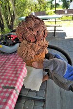
A bowl of raspberry cheesecake for my petit epouse and a double scoop of Rocky Road and salted caramel chocolate served up in a waffle cone pour moi. Best $6 cone that I think I’ve ever come across and some much-needed sustenance for the ride home. I couldn’t bear the thought of digging into a slice of homemade pie after barely being able to finish off that cone. I feel at times that I’m tuned in to the Food Network here as @Stefan Mikes and @PowerflyLee formerly known as CheetahLee have really amped up their trip reports with so many images of delectable treats. 😋
IMG_20210621_1340584.jpgIMG_20210621_1341440.jpg
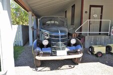
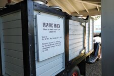
Loved this vintage delivery truck that they had on display.
IMG_20210621_1404476.jpg

IMG_20210621_1405030.jpgIMG_20210621_1407045.jpg

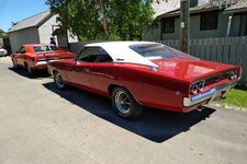
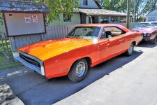
On this day, members of a Calgary car club were also showing off their classic wheels to whomever might be passing by. I admit that I don’t know an awful lot about vintage muscle cars but these looked to be well restored and cared for.
IMG_20210621_1406092.jpg

IMG_20210621_1405179.jpgIMG_20210621_1405333.jpg

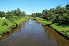
As we parted for home, I took a couple of pics of the Red Deer River as it quietly meanders through this tiny community.

IMG_20210621_1409275.jpg

IMG_20210621_1409355.jpg

Video footage is as plain Jane as it gets. These are the prairies after all. 😉


Back