RabH
Well-Known Member
I decided to get out early today to avoid the winds, even at 7am it was very blowy and directly from the east so it was rather chilly! I picked the perfect route to take adavantage of the wind, it couldn't have worked out any better!
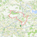
 I started off into the wind using the back roads to Bonnybridge so around 15 miles battling the headwind, I then had a good 20 miles with the wind at my back and it was such a blast!
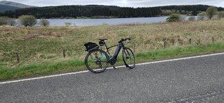
First photo of the day at Lonriggend!
From Bonnybridge I took the road to Denny to use the back roads to the Carron Valley reservoir, there was a lot of climbing involved but I had the wind at my back so it was a breeze so to speak!
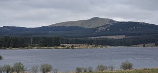
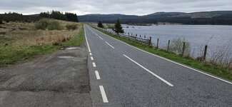
This is actually the first time I have used this road from east to west and the last time was many years ago from west to east, its such a good road for the bike! It eventually reaches the crossroads where I normally take the Campsie Hills route, I have taken a photo of the River Carron here many times but from the other direction!I was soon passing the reservoir with that strong wind pushing me on, the water is very high at the moment!
I just love this road, especially the smooth parts like this!
A few miles on I came down this descent at 43.6mph with that wind behind me, the camera doesn't do the hill justice of course!
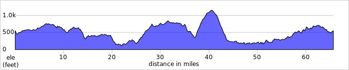
I was flying along and soon reached the turn where I would be climbing up Crow road up over the Campsie Hills to Lennoxtown! The climb can be seen from here, it starts at around 400ft and climbs to almost 1200ft!
Just before I was leaving today my Wahoo received an update, imagine my surprise when it started telling me when I was approaching a climb! Pretty cool feature, this is what it looked like before the climb up the Campsies! It tells you how long the climb is and how long it will take plus the height at the top of the climb!
I reached the top of the climb, it was a tough one today as I was into the wind for quite a bit but when I reached the summit I then had the wind at my back again and reached exactly 48mph on the descent, that was quite a buzz!
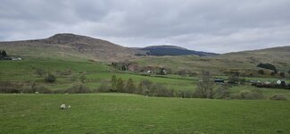
I stopped part way down for a snack and a couple of photos of the valley!Going down this part of the descent I was struggling to hit 25mph as it was straight into the 30mph headwind, it felt like I was pedalling backwards! At the bottom of the descent I stopped at Whitefield pond in Lennoxtown for more photos!
I now had around 21 miles to go and it was mostly into the wind but I was on my second battery and had lots of juice left, that was quite a relief! I was on the road to Kilsyth now which can be busy at times but wasn't too bad today, the drivers all behaved themselves and there were no grannies around...
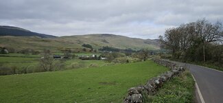
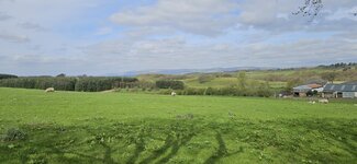
 After Kilsyth I was soon on the back roads again and took this photo of the Campsie Hills on the back road to Greengairs!
Of course I had to catch the lambs also, they soon bolted when I stopped!
Only a few miles to home now and no problems encountered, it sure was a day of climbing with almost 5000ft of elevation gain...slightly more than 214m @Stefan Mikes
I was surprised how strong I was today after riding 70 miles on Monday, my legs were feeling good! What a fantastic day on the bike, I'm so glad I got out at 7am as the wind was set to get stronger as they day progressed! I even got home with a spotless bike, always a bonus!
Attachments
-
 elevation_profile161.jpg20.8 KB · Views: 231
 -
 trip-119934659-map-full161.png498.1 KB · Views: 241
 -
 20230504_091235.jpg276.5 KB · Views: 229
 -
 20230504_091425.jpg613.4 KB · Views: 224
 -
 20230504_092112.jpg744.7 KB · Views: 233
 -
 20230504_093447.jpg323.8 KB · Views: 237
 -
 20230504_093453.jpg381.2 KB · Views: 221
 -
 20230504_111555.jpg385.5 KB · Views: 230


