Our Rides in Words, Photos & Videos

I did 16 miles today and found another barn to take a picture of. An abandoned windmill tower, a more modern metal building in the front and the old wooden barn in the background.
1EE14671-A7FC-4E17-9D0A-5C3829CA3472.jpeg
 
When the foliage peaks, it fades away quickly. November is probably the dreariness month in the Northeast US. Late March and April are similar, but with Spring you feel more optimistic.

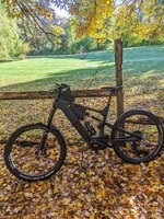
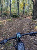
Today was still beautiful and Ole Sparky still managed to photobomb some otherwise nice, past peak images. Vermont is pretty, even when dreary.

31DBF313-D622-4FC2-B8E1-F6595D556754.jpeg


63B74C89-7422-42BD-95D6-B40C4BA58951.jpeg


FD2B6E6C-F458-41D7-A678-0322E79B1C69.jpeg


EBE90B53-D361-4F7A-A82D-B5B164255508.jpeg


26C79851-2F11-4510-BC8C-B774CA961860.jpeg
 
Graveloza Bolimowski Sztos*
*) "Sztos" (Polish) is derived from the German Stoß (a hit) and translates the best to American English as "a shiznit" :)

-- "Are you going for Graveloza today?" -- my brother texted me around 8:30 a.m. -- "Yes, leaving by train soon!" -- "Jumping into my car!"

1665909841822.png

The 21 people gravel group ride of Graveloza CC started at 10:35 a.m. on Saturday from the Skierniewice Railway Station.

1665910037504.png

(Photo by Tomek M.) Immediately, the whole bunch split into "the competing group" and "the main group". Both groups lived quite different lives! For instance, the main group was encouraged by a local participant to ride an unplanned singletrack; the competing group was precisely following the prescribed route. The fast group took some stop at a grocery store; they also experienced a flat. Meanwhile...

1665910349794.png

(photo by Tomek M) ...the main group rode at a racing pace for the first 56 km! It was me to ask for the stop. One of activities I took on that 15 minute stop was swapping batteries of my Speed Vado (not that the battery was empty; I needed a fresh battery just not to worry later!) Here, the Graveloza founder Mat (me standing with my back to the camera).

1665910520096.png

(Photo by Jacek Mikulski). As the group restarted the ride, I was just lighting a cigarette :D I and Jacek had to pursue the main group, and we only caught up with them at another stop!

1665910650532.png

Jacek at the Bolimów Lake. As you can see, he rides a Giant Trance E+. The e-MTB was
too good for the rough terrain of the Bolimów Landscape Park! However, MTBs tend to be slower than gravel bikes because of their gearing. Nonetheless, Jacek (riding his Monster at minimum assistance) was as strong as he could easily compete with traditional gravel riders!

1665910962109.png

(Photo by Jacek Mikulski). Me crossing a walkway over River Rawka.

1665911117733.png

82nd kilometre. Coffee and cake at a café in Nieborów. Here, the two groups joined for awhile.


1665911068862.png

(Photo by Jacek Mikulski). The ride was kept at a racing speed! The competing group made 104 km in 3 h 48 min. The main group arrived eleven minutes later, still under 4 hours! It was a crazy crazy crazy pace! I need to proudly mention I and Jacek matched the demands perfectly. There were some stragglers who "hit the wall" ("bonked") to reach the finish line far behind the main group!

1665911668997.png

Unbeknownst to me and Jacek, we entered a "Strava E-Bike Segment" at the straight 8 km stretch of perfect gravel! As I was in the tail of the group and wanted to get to the front, I pushed the pedals of my Vado very hard and started spinning. I caught up with Jacek near to the fire-road exit. My performance won me the E-Bike Course Record (CR) there, and my brother who needed 11 seconds more was awarded with the King Of Mountain (KOM) crown :) Necessary to mention, I have been riding that very fire-road for ten times already! (The 11th attempt belongs to Jacek). Verdict: No e-biker with Strava (except us two) has ever ridden that part of the Bolimów Forest yet!


That crazy ride was one of the best I could experience ever! (For your information: My Vado 5.0 used 802 Wh from its batteries, and the average level of assistance was 46.8% - Micro Tune achieved with the O-Synce remote and BLEvo app).
 
Last edited:
Graveloza Bolimowski Sztos*
*) "Sztos" (Polish) is derived from the German Stoß (a hit) and translates the best to American English as "a shiznit" :)

-- "Are you going for Graveloza today?" -- my brother texted me around 8:30 a.m. -- "Yes, leaving by train soon!" -- "Jumping into my car!"

View attachment 137963
The 21 people gravel group ride of Graveloza CC started at 10:35 a.m. on Saturday from the Skierniewice Railway Station.

View attachment 137964
(Photo by Tomek M.) Immediately, the whole bunch got split into "the competing group" and "the main group". Both groups lived quite different lives! For instance, the main group was encouraged by a local participant to ride an unplanned singletrack; the competing group was precisely following the prescribed route. The fast group took some stop at a grocery store; they also experienced a flat. Meanwhile...

View attachment 137965
(photo by Tomek M) ...the main group rode at a racing pace for the first 56 km! It was me to ask for the stop. One of activities I took on that 15 minute stop was swapping batteries of my Speed Vado (not that the battery was empty; I needed a fresh battery just not to worry later!) Here, the Graveloza founder Mat (me standing with my back to the camera).

View attachment 137966
(Photo by Jacek Mikulski). As the group restarted the ride, I was just lighting a cigarette :D I and Jacek had to pursue the main group, and we only caught up with them at another stop!

View attachment 137967
Jacek at the Bolimów Lake. As you can see, he rides a Giant Trance E+. The e-MTB was
too good for the rough terrain of the Bolimów Landscape Park! However, MTBs tend to be slower than gravel bikes because of their gearing. Nonetheless, Jacek (riding his Monster at minimum assistance) was as strong as he could easily compete with traditional gravel riders!

View attachment 137968
(Photo by Jacek Mikulski). Me crossing a walkway over River Rawka.

View attachment 137970
82nd kilometre. Coffee and cake at a café in Nieborów. Here, the two groups joined for awhile.


View attachment 137969
(Photo by Jacek Mikulski). The ride was kept at a racing speed! The competing group made 104 km in 3 h 48 min. The main group arrived eleven minutes later, still under 4 hours! It was a crazy crazy crazy pace! I need to proudly mention I and Jacek matched the demands perfectly. There were some stragglers who "hit the wall" ("bonked") to reach the finish line far behind the main group!

View attachment 137971
Unbeknownst to me and Jacek, we entered an "Strava E-Bike Segment" at the straight 8 km stretch of perfect gravel! As I was in the tail of the group and wanted to get to the front, I pushed the pedals of my Vado very strong and started spinning. I caught up with Jacek near to the fire-road exit. My performance won me the E-Bike Course Record (CR) there, and my brother who needed 11 seconds more was awarded with the King Of Mountain (KOM) crown :) Necessary to mention, I have been riding that very fire-road for ten times already! (The 11th attempt belongs to Jacek). Verdict: No e-biker with Strava (except us two) has ever ridden that part of the Bolimów Forest yet!


That crazy ride was one of the best I could experience ever! (For your information: My Vado 5.0 used 802 Wh from its batteries, and the average level of assistance was 46.8% - Micro Tune achieved with the O-Synce remote and BLEvo app).

That’s the way to do it, (fun, food and good company). Thank you for sharing the adventure. I miss riding with my Czech friends. It was very different from the “training rides” that I have endured on this side of the pond, (they are fun, but a bit intense). Nowadays, I just ride for the love of it, and it only took me 67 years to figure that out.
 
1665927939969.png


Back to my local roads today on a very blustery day with rain threatening, it didn't spoil my enjoyment though on these amazing roads! I headed for my local loch where I was hoping to see the water at a higher level after all the rain recently and I wasn't disappointed, its almost back to normal levels now!

1665928285627.png


The eastern end of the loch was bone dry recently so I was very pleased to see the water back up to normal levels there!

1665928443298.png


Of course the rain did arrive and with the strength of the wind I was never going to outrun it, thankfully it passed quickly though and the sun returned! I then turned north towards Limerigg with the roads pretty wet now and I had a nasty crosswind to endure here at the exposed part! I quickly took a photo before the bike almost toppled over, my quick reactions saved the day!

1665928782132.png


At the end of the road I was glad to turn right and now had the strong wind behind me, what a difference that made! I use this road to head home a lot of the time but I made sure I avoided it on the way home today, its just very exposed and even on the e bike it can be very hard work!

1665929091001.png


This road is a blast with a strong wind behind you!
1665929173553.png


I reached Limerigg and turned north again heading for Slamannan, thankfully no problems with the crosswind here due to trees and buildings and a lovely big descent to enjoy! At Slamannan I turned east again on to one of my favourite back roads, it can be bad for floods though but I got lucky today and it was only partly across the road in the usual spots!

Some rather large barns for @dodgeman in the distance here, we don't have many of those old vintage barns with lots of character around these parts!

1665929629281.png

1665929703622.png


After lots of twists and turns and lots of climbing another big descent awaited me and with the wind behind me it was such a blast, over 40mph here today and the roads had started to dry up now!

1665929939665.png


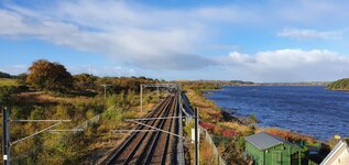
It was time to head north again towards Shieldhill, once again I had the strong crosswind trying its best to blow me off the bike but I won today! ;) The road is really exposed here but I managed to get some shelter from a lone tree to grab this photo!

1665930201835.png


I turned north again just before Shieldhill to enjoy another favourite back road with a huge descent, this one is well protected from the wind so it was an awesome descent down into Glenn Village despite the wet roads here!

The fastest part of the descent!

1665930523235.png


I passed through Glenn Village and thought about the best roads to take with the strong wind in mind, so I headed through Hallgen and enjoyed another big descent down into Falkirk! I was surprised that this descent turned out to be my fastest of the day at 42.1mph, I guess the wind played a part! I then knew I was going to be turning into the strong headwind almost all the way back home with almost 30 miles still to cover! I knew the perfect road to take with lots of tree cover, out to Allandale!

The Ochill hills can be seen in the distance!

1665931187669.png


A closer view!

1665931262900.png


This road is so much fun to ride with very few cars to be seen, there can be a lot of farm traffic at times but my luck was in today! I passed a grumpy roadie who wasn't keen on saying hello, I stopped here to take this photo and he passed me and still ignored my hello! I guess the strong wind affected his mood!:rolleyes:

1665931532572.png


It was time for some descents once again and I got a nice bonus near the bottom of the descent with lots of deer prancing around in the field! Sadly by the time I got my phone out they had darted to the far side of the field away from the scary cyclist!;)

1665931718895.png


A look back up the road I had descended, lovely new tarmac to enjoy!

1665931951284.png


I reached Allandale and continued west into the wind and heading for Castlecary, this road can be busy during the week but it was fine today thankfully! I then turned south on to a dual carriageway with a 50mph speed limit and as soon as I joined the road I could hear an engine at high revs and a boy racer in a Subaru Impreza shot past at probably 100mph at least!:rolleyes: He did leave me lots of room though but he was a total jerk! I reached the end of the dual carriageway unscathed and I was soon back on the quiet back roads and heading uphill towards Palacerigg Country Park! I thought about turning up this road but its notorious for bad flooding so I took the Palacerigg route to avoid it!

1665932492345.png


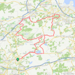
By now most of the roads were dry, although the wind was still causing problems I had an uneventful ride back home and was very satisfied with my day on the bike! On Thursday I had a 70 mile ride with 3800ft of climbing, today it was 20 miles less but only 300ft less climbing than Thursday! My local roads are very hilly and so much fun to ride, I don't think I will ever get bored of riding them!:D
 

Attachments

  • elevation_profile116.jpg
    elevation_profile116.jpg
    22.1 KB · Views: 87
  • trip-105684695-map-full116.png
    trip-105684695-map-full116.png
    423.1 KB · Views: 94
  • 20221016_100603.jpg
    20221016_100603.jpg
    471.5 KB · Views: 90
  • 20221016_103049.jpg
    20221016_103049.jpg
    432.8 KB · Views: 88
  • 20221016_104628.jpg
    20221016_104628.jpg
    754.3 KB · Views: 91
View attachment 137985

Back to my local roads today on a very blustery day with rain threatening, it didn't spoil my enjoyment though on these amazing roads! I headed for my local loch where I was hoping to see the water at a higher level after all the rain recently and I wasn't disappointed, its almost back to normal levels now!

View attachment 137986

The eastern end of the loch was bone dry recently so I was very pleased to see the water back up to normal levels there!

View attachment 137987

Of course the rain did arrive and with the strength of the wind I was never going to outrun it, thankfully it passed quickly though and the sun returned! I then turned north towards Limerigg with the roads pretty wet now and I had a nasty crosswind to endure here at the exposed part! I quickly took a photo before the bike almost toppled over, my quick reactions saved the day!

View attachment 137991

At the end of the road I was glad to turn right and now had the strong wind behind me, what a difference that made! I use this road to head home a lot of the time but I made sure I avoided it on the way home today, its just very exposed and even on the e bike it can be very hard work!

View attachment 137992

This road is a blast with a strong wind behind you!
View attachment 137993

I reached Limerigg and turned north again heading for Slamannan, thankfully no problems with the crosswind here due to trees and buildings and a lovely big descent to enjoy! At Slamannan I turned east again on to one of my favourite back roads, it can be bad for floods though but I got lucky today and it was only partly across the road in the usual spots!

Some rather large barns for @dodgeman in the distance here, we don't have many of those old vintage barns with lots of character around these parts!

View attachment 137994
View attachment 137995

After lots of twists and turns and lots of climbing another big descent awaited me and with the wind behind me it was such a blast, over 40mph here today and the roads had started to dry up now!

View attachment 137996

It was time to head north again towards Shieldhill, once again I had the strong crosswind trying its best to blow me off the bike but I won today! ;) The road is really exposed here but I managed to get some shelter from a lone tree to grab this photo!

View attachment 137997

I turned north again just before Shieldhill to enjoy another favourite back road with a huge descent, this one is well protected from the wind so it was an awesome descent down into Glenn Village despite the wet roads here!

The fastest part of the descent!

View attachment 137998

I passed through Glenn Village and thought about the best roads to take with the strong wind in mind, so I headed through Hallgen and enjoyed another big descent down into Falkirk! I was surprised that this descent turned out to be my fastest of the day at 42.1mph, I guess the wind played a part! I then knew I was going to be turning into the strong headwind almost all the way back home with almost 30 miles still to cover! I knew the perfect road to take with lots of tree cover, out to Allandale!

The Ochill hills can be seen in the distance!

View attachment 137999

A closer view!

View attachment 138000

This road is so much fun to ride with very few cars to be seen, there can be a lot of farm traffic at times but my luck was in today! I passed a grumpy roadie who wasn't keen on saying hello, I stopped here to take this photo and he passed me and still ignored my hello! I guess the strong wind affected his mood!:rolleyes:

View attachment 138001

It was time for some descents once again and I got a nice bonus near the bottom of the descent with lots of deer prancing around in the field! Sadly by the time I got my phone out they had darted to the far side of the field away from the scary cyclist!;)

View attachment 138002

A look back up the road I had descended, lovely new tarmac to enjoy!

View attachment 138003

I reached Allandale and continued west into the wind and heading for Castlecary, this road can be busy during the week but it was fine today thankfully! I then turned south on to a dual carriageway with a 50mph speed limit and as soon as I joined the road I could hear an engine at high revs and a boy racer in a Subaru Impreza shot past at probably 100mph at least!:rolleyes: He did leave me lots of room though but he was a total jerk! I reached the end of the dual carriageway unscathed and I was soon back on the quiet back roads and heading uphill towards Palacerigg Country Park! I thought about turning up this road but its notorious for bad flooding so I took the Palacerigg route to avoid it!

View attachment 138004

By now most of the roads were dry, although the wind was still causing problems I had an uneventful ride back home and was very satisfied with my day on the bike! On Thursday I had a 70 mile ride with 3800ft of climbing, today it was 20 miles less but only 300ft less climbing than Thursday! My local roads are very hilly and so much fun to ride, I don't think I will ever get bored of riding them!:D
Not enjoyable at all to see from where I sit….at my desk. :( Gorgeous vistas, serene landscapes, endless roads without traffic and awesome riding conditions. No, I can’t bear to look any longer. ;)

As for the grumpy fellow, we have one of our own on our daily rides and his demeanor doesn’t change wind or no wind.
 
As autumn progresses, the colors fade and the leaves fall, but spring is coming, (after winter and mud season). I don’t mind the winter. It gives me an opportunity to catch on everything that I put off all summer.

I put this little video together from yesterday’s ride. It was a bright and beautiful fall day with a high of 64. Give it a look if you are not too tired of my displays of Vermont yet.

Tired of seeing Vermont? I think not. Wonderful footage of the fall colors. Well done.
 
I did 15 miles today and found a barn that had escaped my camera so far. This one sits further back off the road so I had to zoom in some to get it. Like most barns of this style I suspect it’s close to 80 years old or older. It had two cupolas on top, I assume these double as vents also. It has a newer house out front which most likely means the original farm house was torn down.
5FF85000-FFF5-483C-8C90-583A2A435AE7.jpeg
 
The days of sweltering heat and humidity are long past now, and the trees are slowly changing into Autumn dress. Stealing away an hour or so for a bit of local cycling has become a joy when one can escape the ever increasing farm chores before winter sets in.

Friend G and I were out yesterday late afternoon for a quick 17 mile "gossip and news sharing" ride around our rural countryside on the paved roads. I was trying out the newly replaced motor on the Vado, and was happy that it was as smooth as the bike tech had claimed it was when he had tested it ....after the $700 install. (Long story - I thought the new motor was to be an even exchange for the bad motor, but the tech said no. Shop owner was away for 2 weeks and if I wanted the bike back I needed to fork over payment). No pictures from yesterday. We were too busy talking and zipping along. We had only an hour to ride and we were making the most of it.

I also had only an hour to be away on my solo ride the day before, and as a stress reliever for the hectic day I chose to take the peaceful gravel roads for a mind soothing ramble. I hadn't planned any particular route so, on the spur of the moment, I decided to check out the creek crossing a few miles from my place. It had been well over a year since I last took a bike through the waters, but with the recent dryer days of Fall, I was hoping to see a much diminished level of water than in the picture below:
Screenshot_20220614_072920_copy_800x521.jpg


The gravel road leading to the creek is barely one car width wide, but gorgeous with heavy tree shade both sides.
20221015_161545_copy_750x1000.jpg


Closer to the level crossing was this sign. I don't know if this was a new sign or not, but I hadn't remembered a warning that said "not". I thought the sign had merely cautioned against crossing with motor vehicles at high water. Someone had apparently sprayed out the word NOT as a joke. The Virginia Department of Transportation (VDOT), not at all amused, had re-stenciled in the essential NOT, leaving traces of the prior joke for all to see.
20221015_161700_copy_750x1000.jpg


I reached the ford, and stopped to look closely at the creek bed, or what I could see through the clear water with the dappled sunlight reflecting off it at high intensity. Even with polarizing sunglasses on I could barely make out the soft swales of the creek bed that were raised above the deeper traps ready to grab a bike and force it into higher water. I hadn't planned on actually going through the creek, but as I stood and studied (what I could see of the creek bottom) a possible safe passage for an ebike, and noticed the recent impression of a set of bike tires on the soft ground going into the water, the adventurous part of my brain suddenly urged me to go for it.

Throwing caution to the wind, I did. There would be go turning back if I was wrong and the water too deep. Once committed I had to make it to the other side. I wouldn't be honest if I didn't say there were a few moments of heart-in-mouth when my pedals churned up the water and my shoes, going underwater at each pedal stroke, were soaked immediately. I glanced down at one point, highly alarmed to see the lower part of my motor creating a V-shaped wave as the bike plowed through the creek. There was nothing I could do but pray the motor would be watertight enough to not be affected.

20221015_161854_copy_750x1000.jpg

It probably took less than a minute before my bike and I emerged from the water, pedals and shoes soaked, the bottom of the bike and the wheels dripping wet. I took a shot of our tire impressions (mine is the thin one) and then, just at that moment, realized the only way back home was to head further away from home up a long series of tough hills and lots of gravel roads. And I had less than an hour to do it.

20221015_162210_copy_750x1000.jpg

This photo may not show the steep incline that well, but trust me when I say it was almost straight up. Because the road is rarely used anymore thanks to the posted warning signs, VDOT didn't seem to be spending much time or effort in smoothing out the many washout ditches the rains had been carving across the road surface. This road would have been better served by a mountain bike. But the Gazelle was doing an awesome job, and it's motor unfazed by the creek crossing. I did make a mistake in stopping and getting off at one point during the assent to take a photo. Big mistake. The climb was too steep to start the bike from a dead standstill. Instead, I was forced to walk the bike up the assent, and over the washouts, until I reached ground that was less of a mountainside and more agreeable to my attempt to remount and ride the rest of the upward climb.

Before long my efforts took me to the top of the road where an intersection offered me a choice. Take the paved road in front of me which, while longer and rolled up some rather daunting hills, was faster than the gravel road option which offered beautiful views and far less traffic, and less miles to cover. I chose the gravel road, and took off at speed, pausing only once to chat with a husband and wife pair out walking. We discussed the weather, and the views.
20221015_162610_copy_1000x750.jpg


The wife said that they had been told that the view from their driveway was the best on the entire road, although after 26 years the trees had grown up a bit. They were 5 driveways up, she told me, and I said I would certainly check out their acclaimed view. I left them behind and out of sight as I cycled up over a crest and down again, counting driveways. By the time I reached the 5th driveway, I stopped. There was nothing to view except trees. I glanced behind me, but the couple were out of sight and far behind. I left, knowing there were far more interesting things to see as the roads took me on a rambling journey home.

20221015_162919_copy_750x1000.jpg

I was, soon enough after a number of twists and turns, back into the woods and on narrow roads again. The swiftest way back home was to take yet another road over the same creek, although this crossing would be dry via a low water bridge. Imagine my surprise seeing signs that the road was closed. Then coming upon evidence that VDOT was serious. The low water bridge was blocked off from traffic, accessible only to whatever bikes and pedestrians dared flouted VDOT's authority.

20221015_163234_copy_750x1000.jpg


The low water bridge seemed fine to my eyes so I guessed any structural damage (if there was any) was at the water line. From the faint traces left on the soft roads on either side of the bridge, I wasn't the first - nor would I be the last - bike to slip around the barriers and cross safely.

20221015_163319_copy_750x1000.jpg


The road leading up from the closed bridge was virtually abandoned by cars, and the trees had taken full advantage of the vehicular absence by dropping a carpet of autumn leaves over the road bed, almost obscuring it completely. It was a bit surreal, to be honest.

20221015_163424_copy_750x1000.jpg

A mile or so later the closed road joined with another gravel road, this one open to cars, which lead to yet another gravel road before that, too, joined forces with a final road leading to a paved road. I was now back into open countryside, a few miles from home. I stopped to take a photo of the shorn cornfield. All around the fields had been harvested for winter, and as if in cue the winds picked up and the temps grew chilly. I had no jacket since I hadn't planned to be out this long, so I ducked my head and pushed into the wind with all the power the bike would give me.

20221015_164525_copy_750x1000.jpg


Riding on the rare paved roads, this one thankfully heading home, gave me the speed I needed as the sun dropped lower in the sky and the shadows stretched out long and thin across the landscape. I was heading west into the wind. The chilly wind. Already late for dinner.

20221015_165158_copy_750x1000.jpg


A few more hills up and down at speed over the smooth tarmack and a final swing in the road to the last mile of gravel before I hit home. Just enough time to stop for a photo of a small herd of horses resting in a congenial group in the 5pm shade. I supposed they were patiently awaiting their own dinner. A lovely sight to finish out my impromptu creek crossing ride, leaving me with wet shoes and some lovely photographs of the day.

20221015_163113_copy_750x1000.jpg
 
Last edited:
The days of sweltering heat and humidity are long past now, and the trees are slowly changing into Autumn dress. Stealing away an hour or so for a bit of local cycling has become a joy when one can escape the ever increasing farm chores before winter sets in.

Friend G and I were out yesterday late afternoon for a quick 17 mile "gossip and news sharing" ride around our rural countryside on the paved roads. I was trying out the newly replaced motor on the Vado, and was happy that it was as smooth as the bike tech had claimed it was when he had tested it ....after the $700 install. (Long story - I thought the new motor was to be an even exchange for the bad motor, but the tech said no. Shop owner was away for 2 weeks and if I wanted the bike back I needed to fork over payment). No pictures from yesterday. We were too busy talking and zipping along. We had only an hour to ride and we were making the most of it.

I also had only an hour to be away on my solo ride the day before, and as a stress reliever for the hectic day I chose to take the peaceful gravel roads for a mind soothing ramble. I hadn't planned any particular route so, on the spur of the moment, I decided to check out the creek crossing a few miles from my place. It had been well over a year since I last took a bike through the waters, but with the recent dryer days of Fall, I was hoping to see a much diminished level of water than in the picture below:
View attachment 138078

The gravel road leading to the creek is barely one car width wide, but gorgeous with heavy tree shade both sides.
View attachment 138079

Closer to the level crossing was this sign. I don't know if this was a new sign or not, but I hadn't remembered a warning that said "not". I thought the sign had merely cautioned against crossing with motor vehicles at high water. Someone had apparently sprayed out the word NOT as a joke. The Virginia Department of Transportation (VDOT), not at all amused, had re-stenciled in the essential NOT, leaving traces of the prior joke for all to see.
View attachment 138080

I reached the ford, and stopped to look closely at the creek bed, or what I could see through the clear water with the dappled sunlight reflecting off it at high intensity. Even with polarizing sunglasses on I could barely make out the soft swales of the creek bed that were raised above the deeper traps ready to grab a bike and force it into higher water. I hadn't planned on actually going through the creek, but as I stood and studied (what I could see of the creek bottom) a possible safe passage for an ebike, and noticed the recent impression of a set of bike tires on the soft ground going into the water, the adventurous part of my brain suddenly urged me to go for it.

Throwing caution to the wind, I did. There would be go turning back if I was wrong and the water too deep. Once committed I had to make it to the other side. I wouldn't be honest if I didn't say there were a few moments of heart-in-mouth when my pedals churned up the water and my shoes, going underwater at each pedal stroke, were soaked immediately. I glanced down at one point, highly alarmed to see the lower part of my motor creating a V-shaped wave as the bike plowed through the creek. There was nothing I could do but pray the motor would be watertight enough to not be affected.

View attachment 138082
It probably took less than a minute before my bike and I emerged from the water, pedals and shoes soaked, the bottom of the bike and the wheels dripping wet. I took a shot of our tire impressions (mine is the thin one) and then, just at that moment, realized the only way back home was to head further away from home up a long series of tough hills and lots of gravel roads. And I had less than an hour to do it.

View attachment 138083
This photo may not show the steep incline that well, but trust me when I say it was almost straight up. Because the road is rarely used anymore thanks to the posted warning signs, VDOT didn't seem to be spending much time or effort in smoothing out the many washout ditches the rains had been carving across the road surface. This road would have been better served by a mountain bike. But the Gazelle was doing an awesome job, and it's motor unfazed by the creek crossing. I did make a mistake in stopping and getting off at one point during the assent to take a photo. Big mistake. The climb was too steep to start the bike from a dead standstill. Instead, I was forced to walk the bike up the assent, and over the washouts, until I reached ground that was less of a mountainside and more agreeable to my attempt to remount and ride the rest of the upward climb.

Before long my efforts took me to the top of the road where an intersection offered me a choice. Take the paved road in front of me which, while longer and rolled up some rather daunting hills, was faster than the gravel road option which offered beautiful views and far less traffic, and less miles to cover. I chose the gravel road, and took off at speed, pausing only once to chat with a husband and wife pair out walking. We discussed the weather, and the views.
View attachment 138084

The wife said that they had been told that the view from their driveway was the best on the entire road, although after 26 years the trees had grown up a bit. They were 5 driveways up, she told me, and I said I would certainly check out their acclaimed view. I left them behind and out of sight as I cycled up over a crest and down again, counting driveways. By the time I reached the 5th driveway, I stopped. There was nothing to view except trees. I glanced behind me, but the couple were out of sight and far behind. I left, knowing there were far more interesting things to see as the roads took me on a rambling journey home.

View attachment 138085
I was, soon enough after a number of twists and turns, back into the woods and on narrow roads again. The swiftest way back home was to take yet another road over the same creek, although this crossing would be dry via a low water bridge. Imagine my surprise seeing signs that the road was closed. Then coming upon evidence that VDOT was serious. The low water bridge was blocked off from traffic, accessible only to whatever bikes and pedestrians dared flouted VDOT's authority.

View attachment 138086

The low water bridge seemed fine to my eyes so I guessed any structural damage (if there was any) was at the water line. From the faint traces left on the soft roads on either side of the bridge, I wasn't the first - nor would I be the last - bike to slip around the barriers and cross safely.

View attachment 138087

The road leading up from the closed bridge was virtually abandoned by cars, and the trees had taken full advantage of the vehicular absence by dropping a carpet of autumn leaves over the road bed, almost obscuring it completely. It was a bit surreal, to be honest.

View attachment 138088
A mile or so later the closed road joined with another gravel road, this one open to cars, which lead to yet another gravel road before that, too, joined forces with a final road leading to a paved road. I was now back into open countryside, a few miles from home. I stopped to take a photo of the shorn cornfield. All around the fields had been harvested for winter, and as if in cue the winds picked up and the temps grew chilly. I had no jacket since I hadn't planned to be out this long, so I ducked my head and pushed into the wind with all the power the bike would give me.

View attachment 138089

Riding on the rare paved roads, this one thankfully heading home, gave me the speed I needed as the sun dropped lower in the sky and the shadows stretched out long and thin across the landscape. I was heading west into the wind. The chilly wind. Already late for dinner.

View attachment 138090

A few more hills up and down at speed over the smooth tarmack and a final swing in the road to the last mile of gravel before I hit home. Just enough time to stop for a photo of a small herd of horses resting in a congenial group in the 5pm shade. I supposed they were patiently awaiting their own dinner. A lovely sight to finish out my impromptu creek crossing ride, leaving me with wet shoes and some lovely photographs of the day.

View attachment 138091
I was just about to retire to bed but couldn’t once I started reading your trip report. After that creek crossing you would be readytoride just about anything that you came across. Bravo! 👏
 
The days of sweltering heat and humidity are long past now, and the trees are slowly changing into Autumn dress. Stealing away an hour or so for a bit of local cycling has become a joy when one can escape the ever increasing farm chores before winter sets in.

Friend G and I were out yesterday late afternoon for a quick 17 mile "gossip and news sharing" ride around our rural countryside on the paved roads. I was trying out the newly replaced motor on the Vado, and was happy that it was as smooth as the bike tech had claimed it was when he had tested it ....after the $700 install. (Long story - I thought the new motor was to be an even exchange for the bad motor, but the tech said no. Shop owner was away for 2 weeks and if I wanted the bike back I needed to fork over payment). No pictures from yesterday. We were too busy talking and zipping along. We had only an hour to ride and we were making the most of it.

I also had only an hour to be away on my solo ride the day before, and as a stress reliever for the hectic day I chose to take the peaceful gravel roads for a mind soothing ramble. I hadn't planned any particular route so, on the spur of the moment, I decided to check out the creek crossing a few miles from my place. It had been well over a year since I last took a bike through the waters, but with the recent dryer days of Fall, I was hoping to see a much diminished level of water than in the picture below:
View attachment 138078

The gravel road leading to the creek is barely one car width wide, but gorgeous with heavy tree shade both sides.
View attachment 138079

Closer to the level crossing was this sign. I don't know if this was a new sign or not, but I hadn't remembered a warning that said "not". I thought the sign had merely cautioned against crossing with motor vehicles at high water. Someone had apparently sprayed out the word NOT as a joke. The Virginia Department of Transportation (VDOT), not at all amused, had re-stenciled in the essential NOT, leaving traces of the prior joke for all to see.
View attachment 138080

I reached the ford, and stopped to look closely at the creek bed, or what I could see through the clear water with the dappled sunlight reflecting off it at high intensity. Even with polarizing sunglasses on I could barely make out the soft swales of the creek bed that were raised above the deeper traps ready to grab a bike and force it into higher water. I hadn't planned on actually going through the creek, but as I stood and studied (what I could see of the creek bottom) a possible safe passage for an ebike, and noticed the recent impression of a set of bike tires on the soft ground going into the water, the adventurous part of my brain suddenly urged me to go for it.

Throwing caution to the wind, I did. There would be go turning back if I was wrong and the water too deep. Once committed I had to make it to the other side. I wouldn't be honest if I didn't say there were a few moments of heart-in-mouth when my pedals churned up the water and my shoes, going underwater at each pedal stroke, were soaked immediately. I glanced down at one point, highly alarmed to see the lower part of my motor creating a V-shaped wave as the bike plowed through the creek. There was nothing I could do but pray the motor would be watertight enough to not be affected.

View attachment 138082
It probably took less than a minute before my bike and I emerged from the water, pedals and shoes soaked, the bottom of the bike and the wheels dripping wet. I took a shot of our tire impressions (mine is the thin one) and then, just at that moment, realized the only way back home was to head further away from home up a long series of tough hills and lots of gravel roads. And I had less than an hour to do it.

View attachment 138083
This photo may not show the steep incline that well, but trust me when I say it was almost straight up. Because the road is rarely used anymore thanks to the posted warning signs, VDOT didn't seem to be spending much time or effort in smoothing out the many washout ditches the rains had been carving across the road surface. This road would have been better served by a mountain bike. But the Gazelle was doing an awesome job, and it's motor unfazed by the creek crossing. I did make a mistake in stopping and getting off at one point during the assent to take a photo. Big mistake. The climb was too steep to start the bike from a dead standstill. Instead, I was forced to walk the bike up the assent, and over the washouts, until I reached ground that was less of a mountainside and more agreeable to my attempt to remount and ride the rest of the upward climb.

Before long my efforts took me to the top of the road where an intersection offered me a choice. Take the paved road in front of me which, while longer and rolled up some rather daunting hills, was faster than the gravel road option which offered beautiful views and far less traffic, and less miles to cover. I chose the gravel road, and took off at speed, pausing only once to chat with a husband and wife pair out walking. We discussed the weather, and the views.
View attachment 138084

The wife said that they had been told that the view from their driveway was the best on the entire road, although after 26 years the trees had grown up a bit. They were 5 driveways up, she told me, and I said I would certainly check out their acclaimed view. I left them behind and out of sight as I cycled up over a crest and down again, counting driveways. By the time I reached the 5th driveway, I stopped. There was nothing to view except trees. I glanced behind me, but the couple were out of sight and far behind. I left, knowing there were far more interesting things to see as the roads took me on a rambling journey home.

View attachment 138085
I was, soon enough after a number of twists and turns, back into the woods and on narrow roads again. The swiftest way back home was to take yet another road over the same creek, although this crossing would be dry via a low water bridge. Imagine my surprise seeing signs that the road was closed. Then coming upon evidence that VDOT was serious. The low water bridge was blocked off from traffic, accessible only to whatever bikes and pedestrians dared flouted VDOT's authority.

View attachment 138086

The low water bridge seemed fine to my eyes so I guessed any structural damage (if there was any) was at the water line. From the faint traces left on the soft roads on either side of the bridge, I wasn't the first - nor would I be the last - bike to slip around the barriers and cross safely.

View attachment 138087

The road leading up from the closed bridge was virtually abandoned by cars, and the trees had taken full advantage of the vehicular absence by dropping a carpet of autumn leaves over the road bed, almost obscuring it completely. It was a bit surreal, to be honest.

View attachment 138088
A mile or so later the closed road joined with another gravel road, this one open to cars, which lead to yet another gravel road before that, too, joined forces with a final road leading to a paved road. I was now back into open countryside, a few miles from home. I stopped to take a photo of the shorn cornfield. All around the fields had been harvested for winter, and as if in cue the winds picked up and the temps grew chilly. I had no jacket since I hadn't planned to be out this long, so I ducked my head and pushed into the wind with all the power the bike would give me.

View attachment 138089

Riding on the rare paved roads, this one thankfully heading home, gave me the speed I needed as the sun dropped lower in the sky and the shadows stretched out long and thin across the landscape. I was heading west into the wind. The chilly wind. Already late for dinner.

View attachment 138090

A few more hills up and down at speed over the smooth tarmack and a final swing in the road to the last mile of gravel before I hit home. Just enough time to stop for a photo of a small herd of horses resting in a congenial group in the 5pm shade. I supposed they were patiently awaiting their own dinner. A lovely sight to finish out my impromptu creek crossing ride, leaving me with wet shoes and some lovely photographs of the day.

View attachment 138091
Beautiful countryside. I like the picture of the stream crossing, but the idea of submerging spinning wheel and bottom bracket bearings makes me cringe.
 
Last edited:
...but the idea of submerging spinning wheel and bottom bracket bearings makes me cringe.
It made quite a few of the cyclists on that ride (2022) cringe as well. Most simply tossed their bikes on their shoulders and marched across. A couple of ladies had their bikes carried for them by friends across the creek although most hoisted their bikes themselves. Some riders, however, were bound and determined to have the time of their life - ignoring the carnage it would take on the gearing - by plowing through the center of the creek which is always deep! Those made for some outstanding photos!
Loudoun_1725_2022_Logos-1253-X3_copy_640x426.jpg

Loudoun_1725_2022_Logos-1195-X3_copy_639x426.jpg

Loudoun_1725_2022_Logos-1196-X3_copy_640x426.jpg

Oops!!!!

Loudoun_1725_2022_Logos-1261-X3_copy_640x426.jpg


Loudoun_1725_2022_Logos-1189-X3_copy_639x426.jpg

Loudoun_1725_2022_Logos-1148-X3_copy_639x426.jpg

This guy obviously didn't notice the deep hole in the center of the creek if you went from Point A to Point B in a straight line.

The photo below when the deep hole sucks your bike from underneath you.
Loudoun_1725_2022_Logos-1071-X3_copy_640x426.jpg


Loudoun_1725_2022_Logos-1315-X3_copy_640x426.jpg

One of only a few electric bikes on the ride.

Loudoun_1725_2022_Logos-886-X3_copy_639x426.jpg

The right way to treat your bike.
Loudoun_1725_2022_Logos-1119-X3_copy_640x426.jpg

Loudoun_1725_2022_Logos-1009-X3_copy_639x426.jpg
 
Last edited:
Did a 1000KM round road trip to bike 24KM of the Kettle Valley Railway Trail section in Myra Valley Park in Kelowna BC. Well worth it......

There are 18 trestles in this section of the KVR. Many had burned in a fire in 2003 but have been restored by volunteers:

#1.jpg


#2.jpg


#3.jpg


The trail is shared by bikers and hikers. Apparently drones aren't allowed. Oops.....


#4.jpg


And there are two tunnels in this section:

#5.jpg


This part of the trail has been cut along a high mountain ridge rather than following a river resulting in amazing views along the entire length:

#6.jpg
 
Did a 1000KM round road trip to bike 24KM of the Kettle Valley Railway Trail section in Myra Valley Park in Kelowna BC. Well worth it......

There are 18 trestles in this section of the KVR. Many had burned in a fire in 2003 but have been restored by volunteers:

View attachment 138105

View attachment 138106

View attachment 138107

The trail is shared by bikers and hikers. Apparently drones aren't allowed. Oops.....


View attachment 138108

And there are two tunnels in this section:

View attachment 138109

This part of the trail has been cut along a high mountain ridge rather than following a river resulting in amazing views along the entire length:

View attachment 138110

That’s spectacular! I would agree, well worth the trip. It must be even more awesome from the rider’s perspective. Thank you for sharing.
 
Back