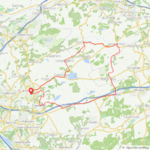
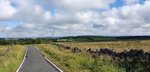
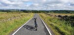
Nice day for ALmost 20 miles on the Cascade Trail in Skagit County, WA, heading towards the Cascade Mountains along the Skagit River. We drove the bikes over to the "Gateway to the North Cascades" logging town of Sedro Woolley, and parked at a trail head about 2 miles east of town to begin the ride.
The trail runs about 20 miles, from Sedro Woolley to the town of Concrete, but for a round trip we wanted to do a total of 20 today, so decided to ride as far as Hamilton - about half way - and back.
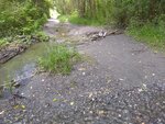
It's mostly dirt/packed gravel, except for a section that is the pebble bed of Wideman Creek (with the creek running through it). Rode most of the section, but walked the bikes across the water. Just cause we didn't want to get splashed.
There's also a rip-rappy loose gravel section of rebuilt bank where the river flooded at some point, a bit before Hamilton.
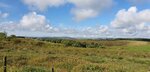
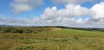
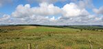
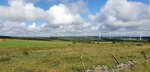
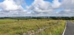
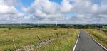
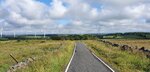
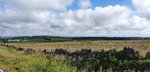
The views along the river were lovely, though the Cascade Peaks were hidden in the clouds
We stopped for lunch at the local cafe/store at our turnaround point, the little town of Hamilton.
A few folks came in to the cafe without masks (our Governor had mandated them in all public indoor spaces), but we wore ours to order, then ate outside.
Heading back towards Sedro Woolley, we decided to ride from Hamilton back to the town of Lyman along the old Lyman-Hamilton highway, to have a break from some of the bumps. Not much traffic, and the speed limit is 35, so even though the shoulder is minimal, the riding was nice.
After getting back on the trail, we stopped to read up on conservation efforts along the river:
Who knew blackberries were a bad thing

?
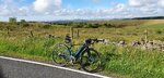
Walked the bikes back over the creek, then hopped back into the saddle for the push back to the car. There are nice benches, but zero "facilities" along the way - you have to detour into one of the towns, or take a cross street out to Route 20 to find those
While lunching in Hamilton, we spotted another SOB couple on their electric bikes. They passed us going in the opposite direction on our return ride - he on a
Specialized, and she on a Liv (I think). Apart from them and a few acoustic riders, we pretty much had the trail to ourselves.
We were aiming for 20 miles, and we nearly made it! If I had checked my app before putting the bike back on the rack I surely would have ridden another .3 to make it even! All in all, a nice, scenic, just about flat little ride. I was hesitant about taking the La Free on the gravel and through the mud, but it performed well (and, no flat tires!).
BTW - stopped at the bike shop on the way home to finally get the firmware update - it took about 10 minutes. But, guess what? The #@+!& App won't see that it's been done!!! I'll try uninstalling and reinstalling AGAIN, and keep my fingers crossed. I still have access to the back version of the app, but an afraid it won't work with the updated firmware. We shall see.
This bike is such a joy, but Giant's app is crap...


 We are used to cool weather, the heat just kills me!