2020 : Our Rides in Words, Photos & Videos

  • Thread starter Deleted member 18083
  • Start date
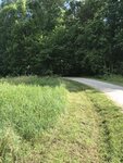
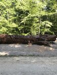
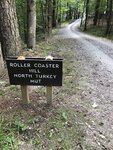
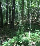
I decided to try my Trek Crossrip + as a gravel bike on the trails at Umstead State Park near the Raleigh Durham Airport. I'm actually riding on 32mm smooth tires meant for street use, but thought I'd see how they fared before switching to wider knobbier tires. The trails there are considered "moderate" as mountain biking trails go and I'd say the majority of the bikes on the trail were drop bar gravel bikes, confirming my sense that e-bikes and gravel bikes are the 2 growing segments of the bike world. I did see maybe a handful of other e-bikes, but they were of the flat bar wide tire variety. The bike held up well over 24 miles except when I lost traction on roller coaster hill. I took the bike on a 35 mile ride the next day though and the front fender came undone on an off-road section of that tamer bike trail likely due to the vibration from the day before. I'm enjoying the versatility of the Crossrip+. It's been great for shopping trips, long rides, keeping pace with younger road riders, and it appears to be fine for moderate to maybe semi-difficult MTB trails. I suspect it could do single track, but I'm pretty sure it wouldn't be all that fun even with more appropriate tires. Amazingly, I had only charged the battery to roughly 90% and did both rides on the same charge. The first day included some reasonably long unpaved hills and the second included long stretches at 20+ mph.
 

Attachments

  • umstead1.jpeg
    umstead1.jpeg
    63.8 KB · Views: 325
  • umstead2.jpg
    umstead2.jpg
    67.7 KB · Views: 336
  • umstead3.jpg
    umstead3.jpg
    75.5 KB · Views: 327
  • umstead4.jpg
    umstead4.jpg
    35.1 KB · Views: 334
After 2 days of incessant rain and strong winds it was good to get back in the saddle today, it was overcast and threatening rain but I decided to take a chance and it paid off! :D Lots of flooded roads and gravel strewn everywhere so I had to be a little more careful today, no dramas thankfully! Just a fun filled splash through the puddles kind of day!;) My mileage is way down this month compared to the last 2 months, mainly due to the weather! April - 627 miles | May - 662 miles | June - 481 miles | 2020 total - 2,855 from 71 rides which gives me an average of 40.21 miles!

1593525741485.png
 

Attachments

  • elevation_profile163.jpg
    elevation_profile163.jpg
    21.8 KB · Views: 317
  • trip-51673507-map-full75.png
    trip-51673507-map-full75.png
    433.9 KB · Views: 331
  • 20200630_095135.jpg
    20200630_095135.jpg
    721.6 KB · Views: 337
  • 20200630_100951.jpg
    20200630_100951.jpg
    793.7 KB · Views: 347
  • 20200630_101014.jpg
    20200630_101014.jpg
    637 KB · Views: 326
  • 20200630_101039.jpg
    20200630_101039.jpg
    669.7 KB · Views: 321
  • 20200630_103525.jpg
    20200630_103525.jpg
    349.8 KB · Views: 321
  • 20200630_104823.jpg
    20200630_104823.jpg
    910.6 KB · Views: 328
  • 20200630_105201.jpg
    20200630_105201.jpg
    825 KB · Views: 332
  • 20200630_105212.jpg
    20200630_105212.jpg
    720.2 KB · Views: 333
  • 20200630_110735.jpg
    20200630_110735.jpg
    693.4 KB · Views: 340
  • 20200630_110804.jpg
    20200630_110804.jpg
    626.5 KB · Views: 332
  • 20200630_110816.jpg
    20200630_110816.jpg
    643 KB · Views: 323
  • 20200630_111004.jpg
    20200630_111004.jpg
    675.1 KB · Views: 345
  • 20200630_111017.jpg
    20200630_111017.jpg
    229.6 KB · Views: 327
  • 20200630_111434.jpg
    20200630_111434.jpg
    747.5 KB · Views: 333
  • 20200630_111442.jpg
    20200630_111442.jpg
    508.6 KB · Views: 329
  • 20200630_111804.jpg
    20200630_111804.jpg
    709 KB · Views: 326
Ever considered tubeless?

Yes, but for a few reasons I haven't yet done so:
  1. My riding is highly seasonal and I ride infrequently during the winter months. At a minimum tubeless will require that I winterize the bike by draining the sealant for those three months.
  2. Working on tubeless tires can be very messy and I also need to invest in the equipment to work on them in my garage.
  3. Major tire repairs on journey will certainly require a shop visit -- and bike shops can be few and far between where I tour.
My own thoughts are that tubeless will work best for day rides and rides close to home. But because the places I ride near my home don't have thorny bushes and shoulders littered with road debris (mostly the roads I ride are shoulderless) I very rarely get flats when I am day riding (the last time it happened was in 2017).

Having said all that if/when I add another bike to the quiver I will configure one bike for local day rides and running errands, and that bike will likely run tubeless.
 
I took my wife’s bike on a 15 mile, very hilly ride near our summer place. This is Crystal Lake, in the Adirondack Mountains. The building is Crystal Lake House.

View attachment 57239
7,000sf makes a nice weekend getaway for two, though @ $2,550 for the 3 night min maybe I'd buy another bike instead...🤣
 
Fort Ord.jpg

Spent a couple of days camping adjacent to Fort Ord National Monument. For ebikers there are paved roads, gravel roads and singletracks all in one place.

Explosivesjpg.jpg


The active military base has been closed for 25 years, however, all the explosives haven't been removed yet. A large area is still fenced off with warning signs.

machine gun.jpg


Lots of signs of the heritage of the area is still in place.

Skyline.jpg
Pilarcitos Canyon.jpg
Skyline Rd.jpg
Jack's Rd.jpg
Watkins Gate Rd.jpg
View.jpg
Toro peak.jpg
Tree moss.jpg

Mudhen Lake.jpg


Mudhen lake pretty much the only water area at this time of the year.
trail 61.jpg
Moab Rd.jpg
grassland.jpg


A sample of some of the grasslands of the area. Although in California everything is brown this time of year, at least in the Central Coast area.

Laguna Seca Raceway.jpg


Laguna Seca Raceway is adjacent to the National Monument, there is also a campground there which has access to the bike trails in the monument.
 
View attachment 57303
Spent a couple of days camping adjacent to Fort Ord National Monument. For ebikers there are paved roads, gravel roads and singletracks all in one place.

View attachment 57304

The active military base has been closed for 25 years, however, all the explosives haven't been removed yet. A large area is still fenced off with warning signs.

View attachment 57305

Lots of signs of the heritage of the area is still in place.

View attachment 57306View attachment 57308View attachment 57309View attachment 57310View attachment 57311View attachment 57312View attachment 57313View attachment 57314
View attachment 57315

Mudhen lake pretty much the only water area at this time of the year.View attachment 57320View attachment 57316View attachment 57318

A sample of some of the grasslands of the area. Although in California everything is brown this time of year, at least in the Central Coast area.

View attachment 57319

Laguna Seca Raceway is adjacent to the National Monument, there is also a campground there which has access to the bike trails in the monument.
My youngest sons had annual cross country MTB races at Fort Ord as a part of their high school mountain bike league race season. Always fun. They also raced at Sea Otter a couple of years. Back then it was held at Laguna Seca Raceway. Not sure about now, but what a bike event!

My wife and I enjoy riding the nearby Monterey Bay Trail on our mech bikes from Pacific Grove to Castroville, the Artichoke Capital of the World, or so they say! Last Summer we took our ebikes to Carmel and rode the 17 Mile Drive and the Lost Coast Road. Some views! The Bay Trail was much easier on an ebike, too!
 
View attachment 57303
Spent a couple of days camping adjacent to Fort Ord National Monument. For ebikers there are paved roads, gravel roads and singletracks all in one place.

View attachment 57304

The active military base has been closed for 25 years, however, all the explosives haven't been removed yet. A large area is still fenced off with warning signs.

View attachment 57305

Lots of signs of the heritage of the area is still in place.

View attachment 57306View attachment 57308View attachment 57309View attachment 57310View attachment 57311View attachment 57312View attachment 57313View attachment 57314
View attachment 57315

Mudhen lake pretty much the only water area at this time of the year.View attachment 57320View attachment 57316View attachment 57318

A sample of some of the grasslands of the area. Although in California everything is brown this time of year, at least in the Central Coast area.

View attachment 57319

Laguna Seca Raceway is adjacent to the National Monument, there is also a campground there which has access to the bike trails in the monument.

Great photos of the old Fort Ord Military base and Laguana Seca track.

Can you post a map of your ride from the trailhead area... I am spending the week Holiday week in Carmel and may explore a bit. ;)
 
Last edited:
My youngest sons had annual cross country MTB races at Fort Ord as a part of their high school mountain bike league race season. Always fun. They also raced at Sea Otter a couple of years. Back then it was held at Laguna Seca Raceway. Not sure about now, but what a bike event!

Sea Otter classic was postponed this year until Oct 1-4, however, who knows with Covid if it will happen then.
 
Great photos of the old Fort Ord Military base and Laguana Seca track.

Can you post a map of your ride from the trailhead area... I am spending the week Holiday week in Carmel and may explore a bit. ;)

The best sources of info are the blm website:
Also good trail info is available from:

There isn't just one trailhead point to start. There are several possible starting points. For bikes if you are not camping at Laguna Seca then starting at Giggling Road and 8th is a good place with parking and several bike routes to take. This map is available on the BLM website
fort ord nm.png
 
The best sources of info are the blm website:
Also good trail info is available from:

There isn't just one trailhead point to start. There are several possible starting points. For bikes, if you are not camping at Laguna Seca then starting at Giggling Road and 8th is a good place with parking and several bike routes to take. This map is available on the BLM website
View attachment 57350

An excellent map of the area... thank you for posting. ;)
 
Last edited:
"Always plan your trip, and always plan to ditch your plan." Truer words never spoken. The plan for the day was to make the long climb to Hurricane Ridge, one of my bucket list rides. However, it was foggy in the mountains and I didn't look forward to riding the steep, shoulderless, and winding road in the fog; and I also didn't like the idea of making the ride just to look at the interior parts of clouds. So I changed plans and continued on the ODT to the Elwha River.

Screen Shot 2020-06-30 at 8.39.13 PM.png

I always like this bridge over the Dungeness River:

odt-dungeness.png


A sign you don't see every day:

gunclub.png


The ODT "green tunnel":

green-tunnel.png


Coming into Port Angeles:

port-angeles.png


And finally there is this amazing bridge over the Elwha River (which is currently where the official ODT ends, while there is an "Adventure Route" that continues further west):

elwha.png


I again want to note how impressed I was by that bridge. It was very clever to hang the trail bridge under a highway bridge. It is almost like something I'd expect to see in the Netherlands or Sweden, not in the backwoods of Washington State.
 
Beautiful photography. What camera do you use?
David, I use a compact camera with a fixed wide-angle lens. It takes up slightly less than half the width of my Ortlieb Ultimate Six Pro handlebar bag with camera insert…
IMG_2940.jpg

The lens hood and lens cap add an extra 2cm to the already large lens but there is still plenty of room for other 'necessities'.
 
Last edited by a moderator:
And finally there is this amazing bridge over the Elwha River: it was very clever to hang the trail bridge under a highway bridge. It is almost like something I'd expect to see in the Netherlands or Sweden, not in the backwoods of Washington State.
Or in New Zealand …
karangahake_34-1600-gb1.jpg

This cycle and pedestrian bridge sits atop an old box girder road bridge…
karangahake_26-gb10.jpg


And when you have crossed over the river, you have to cross over the road and go straight through the hill…
karangahake_28-gb10.jpg


A railway tunnel? Yes, in years gone by there was a rail line laid across the top of the road bridge!

Photos from my last cycling trip in New Zealand. Paradise!
 
Last edited by a moderator:
Today's forecast was light rain and light winds so I had a look when I woke up and it was still dry! So I decided to chance it, I knew I was going to get wet but it wasn't cold and no wind to worry about! I had just started my ride when the rain arrived, just light rain as predicted! Less than 10 miles into my journey and this was now the scene...

1593614092529.jpeg


I also got hit with hail which wasn't fun...oh well I'm wet now so lets continue, 10 miles further and this is now the scene....

1593614279550.jpeg


A little more pleasant and as I continued down into the valley it stayed like this for the next 6 miles or so, then it was time to climb again and I was soon back into the rain, thankfully not as heavy and I was still soaked anyway so it wouldn't matter! ;)

In between times I managed to fall off at the terrifying speed of 2mph! 🤣 I was waiting at some traffic lights and when they changed I set off only for my right foot to slip off the wet pedal and down I went with a car right behind me, the driver looked a bit concerned but I gave him the thumbs up to say all was ok! I had a little cut on my thumb only and the bike was absolutely fine! My thumb is hurting now as I managed to stave it in the fall but I will survive! ;)

This was a good wet test for the bike which never missed a beat, the more I ride this bike the more I love it! ☺ Despite the fall and the weather I still had a great day on the bike, looking forward to my next ride (hopefully tomorrow) already!

1593614955823.png
 

Attachments

  • elevation_profile164.jpg
    elevation_profile164.jpg
    22.8 KB · Views: 276
  • trip-51725330-map-full76.png
    trip-51725330-map-full76.png
    463.7 KB · Views: 291
  • 20200701_094142.jpg
    20200701_094142.jpg
    795.8 KB · Views: 294
  • 20200701_094533.jpg
    20200701_094533.jpg
    590.1 KB · Views: 276
  • 20200701_094612.jpg
    20200701_094612.jpg
    670 KB · Views: 281
  • 20200701_095535.jpg
    20200701_095535.jpg
    596 KB · Views: 301
  • 20200701_095809.jpg
    20200701_095809.jpg
    628.5 KB · Views: 290
  • 20200701_100442.jpg
    20200701_100442.jpg
    600 KB · Views: 289
  • 20200701_101204.jpg
    20200701_101204.jpg
    238.8 KB · Views: 300
  • 20200701_101224.jpg
    20200701_101224.jpg
    611.2 KB · Views: 288
  • 20200701_101945.jpg
    20200701_101945.jpg
    764.3 KB · Views: 292
  • 20200701_102015.jpg
    20200701_102015.jpg
    615.4 KB · Views: 285
  • 20200701_102348.jpg
    20200701_102348.jpg
    653.8 KB · Views: 292
  • 20200701_102427.jpg
    20200701_102427.jpg
    557.9 KB · Views: 284
  • 20200701_103127.jpg
    20200701_103127.jpg
    523.6 KB · Views: 273
  • 20200701_103142.jpg
    20200701_103142.jpg
    314.7 KB · Views: 277
It looks it is the time to invest in decent platform pedals and MTB cycling shoes @RabH ... Glad you came away in one piece!
 
Back