2020 : Our Rides in Words, Photos & Videos

  • Thread starter Deleted member 18083
  • Start date
At last! The snow is in retreat and the woods can be accessed. I called up my friend yesterday expecting a No answer to the question but was surprised by a Yes. The question was, "Wanna go see if we can ride on the North Summit road tomorrow." No hesitation, no discussion of an infectious virus. We were going.

Bike loaded, dog loaded, and then we picked up friend and bike and motored up the pass. My driving felt rusty. I hadn't been on a highway for 2 months or however long (seems like a real long time) we've been staying home. We made it. The preferred parking spot was on Warshington State land so we could not park there. It had a barricade and a CLOSED sign on it. I drove down to the gated entrance to the ski area and parked in a wide spot on Forest Service land. Whilst unloading bikes and loading bike bags the Demon Dog was madly at work, chasing smells at high speed. We had a safety meeting. My friend had a heart incident and I needed to know the procedure if something should go wrong. Then we left.

The sun was out but the wind was blowing and we were somewhere around 4000 feet in elevation so I put on a sweater. We expected to be blocked by snow at the usual, chilly shady spot but SURPRISE! it was melted out. Not even a berm of snow. No ice. So, we were able to ride a dog's length of road. This dog starts slowing down at 9 miles so we rode 5 miles in and 5 back out. I rode my Gazelle and my friend was on her Radmini.

At the start, I made the statement that no way no how did I want to ride The Road again for a long time. Friend agreed. This was the area where The Road takes off. Last year she had trouble with the mini and we'd ride up the road to test it and try out stuff. I think we were up and down it 4 or 5 times trying to trouble shoot and trying out fixes that were suggested by Rad, and parts sent by Rad to try. In fact, I could see that Road being a good try out road for bike companies. We would not ride it today.
DSC01120.JPG

I did not have to carry water for the Demon Dog. This time of year, there are puddles, and creeks, and patches of snow and The Pond. The pond sounded full of frogs today. Demon dog went in and cooled off. A game warden drove by. We continued on. It was good to be in the woods.
DSC01121.JPG

The ride was uneventful. The Demon Dog ran all over. You'd get a glimpse of a black streak running on one side of the road and then blink and she would be tearing along on the other side. That's how the Demon Dog rolls.
DSC01123.JPG

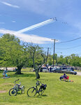
We had a "picnic in the woods" and then rode back. I was thinking at the start that the Demon Dog might not be in very good shape and would tire out quickly. At this point, I was wondering if we should go further up but reason prevailed. We headed back. This time, the Demon Dog went in the pond for a longer swim. I couldn't get the camera out in time, but it would have been a poor picture. A black dog swimming in a black pond. Oh well. At 9 miles, just like usual, the Demon slowed down. I slowed down. We got back to the truck and the Demon flopped down in a shady spot and stayed put. After the bikes were loaded, she slowly plodded over and got in.
DSC01124.JPG

It was a beautiful day to be back in the woods. It was most enjoyable and the goal of having a tired Demon Dog was achieved.
DSC01125.JPG

This area is the North Summit road off Hwy 20, Loup Loup Pass. It's a mountain pass between the Methow and Okanogan Valleys. There's a ski hill with one chairlift that operates when the snow is deep enough. It's a great little hill. There are also cross country ski trails and a Luge run. We ride some of the ski trails when things are a bit drier.

Some trivia. We were eating today and watching the Demon digging and snuffling after something. We both had the same thought. We hoped an angry squirrel was not in the hole. A couple of years ago on the South Summit area, the demon went digging and a squirrel glommed onto her nose. I was behind and heard the painful yipping. My friend was ahead and witnessed the dog head come out of the hole with a squirrel attached. There was frenzied shaking and yelping and finally the squirrel released its hold. The Demon was angry and managed to catch the squirrel and.....well, the squirrel went to heaven that day. The Demon had puncture wounds but survived.
DSC01126.JPG
 
It Rained The Night Before (Hosanna!). I Overslept.

Any chance of making the metric century on that very day was lost. We are having four days of bad weather now (I love it's raining, though). Last Thursday was the last of the "mild days" with decent temperatures (around 14-15 C, 60 F), sunshine and acceptable wind. I re-planned the route and was able to ride out from the main square of Bolimów (which is some 50 minutes of driving from my place) at 1:50 p.m.

At the 12th kilometre, I stopped at the craft Brewery of Bednary and bought two bottles of beer. Since the Bednary ales and stouts are simply not the best and the place looked sad in the times of covid, let us skip that part.

1588340739483.png

19th kilometre. The Nieborów Palace & Park, which is one of the gems of the Polish architecture, art and gardening; it is also one of my favourite places to return to.


The residence was built in the 17th century in Baroque style by the Dutch architect Tylman van Gameren. In 1774, a wealthy aristocrat Prince Michał Hieronim Radziwiłł and his wife Helena obtained the property. Radziwiłł was not only a wealthy man and not only an art lover but he also knew how and from whom to buy beautiful and rare artefacts (he was monitoring Europe for any bankrupt art collector and pursued the person with an offer). The Prince had also hired the excellent designer Szymon Bogumił Zug who helped to re-design the palace interior in Rococo/Classicist style and Zug also designed the gardens in the French style of the era. The Palace & Park are a Department of the National Museum in Warsaw nowadays.

1588341843428.png

The entry to both Parks (Nieborów and the one I visited later) is paid. Additionally, there is a bike ban there. I explained the lady at the gate and the man who was selling tickets my bike was very expensive, so they kept their eyes on it while I was reluctantly walking with the photo pannier (oh, my poor legs that hate walking...)

1588342776755.png

It is a 2017 photo. The Museum is temporarily closed (by the coming Monday). That room was the leisure apartment of Princess Helena. What a woman! The Voivod of Vilnius, the lady-in-waiting for the Empress Catherine The Great, a great lover (her trophies included our last King Stanislaus August Poniatowski and the Russian Ambassador von Stackelberg). She was also openly lesbian; her husband didn't mind as her high-profile love affairs helped him in his career. Both Radziwiłł lived in the hard era between the fully independent Poland and that part of Poland as a Russian puppet state (1740s to 1830s).

1588343470422.png

The Rococo style demanded constructing hedge mazes in gardens.

1588343607880.png

I love that place!

1588343683371.png

The gardens of the era served the Aristocracy for making parties and romances. There are many tall hedges inside the park making the walking intriguing. There are surprising glades with sculptures. There are marble tables where the Aristocrats could have their meals and drinks served at. And yes, outdoor bathtubs :D

1588343961194.png

That colour of tulips was reserved for the royalty and aristocracy.

1588344107167.png

The Shrine of Diana in the Romantic Park of Arcadia. Yes, you've heard that; Arcadia. The fashion of the Classicist (and the preceding Rococo/Late Baroque) style was to create Idyllic parks. Princess Helena bought the property and created an Idyllic park at a village neighbouring with Nieborów and renamed it to Arkadia. The fake ruins are not very much interesting nowadays but the Shrine is a gem. The inscription is taken from one of the sonets of Petrarch and means: "Here I found peace after every of my wars".

Ah. Can you remember those villages around named after the Italian cities of Parma and Piacenza? It must have been the work of Princess Helena 🤣

1588344619964.png

The favourite spot for wedding photographers. There is a bike ban in this park as well. That time, the ladies at the gate/ticket office agreed I walked my Vado in but not ride it; in case of meeting a guard I would have to explain myself again. I admit I walked the Vado up to the Shrine, then thought to myself: "What guard? If he met me, I would outrun him!" So I rode the quite long distance towards the gate.

1588344972361.png

The longer remaining part of the route led through places you've already been to together with me: Skierniewice and the 10 km long wonderful dedicated bike trail through the Bolimów Primeval Forest. Here, my Vado ready for the transport back home in the square of Bolimów (still in the Łódź Voivodship).

1588345251591.png

The square in Bolimów. A smartphone photo.

1588345383448.png

The iconic view of the farming land at this season: Flowering rape. The subject is very difficult photographically regarding the colour, which I could not really manage.


Now, there will be several days of non riding because of the rain and cold. Let it rain! We need water! My Vado goes to the LBS in Warsaw for the display replacement and my Lovelec will be serviced locally to check the crankset (some noise there), the brakes, the drive-train.

And yes, I was 94 kg (207 lbs) yesterday 😊

1588349453678.png

The route stats.
 
Last edited:
It Rained The Night Before (Hosanna!). I Overslept.

Any chance of making the metric century on that very day was lost. We are having four days of bad weather now (I love it's raining, though). Last Thursday was the last of the "mild days" with decent temperatures (around 14-15 C, 60 F), sunshine and acceptable wind. I re-planned the route and was able to ride out from the main square of Bolimów (which is some 50 minutes of driving from my place) at 1:50 p.m.

At the 12th kilometre, I stopped at the craft Brewery of Bednary and bought two bottles of beer. Since the Bednary ales and stouts are simply not the best and the place looked sad in the times of covid, let us skip that part.

View attachment 51283
19th kilometre. The Nieborów Palace & Park, which is one of the gems of the Polish architecture, art and gardening; it is also one of my favourite places to return to.


The residence was built in the 17th century in Baroque style by the Dutch architect Tylman van Gameren. In 1774, a wealthy aristocrat Prince Michał Hieronim Radziwiłł and his wife Helena obtained the property. Radziwiłł was not only a wealthy man and not only an art lover but he also knew how and from whom to buy beautiful and rare artefacts (he was monitoring Europe for any bankrupt art collector and pursued the person with an offer). The Prince had also hired the excellent designer Szymon Bogumił Zug who helped to re-design the palace interior in Rococo/Classicist style and Zug also designed the gardens in the French style of the era. The Palace & Park are a Department of the National Museum in Warsaw nowadays.

View attachment 51302
The entry to both Parks (Nieborów and the one I visited later) is paid. Additionally, there is a bike ban there. I explained the lady at the gate and the man who was selling tickets my bike was very expensive, so they kept their eyes on it while I was reluctantly walking with the photo pannier (oh, my poor legs that hate walking...)

View attachment 51303
It is a 2017 photo. The Museum is temporarily closed (by the coming Monday). That room was the leisure apartment of Princess Helena. What a woman! The Voivod of Vilnius, the lady-in-waiting for the Empress Catherine The Great, a great lover (her trophies included our last King Stanislaus August Poniatowski and the Russian Ambassador von Stackelberg). She was also openly lesbian; her husband didn't mind as her high-profile love affairs helped him in his career. Both Radziwiłł lived in the hard era between the fully independent Poland and that part of Poland as a Russian puppet state (1740s to 1830s).

View attachment 51304
The Rococo style demanded constructing hedge mazes in gardens.

View attachment 51305
I love that place!

View attachment 51306
The gardens of the era served the Aristocracy for making parties and romances. There are many tall hedges inside the park making the walking intriguing. There are surprising glades with sculptures. There are marble tables where the Aristocrats could have their meals and drinks served at. And yes, outdoor bathtubs :D

View attachment 51307
That colour of tulips was reserved for the royalty and aristocracy.

View attachment 51308
The Shrine of Diana in the Romantic Park of Arcadia. Yes, you've heard that; Arcadia. The fashion of the Classicist (and the preceding Rococo/Late Baroque) style was to create Idyllic parks. Princess Helena bought the property and created an Idyllic park at a village neighbouring with Nieborów and renamed it to Arkadia. The fake ruins are not very much interesting nowadays but the Shrine is a gem. The inscription is taken from one of the sonets of Petrarch and means: "Here I found peace after every of my wars".

Ah. Can you remember those villages around named after the Italian cities of Parma and Piacenza? It must have been the work of Princess Helena 🤣

View attachment 51309
The favourite spot for wedding photographers. There is a bike ban in this park as well. That time, the ladies at the gate/ticket office agreed I walked my Vado in but not ride it; in case of meeting a guard I would have to explain myself again. I admit I walked the Vado up to the Shrine, then thought to myself: "What guard? If he met me, I would outrun him!" So I rode the quite long distance towards the gate.

View attachment 51310
The longer remaining part of the route led through places you've already been to together with me: Skierniewice and the 10 km long wonderful dedicated bike trail through the Bolimów Primeval Forest. Here, my Vado ready for the transport back home in the square of Bolimów (still in the Łódź Voivodship).

View attachment 51311
The square in Bolimów. A smartphone photo.

View attachment 51312
The iconic view of the farming land at this season: Flowering rape. The subject is very difficult photographically regarding the colour, which I could not really manage.


Now, there will be several days of non riding because of the rain and cold. Let it rain! We need water! My Vado goes to the LBS in Warsaw for the display replacement and my Lovelec will be serviced locally to check the crankset (some noise there), the brakes, the drive-train.

And yes, I was 94 kg (207 lbs) yesterday 😊
I Like your new pedals and grips. I found it took many micro-adustments to get the grips into the sweet spot.
 
Last edited:
Like the new pedals and grips. I found it took many micro-adustments to get the grips into the sweet spot.
Luckily, it worked for me from the very first moment. Regarding the pedals, friends of mine ask me whether the store was short of the male ones :D Would like send them to @Readytoride as these colour-match her Vado but the mail doesn't operate well under present situation...
 
Last edited:
Somewhere flat; somewhere hilly …
It was one of those days when I couldn't decide where to ride until I was well on my way. Light bulb moment: ride a loop with no returning along the same road and no crossing over! Somehow I managed it but there were two places where the out and return tracks came very close.

2020-04-29-map-ebr.jpg


From home the route ran south to the Warrego Highway – don't even contemplate riding on it! – and then east along a mix of gravel and sealed country roads that I hadn't visited this year (5–15 km on map).

Now north across some hills – and the Warrego Highway again – towards Fernvale (25 km), Lowood (35 km) and the broccoli, cabbage cauliflower and lettuce farms of the Lockyer plains (40–50 km). None of R2R's scary Hereford bulls here!

2020-04-29-cabbabes-ebr.jpg


2020-04-29-lettuce-ebr.jpg

Irrigated farmland where the Lockyer Creek joins the Brisbane River

The furthest point from home was the Lockyer Creek trestle bridge (47 km – been there before!) where I'd leave the road for the rail trail. Several F/A-18F Super Hornets roared in from the east about four kilometres beyond the bridge. They'd be back at RAAF Amberley Base in five minutes or so; I'd take over two hours. The Super Hornet is the black dot against the cloud towards the right end of the girder section of the bridge (see crop below).

2020-04-29-lockyer-ck-ebr.jpg

Trestle bridge over Lockyer Creek.
2020-04-29-lockyer-fa18f-ebr.jpg

The unquiet sky; Super Hornet heads home.
Cropped from previous wide angle photo.
Back to Lowood for a coffee and a chat with a fellow rail trail enthusiast, then onward and upward, being ever so careful not to cross my outward track.

As usual, I stopped near the crest of the Marburg Range (57 km). Smoke from someone's faraway fire – quite close to the cabbage farms – indicated that I'd be heading into a fresh easterly headwind for most of the way home.

2020-04-29-marburg-range-a-ebr.jpg

Looking NW from the Marburg Range.

After 15 km along flat roads, it was time to climb Evans Hill (77 km) for a view south towards the New South Wales border. These minor ranges, and the winds when they are contrary, are cancelled out by an ebike's generous help. I couldn't be out here enjoying myself without an ebike, probably wouldn't be out here not enjoying myself if I still had to rely on my own strength.

2020-04-29-evans-hill-a-ebr.jpg

Looking south from Evans Hill.
From Rosewood (82 km), at the base of Evans Hill and left of my Homage in the above photo, I headed for Ipswich, being careful once again to avoid my outward journey. A lone C-17 Globemaster was practising landings as I passed the Royal Australian Air Force Base at Amberley (90–95 km).

And so to home.
 
Last edited by a moderator:
That's the state right above Arrrghon?🤣

I had to look it up.

I had no idea about glom. I just grew up using it. Dad was of Scotch/English heritage.

I believe that we need to add the R to Washington then we would not be confused with the other Washington. Orygun is Orygun. :) My dad was Vancouver area born and raised and Bonneville was pronounced Bonnyville.
 
Somewhere flat; somewhere hilly …
It was one of those days when I couldn't decide where to ride until I was well on my way. Light bulb moment: ride a loop with no returning along the same road and no crossing over! Somehow I managed it but there were two places where the out and return tracks came very close.

View attachment 51278

From home the route ran south to the Warrego Highway – don't even contemplate riding on it! – and then east along a mix of gravel and sealed country roads that I hadn't visited this year (5–15 km on map).

Now north across some hills – and the Warrego Highway again – towards Fernvale (25 km), Lowood (35 km) and the broccoli, cabbage cauliflower and lettuce farms of the Lockyer plains (40–50 km). None of R2R's scary Hereford bulls here!

View attachment 51342

View attachment 51273
Irrigated farmland where the Lockyer Creek joins the Brisbane River

The furthest point from home was the Lockyer Creek trestle bridge (47 km – been there before!) where I'd leave the road for the rail trail. Several F/A-18F Super Hornets roared in from the east about four kilometres beyond the bridge. They'd were be back at RAAF Amberley Base in five minutes or so; I'd take over two hours. The Super Hornet is the black dot against the cloud towards the right end of the girder section of the bridge (see crop below).

View attachment 51272
Trestle bridge over Lockyer Creek.
View attachment 51260
The unquiet sky; Super Hornet heads home.
Cropped from previous wide angle photo.
Back to Lowood for a coffee and a chat with a fellow rail trail enthusiast, then onward and upward, being ever so careful not to cross my outward track.

As usual, I stopped near the crest of the Marburg Range (57 km). Smoke from someone's faraway fire – quite close to the cabbage farms – indicated that I'd be heading into a fresh easterly headwind for most of the way home.

View attachment 51334
Looking NW from the Marburg Range.

After 15 km along flat roads, it was time to climb Evans Hill for a view south towards the New South Wales border. These minor ranges, and the winds when they are contrary, are cancelled out by an ebike's generous help. I couldn't be out here enjoying myself without an ebike, probably wouldn't be out here not enjoying myself if I still had to rely on my own strength.

View attachment 51336
Looking south from Evans Hill.
From Rosewood (82 km), at the base of Evans Hill and left of my Homage in the above photo, I headed for Ipswich, being careful once again to avoid my outward journey. A lone C-17 Globemaster was practising landings as I passed the Royal Australian Air Force Base at Amberley (90–95 km).

And so to home.
That bottom picture is glorious
 
That bottom picture is glorious
It sure is. I will likely never visit down-under so it is great to see these pics!
Evans Hill has become a favourite place to take a break… mainly because there is a shady shelter at the cemetery which has a decent view to the north.

The view to the south-west that you refer to is different: instead of rolling hills there is a near-precipice right next to the road. On Wednesday, after I had stopped to take in the numinous view at the graveyard, I noticed that the tangle of weeds and grass edging the southern side of the road had been cleared. I turned around to find that the steep hillside to the west of the pine plantation had been bulldozed. If this is for 'development' there will be some architectural challenges waiting! Who'd put their life's savings into a property that will, quite likely, slip down to the bottom of the hill? The aerial photo – satellite in Googlespeak – doesn't give any idea of the slope!

2020-04-29-evans-hill-sat-ebr.jpg


The wide-angle photo from Evans Hill was taken facing south-west early on an autumn afternoon: the sunlight was moderately low (roughly 45º) and over my right shoulder (from the NW) providing a dramatic modelling effect.

Right next to where the photo was taken the once-dilapidated Country Perk Café was being renovated, I hope as an old-style café catering for cyclists – especially oldies on ebikes – in need of refreshment. (If it's being converted into an estate agent's office, please let that be temporary!)

Apart from the views (and one, day fresh coffee?), the best reward for climbing Evans Hill is the effortless zoom downhill afterwards – north to Marburg or south to Rosewood. Don't go too fast or you'll miss the unexpected, like the hot tin roof on the old shed (right-click for last year's photo).

In the photo above, Mount Walker is the cone-shaped hill in the centre; the Great Dividing Range is to its right and beyond (southwest).

2020-04-29-evans-hill-map-a-ebr.jpg

South East Queensland
The lower edge of map approximates the Queensland–New South Wales border.
 
Last edited by a moderator:
The unquiet sky; Super Hornet heads home.

Airplanes galore! My Gazelle Aroyo and a friend's e-trike rest in the foreground this morning as six F-16 Falcon and six F/A-18 Hornet fighters fly by hospitals in the Washington DC area.

The Navy Blue Angels and Air Force Thunderbirds are on a multi-city tour in a salute to front-line Covid-19 responders. Yesterday they were over New York and Philadelphia, today Baltimore, Washington, and Atlanta.

This shot is from the boundary between Washington DC and Maryland. I had set up there expecting (hoping) to watch these formations. Good plan.
 

Attachments

  • Blue Angels-Thunderbirds over Sibley Hospital.jpg
    Blue Angels-Thunderbirds over Sibley Hospital.jpg
    487.1 KB · Views: 275
Airplanes galore! My Gazelle Aroyo and a friend's e-trike rest in the foreground this morning as six F-16 Falcon and six F/A-18 Hornet fighters fly by hospitals in the Washington DC area.

The Navy Blue Angels and Air Force Thunderbirds are on a multi-city tour in a salute to front-line Covid-19 responders. Yesterday they were over New York and Philadelphia, today Baltimore, Washington, and Atlanta.

This shot is from the boundary between Washington DC and Maryland. I had set up there expecting (hoping) to watch these formations. Good plan.
$60,000 per hour each to fly those things. How much PPE could that buy? Better the Federal Government keeps them on the ground, gets its act together and offers some real solutions to help in fighting the virus. Enough with the publicity stunts.
 
Back