2020 : Our Rides in Words, Photos & Videos

  • Thread starter Deleted member 18083
  • Start date
Permanent mooring?

2020-09-21-120859-2400-w1g6b1.jpg

Brisbane River, New Farm

One day I'll ride along the New Farm Riverwalk and find that this old catamaran has slipped its moorings and headed out to sea. It's not happened yet and the catamaran has become a fixture on Google's 'Satellite' view.

The same cannot be said for a former a Google CEO's motor vessel which was moored a few kilometres downstream…

2020-09-21-112836-2400-w1g6b1.jpg

Bretts Wharf, Brisbane

For the duration of the world's present troubles, the research vessel Falkor of the Schmidt Ocean Institute is effectively quarantined in Queensland. If it strays into any 'foreign port' (for example, Sydney), it'll have to stay away.

The good news is that the entire Great Barrier Reef is within Queensland waters and the little ship can put into any port or island, and its crew can may come ashore as if they owned the place. Just don't leave and expect to be allowed back!

Website : Schmidt Ocean Institute
 
What's happened to that ship?
Stefan, I assume the research vessel will stay around because there is so much work to be done.

New researchers or crew can fly into Queensland but must immediately go into 14-day quarantine at their own expense in a locked hotel. Taking the vessel away and then returning might be a bit trickier.

Here's one of the toys that helps academics pass the time…

2020-09-21-112015-2400-w1g6b1.jpg

ROV: Remotely-operated Vehicle

Falkor's ROVs aren't as fancy as those beloved by TV docos – 'glass bubbles' with David Attenborough inside – but they (plural, note) can be deployed for almost any mission.

If the ROV here were loaded on a truck, I doubt that anyone would give it a second glance, assuming it to be just another 'bit of equipment for the mines'. I was told that some ROVs can descend to depths of around 4500 metres.

Other data-gathering devices are towed. They look disarmingly – not a good choice of word – like the missiles attached to the F/A-18 Super Hornets that fly around here!
 
Last edited by a moderator:
Yesterday we were back to blue skies. A treat after enduring a few unsettling overcast days of hazy, otherworldly milky white skies caused by the western fires smoke being blown into the upper atmosphere and carried eastward across the US on the prevailing westerly winds.

I had been riding pretty much every day without concern. The smoke particles were several thousand feet up, and while they diluted the natural colors of the skies and our sun, they didn't present any hazard to breathing. Still, it was nice when the winds shifted and took the smoke into an arched dive due south to plague Alabama and Texas. As if the recent spate of hurricanes in that area weren't enough biblical wrath.

But the wind shift did bring us something else. Cold air from the north. Cold enough to demand that before even one foot was set on a pedal that all the summer attire be left at home and winter attire be dug out of bins and drawers to wear - jackets, gloves, neck warmers, ear bands, sweat pants over the cycling pants. Maybe carry an extra jacket or two? I thought I was prepared. My friend 100 miles south of me texted she had ridden 35 freezing cold miles with her club the day before. She had her heat on in her house and was snuggled down in an easy chair with a warm comforter watching the final stage of the Tour de France. Meanwhile, I was bundling up for a planned 35 mile ride, hoping I was wearing enough to keep me warm.

Turns out I wasn't. At least not for riding a fast pace on the paved roads. In hindsight a gravel road ride would have been better, but I'd just gotten the Vado back from 3 days at the bike shop (waiting) for a disk brake adjustment (the shops, all of them, are being slammed by a flood of repairs and adjustments being needed for bikes that have been dragged out of garages, or bought used at yard sales and through ads as a result of the pandemic) and I was anxious to get back on it. Since this is my "paved road bike" and I tend to ride fast with a cavalier disregard for "saving the battery", my lack of warm clothing insisted I slow down and look at the scenery. Perhaps take a photo or two.

IMG_20200920_113105_6_copy_800x600.jpg


The paved road passed an in-process housing development and, on a whim, I decided to cruise their roads. The development had been planned around a lake, but at one point, at least 2 or 3 years prior, the developers had blocked off with Jersey concrete barriers and landlocked gates a lovely section that would have been for the most expensive homes. Don't know why. The rest of the development was in full building mode with lots of activity. Not this section, however. It was dead silent and completely empty.

IMG_20200920_111515_1_copy_800x600.jpg


I decided the forbidden road was worthy of exploration and slipped my bike and myself through a gap in the barriers. Sadly, only the trees growing on the curbs and weeds in the cracks of the pavement were interesting, appearing (if you let your imagination run a bit wild) like an apocalyptic scene from an "end of the world" movie set.

IMG_20200920_111015_4_copy_800x600.jpg


Back through the gap in the barriers and down the winding populated streets was fairly nice. Stopped to chat with two pleasant residents strolling one of the roads. They were attached by a rather long leash to a lovely red merle Aussie leading the way while carrying a somewhat large stick in her mouth, apparently just for the fun of taking "her stick" along for the outing. Instead of cars it was the residents who populated the roads - moms with babies in strollers, couples walking side by side, the odd jogger here and there - all very polite.

The slower pace through the development allowed me to warm up a bit, but once back out on the main roads I chilled up again. A few cyclists that I passed also looked a tad cold, but the majority flying past were bundled up warmer and seemed determined to get where they wanted to go as quickly as possible. I had stopped to take another photo when a peloton of about 20 riders on extremely fast road bikes went past me at a speed that made the air buzz like a hive of agitated bees. They looked like they had gotten lost from the Tour de France and were hell bent towards finding their way back. I watched them climb a rise like they were on electric bikes and disappear over the crest in a fading hum of gearing and swirling air. I turned my attention back to the landscape, which I'm sure the peloton never even noticed: the sweep of the lands with a farmer in the distance mowing a cattle field, the wineries sitting on top of the mountains, the skies as blue as blue can be in a soft watercolor wash, and not even a hint of a cloud to mar such perfection.

IMG_20200920_113111_2.jpg


Yet...it was still cold and the wind kept biting me through my jacket, forcing me to decide if I wanted to cut my ride short, or soldier on. The fact that the roads also seemed busier with cars than I was used to wasn't helping either. I checked the time. A few minutes before noon, it said. Lunch time, it said. Sounded good to me. I headed off in the direction of the peloton, which by now was long gone, miles ahead of me, probably in the next county, with probably many miles left to go.

For me it was just a mere 7 more miles for a grand total of 20 miles and I was back home in time to enjoy lunch with hubby, and get myself warm again. That took about two more hours (seriously) to get my core warmed up, but I'm not complaining. Today is even colder, but this time I'm going to bundle up like I'm hitting the ski slopes. I have a lovely ride planned, and with a faultless blue skies still overhead, it will be a perfect day to be out on the bike.
 
For me it was just a mere 7 more miles for a grand total of 20 miles and I was back home in time to enjoy lunch with hubby, and get myself warm again. That took about two more hours (seriously) to get my core warmed up, but I'm not complaining. Today is even colder, but this time I'm going to bundle up like I'm hitting the ski slopes. I have a lovely ride planned, and with a faultless blue skies still overhead, it will be a perfect day to be out on the bike.
It is a similar kind of weather here now. The only item of the winter clothing I am unable to find are my clear goggles...
 
@Stefan Mikes Amazing effort there Stefan, your brother is a machine! ;)

@Readytoride Quite a change in your weather there!😮

There really are some amazing stories in this thread, its such a joy reading them!:)

No ride for me yesterday, I finally got to attend a motorcycle racing event for the first time this year, I was one of a lucky 200 that were allowed to attend! I would have loved to cycle to the racing as I have done many times in the past but circumstances prevented it this time!

I did get out for a ride today with my brand new chain fitted but it didn't go well due to my chain skipping, it turned out to be worn front chainrings which really took me by surprise! I have now covered 11,463 miles and I really didn't expect my chainrings to be worn this soon, I guess its an e bike thing...I now know to keep an eye on them in the future!

My new chainrings should arrive tomorrow so all going well I will be back in action on Wednesday, gusty winds expected tomorrow anyway...

1600709276556.png
 

Attachments

  • elevation_profile204.jpg
    elevation_profile204.jpg
    21.2 KB · Views: 344
  • trip-56490598-map-full117.png
    trip-56490598-map-full117.png
    440 KB · Views: 330
I will be back in action on Wednesday, gusty winds expected tomorrow anyway...
I'm torn, Rab. While the nights are very cold, the next three days promise Summer temperatures. I need to work though. Perhaps could find time for riding in afternoons...
 
To quote Rab H this weekend provided a pair of awesome rides. The smoke from the U.S. fires lessened (thoughts and prayers to our southern neighbors dealing with these devastating forest fires) and we could once again see the peaks along the surrounding ranges (Purcells and Rocky mountains). On Saturday we followed along the grand opening of the legacy trail - a 24 km paved trail on the west side of Lake Windermere - at the half way point before turning back home we managed to find a spot on a balcony of an Invermere pub overlooking the lake that even had Guiness on tap - not as perfect as was poured on on past trips to Europe but a Guiness nevertheless. This morning as I left for some mountain trekking with my brother-in-law who like Stefan loves his Giant Trance e-bike we met this momma black bear and cubs - luckily she was more interested in the berry bushes than my lunch in the back pack. We had a good climb up Fairmont Ridge along "Spirit Trail" single track and even with e-bikes on turbo there were sections my breathing was louder than our bear bells clanging away. View attachment 66037View attachment 66039

She bear was looking at you though. :oops:
 
Continuing my photo journal from my Saturday ride -

As I left 'downtown' Humbug, CA I looked back over my shoulder for this pic;
P1010441.jpg

The blue skies were back! Except for a Park Ranger in the visitor center I was the only person downtown. Eerily quite for a summer afternoon. At its peak this mining community was populated by thousands, many of them recent French immigrants draw by gold. The local language was mostly French as were location names like Hotel de France and French Corral.

The State Park hosts annual Humbug Days featuring reenactors, gold panning, Ranger lead hikes, and period food and music. We've attended several times, but not this year due to the 'pest'.
20200921_094111.jpg

The back of a Humbug Days t-shirt reproduces a local poster that expressed popular local sentiment after the 1884 Sawyer decision banned hydraulic mining.

Malakoff Diggins SHP may be the only State Park in CA that hosts an active cemetary;
P1010442.jpg

Another Clamper plaque commemorating local history.

P1010443.jpg

Humbug's early residents were from all over the world, including Denmark. There's still plenty of room so if you want to be laid to rest in Humbug, CA just contact the local cemetary district 🙄

The State Park also encompasses nearby hydraulic works;
P1010445.jpg

The Le Du mine was able to operate well past the 1884 Sawyer decision by removing their monitors and slucing the dreggings.
P1010449.jpg

Their relatively small pit remains today a testament to the damage from hydraulic mining.


The main pit of the Malakoff diggins;
P1010455.jpg

Their mining claim comprised over 1,500 acres, all of it devoted to hydraulic mining, the most efficient way to get to the gold.
P1010458.jpg

With my camera zoomed in you can make out this giant monitor at the bottom of the main pit several hundred feet below. Several of these would have been operating in this pit at one time using water impounded and diverted from local creeks. The pit got so deep that a tunnel had to be dug to keep the bottom of the pit clear for more work.


From here it was gravel all the way to the bridge at Edwards Crossing on the S. Yuba River. This gravel was in pretty good shape compared to the morning's ride down to and up from Purdon Crossing. Several miles uphill and then several more down to the bridge;
P1010460_20200921101349211.jpg

There were more people on the river here but there was also quite a bit of wildfire smoke in the river canyon. The road home was paved from here, but also mostly uphill with several steep sections. I had a small snack, added my last mineral tablet to my handlebar water bottle and was off for home.

I rode into the shop at home just before 4PM with water and snacks still available, but hardly any battery. Battery #1 was swapped near the top of Cruzon Grade at 7%. I hadn't planned on drawing it down that far, but the road was very narrow with few wide spots to do a swap. The 2nd battery was at 17% when I got off the bike at home. The Vado's running light was fine, but my brighter flashing headlight had run out of juice somewhere on the way down to Edwards Crossing. It is getting older so time for a new battery pack I suppose. No other issues so a great ride to places I had only driven before.
 
Last edited:
Battery #1 was swapped near the top of Cruzon Grade at 7%. I hadn't planned on drawing it down that far, but the road was very narrow with few wide spots to do a swap. The 2nd battery was at 17% when I got off the bike at home.
I reckon Tim the high battery use was the outcome of big elevation gain, right? What assistance modes were you using?
 
I reckon Tim the high battery use was the outcome of big elevation gain, right? What assistance modes were you using?
Yep, over 6,000 feet of climbing Saturday. The Purdon and Cruzon grades were all in Turbo. Both are steep miles long climbs. Of course I was in '0' assist on the way down...🤣

As an aside I was stopped at the Mother Truckers market refilling water bottles when 2 roadies went by on ebikes. One looked like a Vado SL. I put myself back together and turned in the same direction not expecting to see them again. I did catch up with them within a few miles so I was obviously burning more watts than they so part of my battery usage is my tendency to ride faster than really necessary I suppose. Even at my faster pace I was out for nearly 6 hours for the day ride.

We rode our Vados on the Monterey Bay trail last summer. I used <40% of my battery for the 36 mile ride. My wife used even less. The trail is paved over rolling sand dunes. We'd ridden it many times on our mech bikes and the seemingly endless dunes become very tiring, but not so much with an ebike.
As I ride in the flatland currently and economise on the assistance, my theoretical 604 Wh battery range is over 100 km. However, I don't take risk. In case my planned ride exceeds 80 km (50 mi), I'm taking a spare battery with me. The beauty is the possibility to ride back home in Turbo mode for the last 40 km... :)
 
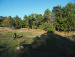
Saturday at 14.45 I managed to convince myself to get out and ride. It was a lovely autumn afternoon.
1600713491283.jpeg

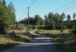
First picture is at the lake at 20km and second a few km later.

C00D813E-2C7E-4882-BE74-5ED0DF2C7425.jpeg B0C4AB2D-CE43-4A00-B188-7349077FACAD.jpeg

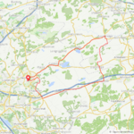
I knew by looking at the map that at about 24km the gravel road would end and there was a path for about 1.5km but I wanted to give it a try to make a loop at the turning point rather then going back.
There was a sign clearly stating it was private property before coming to the path but I stopped and asked a woman working with a horse if It was ok to pass. She said it was ok they just didn’t want people coming up the houses and barns.
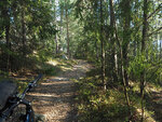
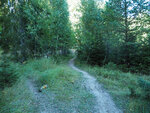
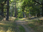
Picture from the path. It got worse than my pictures show. Very narrow path with rocks and roots so I walked for more than 1km. Maybe almost a mile.
18C612D5-7552-4205-AB49-F46451DE66E5.jpeg 078B7AF6-CD0E-4C42-8C84-C4B3D70B8D60.jpeg CC4256BE-FD9F-4F50-B313-ED9B690AD201.jpeg

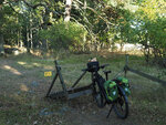
The last part of the path was beatiful and I then found myself in front of an electric fennce with a some sort of ”gate” . I had to take all bags and lock off the bike to be able to get it to the other side without falling into the electric fence.
864D17B3-6855-4CD6-A703-9A41C5B96337.jpeg 19152AAD-E726-425C-B82A-3B8F8016A44A.jpeg

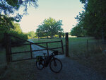
Continued on what was now more road than path and of course a new gate but it was not locked so no problem.
A1E82941-DBC2-4CC9-A210-FD090E2256FC.jpeg EFD18F32-2FA3-4114-BC95-95E813285C05.jpeg

Another gate at about 27km and a new sign saying private property and something about reporting to the police.
I did not want to go back so I was thinking let them call the police. I was passing near stables and a large over decked riding school or manège but there was no one in sight. Having left the private area I sat down and had a late picknick. Cold blueberry soup and rye bread😊
Really nice afternoon.
 
I'm torn, Rab. While the nights are very cold, the next three days promise Summer temperatures. I need to work though. Perhaps could find time for riding in afternoons...
Work getting in the way, I wish I had the same problem...in 2 days time I will have been off work for 6 months! Thankfully the government are paying 80% of my wages so I'm luckier than some! I'm sure you will grab any opportunity to get out! ;)
 
What's happened to the Swedish Free Access Law?

Sweden, a beautiful country!
The free access law ( Allemansrätten) is still valid. You are supposed to respect peoples privacy, not allowed to e.g. camp on somebody’s lawn😄
The areas I passed or were near on my ride were like courtyards. If it’s e.g a courtyard near a stable or a machine house for farming I guess they can call it an industrial area.
If there is someone near I say hello and ask.
A good explanation, thank you. I was always impressed with the Allemansrätten. Although we were typically staying at stuga (a camping house if I'm not wrong) during our vacation travelling over Sweden, we camped at the great lake Vänern using the free access law. Ah, that was a lot of fun! When we woke up in the morning and were eating breakfast straight from the hood of our car (instead of a table), a group of school-children came for physical training. The teacher shouted:

-- Säg "Hej" till den polska familjen!
-- HEJ!
:D
 
As I ride in the flatland currently and economise on the assistance, my theoretical 604 Wh battery range is over 100 km. However, I don't take risk. In case my planned ride exceeds 80 km (50 mi), I'm taking a spare battery with me. The beauty is the possibility to ride back home in Turbo mode for the last 40 km... :)
I did a bit of math to get an idea as to how much energy it would take to lift my bike and me up the 6,050 feet I climbed Saturday. In a lossless world (no friction, no air resistance, etc) it works out that it takes 3.7691x10^-4 Wh to lift 1lb 1 foot in elevation. With the bike, rider, 2nd battery, water, gear, etc at ~280lbs the 6,050 feet of climbing consumed ~570Wh of energy. Seems about right. I was helping but probably no more than 30% on the steep climbs so the electrical energy would be 30% less or ~400Wh. The batteries delivered something like 1,060Wh for the entire ride meaning that ~660Wh went to riding the flats, overcoming friction and air resistance, accelerating, etc. Seems high. I could reduce the 400Wh it takes just to lift the weight up 6,050 feet by getting rid of some weight, but I could also conserve battery energy by riding slower and laying more forward (lower wind resistance), not stopping as often (less acceleration), etc.

Something to think about...🤔
 
Let me do a quick check-up in metric units. Potential energy change is m * g * Delta_h. 6050 ft is 1844 m. 280 lbs is 127 kg. Gravity is 9.81 m/s. Thus, potential energy change is 127 * 1844 * 9.81= 2.297 e+6 Joules or 2297 kJ. That's 638 Wh. You said 570 Wh. What's correct?

Of course, these numbers mean just lifting the weight with 100% efficiency. Now, I would say the 1.3 motor could have 80% efficiency making the battery energy consumption even higher (around 800 Wh). Add to it the rolling and air resistance. Subtract your own power input. Vado tells you how many kcal you have burnt on your ride. Convert kcal to Wh and divide by 4 (the human body efficiency is about 25%) and you get your own Wh ;)

Whatever, the elevation gain and the mass are the major factors contributing to the battery usage on mountain rides, while air resistance is critical for fast riding (I don't want to check equations again but it is said the power demand is in cube relationship to the speed).
 
Last edited:
The Arrival of the Autumn Equinox, Preparing the Fields for Winter, and Meeting a Touring Cyclist.

After yesterday's freezing bike ride, I vowed to be more prepared today with the even lower morning temps to make 32 miles a reality. Hence, warmer gloves, extra layers of clothing, etc. etc. Also it helped to leave at a later hour when the sun had a chance to warm things up a bit.

That second part wasn't quite by choice because, instead of being out riding, I was instead at my computer fighting with my recalcitrant Garmin Edge to upload a bike route I had designed last night. I normally just chose my routes on the fly, but this time I wanted to specifically hit the paved roads since I was on the Vado and not just willy-nilly take whatever directional road I happened to stumble across. And so I wanted the Edge to tell me my turn by turn. Except my Edge kept crossing its arms and refusing to acknowledge my upload. The entire process involved not only being forced to use outdated propriatory Garmin software, but also having to eject the GPS from the laptop each time I needed to check if the route would show up. Tedious and time consuming, especially as the route failed to show on the unit even as my laptop swore on a stack of bibles that it had uploaded, and even showed me it had. I spent a good 20 frustrating minutes trying to get both electronic devices to actually agree with one another, and was failing miserably. I was about to give up in very vocal frustration and just go ride when I abruptly remembered... I had written a set of instructions to myself last year on exactly what trick to use in order to upload to the Edge. And had pasted the said "how to" right on the desktop of the laptop. It was right at my finger tips the entire time, waiting for me to notice. I opened the document, followed my own instructions, and miracle of miracle, it worked. No fuss. Piece of cake. I was now ready to ride.

[Memo To Self To Read Instructions First next time. Got it.]

Screenshot_20200922_003735.jpg


My route began by heading north on several "bike friendly" paved roads. Thankfully, in my area the rural scenery remains consistent and I noticed that more and more of the cultivated fields were in the process of being plowed to make way for the winter crops. Several massive farm tractors, with even more massive field impliments in tow, rumbled past me on the roads. Frankly, within the first few miles of my ride I saw more tractors than cars on the road. In the photo below a big tractor with a cultivator sits off to the edge of a plowed field, waiting for the farmer to return from whatever errands had taken him away.

00001IMG_00001_BURST1600702122650_COVER~2_copy_600x338.jpg


It also seemed like the nice Fall weather had encouraged landowners to spruce up their road frontage because each and every estate had some member of their staff out on a mower or zero turn buzzcutting the turf to perfection. One estate had even gone the extra mile to have its stone walls rebuilt to engineering standards. The remarkable precision of the impeccably stacked stone simply awed me, especially as it carried itself for a full half mile without the slightest stone out of place. In contrast an old stone fence belonging to a different estate on the other side of the road had been left "au naturale", the stones lounging atop each other in a relaxed carefree fashion that suggested it may have been stacked neatly, once, a very very long time ago. Maybe a century ago. And honestly didn't care one iota it was being shown up by the military spit-and-polish line of stone across the road. To each its own, it seemed to imply. Still, I had to admire the neatly arrayed wall. The perfection was exquisite.

IMG_20200921_112600_4_copy_600x800.jpg


The roads soon left the rural estate area behind, wandering in a vaguely purposeful direction into more residentually developed areas, although still heavily horse county. At one point I was so busy checking out old haunts - old fields and woods where I used to foxhunt - that I forgot to pay attention to where I was aiming my bike and ran off the road onto the (fortunately neatly mowed) grassy shoulder. A brief moment of panic ensued before I managed to get back on the road with no harm done with the exception of a few more gray hairs being added to those already under the helmet. A few miles later I passed by a roadside "ditch" that could have swallowed a tractor trailer whole without pause into the stream bed below. The ditch was right against the edge of the road, so close that there wasn't even breathing space between the road itself and the plunge down to Middle Earth. It was an awesome drop, and fully warranted my respect, as well as a photo.

IMG_20200921_120802_0_copy_600x800.jpg


[Memo To Self to Remember to Watch The Road: duly noted]

A rainwashed flyer caught my eye further on. It was tacked to a telephone pole at an intersection of a gentle gravel road and my paved road. I stopped to take a drink and to read the paper notice. It was heartfelt, and as the paper was faded and worn from time and exposure, I could only hope by now that Remy, the beloved barn cat, had reappeared in his loud boisterous self back at his barn, much to the delight of the owners and boarders. I hoped that this notice has simply been forgotten about, and at some point someone will remember to take it down. I hoped.

[Memo To Self: Call to see if Remy made it back home. Will do.]

IMG_20200921_115831_4_copy_600x800.jpg


My route peaked at the small town of Lincoln, then switched direction to head south again, this time employing a gravel road to keep me well away from a very fast, very dangerous parallel paved road. I was content to meander at a reduced pace, enjoying the day, the warmth of the sun, and the changing landscapes drifting back from residential into more estate holdings. The mountains, which had been receding on the journey north, now started to dominate the landscape once again. They were always there whenever I lifted my eyes from the surrounding roadside views, and I smiled at how much they reminded me that home was never too far away.

IMG_20200921_122730_1_copy_600x800.jpg


By 20 miles my route returned me to more familiar roads, my roads, so perfect for cycling. So I wasn't surprised to see yet another cyclist out enjoying the quiet road, although at a decidedly slower pace. His touring panniers were an instant recognition of his intentions, and I snapped a quick shot of him before I cruised up to say hello. It isn't terribly often I see a touring cyclist on my road, but our rural byways are apparently becoming a preferred north-south route to eliminate the more highly trafficked highways just beyond.

IMG_20200921_124343_9_copy_600x800.jpg


And so this delightful 27 year old research scientist named Tom, who had left Ashburn (about 25 miles northeast) this morning on his trusty old Trek, taking the W&OD bike trail west with plans to ride Skyline Drive in the Shenandoah National Park (about 35 miles southwest), was now well on his way to eventually meeting up with his girlfriend sometime tomorrow in a town south of the national park. He had his hammock to sleep on tonight in a bit of stealth camping, and was just the sweetest kid ever. We rode the next 4 miles together (I had to ride really really REALLY slow just to stay with him and told him a few times to ride his own pace and I will match his, but NOT to try to ride at my speed), chatting away, then stopped and stood conversing for an additional half hour, thoroughly enjoying the repast. He was already an accomplished touring cyclist having done the Northern Tier (Washington State to Boston, Mass), a cycle tour of southern Australia, and hopes to soon do a ride across the southern US once the current pandemic fades to a less vicious mutation.

IMG_20200921_132047_1_copy_600x800.jpg


We had the best time exchanging stories, taking photos (I took a great shot of him using his phone which absolutely delighted him) talking touring, Warm Shower hosting, the pandemic, et al, but all too soon it was time to say our farewells. I wished him a safe journey and we waved goodbye as he turned south to head to Front Royal while I turned east to finish out the remaining 4 miles of my route. I hope he's doing OK tonight camping overnight as the entire western region of our area, including the national park, is under a freeze warning. [Edited to add: last night the temps dropped below freezing to bring on a heavy frost. Our fields were covered in a thick blanket of cold sparkling white this morning]

Back home I got a text from my friend 100 miles south of me. She had just finished a 30 mile ride and had the company (for the first 5 miles) of a friend and her husband on their brand new electric Trek bikes. She said they went at the blistering pace of 8 mph that entire 5 miles. [Laughing face and rolling eyes emojie] "Newbies!" She said. I texted back hoping they didn't get windburn.

Tomorrow is a gravel road ride day. A perfect way to celebrate the Autumn Equinox.
 
Last edited:
Back