2020 : Our Rides in Words, Photos & Videos

  • Thread starter Deleted member 18083
  • Start date
Thank you. :) I'm anticipating both shoulder and weather will be vastly improved by next week. Our temps are supposed to drop into more agreeable realms at the end of this week, so the probabilities of me and my bikes being able to hit the roads again are a big One-O on the scale.

Yes, you are lucky. Rain and cool weather (sigh!) I would give my injured left arm for that right now.

My current view from the screened in porch, watching hummingbirds war over the feeders as the temps rise. Already at 91°f (33°c) and rapidly rising. Just out of camera range is a lone cyclist tootling down the road. Brave or crazy. Can't decide which.

View attachment 60293
That's good to hear, very nice view! Probably crazy ;) You have a very nice neighbour!
 
We were going to a different city for the first time and google had us go over this nice bridge and up the road on the next side. Only the next road was a huge cemetery I stopped and checked and yep thats where the directions said to go. Had a long climb and the first hint was this mausoleum on the side of the hill there were two doglegs before you made it to the graves. They were above and this was a fancy graveyard. But it had bike directions the whole way through. Never found that before. It was all uphill but a really nice ride for a hot day. When we got past it and on our way the road we were supposed to take was closed. So we came back and I saw bike path through the forrest and ended up in a small national forrest with really nice paved paths all the way through in several directions. Even saw a emergency phone with a light.
IMG_1307.PNG
IMG_1303.jpg
IMG_1304.jpg
IMG_1305.jpg
IMG_1306.jpg
 

Attachments

  • IMG_1307.PNG
    IMG_1307.PNG
    3.3 MB · Views: 337
  • IMG_1303.jpg
    IMG_1303.jpg
    1.1 MB · Views: 323
  • IMG_1304.jpg
    IMG_1304.jpg
    957.2 KB · Views: 325
  • IMG_1305.jpg
    IMG_1305.jpg
    1.2 MB · Views: 331
  • IMG_1306.jpg
    IMG_1306.jpg
    1 MB · Views: 327
Polish Table Mountains: Beauty & The Beast

Lower Silesia (Pol. Dolny Śląsk, Ger. Niederschlesien): What a beautiful and diversified region. With its gorgeous capital city of Wrocław, bordering with the Czech Republic and Germany, with numerous completely different mountain ranges, it is a tourist paradise. Unfortunately, it is far away from my place. The distance from my Brwinów to Nowa Ruda (in the Kłodzko Basin) is 423 km (264 mi), of which 330 km (206 mi) is covered with perfect roads but the travel past Wrocław becomes very slow. I typically spent 6 hours gross for travelling each way.

On Saturday July 25th morning, I drove with my Trance E+ Monster to Batorówek, which is one of entry points to the National Park of Table Mountains (PNGS).

1595866990018.png

The route plan (blue). The actual ride route had changed.

1595867192361.png

There was a sea there aeons ago. The sea retracted, leaving horizontal layers of sandstone. The stone underwent erosion. The Table Mts are a cliff with more or less flat "tabletop". The initial ride on e-MTB was very easy, leading through gravel roads with fancy names such "The Prague Tract" etc. Yes, there was some climbing but very easy even at Basic assistance level (one level up of Eco).

1595867566639.png

You can roam over the PNGS through three types of trails: Easy hiking/cycling roads; difficult hiking trails; and MTB single-track.

1595867797717.png

There are hundreds of rocks formed into fanciful shapes atop the "table". The rock here is called The Thug.

1595867926002.png

It was so beautiful and so easy I missed my way, rode half a kilometre downhill and then had to climb back :D

1595868055023.png

There was a large marvellous clearing where people were taking their rest. The Park was full of tourist. People greet one another on the trails here. I chatted with several of them here. After taking the rest, I should have ridden ahead but my route plan claimed otherwise...

1595868263278.png

I entered the Yellow Trail, which turned out to be hiking only. If I saw these rocks today, I would have escaped. But it was two days ago... Many hikers were talking with me. There were three type of people talking with me:

  • Admiring my e-bike
  • Saying I was going to expect challenge on the trail
  • Warning me I was on Mission Impossible
I was walking my Monster almost all the way. It was impossible to ride. Impossible for me.

1595868530650.png

The point of no return. A senior gentleman had a longer talk with me: "You are in big trouble, pal. When you will eventually reach a wooden staircase, don't even attempt to continue. You would be met by impassable rocks and you wouldn't be able to lift your bike up there. However, there is an escape route. Just before the stairs, take a path to the right: It is marked with black symbols. When the path ends, go cross-country; but you have the GPS and will manage it. Good luck!" He was a former MTB cyclist and he knew the trail. He saved me.

1595868844687.png

Whatever the pain was, it was worthwhile to see all those rock formations. (My shins and calves were bleeding even if I had more forgiving pedals on my Monster on the ride). I would prefer to be on that trail just by foot...

1595869048177.png

I was talking with several people there. Everybody was worried about me. See the black arrow on the rock. It reads "Follow me to see something interesting". I met the same marks later on the escape route.

1595869008395.png

Now you are certainly grabbing the story ;)

1595869183973.png

I was fighting. Lifting the bike and carrying it over the rocks. And I found myself in an impossible place. A grey-haired, sporty gentleman smiled at me and said: "I won't leave you alone here". We both carried the Monster through a tall rock... Then a younger man continued the help. After the next 100 metres, I met the said staircase...


1595869479400.png

The said Escape Route was blocked by many fallen trees. I was patient and hard, carrying the bike over the next and next obstacle. When the path terminated, I was met by two very long tree trunks blocking the access to a valley. I was in the complete command of the situation. First, I cleared my planned path from tree branches. Then I walked the Monster there. Step by step, I carried myself and the bike over the first trunk. Then I lifted Monster and just threw it down the valley! :D Luckily, it stopped on a tree branch still within my reach. I could hear human voices somewhere. I and Monster walked through the wilderness, crossing a muddy creek. We reached the trail. Saved! It was only necessary to ride very carefully for several hundred of metres to get onto the cycling trail.

See my head. It is covered with tree needles despite of the fact I wore a helmet.

1595870125301.png

The Yellow Trail in its whole.

1595870756256.png

Mission Impossible :)

1595870846538.png

Upon arriving to Karłów, I ate a lunch at a restaurant, and then rode up a little to see how the entry to the Szczeliniec Wielki (The Great Slotted Mountain) had changed over years. Well, it was a Disneyland, if you ask me. A tourist industry factory.


1595871121223.png

I was atop both of Great and Little Slotted Mountains when I was a hiking student back in 1982. It was wild then. In 2004, we walked up with the whole family via a new steel staircase (it is a long climb) atop the Szczeliniec Wielki (as seen in the photo). The climb is worth every money! The mountain is full of fanciful rock formations, and is a great tourist attraction. (You can even see people on the vista platforms at the right hand side of the photo). There is a mountain lounge atop the hill.

I escaped Karłów as soon as possible, hitting yet another cycling gravel trail towards the Czech Republic.


1595871555551.png

The Slotted Mts massif. The area is full of huge meadows. You can feel the aeons passed there.

1595871664941.png

It is the Shepherd Meadow. You can find fancy rocks down in the meadows. The mountain behind the tree is the Pustelnik (Hermit).

1595871815557.png

A rocky descent. Table Mountains (and Owl Mountains, too) are full of rocky roads. Don't go there without thick tubeless tyres! (Full suspension is advisable, too). "Don't worry! It's just 100 metres of rock more only! After that, it will be fine!" -- smiled the tourist at me.

1595872003557.png

I wouldn't recommend taking the Vado there, @Marci jo :D You would need a FS e-MTB there to be fully happy! Besides, Adidas FreeRider Pro shoes turned out to be excellent mountain-hiking footwear!

1595872200306.png

Past the rocky road, it was a pure pleasure. First, very fast descent on tarmac to the village of Pasterka (Shepherdess). Then very short ascent to the PTTK Pasterka Mountain Lodge, very popular and pleasant place. The PTTK organisation still owns many mountain lodges and takes care of the tourist trails in Poland. Note: Behind the lodge, there is the Czech frontier not far away. Nowadays, it is OK to cross the border at any place you like (we call it "crossing the green border"). (The covid restrictions have been lifted in this matter).

1595872582189.png

"R.I.P. The Heart Left in Pasterka" :) You can see the Slotted Mts massif in the background.


1595872710609.png

When I rode up to the meadow ridge, I found out the place to be a favourite vista and leisure location, especially to the young ones. Here, a group of Czech youth. They spoke a very different accent to the Prague one! (I think they were mountaineers from the other side of the frontier). See their beer!

1595872931611.png

I had had enough of off-road for that day. I turned the POWER mode on and rode up like a devil a very steep tarmac ascent to the One Hundred Turns Highway, passed Karłów and was determined to return to my car fast.

1595873089586.png

On the One Hundred Turns Highway. Very soon, I could turn left and...

1595873175622.png

...zoom at high speed downhill from Karłów to the very opposite side of the Table Mountains! You can see the bottom exit of the road called Kręgielny Trakt (the Bowling Tract). Crossing the whole way took me, well, a quarter? Twenty minutes? I don't know. The Bowling Tract is a post-German gravel and rock "highway" across the whole Park. Only the PNGS employees have a motorised access there, no restriction on hikers and cyclists. The level of adrenalin in my body was high! Then, it was a short but very steep ascent back to Batorówek (the arrow showing the direction). I could not control myself: I switched the POWER mode on and zoomed aside a road cyclist riding uphill :D When I was already by my car and started packing, he rode nearby, watching my Trance with a great interest.

1595873713267.png

Actual ride map and stats.

1595873825494.png

When I was driving back, I spotted a castle atop the Szczytnik Mt in the small town of Szczytna. I had to see that. Here, a vista from a PTTK platform there.

1595873925739.png

Szczytnik Rocks!

1595874044736.png

The Prussian castle of Szczytnik (1830s) built by Count Leopold von Hochberg (von Hochbergs were one of the wealthiest German families until 1918). It belongs to a monastic order now, and you can visit the interiors.

1595874239120.png

These stairs can be walked the whole way up from Szczytna to the Castle!

1595875231080.png

The last attraction en route: Zamek Sarny (Schloss Scharfeneck), a castle built in 18th c. by Graf Franz Anton von Götzen. The castle is huge. The lowest part hosts an excellent restaurant.


That was a very interesting day... Two more reports are awaiting but I will post them perhaps tomorrow.
 
Last edited:
Polish Table Mountains: Beauty & The Beast

Lower Silesia (Pol. Dolny Śląsk, Ger. Niederschlesien): What a beautiful and diversified region. With its gorgeous capital city of Wrocław, bordering with the Czech Republic and Germany, with numerous completely different mountain ranges, it is a tourist paradise. Unfortunately, it is far away from my place. The distance from my Brwinów to Nowa Ruda (in the Kłodzko Basin) is 423 km (264 mi), of which 330 km (206 mi) is covered with perfect roads but the travel past Wrocław becomes very slow. I typically spent 6 hours gross for travelling each way.

On Saturday July 25th morning, I drove with my Trance E+ Monster to Batorówek, which is one of entry points to the National Park of Table Mountains (PNGS).

View attachment 60300
The route plan (blue). The actual ride route had changed.

View attachment 60301
There was a sea there aeons ago. The sea retracted, leaving horizontal layers of sandstone. The stone underwent erosion. The Table Mts are a cliff with more or less flat "tabletop". The initial ride on e-MTB was very easy, leading through gravel roads with fancy names such "The Prague Tract" etc. Yes, there was some climbing but very easy even at Basic assistance level (one level up of Eco).

View attachment 60302
You can roam over the PNGS through three types of trails: Easy hiking/cycling roads; difficult hiking trails; and MTB single-track.

View attachment 60303
There are hundreds of rocks formed into fanciful shapes atop the "table". The rock here is called The Thug.

View attachment 60304
It was so beautiful and so easy I missed my way, rode half a kilometre downhill and then had to climb back :D

View attachment 60305
There was a large marvellous clearing where people were taking their rest. The Park was full of tourist. People greet one another on the trails here. I chatted with several of them here. After taking the rest, I should have ridden ahead but my route plan claimed otherwise...

View attachment 60306
I entered the Yellow Trail, which turned out to be hiking only. If I saw these rocks today, I would have escaped. But it was two days ago... Many hikers were talking with me. There were three type of people talking with me:

  • Admiring my e-bike
  • Saying I was going to expect challenge on the trail
  • Warning me I was on Mission Impossible
I was walking my Monster almost all the way. It was impossible to ride. Impossible for me.

View attachment 60307
The point of no return. A senior gentleman had a longer talk with me: "You are in big trouble, pal. When you will eventually reach a wooden staircase, don't even attempt to continue. You would be met by impassable rocks and you wouldn't be able to lift your bike up there. However, there is an escape route. Just before the stairs, take a path to the right: It is marked with black symbols. When the path ends, go cross-country; but you have the GPS and will manage it. Good luck!" He was a former MTB cyclists and he knew the trail. He saved me.

View attachment 60314
Whatever the pain was, it was worthwhile to see all those rock formations. (My shins and calves were bleeding even if I had more forgiving pedals on my Monster on the ride). I would prefer to be on that trail just by foot...

View attachment 60320
I was talking with several people there. Everybody was worried about me. See the black arrow on the rock. It reads "Follow me to see something interesting". I met the same marks later on the escape route.

View attachment 60319
Now you are certainly grabbing the story ;)

View attachment 60321
I was fighting. Lifting the bike and carrying it over the rocks. And I found myself in an impossible place. A grey-haired, sporty gentleman smiled at me and said: "I won't leave you alone here". We both carried the Monster through a tall rock... Then a younger man continued the help. After the next 100 metres, I met the said staircase...


View attachment 60322
The said Escape Route was blocked by many fallen trees. I was patient and hard, carrying the bike over the next and next obstacle. When the path terminated, I was met by two very long tree trunks blocking the access to a valley. I was in the complete command of the situation. First, I cleared my planned path from tree branches. Then I walked the Monster there. Step by step, I carried myself and the bike over the first trunk. Then I lifted Monster and just threw it down the valley! :D Luckily, it stopped on a tree branch still within my reach. I could hear human voices somewhere. I and Monster walked through the wilderness, crossing a muddy creek. We reached the trail. Saved! It was only necessary to ride very carefully for several hundred of metres to get onto the cycling trail.

See my head. It is covered with tree needles despite of the fact I wore a helmet.

View attachment 60323
The Yellow Trail in its whole.

View attachment 60324
Mission Impossible :)

View attachment 60325
Upon arriving to Karłów, I ate a lunch at a restaurant, and then rode up a little to see how the entry to the Szczeliniec Wielki (The Great Slotted Mountain) had changed over years. Well, it was a Disneyland, if you ask me. A tourist industry factory.


View attachment 60326
I was atop both of Great and Little Slotted Mountains when I was a hiking student back in 1982. It was wild then. In 2004, we walked up with the whole family via a new steel staircase (it is a long climb) atop the Szczeliniec Wielki (as seen in the photo). The climb is worth every money! The mountain is full of fanciful rock formations, and is a great tourist attraction. (You can even see people on the vista platforms at the right hand side of the photo). There is a mountain lounge atop the hill.

I escaped Karłów as soon as possible, hitting yet another cycling gravel trail towards the Czech Republic.


View attachment 60327
The Slotted Mts massif. The area is full of huge meadows. You can feel the aeons passed there.

View attachment 60328
It is the Shepherd Meadow. You can find fancy rocks down in the meadows. The mountain behind the tree is the Pustelnik (Hermit).

View attachment 60329
A rocky descent. Table Mountains (and Owl Mountains, too) are full of rocky roads. Don't go there without thick tubeless tyres! (Full suspension is advisable, too). "Don't worry! It's just 100 metres of rock more only! After that, it will be fine!" -- smiled the tourist at me.

View attachment 60330
I wouldn't recommend taking the Vado there, @Marci jo :D You would need a FS e-MTB there to be fully happy! Besides, Adidas FreeRider Pro shoes turned out to be excellent mountain-hiking footwear!

View attachment 60331
Past the rocky road, it was a pure pleasure. First, very fast descent on tarmac to the village of Pasterka (Shepherdess). Then very short ascent to the PTTK Pasterka Mountain Lodge, very popular and pleasant place. The PTTK organisation still owns many mountain lodges and takes care of the tourist trails in Poland. Note: Behind the lodge, there is the Czech frontier not far away. Nowadays, it is OK to cross the border at any place you like (we call it "crossing the green border"). (The covid restrictions have been lifted in this matter).

View attachment 60332
"R.I.P. The Heart Left in Pasterka" :) You can see the Slotted Mts massif in the background.


View attachment 60333
When I rode up to the meadow ridge, I found out the place to be a favourite vista and leisure location, especially to the young ones. Here, a group of Czech youth. They spoke a very different accent to the Prague one! (I think they were mountaineers from the other side of the frontier). See their beer!

View attachment 60334
I had had enough of off-road for that day. I turned the POWER mode on and rode up like a devil a very steep tarmac ascent to the One Hundred Turns Highway, passed Karłów and was determined to return to my car fast.

View attachment 60335
On the One Hundred Turns Highway. Very soon, I could turn left and...

View attachment 60336
...zoom at high speed downhill from Karłów to the very opposite side of the Table Mountains! You can see the bottom exit of the road called Kręgielny Trakt (the Bowling Tract). Crossing the whole way took me, well, a quarter? Twenty minutes? I don't know. The Bowling Tract is a post-German gravel and rock "highway" across the whole Park. Only the PNGS employees have a motorised access there, no restriction on hikers and cyclists. The level of adrenalin in my body was high! Then, it was a short but very steep ascent back to Batorówek (the arrow showing the direction). I could not control myself: I switched the POWER mode on and zoomed aside a road cyclist riding uphill :D When I was already by my car and started packing, he rode nearby, watching my Trance with a great interest.

View attachment 60337
Actual ride map and stats.

View attachment 60338
When I was driving back, I spotted a castle atop the Szczytnik Mt in the small town of Szczytna. I had to see that. Here, a vista from a PTTK platform there.

View attachment 60339
Szczytnik Rocks!

View attachment 60340
The Prussian castle of Szczytnik (1830s) built by Count Leopold von Hochberg (von Hochbergs were one of the wealthiest German families until 1918). It belongs to a monastic order now, and you can visit the interiors.

View attachment 60341
These stairs can be walked the whole way up from Szczytna to the Castle!

View attachment 60342
The last attraction en route: Zamek Sarny (Schloss Scharfeneck), a castle built in 18th c. by Graf Franz Anton von Götzen. The castle is huge. The lowest part hosts an excellent restaurant.


That was a very interesting day... Two more reports are awaiting but I will post them perhaps tomorrow.
Beautiful countryside !
 
Beautiful countryside !

Steve, let me tell you something very personal. I have seen parts of Lower Silesia, not everything, but I fell in love with the Kłodzko Basin area when I was a student in 1982. At that time, it was difficult to buy the local maps of the region in Warsaw, and the public library... There was still some espionage mania in Poland at that time. There was no map catalog available! If you could name the map, the librarian would produce it to you but making a xero was forbidden.

Therefore, I brought some tracing paper and pencils with me. I drew all the contours, place names, trails, etc. in pencil and that was our sole map. For me, and my best friend Julian. With a meager load of food from our parents and on tight money, we spent a beautiful vacation in that area, sleeping in a tent. Several photographs still exist.

Far, Far Away countryside.
 
Thank you Steve and Flora! I should start working tomorrow, so...

Conquering The Great Owl

In 1982, Julian (sadly passed away in 2016) and I were on a foot escapade in the region. (There is far more to see in the area than I could cover over the weekend now). We could also hike in the Owl Mountains, which are the oldest mountains found in the Poland's territory of today. There is a post-German observation tower atop the Great Owl Mt. We climbed atop of it... and I got stunned with the view. Guess what? I had no film left for my 120 camera at that trip stage. Next time, I climbed atop of Wielka Sowa exactly on my 43th birthday, July 22nd, 2004:

1595883532227.png

The tower was strongly damaged and inaccessible, 2004. No tourists around! No tourists!

I have many friends, a great share of them "met" on the Internet, and later in real life. My friend Romek is a local there. (We "met" at a guitar forum when he was 15! Long time ago!) The 27-yo man now drew a route for me I could live with. On Sunday, July 26th 2020, I started riding from the village of Walim.

1595884872318.png

Romek Szymański's Route that I fulfilled in 100%!

The whole ride from Walim atop the Great Owl meant ascents. The first segment was to climb up to the Walim Pass by Janusz Kulig Road, which was partly made of excellent paving, and partly of tarmac, with several switchbacks. (Janusz Kulig was a champion rally driver, who died in road accident in 2004). The Active mode (Level 4 PAS) was OK for comfortable ride. There were as many as three possible trails from the Walim Pass: Orange (MTB single-track Level Hard), Violet, and Black. I followed the Violet Trail.

1595885529538.png

On the Violet Trail, the Silver Road. It's good to mention silver was mined in the area in past ages, replaced by uranium mining during the WWII...

1595885685630.png

I was not sure if it was the Silver Road or the Miner's Road at that segment but I saw that beautiful view...

1595885842044.png

...to stop again just several metres farther, because I saw that view. Sokół (Falcon Mt).

1595885968333.png

The Great Owl conquered! You can see the tower in far better shape than it was in 2004. I re-hydrated, bought some souvenirs (another tourist factory now...), ate ice-cream, removed everything detachable from the Monster, locked it to the sign-post with the alarm U-lock (see the picture!), bought a 6 PLN (US$1.50) ticket and started climbing up the tower. Halfway, I got rid of the pannier and helmet :D

1595886377174.png

O, Mamma Mia! Vista towards Pieszyce.

1595886443120.png

The mobile telephony tower gives more sense of scale.

1595886528867.png

Vista towards the Little Owl Mt. See the gate. There is the Imperial Road down there, by which I rode in and out.

1595886651986.png

Vista towards Rzeczka. I was expected to descend in that direction.

1595886727608.png

Close-up of the Little Owl Mt.

1595886822266.png

A beautiful young tourist shot that photo for me. My camera was set to "point & shoot" mode but the girl was really trying some composition!

1595886939087.png

It was a crazy and reckless downhill ride! I only took care to use brakes not to exceed 32 km/h (20 mph) because I wanted to live. I was riding with the seat dropped, standing on the pedals, my behind above the rear wheel properly. The Silver Road was rocky, cut across with the rainfall drains, littered with waste after woodcutting, etc... Adrenalin shot and then BANG! I stopped immediately. The pannier detached because of the vibration. How to say it. My Pentax camera is in need of a major repair or to be written off. I don't care! I put the pannier back on the rack and swooped down again! Here in Rzeczka at the bottom-end of the Silver Road.

1595887386533.png

The Rzeczka-Walim tarmac road was very steep. I was riding faster and faster! I was modulating the 4-piston, 203 mm brakes and these felt as if not working at all! I pulled on the levers stronger only when I rode in a 50 km/h speed limit zone :D I'm not @RabH, and didn't want more speed than 38.7 mph 🙃 P.S. I was left with the 51% of the battery. The descent cost me only 1% for re-starts and the bike computer operation.

1595887664166.png

Back in Walim, I had roast pork with Silesian Dumplings in the Hubertus Inn.

1595887766413.png

The ride map & stats. The whole ride was 1 hour 8 minutes net!

1595887910343.png

When I was packing, the first droplets of rain fell. When I was inside the car, it poured! The weather changed completely in minutes. I drove back to the hotel, said "Goodbye" and set off for home, another 6 hours travel. Here: In Pilawa Górna, a Lower Silesian city I've never heard of before. Notice the post-German architecture.

1595888068036.png

Post-German architecture in Pilawa Górna.


I owe you the report #3, too.
 
Last edited:
115 tonnes of industrial junk heritage …View attachment 60120Raw Mill #6
Rocks Riverside Park
Once again I took a mid-ride break at the Rocks Riverside Park where once dead coral dredged from Moreton Bay had been offloaded and transported to the cements work.

The huge tumbler that had been used to crush the coral – there were several thousand metal balls inside – is now on display. In times gone by, the youngest and, presumably, slimmest apprentices were assigned the unenviable task of entering the barrel through the hatches clearly seen in the photo. Inspections and maintenance had to be done. It makes me feel claustrophobic just thinking of being inside that thing!
View attachment 60124 View attachment 60122Oxley Wharf, Brisbane RiverRocks Riverside Park
The old Oxley Wharf photo was taken in early 1939. After WW2 trucks were replaced by a conveyor belt from wharf to cement works. The cycle trail that follows the route of the conveyor belt was featured in post #1698 (click).
In the top photo the concrete (not steel!) structure of the conveyor belt system can be seen on the left. The whitish mound in the background of the first photo is crushed coral that never made it the cement works.

Thanks for sharing a bit of local history!
 
Last edited:
Polish Table Mountains: Beauty & The Beast

Lower Silesia (Pol. Dolny Śląsk, Ger. Niederschlesien): What a beautiful and diversified region. With its gorgeous capital city of Wrocław, bordering with the Czech Republic and Germany, with numerous completely different mountain ranges, it is a tourist paradise. Unfortunately, it is far away from my place. The distance from my Brwinów to Nowa Ruda (in the Kłodzko Basin) is 423 km (264 mi), of which 330 km (206 mi) is covered with perfect roads but the travel past Wrocław becomes very slow. I typically spent 6 hours gross for travelling each way.

On Saturday July 25th morning, I drove with my Trance E+ Monster to Batorówek, which is one of entry points to the National Park of Table Mountains (PNGS).

View attachment 60300
The route plan (blue). The actual ride route had changed.

View attachment 60301
There was a sea there aeons ago. The sea retracted, leaving horizontal layers of sandstone. The stone underwent erosion. The Table Mts are a cliff with more or less flat "tabletop". The initial ride on e-MTB was very easy, leading through gravel roads with fancy names such "The Prague Tract" etc. Yes, there was some climbing but very easy even at Basic assistance level (one level up of Eco).

View attachment 60302
You can roam over the PNGS through three types of trails: Easy hiking/cycling roads; difficult hiking trails; and MTB single-track.

View attachment 60303
There are hundreds of rocks formed into fanciful shapes atop the "table". The rock here is called The Thug.

View attachment 60304
It was so beautiful and so easy I missed my way, rode half a kilometre downhill and then had to climb back :D

View attachment 60305
There was a large marvellous clearing where people were taking their rest. The Park was full of tourist. People greet one another on the trails here. I chatted with several of them here. After taking the rest, I should have ridden ahead but my route plan claimed otherwise...

View attachment 60306
I entered the Yellow Trail, which turned out to be hiking only. If I saw these rocks today, I would have escaped. But it was two days ago... Many hikers were talking with me. There were three type of people talking with me:

  • Admiring my e-bike
  • Saying I was going to expect challenge on the trail
  • Warning me I was on Mission Impossible
I was walking my Monster almost all the way. It was impossible to ride. Impossible for me.

View attachment 60307
The point of no return. A senior gentleman had a longer talk with me: "You are in big trouble, pal. When you will eventually reach a wooden staircase, don't even attempt to continue. You would be met by impassable rocks and you wouldn't be able to lift your bike up there. However, there is an escape route. Just before the stairs, take a path to the right: It is marked with black symbols. When the path ends, go cross-country; but you have the GPS and will manage it. Good luck!" He was a former MTB cyclist and he knew the trail. He saved me.

View attachment 60314
Whatever the pain was, it was worthwhile to see all those rock formations. (My shins and calves were bleeding even if I had more forgiving pedals on my Monster on the ride). I would prefer to be on that trail just by foot...

View attachment 60320
I was talking with several people there. Everybody was worried about me. See the black arrow on the rock. It reads "Follow me to see something interesting". I met the same marks later on the escape route.

View attachment 60319
Now you are certainly grabbing the story ;)

View attachment 60321
I was fighting. Lifting the bike and carrying it over the rocks. And I found myself in an impossible place. A grey-haired, sporty gentleman smiled at me and said: "I won't leave you alone here". We both carried the Monster through a tall rock... Then a younger man continued the help. After the next 100 metres, I met the said staircase...


View attachment 60322
The said Escape Route was blocked by many fallen trees. I was patient and hard, carrying the bike over the next and next obstacle. When the path terminated, I was met by two very long tree trunks blocking the access to a valley. I was in the complete command of the situation. First, I cleared my planned path from tree branches. Then I walked the Monster there. Step by step, I carried myself and the bike over the first trunk. Then I lifted Monster and just threw it down the valley! :D Luckily, it stopped on a tree branch still within my reach. I could hear human voices somewhere. I and Monster walked through the wilderness, crossing a muddy creek. We reached the trail. Saved! It was only necessary to ride very carefully for several hundred of metres to get onto the cycling trail.

See my head. It is covered with tree needles despite of the fact I wore a helmet.

View attachment 60323
The Yellow Trail in its whole.

View attachment 60324
Mission Impossible :)

View attachment 60325
Upon arriving to Karłów, I ate a lunch at a restaurant, and then rode up a little to see how the entry to the Szczeliniec Wielki (The Great Slotted Mountain) had changed over years. Well, it was a Disneyland, if you ask me. A tourist industry factory.


View attachment 60326
I was atop both of Great and Little Slotted Mountains when I was a hiking student back in 1982. It was wild then. In 2004, we walked up with the whole family via a new steel staircase (it is a long climb) atop the Szczeliniec Wielki (as seen in the photo). The climb is worth every money! The mountain is full of fanciful rock formations, and is a great tourist attraction. (You can even see people on the vista platforms at the right hand side of the photo). There is a mountain lounge atop the hill.

I escaped Karłów as soon as possible, hitting yet another cycling gravel trail towards the Czech Republic.


View attachment 60327
The Slotted Mts massif. The area is full of huge meadows. You can feel the aeons passed there.

View attachment 60328
It is the Shepherd Meadow. You can find fancy rocks down in the meadows. The mountain behind the tree is the Pustelnik (Hermit).

View attachment 60329
A rocky descent. Table Mountains (and Owl Mountains, too) are full of rocky roads. Don't go there without thick tubeless tyres! (Full suspension is advisable, too). "Don't worry! It's just 100 metres of rock more only! After that, it will be fine!" -- smiled the tourist at me.

View attachment 60330
I wouldn't recommend taking the Vado there, @Marci jo :D You would need a FS e-MTB there to be fully happy! Besides, Adidas FreeRider Pro shoes turned out to be excellent mountain-hiking footwear!

View attachment 60331
Past the rocky road, it was a pure pleasure. First, very fast descent on tarmac to the village of Pasterka (Shepherdess). Then very short ascent to the PTTK Pasterka Mountain Lodge, very popular and pleasant place. The PTTK organisation still owns many mountain lodges and takes care of the tourist trails in Poland. Note: Behind the lodge, there is the Czech frontier not far away. Nowadays, it is OK to cross the border at any place you like (we call it "crossing the green border"). (The covid restrictions have been lifted in this matter).

View attachment 60332
"R.I.P. The Heart Left in Pasterka" :) You can see the Slotted Mts massif in the background.


View attachment 60333
When I rode up to the meadow ridge, I found out the place to be a favourite vista and leisure location, especially to the young ones. Here, a group of Czech youth. They spoke a very different accent to the Prague one! (I think they were mountaineers from the other side of the frontier). See their beer!

View attachment 60334
I had had enough of off-road for that day. I turned the POWER mode on and rode up like a devil a very steep tarmac ascent to the One Hundred Turns Highway, passed Karłów and was determined to return to my car fast.

View attachment 60335
On the One Hundred Turns Highway. Very soon, I could turn left and...

View attachment 60336
...zoom at high speed downhill from Karłów to the very opposite side of the Table Mountains! You can see the bottom exit of the road called Kręgielny Trakt (the Bowling Tract). Crossing the whole way took me, well, a quarter? Twenty minutes? I don't know. The Bowling Tract is a post-German gravel and rock "highway" across the whole Park. Only the PNGS employees have a motorised access there, no restriction on hikers and cyclists. The level of adrenalin in my body was high! Then, it was a short but very steep ascent back to Batorówek (the arrow showing the direction). I could not control myself: I switched the POWER mode on and zoomed aside a road cyclist riding uphill :D When I was already by my car and started packing, he rode nearby, watching my Trance with a great interest.

View attachment 60337
Actual ride map and stats.

View attachment 60338
When I was driving back, I spotted a castle atop the Szczytnik Mt in the small town of Szczytna. I had to see that. Here, a vista from a PTTK platform there.

View attachment 60339
Szczytnik Rocks!

View attachment 60340
The Prussian castle of Szczytnik (1830s) built by Count Leopold von Hochberg (von Hochbergs were one of the wealthiest German families until 1918). It belongs to a monastic order now, and you can visit the interiors.

View attachment 60341
These stairs can be walked the whole way up from Szczytna to the Castle!

View attachment 60342
The last attraction en route: Zamek Sarny (Schloss Scharfeneck), a castle built in 18th c. by Graf Franz Anton von Götzen. The castle is huge. The lowest part hosts an excellent restaurant.


That was a very interesting day... Two more reports are awaiting but I will post them perhaps tomorrow.

What a fabulous adventure Stefan.
Stunning views.
 
Polish Table Mountains: Beauty & The Beast

Lower Silesia (Pol. Dolny Śląsk, Ger. Niederschlesien): What a beautiful and diversified region. With its gorgeous capital city of Wrocław, bordering with the Czech Republic and Germany, with numerous completely different mountain ranges, it is a tourist paradise. Unfortunately, it is far away from my place. The distance from my Brwinów to Nowa Ruda (in the Kłodzko Basin) is 423 km (264 mi), of which 330 km (206 mi) is covered with perfect roads but the travel past Wrocław becomes very slow. I typically spent 6 hours gross for travelling each way.

On Saturday July 25th morning, I drove with my Trance E+ Monster to Batorówek, which is one of entry points to the National Park of Table Mountains (PNGS).

View attachment 60300
The route plan (blue). The actual ride route had changed.

View attachment 60301
There was a sea there aeons ago. The sea retracted, leaving horizontal layers of sandstone. The stone underwent erosion. The Table Mts are a cliff with more or less flat "tabletop". The initial ride on e-MTB was very easy, leading through gravel roads with fancy names such "The Prague Tract" etc. Yes, there was some climbing but very easy even at Basic assistance level (one level up of Eco).

View attachment 60302
You can roam over the PNGS through three types of trails: Easy hiking/cycling roads; difficult hiking trails; and MTB single-track.

View attachment 60303
There are hundreds of rocks formed into fanciful shapes atop the "table". The rock here is called The Thug.

View attachment 60304
It was so beautiful and so easy I missed my way, rode half a kilometre downhill and then had to climb back :D

View attachment 60305
There was a large marvellous clearing where people were taking their rest. The Park was full of tourist. People greet one another on the trails here. I chatted with several of them here. After taking the rest, I should have ridden ahead but my route plan claimed otherwise...

View attachment 60306
I entered the Yellow Trail, which turned out to be hiking only. If I saw these rocks today, I would have escaped. But it was two days ago... Many hikers were talking with me. There were three type of people talking with me:

  • Admiring my e-bike
  • Saying I was going to expect challenge on the trail
  • Warning me I was on Mission Impossible
I was walking my Monster almost all the way. It was impossible to ride. Impossible for me.

View attachment 60307
The point of no return. A senior gentleman had a longer talk with me: "You are in big trouble, pal. When you will eventually reach a wooden staircase, don't even attempt to continue. You would be met by impassable rocks and you wouldn't be able to lift your bike up there. However, there is an escape route. Just before the stairs, take a path to the right: It is marked with black symbols. When the path ends, go cross-country; but you have the GPS and will manage it. Good luck!" He was a former MTB cyclist and he knew the trail. He saved me.

View attachment 60314
Whatever the pain was, it was worthwhile to see all those rock formations. (My shins and calves were bleeding even if I had more forgiving pedals on my Monster on the ride). I would prefer to be on that trail just by foot...

View attachment 60320
I was talking with several people there. Everybody was worried about me. See the black arrow on the rock. It reads "Follow me to see something interesting". I met the same marks later on the escape route.

View attachment 60319
Now you are certainly grabbing the story ;)

View attachment 60321
I was fighting. Lifting the bike and carrying it over the rocks. And I found myself in an impossible place. A grey-haired, sporty gentleman smiled at me and said: "I won't leave you alone here". We both carried the Monster through a tall rock... Then a younger man continued the help. After the next 100 metres, I met the said staircase...


View attachment 60322
The said Escape Route was blocked by many fallen trees. I was patient and hard, carrying the bike over the next and next obstacle. When the path terminated, I was met by two very long tree trunks blocking the access to a valley. I was in the complete command of the situation. First, I cleared my planned path from tree branches. Then I walked the Monster there. Step by step, I carried myself and the bike over the first trunk. Then I lifted Monster and just threw it down the valley! :D Luckily, it stopped on a tree branch still within my reach. I could hear human voices somewhere. I and Monster walked through the wilderness, crossing a muddy creek. We reached the trail. Saved! It was only necessary to ride very carefully for several hundred of metres to get onto the cycling trail.

See my head. It is covered with tree needles despite of the fact I wore a helmet.

View attachment 60323
The Yellow Trail in its whole.

View attachment 60324
Mission Impossible :)

View attachment 60325
Upon arriving to Karłów, I ate a lunch at a restaurant, and then rode up a little to see how the entry to the Szczeliniec Wielki (The Great Slotted Mountain) had changed over years. Well, it was a Disneyland, if you ask me. A tourist industry factory.


View attachment 60326
I was atop both of Great and Little Slotted Mountains when I was a hiking student back in 1982. It was wild then. In 2004, we walked up with the whole family via a new steel staircase (it is a long climb) atop the Szczeliniec Wielki (as seen in the photo). The climb is worth every money! The mountain is full of fanciful rock formations, and is a great tourist attraction. (You can even see people on the vista platforms at the right hand side of the photo). There is a mountain lounge atop the hill.

I escaped Karłów as soon as possible, hitting yet another cycling gravel trail towards the Czech Republic.


View attachment 60327
The Slotted Mts massif. The area is full of huge meadows. You can feel the aeons passed there.

View attachment 60328
It is the Shepherd Meadow. You can find fancy rocks down in the meadows. The mountain behind the tree is the Pustelnik (Hermit).

View attachment 60329
A rocky descent. Table Mountains (and Owl Mountains, too) are full of rocky roads. Don't go there without thick tubeless tyres! (Full suspension is advisable, too). "Don't worry! It's just 100 metres of rock more only! After that, it will be fine!" -- smiled the tourist at me.

View attachment 60330
I wouldn't recommend taking the Vado there, @Marci jo :D You would need a FS e-MTB there to be fully happy! Besides, Adidas FreeRider Pro shoes turned out to be excellent mountain-hiking footwear!

View attachment 60331
Past the rocky road, it was a pure pleasure. First, very fast descent on tarmac to the village of Pasterka (Shepherdess). Then very short ascent to the PTTK Pasterka Mountain Lodge, very popular and pleasant place. The PTTK organisation still owns many mountain lodges and takes care of the tourist trails in Poland. Note: Behind the lodge, there is the Czech frontier not far away. Nowadays, it is OK to cross the border at any place you like (we call it "crossing the green border"). (The covid restrictions have been lifted in this matter).

View attachment 60332
"R.I.P. The Heart Left in Pasterka" :) You can see the Slotted Mts massif in the background.


View attachment 60333
When I rode up to the meadow ridge, I found out the place to be a favourite vista and leisure location, especially to the young ones. Here, a group of Czech youth. They spoke a very different accent to the Prague one! (I think they were mountaineers from the other side of the frontier). See their beer!

View attachment 60334
I had had enough of off-road for that day. I turned the POWER mode on and rode up like a devil a very steep tarmac ascent to the One Hundred Turns Highway, passed Karłów and was determined to return to my car fast.

View attachment 60335
On the One Hundred Turns Highway. Very soon, I could turn left and...

View attachment 60336
...zoom at high speed downhill from Karłów to the very opposite side of the Table Mountains! You can see the bottom exit of the road called Kręgielny Trakt (the Bowling Tract). Crossing the whole way took me, well, a quarter? Twenty minutes? I don't know. The Bowling Tract is a post-German gravel and rock "highway" across the whole Park. Only the PNGS employees have a motorised access there, no restriction on hikers and cyclists. The level of adrenalin in my body was high! Then, it was a short but very steep ascent back to Batorówek (the arrow showing the direction). I could not control myself: I switched the POWER mode on and zoomed aside a road cyclist riding uphill :D When I was already by my car and started packing, he rode nearby, watching my Trance with a great interest.

View attachment 60337
Actual ride map and stats.

View attachment 60338
When I was driving back, I spotted a castle atop the Szczytnik Mt in the small town of Szczytna. I had to see that. Here, a vista from a PTTK platform there.

View attachment 60339
Szczytnik Rocks!

View attachment 60340
The Prussian castle of Szczytnik (1830s) built by Count Leopold von Hochberg (von Hochbergs were one of the wealthiest German families until 1918). It belongs to a monastic order now, and you can visit the interiors.

View attachment 60341
These stairs can be walked the whole way up from Szczytna to the Castle!

View attachment 60342
The last attraction en route: Zamek Sarny (Schloss Scharfeneck), a castle built in 18th c. by Graf Franz Anton von Götzen. The castle is huge. The lowest part hosts an excellent restaurant.


That was a very interesting day... Two more reports are awaiting but I will post them perhaps tomorrow.

Stefan, a great story about navigating the gnarly rock garden... next time you will be ready to conquer all! 😉

1595902320395.png
 
Wambierzyce: The Silesian Jerusalem

There was no way to miss driving through Wambierzyce on my way to the Table Mountains on last Saturday:

1595910056737.png

A 2004 photo taken with an Olympus film camera. Our cousin on the stairs of the Wambierzyce Basilica.

Some history

In 12th c., someone put a figurine of Our Lady into a hollow of a tall tree. The place has become a site of pilgrimage, bearing the Czech name of Vambeřice (that was in the era Poland had no kings and Czech Kings were powerful).

Silesia was ruled by (Polish) Silesian Piast dukes, then by Bohemian Crown, then by mighty Hungary, again by Bohemia, by Polish Jagiellon Kings, then by the House of Brandenburg, by the Austrian Habsburg monarchy next, to finally fall to Prussia in 1742. The German rule continued to 1945, when the whole Silesia was given to Poland as a compensation for the land we lost in the East to the Soviet Union. History is so complicated...

In the beginning of 18 c., the village of Albendorf was owned by one Daniel von Osterberg. The guy fancied he would convert the popular pilgrimage site into an emulation of Jerusalem. The brook there is called Cedron (Kidron), there is the Mount of Olives, Calvary, etc. The village sports a big number of historical chapels dedicated to Passion of Christ. The only thing von Osterberg was unsuccessful was building a good church. The next owner, Count Franz Anton von Götzen (the owner of, i.a., the Castle of Scharfeneck) built an impressive Baroque church (1715-1725) there.

1595912096618.png

In 1936, the church received the status of Basilica Minor from the Pope Pius XI.

1595912236132.png

A big number of chapels is filled with original historical basswood figures.

1595912384303.png

I guess the hill opposite the church is the Mount of Olives. That area sports as many as 74 chapels from 18-19th c. Although Wambierzyce look like a town, it is still a village.

1595912709648.png

The main church is surrounded by a cloister (a gallery) where pilgrims could sleep at night. The crutches on the wall are votive offerings of the miraculously cured. The central painting is by Michael Willman and is a biblical scene with the Table Mountains in the background.

1595912917058.png

Michael Willmann (dubbed "the Silesian Rembrandt") was a German painter of the 17th c. His Albendorf paintings show biblical scenes but the background always includes Table Mountains, so the pilgrims could match the location with their imagination of the Holy Land.


1595913408848.png

The Baroque interior.

1595913516952.png

The pulpit is made of basswood.

1595913581390.png

The Brook of Cedron.


There also is a historical mobile (mechanical) Christmas crib in Wambierzyce to see.

1595914832557.png

The Kłodzko Basin.

1595915225007.png

Within East Europe. The net drive time of 4 h 28 minutes is a good joke of Google Maps :D
 
Last edited:
The Kindness of Strangers

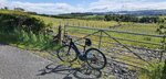
View attachment 60182

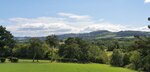
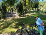
As seen (newly installed this week I might add) just a bit down the gravel road from the entry of a neighbor's estate. I was tickled pink to see it, and texted her that I loved what she and her hubby had provided.

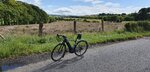
What better way to employ an old tree truck, and a shady bit of land next to an equally shady and extremely quaint centuries old gravel road.

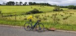
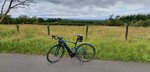
Only did 13 miles this morning, just to enjoy some cycling time. A torn rotator cuff and a project "Honey Do" list that was long enough to wrap around the house twice, down the driveway, and out to the road to disappear over the horizon have kept me otherwise occupied, but the majority of my efforts have been towards things that let the arm have some downtime to heal. Which, sadly, means no biking. Anytime the arm is stretched to hold the handlebar means teeth clenching pain. And pain overrides the pleasure of biking.

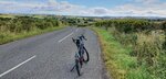
But the arm has been getting better, so I chanced a quiet, local ride today, mostly letting my arm remain quietly relaxed at my side while letting the uninjured arm do the lion's share of guiding the bike. My hubby was tackling his own "Honey Do" list - the item on the agenda today was replacing some 33 year old rotting trim on the garage. We called out goodbye to one another as I zipped down the driveway on my bike while he stood on the ladder, removing old trim boards.

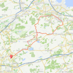
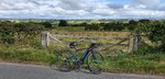
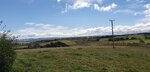
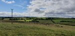
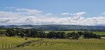
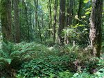
Was rather surprised to see a great many cyclists out on the gravel roads. Now that we'd had some much needed and greatly appreciated rains, the roads are lovely again. No choking, blinding dust storms rising up like avenging tornadoes behind every passing vehicle, no fine film of dirt covering everything at the end of a ride, rider as well as bike. The scenery, parched and brown and sorrowful only days before, had recovered to a vibrant green so vivid that it bordered on intoxicating. Perhaps that had something to do with the big grins that met me as I drew up on a gravel road corner where 5 cyclists were standing, taking a breather before tackling the steep curvy hill in front of us.

Upon my query as to their starting point, I was told "The Plains", which was easily 20 miles south of where we all stood. "So you've come to ride our gravel roads now that the rains have finally dampened them down", I chuckled. All of them grinned a 'yes' in return, and one of the riders, a thin older fellow with a very elegant, very bushy beard, standing astride a very capable mountain bike, said "No more... 
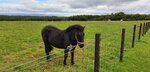
poof " while pantomiming with both hands rising in the air the image of a massive mushroom cloud explosion of dust that any passing vehicle would incite on the previously dry-as-a-desert roads. "I wish we had left earlier...like 6am", he added with a resigned shake of his head. It wasn't hot...yet... but I noticed he looked a bit tired already, and asked them all if they had enough water. I pointed just down the road they can come upon, telling them that the Huntsman's house and barn just around the bend had plenty of outdoor faucets for water if they needed any. One of the riders seemed very happy to hear that, and thanked me profusely.

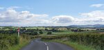
I left them with goodbyes all around, and tootled up the steep hill in maximum assist, 3rd gear. (Yes, it is a very steep little hill). The next 2.5 miles were relatively flat, and I was in no hurry to put on any speed. Which is why, after two other cyclists going the opposite way passed me, both saying hello and one actually greeting me by name (still wondering who that was?? Obviously a neighbor...) the group I'd left behind finally caught up with me. The lead rider, as he passed me, said they didn't think they were going to catch up with me. I laughed and told them I was on an electric bike, and if we'd been on an uphill they never would have caught up. Another rider pulled up next to me, curious as to how far my bike would hold a charge. We talked for a few minutes, and he was very impressed (he said) by my bike's capabilities. I wished them all a good ride home - 20 miles by my estimation - and watched them slowly disappear from view.

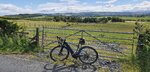
Even with my arm dangling down at my side being completely useless with the exception of that hand being the one changing the assist levels, my rotator cuff was bothering me. So I took the shortcut home, enjoying the blissfully cool shade of the trees hugging the sides of the gravel roads, and the peace and quiet of the newly revived and freshly cleansed countryside. It wasn't until I reached the paved road in front of my farm that I felt the first hit of hot air like a body slam out of nowhere. The first warning of the impending 94 degree heat that would envelop us within the hour.

I was already rolling up my driveway when the lovely cool morning abruptly disappeared in the face of a heat so intense it felt like someone had opened an oven door while it was on broil. Perhaps, as that one rider had said in that ride group, they should have started sooner, I mused. I sincerely hoped they'd be back home before this sudden intense heat hit them as well. I sincerely hoped that every rider I met on my little loop would be back home poste haste.

Tomorrow we are expecting to hit the century mark for temperatures. 100°F (37°C). A good day to continue resting the arm, and slowly checking items off the Honey Do list.
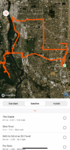
I ride with one hand making videos, which sides do you have the brakes on...its standard front brake on the right in England which leaves me with back brake only as I use the right arm to hold the camera.

Unless I put in my mouth :)
 
Wambierzyce: The Silesian Jerusalem

There was no way to miss driving through Wambierzyce on my way to the Table Mountains on last Saturday:

View attachment 60421
A 2004 photo taken with an Olympus film camera. Our cousin on the stairs of the Wambierzyce Basilica.

Some history

In 12th c., someone put a figurine of Our Lady into a hollow of a tall tree. The place has become a site of pilgrimage, bearing the Czech name of Vambeřice (that was in the era Poland had no kings and Czech Kings were powerful).

Silesia was ruled by (Polish) Silesian Piast dukes, then by Bohemian Crown, then by mighty Hungary, again by Bohemia, by Polish Jagiellon Kings, then by the House of Brandenburg, by the Austrian Habsburg monarchy next, to finally fall to Prussia in 1742. The German rule continued to 1945, when the whole Silesia was given to Poland as a compensation for the land we lost in the East to the Soviet Union. History is so complicated...

In the beginning of 18 c., the village of Albendorf was owned by one Daniel von Osterberg. The guy fancied he would convert the popular pilgrimage site into an emulation of Jerusalem. The brook there is called Cedron (Kidron), there is the Mount of Olives, Calvary, etc. The village sports a big number of historical chapels dedicated to Passion of Christ. The only thing von Osterberg was unsuccessful was building a good church. The next owner, Count Franz Anton von Götzen (the owner of, i.a., the Castle of Scharfeneck) built an impressive Baroque church (1715-1725) there.

View attachment 60423
In 1936, the church received the status of Basilica Minor from the Pope Pius XI.

View attachment 60424
A big number of chapels is filled with original historical basswood figures.

View attachment 60425
I guess the hill opposite the church is the Mount of Olives. That area sports as many as 74 chapels from 18-19th c. Although Wambierzyce look like a town, it is still a village.

View attachment 60426
The main church is surrounded by a cloister (a gallery) where pilgrims could sleep at night. The crutches on the wall are votive offerings of the miraculously cured. The central painting is by Michael Willman and is a biblical scene with the Table Mountains in the background.

View attachment 60427
Michael Willmann (dubbed "the Silesian Rembrandt") was a German painter of the 17th c. His Albendorf paintings show biblical scenes but the background always includes Table Mountains, so the pilgrims could match the location with their imagination of the Holy Land.


View attachment 60429
The Baroque interior.

View attachment 60430
The pulpit is made of basswood.

View attachment 60431
The Brook of Cedron.


There also is a historical mobile (mechanical) Christmas crib in Wambierzyce to see.

View attachment 60432
The Kłodzko Basin.

View attachment 60433
Within East Europe. The net drive time of 4 h 28 minutes is a good joke of Google Maps :D
Thats very colourful to us dour protestants.
 
@Stefan Mikes Quite an adventure you had there Stefan, I loved reading your story and looking at your fantastic pictures, Poland has such beautiful countryside! :)

Yesterday's torrential rain had gone this morning to be replaced by gusty winds, 30-40mph gusts at times! I wasn't letting a little wind get in the way of another cycling trip, just 37 miles today which felt like a trip round the block after my recent rides!:p I managed to pick a route to avoid the worst of the nasty crosswinds, I actually really enjoyed it despite the winds! Its a great feeling riding into a 40mph headwind at 15mph, without the assist I would have been going backwards!;)

1595946886342.png
 

Attachments

  • elevation_profile175.jpg
    elevation_profile175.jpg
    22.8 KB · Views: 282
  • trip-53231055-map-full88.png
    trip-53231055-map-full88.png
    413.5 KB · Views: 304
  • 20200728_101123.jpg
    20200728_101123.jpg
    697.9 KB · Views: 293
  • 20200728_102009.jpg
    20200728_102009.jpg
    671.9 KB · Views: 266
  • 20200728_102026.jpg
    20200728_102026.jpg
    419.1 KB · Views: 270
  • 20200728_102031.jpg
    20200728_102031.jpg
    390 KB · Views: 301
  • 20200728_102059.jpg
    20200728_102059.jpg
    656.8 KB · Views: 277
  • 20200728_102110.jpg
    20200728_102110.jpg
    332.6 KB · Views: 283
  • 20200728_103254.jpg
    20200728_103254.jpg
    720.2 KB · Views: 282
  • 20200728_103301.jpg
    20200728_103301.jpg
    768.4 KB · Views: 273
  • 20200728_103322.jpg
    20200728_103322.jpg
    348.6 KB · Views: 286
  • 20200728_104431.jpg
    20200728_104431.jpg
    784.9 KB · Views: 283
  • 20200728_104458.jpg
    20200728_104458.jpg
    528.9 KB · Views: 278
  • 20200728_104517.jpg
    20200728_104517.jpg
    382.3 KB · Views: 266
  • 20200728_114816.jpg
    20200728_114816.jpg
    584.9 KB · Views: 271
  • 20200728_114939.jpg
    20200728_114939.jpg
    600.8 KB · Views: 271
Yeah, you’re killing it. Amazing numbers, but you ride in a gorgeous place. I don’t know how you get those long rides done, stopping to take all those great pictures.

Just got in and rode that same stretch in the picture above. It looks a little better today.
 
Back