bikeman242
Active Member
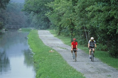
I couldn't resist the great weather last week and took a 4 day trip back down to Cumberland MD. to ride the C&O, GAP and WMRT trails. Not much fall color left but there was still some to be seen.
Up on Big Savage Mountain:
View attachment 69793 View attachment 69794 View attachment 69795 View attachment 69798 View attachment 69799
Mile 186 on the C&O where it joins the GAP trail in Cumberland:
View attachment 69797 View attachment 69796
The Keystone and Salisbury viaducts:
View attachment 69800 View attachment 69801
Pinkerton high bridge with the Pinkerton Tunnel in the background:
View attachment 69802
With most of the leaves gone, good views of the river between Confluence & Ohiopyle:
View attachment 69803 View attachment 69806
Crowded for a weekday at Ohiopyle:
View attachment 69804 View attachment 69805
Great pictures, thanks. I am planning a three night trip next Tuesday through Thursday, driving in from NE Philly on Tuesday, then back friday morning. I was thinking of doing the WMRT and the C&O, and/or anything else in the general area that I may not be aware of. I already did the GAP trail and the Pine Creek trail this season, thanks to yours @6zfshdb and @J.R. very helpful planning advice. This sadly looks like my "last bike trip" of the season.
What would you suggest for an ideal itinerary, weather permitting? You mentioned the WMRT and the C&O as the best in the area, though I am happy to drive a bit further if there are better fish out there. I thought about the Blue Ridge trail, but am not comfortable biking on the road.
Thanks and cheers for the pics.


") and it's not the PA Keystone... Curious minds want to know (of course it might be just me). They are made from that large aggregate concrete one typically sees from the 1920's and 30's.
and it's not the PA Keystone... Curious minds want to know (of course it might be just me). They are made from that large aggregate concrete one typically sees from the 1920's and 30's.


