GPS vs Maps

6zfshdb

Well-Known Member
Region
USA
City
Northeast Pennsylvania
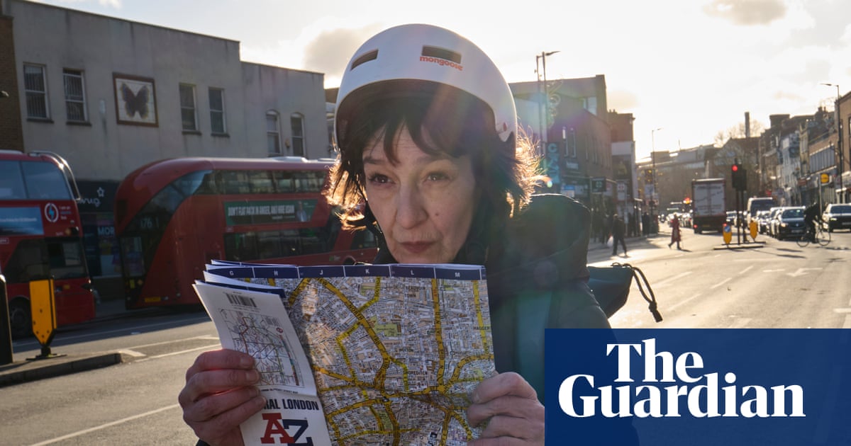
Humorous article in the Guardian by Zoe Williams on navigating around London by bike without using GPS technology. Apparently, it's healthier? :oops:
I guess this assumes you don't get hit by a bus while you stop to read the map.

1734791581534.png


My wife always likes to carry a map when we travel and doesn't use GPS. I guess her elevator will continue to go to the top floor long after mine crashes into the basement. 😄
 
I suffered an episode of Alzheimer's when I woke up in a field of stubble in November, 1973. For two days I'd been in snow and a 30 mph crosswind on my way from Red Lodge to Buffalo. When I awoke, it wasn't snowing or windy. I remembered I was in Iowa.

Normally, I navigated without maps. I knew where the states were, and road signs pointing to cities would tell me where I was within a state.The sun was my compass. On this morning, for some reason I couldn't recall where Iowa was. Then I remembered it was Minnesota's southern neighbor. I headed north. As soon as I crossed the border, I had my bearings. Unfortunately, Minnesota greeted me with heavy rain, which continued across Wisconsin.
 
I have a map of the US in my head. I spent my years 2-4 standing in the front seat of the car to avoid motion sickness. So I knew my way to & from grocery (24 miles) by age 3. Totally illegal these days.
My wife reports GPS ran her & daughter in a circle 3 times on way from Elizabethtown to Paducah. I navigated my brother to the airport in MI to pick up a gyrocopter via Rand McNally atlas. Then he referred to his Apple phone to lead us out, which immediately directed us onto a gravel road. We had to stay below 5 mph to avoid scratching the windshield of the craft on the trailer. So I still don't own a GPS navigator.
My Rand McNally atlas was obsolete 2017 so I did not take it on my recent trip to Houston. I stopped at Wal-mart in Union CIty, TN to buy a new one, and they do not stock them anymore. I missed the new freeway Union CIty TN to Dyesrburg because it is labeled TN130, not I-69. Unfortunately the new Rand McNally atlas the wife bought me from Amazon is easy-to-read and leaves out such details. I missed an unmarked turn in the I-69 construction in Nacogdoches TX and lost 30 minutes. You are allowed to look at a paper map while driving, but you are forced to pull off and park while looking at google maps on your phone. As parades of trucks passed me on US 59 in 55 mph construction speed zones, then blocked both lanes at 54 mph uphill in 75 mph zones, I decided to come back from Houston via Huntsville, Crockette, Alto, Rusk, Ponta, Troup, Arp and Kilgore, then I20 to Marshall and US 59 again. Unfortunately Google maps had mostly wrong route numbers from Ponta to Kilgore. I had to stop in every hamlet and search for the next town names on signs to navigate, in the dark and the rain. No compass. The new Easy To Read Rand McNally atlas does not even show any of the roads Rusk to Kilgore. Another problem with google maps, when you spread cities out big enough to show the smaller streets, all the main street names disappear. I lost 20 minutes trying to meet my brother at Cracker Barrel N. Houston because Ella blvd is broken at Greens Bayou and I did not see that until the road ended. Then I got in the wrong lane trying to get on I45 North from N. Shepard and had to drive a box to turn around and try again.
I am really enjoying Delorme Maps, which are quasi-geosodic but not as out of date as the USGS ones. As I was sneezing my head off last midnight, I spent 90 minutes reviewing Idaho Montana and Utah. Mostly tracking railroad routing versus the Oregon trail, but also the Overland route to Sacramento. Which route across Great Salt Lake is still a mystery. UP owns both the northern route acroos the causeway (SP) and the southern route around the lake. Which is high traffic flow now? I discovered in Colorado in 2022 that UP is allowing trees to grow through the D&RG rails through Tennessee pass (US 24), which they now own.
 
Last edited:
I am very glad I grew up with needing maps. Having an idea of how interstate in the US are organized, having a basic idea of where things are how things are laid out in my state and neighboring states is beyond helpful.

GPS is a great tool though, I still can't imagine using it without having that base knowledge of how everything is laid out.

Interacted with people that rely nothing but Google maps, anytime it sends them in a wrong direction they are completely lost. Again because they have no basic understanding of how even their own neighborhood is laid out.

End conclusion: I recommend using both.
 
This has been fascinating. I must be lucky since I live on the DMV (DC, Maryland, Virginia) which is so heavily mapped. The only times I’ve had GPS issues, recently, is when there’s new or emergency road construction. I even was successful using Apple Maps in the Israeli west bank in areas that did not appear in the satellite images due to security.

OTOH, the turn by turn navigation in Ride with GPS can be extremely frustrating when the turn announcements come after passing the actual turn due to lag.
 
GPS is nice but not 100% trustworthy. Maps don't need electricity and in an emergency one can start a Fire with it IF one has a Lighter or Matches along. I use my eBike as a fun activity. When on my eBike I pretty well always know from experience where I am and what Compass direction I am heading.
My workplaces are mostly very remote without cellphone service. There I use a Garmin Inreach with Map but also have Paper Maps for just in case.

Cheers
 
We periodically do orienteering to maintain our skill. Once you can read a map, it's fairly elementary to follow a map.
 
If you know how to get where you're going without maps, great. Obviously, you don't need GPS either. I just went to Europe for the first time and used GPS all over the place. Amsterdam, Zurich, Milan, Paris, etc. Worked great. Few problems, and no stopping to unfold, firgure things out, and then carefully refold multiple maps. In situations like that I'd much prefer GPS.

I was using Google Maps, so I if wanted to look at a map, it was right there, on something I had in my pocket anyway,, showing me exactly where I was, and if desired, where I wanted to be.

Around home, yeah, I can find the grocery store without maps or GPS

TT
 
Back