Stefan Mikes
Gravel e-biker
- Region
- Europe
- City
- Mazovia, PL
"Nine Men Riding, A Hundred Watching It", Or Korboloza Bolimoza ")
108 people were "Interested" but only nine started the gravel group ride at 10:35 am on Saturday. I'm glad those riders were in a good part the "creme de la creme"!
I (of course) spoiled the ride plan and led the group into sand! I paid the full price of that mistake as I got dropped by people not afraid of sand, and then had to sprint for 15 km to catch up with the tail of the group! (I only allowed myself to have 40% of assistance for Turbo to conserve the single battery I took with me; my principal assistance mode was only 15/20% to keep me below 25 km/h!) Eventually, I joined the Slow Group consisting of a new man, Marek, riding a Giant full suspension MTB, and Tomek (who rode with me on the previous group ride).
25 km into the ride, the Performance and Slow Groups joined at a stop. We discovered the Vintage Man (who rode a 1970s Polish made Jaguar road bike) disappeared again! I cannot understand the old man. He has no form of GPS navigation, fine. He is too slow for the Performance Group, OK. Why didn't he wait for Slow Riders to join them? (The man was later discovered in a return train by another group ride member who had to leave earlier).
We continued riding, taking a long stop at the gorgeous Bolimów Lake (32nd kilometre).

"You guys hiding from the sun in the woods remind me of the knights of King Władysław Jagiełło before the Battle of Grunwald against the Teutonic Order!' (The opposing side had to wait for the battle in full armour in the scorching July sunshine; and they lost). L to R: Przemek, Tomaz, Roland, Marek (MTB), Alfer, Tomek, my brother Jacek.

Five of us formed the Performance Group and rode at the racing speed!

Except the sand in the beginning, it was either premium gravel or asphalt.

The man in blue (Roland) lead the fast group. My brother was trying to match the man. 'When I saw him riding at 40 km/h on concrete slabs, I gave up!' said Jacek later.

We took a long rest by the lake. (An 'Unknown Stranger' was taking those photos). See Alfer jumping! He's always doing that!

Przemek (who always has brilliant ideas!) set us up for the photo session...

The Multiheaded Monster had emerged from Bolimów Lake!

A Multi-Arm, Multi-Headed Monster!

Jacek and Alfer always get the best photos together!
Past the Lake, only five of us remained in the group (others went their own ways). We zoomed into the next set of perfect gravel roads soon.
Marek is a man with similar habits to mine. Like me, he has to stop to drink from the water-bottle, for instance. As I suggested a short stop, Tomaz missed my signals. He stopped his bike abruptly, unclipped his feet from the pedals but actually his body was still moving at speed! To save himself, he dropped his bike and started running! To crash soon! (I hope his road rash was just symbolic...)

Eventually, the five of us re-joined at the Posterunek 77 (Police Station '77) in Nieborów again (51st km). The quite elegant restaurant maintains the vocabulary of the People's Republic of Poland from them olden days (Marek - left - is actually a slim person! I will never ever use a wide-angle lens to take pictures of people again!) Given the busy day, 30 minuts of waiting for the food was not bad at all. However, it was no wind where we were sitting, and soon we started suffering at 31 C...

Potato Pancakes with Chanterelle Sauce.

Guess who ate that large Knuckle? Of course, my skinny brother!
The restaurant specialized in goose meat (and poultry in general), which I do not eat. The Potato Pancakes was exactly what I wanted though. Now, we were as thirsty as I and Tomas drank a litre of Compote each! We were badly dehydrated!
Then, we had a very nice 17 km return via the premium gravel Łowicz Road. Had the time to eat ice-cream in Skierniewice Rawka and be on time for the train!

Ride Map with POI. I rode for 80 km/50 mi on the day.
108 people were "Interested" but only nine started the gravel group ride at 10:35 am on Saturday. I'm glad those riders were in a good part the "creme de la creme"!
I (of course) spoiled the ride plan and led the group into sand! I paid the full price of that mistake as I got dropped by people not afraid of sand, and then had to sprint for 15 km to catch up with the tail of the group! (I only allowed myself to have 40% of assistance for Turbo to conserve the single battery I took with me; my principal assistance mode was only 15/20% to keep me below 25 km/h!) Eventually, I joined the Slow Group consisting of a new man, Marek, riding a Giant full suspension MTB, and Tomek (who rode with me on the previous group ride).
25 km into the ride, the Performance and Slow Groups joined at a stop. We discovered the Vintage Man (who rode a 1970s Polish made Jaguar road bike) disappeared again! I cannot understand the old man. He has no form of GPS navigation, fine. He is too slow for the Performance Group, OK. Why didn't he wait for Slow Riders to join them? (The man was later discovered in a return train by another group ride member who had to leave earlier).
We continued riding, taking a long stop at the gorgeous Bolimów Lake (32nd kilometre).
"You guys hiding from the sun in the woods remind me of the knights of King Władysław Jagiełło before the Battle of Grunwald against the Teutonic Order!'
(The opposing side had to wait for the battle in full armour in the scorching July sunshine; and they lost). L to R: Przemek, Tomaz, Roland, Marek (MTB), Alfer, Tomek, my brother Jacek.Five of us formed the Performance Group and rode at the racing speed!
Except the sand in the beginning, it was either premium gravel or asphalt.
The man in blue (Roland) lead the fast group. My brother was trying to match the man. 'When I saw him riding at 40 km/h on concrete slabs, I gave up!' said Jacek later.
We took a long rest by the lake. (An 'Unknown Stranger' was taking those photos). See Alfer jumping! He's always doing that!
Przemek (who always has brilliant ideas!) set us up for the photo session...
The Multiheaded Monster had emerged from Bolimów Lake!
A Multi-Arm, Multi-Headed Monster!
Jacek and Alfer always get the best photos together!
Past the Lake, only five of us remained in the group (others went their own ways). We zoomed into the next set of perfect gravel roads soon.
Marek is a man with similar habits to mine. Like me, he has to stop to drink from the water-bottle, for instance. As I suggested a short stop, Tomaz missed my signals. He stopped his bike abruptly, unclipped his feet from the pedals but actually his body was still moving at speed! To save himself, he dropped his bike and started running! To crash soon! (I hope his road rash was just symbolic...)
Eventually, the five of us re-joined at the Posterunek 77 (Police Station '77) in Nieborów again (51st km). The quite elegant restaurant maintains the vocabulary of the People's Republic of Poland from them olden days
(Marek - left - is actually a slim person! I will never ever use a wide-angle lens to take pictures of people again!) Given the busy day, 30 minuts of waiting for the food was not bad at all. However, it was no wind where we were sitting, and soon we started suffering at 31 C...Potato Pancakes with Chanterelle Sauce.
Guess who ate that large Knuckle? Of course, my skinny brother!
The restaurant specialized in goose meat (and poultry in general), which I do not eat. The Potato Pancakes was exactly what I wanted though. Now, we were as thirsty as I and Tomas drank a litre of Compote each! We were badly dehydrated!
Then, we had a very nice 17 km return via the premium gravel Łowicz Road. Had the time to eat ice-cream in Skierniewice Rawka and be on time for the train!
Ride Map with POI. I rode for 80 km/50 mi on the day.
Last edited:


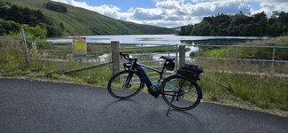
 Just after Rigside 50 miles appeared on my gps and my first battery had over 30% left, pretty impressive given the headwind for 35 miles and 3500ft of climbing!
 It doesn't get much better than this, it blows my mind to think 8 days ago I did 68 miles more than I did today! Today felt so much harder I have to say...maybe I was still fatigued!