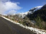
Of course it gets a bit chilly at times. Here's a photo of Ben and me taken in January a few years ago (2007 actually). I've mislaid the location but it must be somewhere in the southern Queensland highlands; the hill furthest to the left has a familiar profile.
View attachment 44055
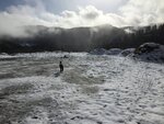
Perhaps, this was the photo I was looking for. The same two in July 1984 when it did snow in the southern highlands (at around 900 m). It took me ages to rake up that amount of the white stuff! Any blizzards between then and now have escaped my notice.
View attachment 44056


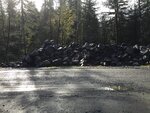
 ( well, actually the same but before asphalt was put on top of the grass)