Show us pictures of where you ride your ebikes!

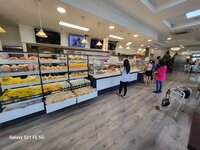
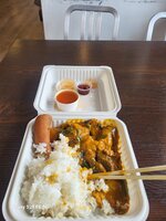
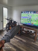
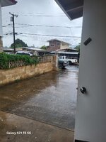
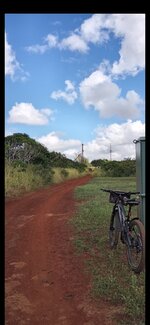
I went to Golden Coin one of my stops for eats along my route. Then had to race home because of rain 3 miles of hard pedaling. Did approximately 18 miles today. Take a shower and watch NFL
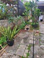
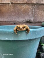
I can ride completely around my yard in fact the rain prevents me from yard work then this lovely creature greeted me while I was filling up my mop bucket.
 

Attachments

  • 20231119_113901.jpg
    20231119_113901.jpg
    705.5 KB · Views: 180
  • 20231119_111550.jpg
    20231119_111550.jpg
    522.4 KB · Views: 189
  • 20231119_111525.jpg
    20231119_111525.jpg
    340.5 KB · Views: 163
  • 20231119_113353.jpg
    20231119_113353.jpg
    643.5 KB · Views: 171
  • 20231119_111450.jpg
    20231119_111450.jpg
    273.2 KB · Views: 173
  • 20231119_113901.jpg
    20231119_113901.jpg
    705.5 KB · Views: 174
  • 20231119_113805.jpg
    20231119_113805.jpg
    226 KB · Views: 169
My weekend banging ebike.I Put 20-30 miles every weekend on it.
Rainy season here it's very unpredictable .
 

Attachments

  • 20231119_140834.jpg
    20231119_140834.jpg
    289.7 KB · Views: 167
  • 20231119_132616.jpg
    20231119_132616.jpg
    365.8 KB · Views: 167
  • Screenshot_20231118_100459_Photos.jpg
    Screenshot_20231118_100459_Photos.jpg
    206.8 KB · Views: 153
Oh dear... A train derailment on the greenway I often take down to Mud Bay...
You can see a piece of the Nemesis puddle on the path. This happened yesterday morning early...


Glad I wasn't there!
Looks like the tank cars were thirsty and pulled the rest of the train off the tracks to get to your beloved puddle.

The authorities might fix the puddle if you alert them to this possibility. Either that or have you committed.
 
I went for a short jaunt to the smoke shop to score some raw Vados. I was scolded by a verysexy black Hawaiian girl probably mid 20s with fake eye lashes for taking pictures.
I did however score some primo buds good to go for Sunday Football.
 

Attachments

  • 20231125_112835.jpg
    20231125_112835.jpg
    701.8 KB · Views: 158
Drain issue here.
Wtf I guess turn around go on the motorway.
It's the Butler Freeport Trail in central PA. which I've ridden many times. That was the first time I had seen it flooded. The natural drainage couldn't handle the heavy morning rain.

IMG_0564b.jpg


Yeah, turning around and cutting the ride short was the best option. The on road bypass was too long and traffic congested.
 
Yesterday I had the idea to go and check out the train derailment on the path to Mud Bay.
I had no clue as to what the situation would be 7 days later.
Was a bit cool at 7C so took my heated gloves and headed out.

Lots of sun...


Hmmm... a warning that I hoped would not be accurate when I got to the section this sign refers to...


Well, the warning sign was accurate. Rats, you can see the security car there. I decided to go up a steep path to the road (64th Ave) and carry on South to Watershed Park...


And here's the other end of the section, also shut down. My curiosity left unsatisfied...


I was an idiot and forgot to charge the heated gloves, and the right one died. My fingers were numb, so I headed up this steep path and took the road back home...


Short ride, but good to get out...
 
Couldn't read the fine print...does it say "No Diving"?
Speaking of which, I'm kind of a completionist so I keep a heat map of my rides in order to slowly make sure to ride every street & trail in my neighborhood.

i'll have trouble completing my hometown after the last OSM map update. Someone added the ~2.5 miles of trails in the Edmonds Underwater Park to OSM. :confused:

The red(red=unridden by me) lines are the underwater trails used by divers to navigate the park. Can't even use a pedal boat to complete them as no boats are allowed.
1000006625.png

PXL_20231126_192943663~2.jpg
 
Speaking of which, I'm kind of a completionist so I keep a heat map of my rides in order to slowly make sure to ride every street & trail in my neighborhood.

i'll have trouble completing my hometown after the last OSM map update. Someone added the ~2.5 miles of trails in the Edmonds Underwater Park to OSM. :confused:

The red(red=unridden by me) lines are the underwater trails used by divers to navigate the park. Can't even use a pedal boat to complete them as no boats are allowed.
View attachment 167161
View attachment 167162
Methinks you need an esubmarine!
 
Yesterday's late afternoon coast ride found North Ponto Beach in a rideable state at an exceptionally low tide. (The spring tides surrounding last night's full moon have been quite impressive.)

Screenshot_20231128_100543_Ride with GPS.jpg

Result: A blissful 6-mile sunset loop on the sand!

My beach rides are usually limited by tides and physical obstacles like headlands, unrideable sand or gravel, standing saltwater, or jetties. This time, it was the last two. But with the tide so low, I was able to beat my previous record for a single beach ride by nearly 2 miles!

20231127_162538.jpg

It was getting dark fast, so I stopped for photos only at my north turn-around at the jetty at the south end of Tamarack Beach (see map).This was the view south toward the La Jolla Peninsula. The sand/gravel ratio will soon reverse as the sand moves to its winter residence in offshore bars.

Locals call this jetty the "warm water jetty" because it channels cooling water from the power plant across the Coast Highway.

20231127_162456.jpg
20231127_162504.jpg

From the beach, (lifeguard) Tower 30 looked like it had grown a giant yellow crane. Not sure what the power plant does with these cranes, as they're always idle when I go by.
 
Back