Show us pictures of where you ride your ebikes!

Location?? Location?? Location??
Ride up hurricane ridge road in Olympic national park.
I've done this ride a few times in the past with regular non-assist bikes (including this Walmart Schwinn bike that I've added a Tongsheng TSDZ2). So much more pleasant with the assist even though I sort of despise the extra weight of motor and battery. From Heart O the hills campground to the second picnic spot (past the wildly popular main visitors center) is 13.4 miles according to Google maps with elevation gain of 3,474 feet.
Below photo is just before the visitor center at the top, near the Obstruction Point road. So many people at the visitor center but I had the entire picnic area with incredible views by myself because the crowds don't seem to go the extra mile, and I'm thankful for that.
IMG_20220820_160536936_HDR.jpg
 
Last edited:
Off on a ride today to the Steveston Marine Festival.

Along the Horseshoe Slough trail:

1.jpg


Along the South Dyke:

2.jpg

Finn Slough, a very interesting spot:

3.jpg


The sights and sounds of the festival:

4.jpg


The historic Cannery in Steveston:

5.jpg


Garry Point Park:

6.jpg


Along the West Dyke:

7.jpg


Stop to smell the flowers and return home:

8.jpg
 
Off on a ride today to the Steveston Marine Festival.

Along the Horseshoe Slough trail:

View attachment 132817

Along the South Dyke:

View attachment 132818
Finn Slough, a very interesting spot:

View attachment 132819

The sights and sounds of the festival:

View attachment 132820

The historic Cannery in Steveston:

View attachment 132821

Garry Point Park:

View attachment 132822

Along the West Dyke:

View attachment 132823

Stop to smell the flowers and return home:

View attachment 132824
Great ride.
 
Past few days was morning passing rain here.
I have been going to work with my trusty Tacoma and I had some "Honey do this" that cannot be done on a bike.
I did get a couple relaxing rides.
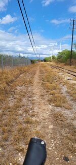
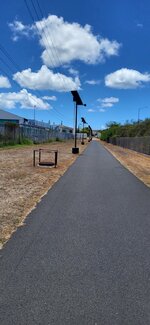
Narrow path next to rails, I pretty much carve that riding to work.
I am one of those ebikers that will as much as possible avoid riding next to fast moving cars.
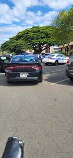
Cops were doing their finest and arrested a drunk bum for being disorderly at a nearby park.
 

Attachments

  • 20220824_154448.jpg
    20220824_154448.jpg
    363.1 KB · Views: 109
  • 20220822_151003.jpg
    20220822_151003.jpg
    368.2 KB · Views: 110
  • 20220824_150412.jpg
    20220824_150412.jpg
    361.3 KB · Views: 105
we had explored the trails in this area but I tried a different road access this time. well hit this gully. we may have handled the slops but the switchbacks and sharp turns no way. we hit the one section and was ok but the second section was a lot more but maybe easier to navigate. my wife had a bit of a hard time she is blind and was afraid when we had a switchback when we were walking. looks like the garmin did not get the slope grade because of lack of speed. Lucky we have a e tandem and it has a walk mode or we could not have gotten up that slop pushing the bike.

IMG_0596.jpeg
 
we had explored the trails in this area but I tried a different road access this time. well hit this gully. we may have handled the slops but the switchbacks and sharp turns no way. we hit the one section and was ok but the second section was a lot more but maybe easier to navigate. my wife had a bit of a hard time she is blind and was afraid when we had a switchback when we were walking. looks like the garmin did not get the slope grade because of lack of speed. Lucky we have a e tandem and it has a walk mode or we could not have gotten up that slop pushing the bike.

View attachment 133392
Good on ya for tryin' it, but I'm with @Prairie Dog
Way too twisty!
 
Pretty tight, sketchy trail for a tandem there, Foofer. Good on you and the wife for going as far as you did. 👍
that was the only bad part. the rest was just a normal path with bark chips. we road around the area before but must have missed that one. the whole rest of the area is pretty flat. so we had no clue. the paths are somewhat marked but not with much info. sharp turns going up are hard as the bike wants to fall over. going down the front tire will slide out. for some reason I can turn fairly sharp left but turning right sharply I have issues.
 
that was the only bad part. the rest was just a normal path with bark chips. we road around the area before but must have missed that one. the whole rest of the area is pretty flat. so we had no clue. the paths are somewhat marked but not with much info. sharp turns going up are hard as the bike wants to fall over. going down the front tire will slide out. for some reason I can turn fairly sharp left but turning right sharply I have issues.
Stay safe mate!
 
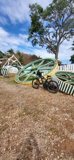
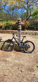
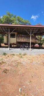
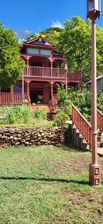
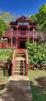
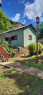
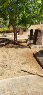
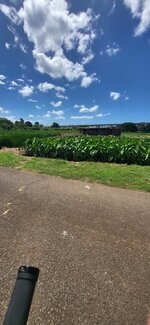
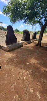
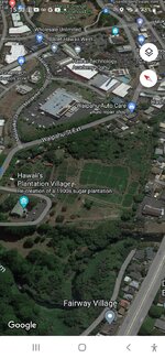
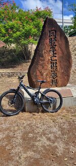
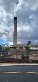
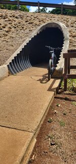
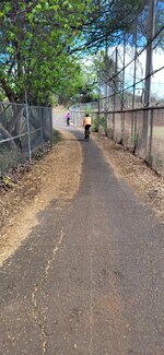
My biking legs got me here today. Re-creation of a plantation village,
Those carved stones were placed there to serve as memorial for the people who worked in sugar cane fields. Mostly Japanese, Philippine, Chinese and Koreans. It's popular destination to visit for the descendants of those hard working people. Smoke stack for the sugar cane press still stands today, it has been converted into YMCA.
 

Attachments

  • 20220827_101321.jpg
    20220827_101321.jpg
    519.5 KB · Views: 101
  • 20220827_100630.jpg
    20220827_100630.jpg
    304.9 KB · Views: 115
  • 20220827_101131.jpg
    20220827_101131.jpg
    460.7 KB · Views: 110
  • 20220827_101148.jpg
    20220827_101148.jpg
    408.2 KB · Views: 110
  • 20220827_101136.jpg
    20220827_101136.jpg
    362.2 KB · Views: 117
  • 20220827_101502.jpg
    20220827_101502.jpg
    449.5 KB · Views: 107
  • 20220827_101825.jpg
    20220827_101825.jpg
    262.9 KB · Views: 103
  • 20220827_101638.jpg
    20220827_101638.jpg
    304.3 KB · Views: 103
  • Screenshot_20220827-155053_Maps.jpg
    Screenshot_20220827-155053_Maps.jpg
    273 KB · Views: 108
  • 20220827_101042.jpg
    20220827_101042.jpg
    438.6 KB · Views: 83
  • 20220825_154058.jpg
    20220825_154058.jpg
    186.4 KB · Views: 85
  • 20220827_101625.jpg
    20220827_101625.jpg
    411.4 KB · Views: 89
  • 20220827_111316.jpg
    20220827_111316.jpg
    380.1 KB · Views: 81
  • 20220827_111350.jpg
    20220827_111350.jpg
    298 KB · Views: 85
  • 20220827_104659.jpg
    20220827_104659.jpg
    387.9 KB · Views: 92
Last edited:
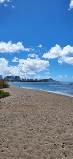
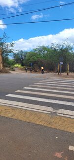
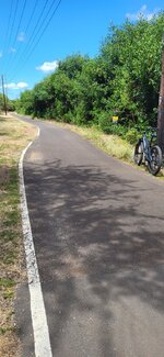
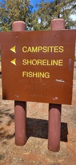
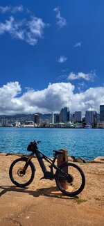
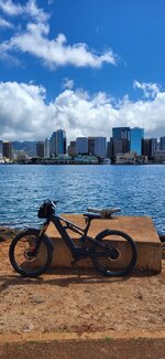
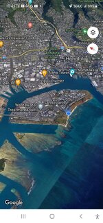
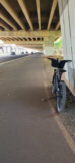
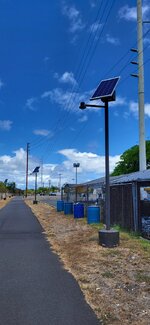
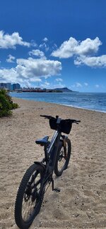
Decided to go sight seeing, when it got warm I went for a swim.
View of Diamond Head and Downtown Honolulu. Taken from Sand Island
 

Attachments

  • Screenshot_20220829-104522_Maps.jpg
    Screenshot_20220829-104522_Maps.jpg
    248.2 KB · Views: 94
  • 20220829_104127.jpg
    20220829_104127.jpg
    269.6 KB · Views: 89
  • 20220829_104103.jpg
    20220829_104103.jpg
    300.6 KB · Views: 87
  • 20220829_103456.jpg
    20220829_103456.jpg
    272.7 KB · Views: 88
  • 20220829_103236.jpg
    20220829_103236.jpg
    252.3 KB · Views: 84
  • 20220829_105837.jpg
    20220829_105837.jpg
    321.2 KB · Views: 89
Back