WattsUpDude
Well-Known Member
- Region
- USA
- City
- San Francisco, Bay Area
Didja score one for Thanksgiving?
Not yet... I'm definitely thinking about it!Didja score one for Thanksgiving?

@WattsUpDude Awesome stuff! Thanks for sharing! I’m waiting for my ebike to arrive and will be looking for suggestions of places where to bike to. I live in SF city center. Any ideas of cool places / trails to do are very welcome. In terms of range I’m getting a double battery R&M bike. Thanks!are videos ok?
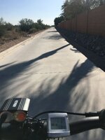
this is some of the daily commute home from San Francisco going south to the Peninsula
this is a little bit of the town of Pacifica
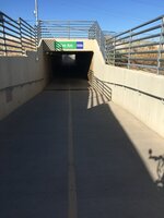
this is a trail that goes from San Bruno to San Mateo
Thanks! I’m based on the Peninsula and commute to SF. We’re blessed with a lot of beautiful places to ride around here. Most of my recreational rides are anywhere from SSF to Pacifica since I usually start from home. I haven’t done them in a while but there’s always Mount Davidson or Sutro Forest if you want to stay local. Check out the thread started by @AleksR who rides an R&M and is also a Bay Area local.@WattsUpDude Awesome stuff! Thanks for sharing! I’m waiting for my ebike to arrive and will be looking for suggestions of places where to bike to. I live in SF city center. Any ideas of cool places / trails to do are very welcome. In terms of range I’m getting a double battery R&M bike. Thanks!


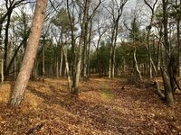
Outstanding pictures!Colder here now, temps just above freezing. Most of the leaves gone from the trees. Some photos from riding in my nearby Provincial Park (Pinery)


Nice, Lat, nice!First significant snowfall here today, temperature around freezing. Marathon GT 365 tires got their first test of that, and performed pretty well on and off-road.