You are using an out of date browser. It may not display this or other websites correctly.
You should upgrade or use an alternative browser.
You should upgrade or use an alternative browser.
2026 - Our Rides in Words, Photos, Maps and Videos
- Thread starter RabH
- Start date



DaveMatthews
Dave's not here. Cheating since 2018
- Region
- Canada
Nicely done!The eagle has landed, they even put my original cover back on to make it look genuine!
View attachment 216891
Chargeride
Well-Known Member
That motor has been around the world, it looks like new.
Chargeride
Well-Known Member
Bri took this picture of the idiot, who didnt take a change of clothes, buying a KFC at a service station.
He said my new biking top was too big, I now realise he was correct.
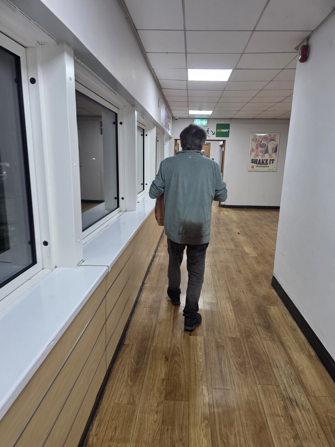
He said my new biking top was too big, I now realise he was correct.



Stefan Mikes
Gravel e-biker
- Region
- Europe
- City
- Mazovia, PL
Saturday, the third ride in the same area. It looks I would be riding the hills alone. The objective is 103 km, SUB 5 (gross ride time).
The new name:
Łódź Sights
Łódź Sighs
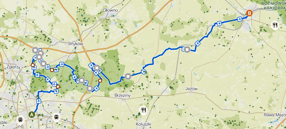
Radars, singletracks, Premium Grass, murals, stores, inns, taking photos, all eliminated. Premium Gravel included. Riding along the railroad not in the plans. Sheer power, no stops, four energy gels, four cigarettes only
The new name:
Łódź Sights
Łódź Sighs
Radars, singletracks, Premium Grass, murals, stores, inns, taking photos, all eliminated. Premium Gravel included. Riding along the railroad not in the plans. Sheer power, no stops, four energy gels, four cigarettes only
Last edited:
Chargeride
Well-Known Member
I hear premium gravel.polishes your shoes as you pass
Chargeride
Well-Known Member
That picture was very confusing to me, I dont seem to have grey hair, its totally grey at the front, maybe its just the lighting.
Stefan Mikes
Gravel e-biker
- Region
- Europe
- City
- Mazovia, PL
It was one evening when I entered a live music tavern I used to frequent at those times. Girls hurled at me for the welcome, kiss-kiss. "How come you are blond?" everyone asked. "Well, because I washed my hair?" -- a general laughter. Turned out, I got partly grey in a very short time!That picture was very confusing to me, I dont seem to have grey hair, its totally grey at the front, maybe its just the lighting.
I was wearing long hair then and decided to do a drastic haircut soon as long grey hair do look pathetic, meseems.
Chargeride
Well-Known Member
Gandalf strikes you with his staff.
Chargeride
Well-Known Member
Yup, same here, going to the corner shop feels like venturing out from an arctic science station.
Going the beach tomorrow
Going the beach tomorrow
Last edited:
DaveMatthews
Dave's not here. Cheating since 2018
- Region
- Canada
Fantastic news, congrats!The warrior returns!If only the weather would play ball...50mph winds and heavy rain at the moment, increasing to almost 70mph tomorrow.....
View attachment 216921


Jeremy McCreary
Bought it anyway
- Region
- USA
- City
- Carlsbad, CA
Yup, same here, going to the corner shop feels like venturing out from an arctic science station.
Going the beach tomorrow
Be careful out there. Things happen at Arctic and especially Antarctic science stations.
Chargeride
Well-Known Member
The lads watched the original and we roared at the line..something like..
He moves fast for a man with a pack of dogs on his back.
We quoted it for years everytime we saw someone running.
He moves fast for a man with a pack of dogs on his back.
We quoted it for years everytime we saw someone running.
Stefan Mikes
Gravel e-biker
- Region
- Europe
- City
- Mazovia, PL
Meanwhile in Central Poland (that is, Land of Łódź. Mazovia with Warsaw is not Central Poland).
Last edited:


RabH
Well-Known Member
Nutter...Going the beach tomorrow

Chargeride
Well-Known Member
I might stay in the van
Jeremy McCreary
Bought it anyway
- Region
- USA
- City
- Carlsbad, CA
First ride on my own bike after 8 days away started with a 5 mi coast ride north to Carlsbad Village with no plan beyond that in mind.
On the way, puzzled over the unusually squat thunderheads coming in with the unstable air trailing the remnant of Hurricane Trudy passing through SoCal the day before. Their pancake-shaped tops seemed too low and too broad for a typical anvil cloud.
To this old Trekkie, the one at center looked like the starship Enterprise.
On a whim, the next segment hugged the north shore of Agua Hedionda Lagoon. This shot looks across the lagoon to Carlsbad State Beach and beyond.
Passed lots of posh view homes overlooking the lagoon en route.
And among them, this large, totally out-of-place contraption on a lot surely zoned residential. Some kind of fancy foundation work for another mansion?
Poking around the unfamiliar neighborhoods along Highland Drive came next. Highland follows the crest of Carlsbad's first inland ridge from Agua Hedionda to Buena Vista Lagoon, the next lagoon north.
The odd mix of posh and modest long ocean view homes side by side along Highland suggested gentrification in progress. Lots of that going on in San Diego County beach towns.
From there, it was back down to the Coast Highway and home. Stopped at this bluff at the south end of Carlsbad State Beach to see how much sand it had left, and the sad answer was little to none.
At 78, had to wonder if I'll ever see anything approaching normal sand levels on Carlsbad beaches again? Hard to see expensive and potentially short-lived replenishments as the solution when so much coastal infrastructure also has to be repaired now.
In normal times, sand sloshes back and forth between our beaches and their offshore bars on timescales of days to weeks. All we can hope for now is that some of the sand moved offshore by recent storms will eventually find its way back.
But with many months of El Nino-driven high tides and big wave events ahead, who knows how long that would take and how much sand is already beyond return?
Last edited:
Chargeride
Well-Known Member
I follow the Skid Kids, typical Californian..Whoooaaa surfer dude, his footage is pretty reliable as to the situation, as in doesnt exaggerate..just whooooo
It doesnt really need exaggeration, the sea is burrowing in.
It doesnt really need exaggeration, the sea is burrowing in.
Last edited:
Similar threads

- Replies
- 3K
- Views
- 535K

- Replies
- 2K
- Views
- 509K
- Replies
- 2K
- Views
- 595K
- Replies
- 0
- Views
- 8K
