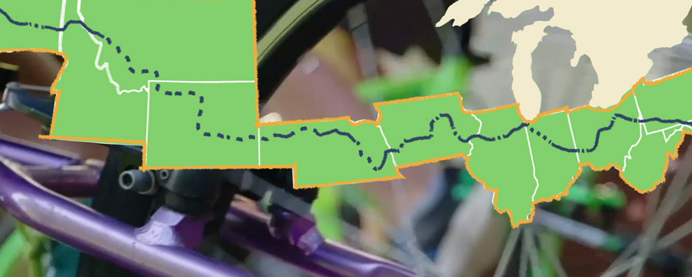
rail trails across USA

There are significant sections of that trail that are not yet complete, and some of them have no good alternates. One important example is the Beverly Bridge over the Columbia River, which is now due for completion on 21 September 2021 (it was supposed to be completed this year, but that is one more thing that went wrong in 2020). There is no good or safe detour.

There is a similar problematic issue with the Spruce Railroad Trail which will not be open until May of 2021 at the earliest. Again there is no safe detour.
 
More bike infrastructure projects that folks could work on. Outdoors, socially distanced, and worth while. Just not immediately profitable.
 
More bike infrastructure projects that folks could work on. Outdoors, socially distanced, and worth while. Just not immediately profitable.
Most rail-trail construction work is pretty heavily mechanized and wouldn't be amenable to having an army of strong backs, at least most of the time.

I've worked trail maintenance and construction projects over the years and the effectiveness of semi-skilled volunteer labor is often disappointing. There are exceptions, especially when you are stacking lots of rocks to make steps or retaining walls, and to a lesser extent if you are limbing trees and brush out of the right-of-way.

On the trans-continental route, I'd say one of the more fraught sections is from where the Palouse-to-Cascades trail ends about twenty miles east of Seattle to where the Olympic Discovery Trail begins, several dozen miles west of Seattle. You probably can claw your way linking several commuter bike routes to a ferry (I'd recommend getting a ferry north of Seattle, because it isn't exactly bike-friendly exiting Bainbridge Island or Bremerton. From there I'd carefully work my way to Blyn where the ODT sort of starts...

On the trail in the far-eastern parts of the state, there are few towns, few places to charge your bike, few places to get drinkable water, and a lot of reroutes. So it isn't super-well set up for a bike tour yet.

Oregon seems to be doing a better job setting up bike-friendly routes and encouraging the bike-friendly infra in towns that makes bicycle travel more enjoyable.
 
I`ll make it there and along the coast too as soon as possible. One more European trip and some parts of the American West that I want to see before either I or the destination turns to dust.
And as far as projects go, I was deliberately picking unprofitable but worthwhile projects that could be done with lots of inefficienct labor.
 
I`ll make it there and along the coast too as soon as possible.
Oregon Coast is better set up than either Washington or California. And ride north to south, especially in Spring, Summer, and Fall. If you go in Winter bring a snorkel.

Just south of Crescent, City, CA (really the northernmost town on the route in CA) you end up on a shoulder less four-lane highway that is often very foggy. Not fun at all. Sections of highway 1 in CA are awesome riding and generally lightly traveled, but when you get stuck on the 101 or even get too close to San Francisco or LA it just plain sucks.
Man, do I appreciate the warning. I will be able to drive some sections in a big van as well. But knowing where to ride and when to drive is a huge deal when it's going to be only one time.
 
Man, do I appreciate the warning. I will be able to drive some sections in a big van as well. But knowing where to ride and when to drive is a huge deal when it's going to be only one time.
If/when you make the trip PM me and I can give you some decent beta on Oregon and Washington for sure.
 
Man, do I appreciate the warning. I will be able to drive some sections in a big van as well. But knowing where to ride and when to drive is a huge deal when it's going to be only one time.
I can highly recommend the "avenue of the giants" in CA (Humboldt Co.) by bike. although there is traffic, you really can see the size of the redwood trees. Also the Lost Coast, in that area is pretty cool.
 
I actually started to try and do a portage reference on the Great American Trail so a rider can better coordinate with the poor sole who agreed to run a SAG vehicle. When I finish it I will post a link. Its a "big" deal, to be able to traverse the country traffic free. Glad @artdeco posted this. By the way a good organization to give a small donation to now and then.
 
I can highly recommend the "avenue of the giants" in CA (Humboldt Co.) by bike. although there is traffic, you really can see the size of the redwood trees. Also the Lost Coast, in that area is pretty cool.
The only time I saw redwoods was at John Muir Park and there were thousands of foreign tourists talking selfies around every tree, it seemed. Certainly could not ride a bike through the crowd.
The segment that goes through Iowa is only about 6 miles from my house.
I have a lot of trouble trying to use the Rail Trail map, but it looks like the Iowa section is mostly completed. True?
 
I have a lot of trouble trying to use the Rail Trail map, but it looks like the Iowa section is mostly completed. True?
There are several segments in Iowa that are complete, but also many gaps. The segment near me is the Cedar Valley Nature trail. It connects to the Hoover Trail to the south and east, making about a 75 mile segment from Iowa City to Waterloo that is complete.
 
There are several segments in Iowa that are complete, but also many gaps. The segment near me is the Cedar Valley Nature trail. It connects to the Hoover Trail to the south and east, making about a 75 mile segment from Iowa City to Waterloo that is complete.
Figuring out what is and is not open can often be a pretty significant effort. While sometimes websites can be fairly up to date sometimes they are not, and the only way to find out is often to go there and figure it out.
 
I should have mentioned that there is about a 25 mile portion of this trail that is packed limestone and still needs to be paved.
 
Figuring out what is and is not open can often be a pretty significant effort. While sometimes websites can be fairly up to date sometimes they are not, and the only way to find out is often to go there and figure it out.
RV travelers report the same thing. I will be vaccinated Beforehand, but still ..
 
Back