mschwett
Well-Known Member
- Region
- USA
i know these have been made for different regions, but i thought it would be a fun exercise to make one from my own most frequent cycling routes. of course it's not to scale, as these often aren't, with everything reduced to 45 degree increments and heavily abstracted - in the style of the famous harry beck tube map. still hard to get all the information in without distorting the scale even further - this is a work in progress with lots of missing segment lengths and elevation changes.
i couldn't come up with a graphically clear way to separate it into "routes" or "lines" with different colors, since it's not really like a transit network where things only go certain ways at junctions
 anyone got any good examples of these, or, better yet, made one?
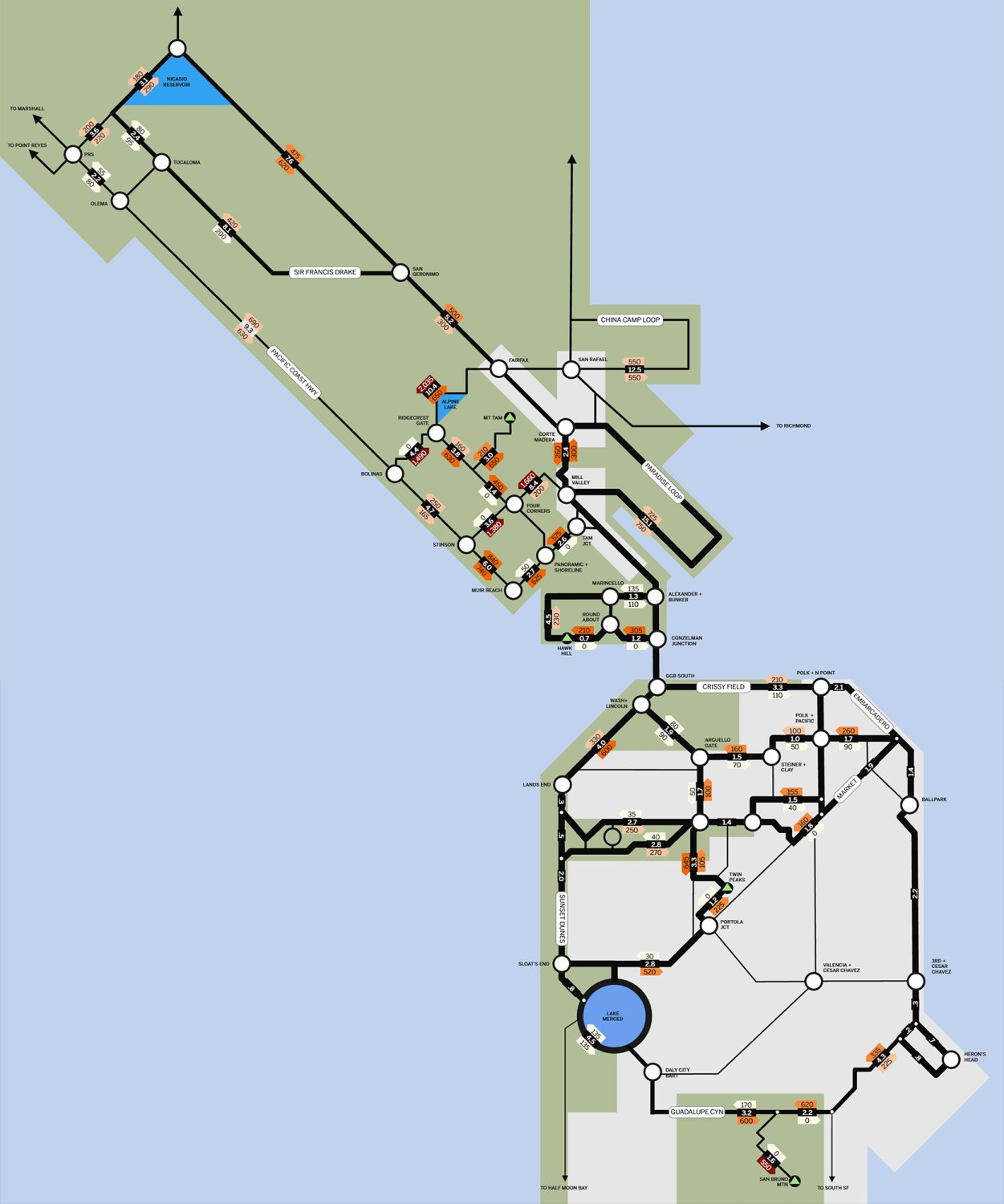
i couldn't come up with a graphically clear way to separate it into "routes" or "lines" with different colors, since it's not really like a transit network where things only go certain ways at junctions