Specialized and Garmin connectivity?

michaeljk1963

Member
Region
USA
I originally posted part of this in another thread about my recently purchased Specialized Tero 3.0, but thought it should be posted as a separate thread since I wasn't able to find one specifically addressing this topic, which is: what's a good solution for a Satellite-based navigation and communications device for when you are out of cell range that also connects to Specialized Mission Control and Ride apps?

I might also go look for a specialized forum to see what my options are for getting my Tero and a Garmin satellite device to work together, or just contact Specialized support.

I currently own a fairly old Garmin "e20" (I think that's the name). Great little device for navigation, but very small screen. I have used it to help me figure out where I am going in the Boundary Waters Canoe Area Wilderness (my cabin is about 20 miles from there), when you can't tell with observation whether what's in front of you is a peninsula, an island or maybe even an isthmus between two lakes! This will work for me for Mountain biking in a pinch, but for sure, I'd have to stop my bike, take it out, take my reading glasses out (I will be 60 in about 6 weeks), figure out where I am, and then put it away until the next time I am not sure where I am. It doesn't have bluetooth to connect to anything, including my phone, and it doesn't have any kind of communication built in (well, usb port solely for firmware and OS upgrades).

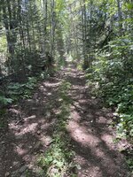
I don't have to go far at all near here (my cabin) to lose reception. There's basically a single highway coming out of Duluth along Lake Superior to Canada (made famous by Bob Dylan--Highway 61), along which there is fairly reliable cell reception, but move even just a few miles from the highway and you lose any signal. My cabin borders the Superior National Forest (I am very lucky that way), which is enormous, beautiful, and ver quicklJust yesterday, my wife and our two collie dogs were hiking up Carlton Peak Trail. There was a faint signal in the parking lot, 1 bar at most. We knew there was a chance of rain, but the Weather app put it at 30%. ½ mile into the hike, no signal. On our way up the trail, the wind picked up, then thunder, then rain, we waited for it to pass for a little while, but then it didn't, and the thunder became more frequent. We turned around, not knowing what to expect, and not wanting to be on the peak if there was lightning.

Here is what I care about: I want to be able to use a reliable map app on my phone when I have no cell signal, I want to be able to send an emergency SOS signal via satellite, and would also prefer weather access, two way messaging, and if possible, have it sync up to my Specialized Mission Control app and Ride app to record my ride. I took the suggestion of @indianajo and bought a Garmin inReach Mini 2. FYI, the link he sent in his recent message is for the inReach Mini, but there is a much improved Mini 2 version, with apparently 3 times the battery life, several new features, better bluetooth connectivity, and the ability to use Garmin's apparently much improved app (Explore rather than Earthmate). I bought my Garmin InReach Mini 2 from REI in case it doesn't end up "ticking all the boxes." Once I get it, I will try to figure out how to connect it to the Specialized Mission Control app, and report on my success or failure. If anyone is currently using this device with their Specialized eBike and can attest to their compatibility, that would be great! I did see that the Specialized Ride app does have an option in Settings for "Connected Accounts" and "Garmin Connect" is one of the options. I just don't know yet if the inReach Mini 2 will let me use Garmin Connect to connect to the Specialized Ride app. Even if it fails at that, if the Garmin Explore app gives me the ability to reliably use their navigation app on my phone that will be sufficient for me (some reviews of the original Mini complained about bluetooth failing on that older device and older app). There were other much more feature-rich satellite GPS devices out there, including the Montana 700, but they are much more expensive, heavier, larger, and don't have nearly the battery life of the inReach Mini 2, and even with a larger screen, I'd still rather use my phone for navigation because I don't have room for yet another device on my handlebars. I'll try the inReach Mini 2 and see how it goes, but if someone around here has a better option to suggest, I am all ears.
 
I want to be able to use a reliable map app on my phone when I have no cell signal
For that you just want any app that has the ability to download maps for offline use. Some have explicit options to do that (like Google maps), some tie it together with route planning (ridewithgps). Specialized says for Mission Control you should just view the target area in the map while still in coverage.
GPS location data does not require cell service so you don't need a dedicated device for this.
I want to be able to send an emergency SOS signal via satellite
Those devices are called "personal locator beacons". If you want more convenience features (like two-way messaging) there will be a subscription fee as well. Some of these are standalone, some are phone controlled, and some are integrated in other devices (Garmin makes some).
and would also prefer weather access,
Most devices are going to use wifi or cell data for this. SiriuxXM (as in satellite radio) does have a satellite based weather product that's available for aviation and marine applications. I don't know if there's a hiking/biking friendly version.
 
I want to be able to send an emergency SOS signal via satellite,
It seems Michael you want to kill two (or three) crows with one stone.

Garmin InReach Mini (as you know) will send SOS message and it looks like an invaluable tool for your hiking purposes. I cannot understand your wish that the device should connect to Mission Control/Ride apps: No device will.

I think you need a second e-bike specific device that will connect not to Mission Control/Ride apps but to your Tero 3.0. Currently, such e-bike GPS computers (that work offline) are Garmin Edge, Wahoo ELEMNT and Karoo2 devices. They provide e-bike communication, offline GPS navigation, and your ride recording.

I do not think there is a single device that can provide all the things you require. And using smartphone on your handlebars is the worst idea possible: short battery life, vulnerability to crashes, vulnerability to precipitation.
 
Thanks for your input Ben. In light of where I ride my bike (and hike, snowshoe, canoe and cross country ski) and with Type 1 diabetes, whatever I buy needs to have a personal locator beacon built into it. The basic subscription for the Garmin inReach Mini 2 is apparently about $15 per month, and I am willing to pay that for the insurance it provides for the safety of me, my wife, and our dogs when we are out of cell range.
It seems Michael you want to kill two (or three) crows with one stone.

Garmin InReach Mini (as you know) will send SOS message and it looks like an invaluable tool for your hiking purposes. I cannot understand your wish that the device should connect to Mission Control/Ride apps: No device will.

I think you need a second e-bike specific device that will connect not to Mission Control/Ride apps but to your Tero 3.0. Currently, such e-bike GPS computers (that work offline) are Garmin Edge, Wahoo ELEMNT and Karoo2 devices. They provide e-bike communication, offline GPS navigation, and your ride recording.

I do not think there is a single device that can provide all the things you require. And using smartphone on your handlebars is the worst idea possible: short battery life, vulnerability to crashes, vulnerability to precipitation.
You are correct Stefan--I was hoping I could find a device that would both let me send SOS emergency beacon/message and also connect to my bike's app, but alas, it appears this will not be the case. The good news is, the inReach Mini 2 works with Garmin's Explore app, so I will be able to navigate just fine when out of cell phone signal. That's good enough for me, even if it won't tell the Mission Control app where I am. I can still use the "My Ride" features to track my workout though.
 
…I was hoping I could find a device that would both let me send SOS emergency beacon/message and also connect to my bike's app, but alas, it appears this will not be the case. The good news is, the inReach Mini 2 works with Garmin's Explore app, so I will be able to navigate just fine when out of cell phone signal. That's good enough for me, even if it won't tell the Mission Control app where I am. I can still use the "My Ride" features to track my workout though.

this device exists and is called an iPhone - or presumably many other types of smartphones. navigates while offline (assuming you downloaded the maps for the region), runs the mission control app natively, and can send SOS satellite messages with location and other info for free while out of cell service.

bike computers vs phones are a bit like clipless vs flats, tubeless vs tubes, disc vs rim, and a bunch of other things in cycling that some people feel irrationally strong about. you’ll have to weigh whether having less devices is more important to you than the tradeoffs associated with using a phone as your primary bike computer / navigator / e-bike controller. there are many advantages as well.

i will note that while i typically cycle relatively near civilization and rescue, i’ve done perhaps 15,000 miles with nothing but an iPhone on my e-bike and regular bikes handlebars. zero issues. if i know a ride is going to be >8 hours, or i expect to use a lot of mapping and communication services, i throw a tiny extra battery in my pocket.

it’s a pretty robust service:

 
I would not jeopardize an expensive smartphone on a rough trail. Lost too many of them.
The battery life is a laugh, too.
 
this device exists and is called an iPhone - or presumably many other types of smartphones. navigates while offline (assuming you downloaded the maps for the region), runs the mission control app natively, and can send SOS satellite messages with location and other info for free while out of cell service.

bike computers vs phones are a bit like clipless vs flats, tubeless vs tubes, disc vs rim, and a bunch of other things in cycling that some people feel irrationally strong about. you’ll have to weigh whether having less devices is more important to you than the tradeoffs associated with using a phone as your primary bike computer / navigator / e-bike controller. there are many advantages as well.

i will note that while i typically cycle relatively near civilization and rescue, i’ve done perhaps 15,000 miles with nothing but an iPhone on my e-bike and regular bikes handlebars. zero issues. if i know a ride is going to be >8 hours, or i expect to use a lot of mapping and communication services, i throw a tiny extra battery in my pocket.

it’s a pretty robust service:

Thanks for the reminder of the iPhone's recent capability to do SOS communications. I have an iPhone 12 Pro, though, and don't necessarily want to spend $1,200 to get a new phone, instead of $400 for the Garmin device. I was planning to wait for the iPhone 16 Pro, in late 2024, but now that you've reminded me of this, I will need to rethink my plans. I will also need to look into reports of the iPhone's SOS service's reliability compared to Garmin.

I have used the Google Downloaded maps when traveling before, and also have Alltrails, where you can download maps and routes to be used offline. I can't remember, though, if when you are offline, your phone will tell you where you are on the map (true GPS navigation). I don't think they do, but might be mistaken.
 
I would not jeopardize an expensive smartphone on a rough trail. Lost too many of them.
The battery life is a laugh, too.
I have two locations for my phone. When traveling on pavement or relatively smooth gravel or dirt, I will be using a robust and secure handlebar holder (made for motorcycles). When I have gone on rougher terrain, I put my phone in my top tube bag, where it obviously isn't available to read all the time, but is handy at all times. I bought a Tero 3.0 because I know I will not be doing any serious downhill mountain biking (like my son and I used to do out in the Colorado mountains with our old analog MTBs). I am just too old for that, and with my Type 1 diabetes, if I am seriously injured (broken arm, wrist, ankle or leg), I risk infections and even possibly amputations. No thanks!

I really need my phone as accessible as possible, not really for navigation, but to keep an eye on my blood sugar. Yesterday, I took a 25 mile ride, despite starting with a good blood sugar reading of 128, I quickly dipped to 72, then ate some glucose tablets, then a bit later dipped to 58, stopped, had a protein bar, several more glucose tablets waited until my blood sugar was back up to 110, and then was back down to 68 by the end of the ride. This is the nature of the beast with Type 1 when you are trying to have good control.
OK, I understand now. Do you carry a power pack with you, too? It looks a necessary thing for you!
 
I can't remember, though, if when you are offline, your phone will tell you where you are on the map (true GPS navigation). I don't think they do, but might be mistaken.
Whenever your maps are downloaded to the phone, you will be navigated offline. I was in a similar situation in the mountains three years ago and that was the last time I did not download the maps for the offline use! Not only missing network coverage but also a neighbouring country! (Now we have free roaming service throughout European Union).
 

I have used the Google Downloaded maps when traveling before, and also have Alltrails, where you can download maps and routes to be used offline. I can't remember, though, if when you are offline, your phone will tell you where you are on the map (true GPS navigation). I don't think they do, but might be mistaken.

it depends on the application. i wouldn’t use google maps for something like this - rideWithGPS, cadence, or many others have better informations displays and cycling specific features. but all the ones i’ve used will still navigate offline as long as the maps are cached.
 
it depends on the application. i wouldn’t use google maps for something like this - rideWithGPS, cadence, or many others have better informations displays and cycling specific features. but all the ones i’ve used will still navigate offline as long as the maps are cached.
I took your suggestion and downloaded the ride with GPS app to my phone. In order to be able to use the offline feature, though, you have to pay a rather steep subscription fee of $7.99 per month. There's a less expensive annual option, but I plan to use the monthly subscription through October, then cancel again until next May.

Yesterday, I went for a 25 mile bike ride on very primitive National Forest Fire Roads, with a significant (for me) elevation climb (1600 feet). There are no markers at some intersections and some of the roads looking more like mere trails, with fallen trees lying across the road that look like they've been there all year, and water and mud patches with no car, bike, or even ATV tread tracks, so no cars have been using at least one long stretch of "road." I didn't see one other person, bike, or vehicle on the entire ride. I took a wrong turn two times and Ride With GPS beeped at me until I took my phone out and looked at what I needed to do to get back on track. The beeping is not obvious though. I wish it would just tell you "you are off course"--maybe there's a setting I need to find so it does this. The map view makes it obvious, though, what you need to do to get back on track. I had to my phone inside a top tube bag with bluetooth headphones for turn by turn navigation--roads were too rough to use a handlebar holder for my phone. Nice to know this option works just fine. I had a great time, and now feel pretty secure with Ride With GPS and my iPhone.

To end this thread (or my need to explore what to do), I want to thank everyone for their input. Now that I have successfully used a very good navigation tool without any cell coverage, and am satisfied with reviews of the iPhone's satellite SOS capabilities, I will be returning my unopened Garmin InReach today and planning to buy an iPhone 15 later this year, instead of waiting for the 16, for the SOS emergency capability. Oh, and next spring, I will set my bike up as tubeless!!
 

Attachments

  • IMG_6858.jpeg
    IMG_6858.jpeg
    756.4 KB · Views: 108
  • IMG_6860.jpeg
    IMG_6860.jpeg
    358.3 KB · Views: 96
b
I took your suggestion and downloaded the ride with GPS app to my phone. In order to be able to use the offline feature, though, you have to pay a rather steep subscription fee of $7.99 per month. There's a less expensive annual option, but I plan to use the monthly subscription through October, then cancel again until next May.

Yesterday, I went for a 25 mile bike ride on very primitive National Forest Fire Roads, with a significant (for me) elevation climb (1600 feet). There are no markers at some intersections and some of the roads looking more like mere trails, with fallen trees lying across the road that look like they've been there all year, and water and mud patches with no car, bike, or even ATV tread tracks, so no cars have been using at least one long stretch of "road." I didn't see one other person, bike, or vehicle on the entire ride. I took a wrong turn two times and Ride With GPS beeped at me until I took my phone out and looked at what I needed to do to get back on track. The beeping is not obvious though. I wish it would just tell you "you are off course"--maybe there's a setting I need to find so it does this. The map view makes it obvious, though, what you need to do to get back on track. I had to my phone inside a top tube bag with bluetooth headphones for turn by turn navigation--roads were too rough to use a handlebar holder for my phone. Nice to know this option works just fine. I had a great time, and now feel pretty secure with Ride With GPS and my iPhone.

To end this thread (or my need to explore what to do), I want to thank everyone for their input. Now that I have successfully used a very good navigation tool without any cell coverage, and am satisfied with reviews of the iPhone's satellite SOS capabilities, I will be returning my unopened Garmin InReach today and planning to buy an iPhone 15 later this year, instead of waiting for the 16, for the SOS emergency capability. Oh, and next spring, I will set my bike up as tubeless!!
nice! sounds like a fantastic ride. and the bike looks great.

you could consider one of these if the routes are too rough to put the phone on the bars. you can’t really interact with it in detail but you’d be able to see the screen clearly.

 
Back