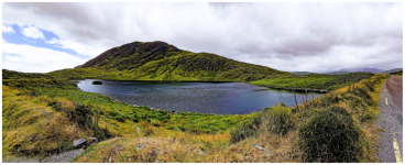
Ireland Cycling: County Kerry (and Cork, with Donegal mentioned)

Stefan Mikes

Gravel e-biker
Region
Europe
City
Mazovia, PL
I've been to Ireland thrice.
  • Dublin is a one day visit and you've seen it all :)
  • County Donegal is very sparsely populated (which is a good thing for a tourist) but I could only find a single area that was breathtaking: Malin Beg with Slieve League cliffs (I will cover it briefly later on)
  • County Kerry is the actual gem. You can do either a car or bike/e-bike trip as all roads are paved, and the drivers of Ireland respect the cyclists. Actually, the area is bustling with the cycling activity, and e-bike rentals can be found in bigger locations (such as Dingle or Killarney). We also went in Bantry, County Cork to find one of the most exciting routes to by taken by e-bike in that area.
Kerry is especially attractive as Ryanair is frequently flying to Kerry Airport Farranfore (KIR). Let me start with naming several towns of Kerry where e-bike rental is doable:
Of course, more e-bike rentals are available, please do your research. Usually, a daily e-bike rental is at or below EUR 50.

I need to mention the village of Castlemaine (14 km from the airport, no bike rental). This small beautiful place with a single B&B (Castlemaine House), a good restaurant nearby (Griffin's) and a grocery store (At Helena) is indeed a hub connecting all the routes, and I greatly recommend a stay there. Importantly, the trip from Dingle (in Dingle Peninsula) to either Cahersiveen or Valentia Island (in Iveragh Peninsula) might require a stop for the night in either Castlemaine or Killorglin (a town).

Important tip
All rides should be taken anti/counter-clockwise. The tourist coaches travel clockwise on all routes; you would like to avoid such a displeasure!

ROUTES (all routes in GPX format can be found under this link)

01 Dingle Peninsula North 75 km, 993 m elevation height
This route starts in Castlemaine, does not enter the county's capital city Tralee, leads through beautiful Blennerville. The highlights are:
  • The Maharees: a 5 km long isthmus north past Castlegregory with beaches on either side
  • Conor's Pass: The second highest mountain pass of Ireland, with a waterfall, a short hiking trail above the waterfall to a hidden mountain lake, and amazing views from the pass' summit
  • You end the trip in the town of Dingle, another hub on the trip.
02 Slea Head Drive 59 km, 800 m elevation height
The kosher route (allowing you to take all the trip along the coast is clockwise. Taking it anti-clockwise helps you avoid traffic but forces you for a return shortcut as described below. It is a loop ride from/to Dingle The highlights are:
  • Views of Brandon Mountain
  • A breathtaking view at Brandon Creek
  • A visit in West Kerry Brewery (Reask)
  • Ballyferriter Village where "The Last Jedi" was filmed
  • Many shockingly beautiful views on the west coast (i.a. Great Blasket Island)
  • Slea Head, the westernmost point of Europe (it is slightly west of Cabo de Roca in Portugal on the continent)
  • Ventry, the heart of Gaeltacht (Gaelic Irish speaking area) and a place important to Gaelic Football (GAA)
After seeing Slea Head, you are not allowed to continue by the coastline road (one-way traffic there), so you need to ride back a little and take the aforementioned shortcut east to Ventry.

03 Dingle Peninsula South and Ring of Kerry North 102 km, 800 m elevation gain
This route is too long for most e-bikes. I recommend stopping for the night either in Castlemaine or perhaps in the town of Killorglin.
  • The Griffin's in Castlemaine opens at 12:30 pm, which is very early as for the restaurants in the area. It is an excellent place!
  • Cahersiveen (KEUGH-see-veen) is an important town in the area. Do your shopping (and eating) there before continuing to Valentia Island
  • Then you take the Valentia Island Ferry to Knightstown in Valentia Island. I recommend buying a return ticket, which is cheaper than the single one. You can buy the ticket from a sailor onboard. The ferry travels every 15 minutes and the trip takes 5 minutes.
Valentia Island
Located past the 10th degree longitude West, it is a wonderful place. We stayed at Reenglass House, a very old residence. There is a single restaurant (Royal) in nearby Knightstown -- making a booking is necessary -- and a single small grocery store :) You can always ride several kilometres west, take a bridge to Portmagee and enjoy!

04 Skellig Ring 58 km, 985 m elevation gain
This route explores the beauty of the very west part of Iveragh Peninsula.
  • Valentia Island Lighthouse
  • Geokaun Mountain (paid entry), spectacular views, cliffs as well!
  • Cliffs of Kerry (paid entry, very well marked to find) - amazing!
  • Climb and switchbacks :)
  • Skellig Chocolate Factory and Cafe near St. Finian's Bay - a must! They make hot chocolate from genuine chocolate!
  • Ballinskelligs - ruins of a castle, nice views
  • Return to Valentia Island Ferry (I recommend shopping and dining in Cahersiveen though).
05 Ring of Kerry South 89 km, 900 m elevation gain
This ride might be too long for an e-bike. I could recommend taking an overnight stay in beautiful Sneem.
  • The route shows a detour to see the Staigue Stone Castle. Unless you are especially interested in ancient engineering, do not go there :)
  • Beautiful views all the way
  • Sneem offers good dining places. There are plenty of B&Bs there
  • The end of the route is in beautiful little town of Kenmare, another important hub
06 Caha Pass and Priest's Leap 58 km and 1170 m elevation gain
It is made as a proper cycling route (the car should get to Glengarriff by the main road!) The cycling route skips Bantry and the main stop should be made in Glengarriff. This is for adventurers only!
  • The first phase involves riding via Beara Way Cycling Route
  • At some 13.8 km you will get on the Wild Atlantic Way and climb up to Caha Tunnel for some 5 km
  • Soon after the tunnel, you must leave the main road and continue on local roads all the way south to rejoin the Wild Atlantic Way at some 25.3 km.
  • Enjoy your stay in Glengarriff!
  • You will continue on N71 until the crossing at some 31.5 km. Leave the main road. The route will take you right to Coomhola Bridge, where you will be instructed to turn into...
  • ...an old, cracked asphalt, winding road with endless climb, climb and descend, climb and descent until you climb onto the summit, or Priest's Leap, the highest pass of all Ireland. The views are more than rewarding! Then, you need to carefully descend all the way to Bonane
  • Then you are directed by side-roads all way to Kenmare.
I need to mention that the Priest's Leap is a very well known place, and many people got there on bikes or by car! It is difficult but not extremely dangerous (provided your brakes work properly!)

07 Killarney National Park, Ring of Kerry East 41 km, 480 m elevation gain
This is a beautiful route!
  • Firstly, you climb onto Moll's Gap
  • You need to visit Avoca store there. I recommend going upstairs and have a lunch. The views through the windows are astonishing. The house rule is you must order something in the upstairs bar to remain in the room :) Downstairs, there is a cafeteria, toilets and a nice gift shop
  • The route tells you to ride in the direction of Sneem. Please do it. As soon as you have seen Loughbarfinnihy (gorgeous lake!) go back and then continue to Killarney from Moll's Gap. (We mistakenly rode in the direction of Sneem past the lake).
  • Don't miss the clearly marked parking of the Ladies View. The views are stunning there!
I recommend The Gardens in Killarney for a stay.

08 Gap of Dunloe - Black Valley - Muckross Lake 58 km, 530 m elevation gain
I have never ride it but my cousin who lives nearby tells me the view are the most spectacular there!

COUNTY DONEGAL
EXTRA_DONEGAL_Carrick_Malin_Beg_Glencolumnbkille_Ireland_by_Bike_rental_.gpx
34 km, 550 m elevation gain
Riding from Carrick onto the loop to Malin Beg provides spectacular views, especially the Silver Strand Beach in Malin Beg.
  • Your base could be in Killybegs, Donegal
  • The e-bike rental is in Carrick F94 VY84
  • You must see the Silver Strand Beach!
  • You can see early 19th c watchtowers every few miles (intended to inform of a possible Napoleonic invasion))
  • You can see impressive cliffs of the area
  • There is a memorial in Glencolumbkille: a map of Ireland with all 32 counties (including British Northern Ireland), made of stone brought from each county
  • There is a Folk Village in Glencolumbkille (Glencolmcille, the same place)
If you are interested, I can post the best photos from each trip!
 
Last edited:
I've been to Ireland thrice.
  • Dublin is a one day visit and you've seen it all :)
  • County Donegal is very sparsely populated (which is a good thing for a tourist) but I could only find a single area that was breathtaking: Malin Beg with Slieve League cliffs (I will cover it briefly later on)
  • County Kerry is the actual gem. You can do either a car or bike/e-bike trip as all roads are paved, and the drivers of Ireland respect the cyclists. Actually, the area is bustling with the cycling activity, and e-bike rentals are to be found in bigger locations (such as Dingle or Killarney). We also went in Bantry, County Cork to find one of the most exciting routes to by taken by e-bike in that area.
Kerry is especially attractive as Ryanair is frequently flying to Kerry Airport Farranfore (KIR). Let me start with naming several towns of Kerry where e-bike rental is doable:
Of course, more e-bike rentals are available, please do your research. Usually, a daily e-bike rental is at or below EUR 50.

I need to mention the village of Castlemaine (14 km from the airport, no bike rental). This small beautiful place with a single B&B (Castlemaine House), a good restaurant nearby (Griffin's) and a grocery store (At Helena) is indeed a hub connecting all the routes, and I greatly recommend a stay there. Importantly, the trip from Dingle (in Dingle Peninsula) to either Cahersiveen or Valentia Island (in Iveragh Peninsula) might require a stop for the night in either Castlemaine or Killorglin (a town).

Important tip
All rides should be taken anti/counter-clockwise. The tourist coaches travel clockwise on all routes; you would like to avoid such a displeasure!

ROUTES (all routes in GPX format can be found under this link)

01 Dingle Peninsula North 75 km, 993 m elevation height
This route starts in Castlemaine, does not enter the county's capital city Tralee, leads through beautiful Blennerville. The highlights are:
  • The Maharees: a 5 km long isthmus north past Castlegregory with beaches on either side
  • Conor's Pass: The second highest mountain pass of Ireland, with a waterfall, a short hiking trail above the waterfall to a hidden mountain lake, and amazing views from the pass' summit
  • You end the trip in the town of Dingle, another hub on the trip.
02 Slea Head Drive 59 km, 800 m elevation height
The kosher route (allowing you to take all the trip along the coast is clockwise. Taking it anti-clockwise helps you avoid traffic but forces you for a return shortcut as described below. It is a loop ride from/to Dingle The highlights are:
  • Views of Brandon Mountain
  • A breathtaking view at Brandon Creek
  • A visit in West Kerry Brewery (Reask)
  • Ballyferriter Village where "The Last Jedi" was filmed
  • Many shockingly beautiful views on the west coast (i.a. Great Blasket Island)
  • Slea Head, the westernmost point of Europe (it is slightly west of Cabo de Roca in Portugal on the continent)
  • Ventry, the heart of Gaeltacht (Gaelic Irish speaking area) and a place important to Gaelic Football (GAA)
After seeing Slea Head, you are not allowed to continue by the coastline road (one-way traffic there), so you need to ride back a little and take the aforementioned shortcut east to Ventry.

03 Dingle Peninsula South and Ring of Kerry North 102 km, 800 m elevation gain
This route is too long for most e-bikes. I recommend stopping for the night either in Castlemaine or perhaps in the town of Killorglin.
  • The Griffin's in Castlemaine opens at 12:30 pm, which is very early as for the restaurants in the area. It is an excellent place!
  • Cahersiveen (KEUGH-see-veen) is an important town in the area. Do your shopping (and eating) there before continuing to Valentia Island
  • Then you take the Valentia Island Ferry to Knightstown in Valentia Island. I recommend buying a return ticket, which is cheaper than the single one. You can buy the ticket from a sailor onboard. The ferry travels every 15 minutes and the trip takes 5 minutes.
Valentia Island
Located past the 10th degree longitude West, it is a wonderful place. We stayed at Reenglass House, a very old residence. There is a single restaurant (Royal) in nearby Knightstown -- making a booking is necessary -- and a single small grocery store :) You can always ride several kilometres west, take a bridge to Portmagee and enjoy!

04 Skellig Ring 58 km, 985 m elevation gain
This route explores the beauty of the very west part of Iveragh Peninsula.
  • Valentia Island Lighthouse
  • Geokaun Mountain (paid entry), spectacular views, cliffs as well!
  • Cliffs of Kerry (paid entry, very well marked to find) - amazing!
  • Climb and switchbacks :)
  • Skellig Chocolate Factory and Cafe near St. Finian's Bay - a must! They make hot chocolate from genuine chocolate!
  • Ballinskelligs - ruins of a castle, nice views
  • Return to Valentia Island Ferry (I recommend shopping and dining in Cahersiveen though).
05 Ring of Kerry South 89 km, 900 m elevation gain
This ride might be too long for an e-bike. I could recommend taking an overnight stay in beautiful Sneem.
  • The route shows a detour to see the Staigue Stone Castle. Unless you are especially interested in ancient engineering, do not go there :)
  • Beautiful views all the way
  • Sneem offers good dining places. There are plenty of B&Bs there
  • The end of the route is in beautiful little town of Kenmare, another important hub
06 Caha Pass and Priest's Leap 58 km and 1170 m elevation gain
It is made as a proper cycling route (the car should get to Glengarriff by the main road!) The cycling route skips Bantry and the main stop should be made in Glengarriff. This is for adventurers only!
  • The first phase involves riding via Beara Way Cycling Route
  • At some 13.8 km you will get on the Wild Atlantic Way and climb up to Caha Tunnel for some 5 km
  • Soon after the tunnel, you must leave the main road and continue on local roads all the way south to rejoin the Wild Atlantic Way at some 25.3 km.
  • Enjoy your stay in Glengarriff!
  • You will continue on N71 until the crossing at some 31.5 km. Leave the main road. The route will take you right to Coomhola Bridge, where you will be instructed to turn into...
  • ...an old, cracked asphalt, winding road with endless climb, climb and descend, climb and descent until you climb onto the summit, or Priest's Leap, the highest pass of all Ireland. The views are more than rewarding! Then, you need to carefully descend all the way to Bonane
  • Then you are directed by side-roads all way to Kenmare.
I need to mention that the Priest's Leap is a very well known place, and many people got there on bikes or by car! It is difficult but not extremely dangerous (provided your brakes work properly!)

07 Killarney National Park, Ring of Kerry East 41 km, 480 m elevation gain
This is a beautiful route!
  • Firstly, you climb onto Moll's Gap
  • You need to visit Avoca store there. I recommend going upstairs and have a lunch. The views through the windows are astonishing. The house rule is you must order something in the upstairs bar to remain in the room :) Downstairs, there is a cafeteria, toilets and a nice gift shop
  • The route tells you to ride in the direction of Sneem. Please do it. As soon as you have seen Loughbarfinnihy (gorgeous lake!) go back and then continue to Killarney from Moll's Gap. (We mistakenly rode in the direction of Sneem past the lake).
  • Don't miss the clearly marked parking of the Ladies View. The views are stunning there!
I recommend The Gardens in Killarney for a stay.

08 Gap of Dunloe - Black Valley - Muckross Lake 58 km, 530 m elevation gain
I have never ride it but my cousin who lives nearby tells me the view are the most spectacular there!

COUNTY DONEGAL
EXTRA_DONEGAL_Carrick_Malin_Beg_Glencolumnbkille_Ireland_by_Bike_rental_.gpx
34 km, 550 m elevation gain
Riding from Carrick onto the loop to Malin Beg provides spectacular views, especially the Silver Strand Beach in Malin Beg.
  • Your base could be in Killybegs, Donegal
  • The e-bike rental is in Carrick F94 VY84
  • You must see the Silver Strand Beach!
  • You can see early 19th c watchtowers every few miles (intended to inform of a possible Napoleonic invasion))
  • You can see impressive cliffs of the area
  • There is a memorial in Glencolumbkille: a map of Ireland with all 32 counties (including British Northern Ireland), made of stone brought from each county
  • There is a Folk Village in Glencolumbkille (Glencolmcille, the same place)
If you are interested, I can post the best photos from each trip!
I wish I lived in Sneem
Where ya from, you fine cycling man!
Aye Im a man from Sneem and proud of it I am
 
The Best Photos From Routes We Covered In A Car
(Each post another route)

Route 01: Castlemaine to Dingle via Conor's Pass (Dingle Peninsula North)
1786735618227.png

1786735975875.png

The Maharees (Fahamore) past Castlegregory.

1786735678744.png

A waterfall below Conor's Pass.

1786736145549.png

Just below the Conor's Pass.

1786735856471.png

1786735899436.png

From a hiking trail above the waterfall.

1786736016722.png

A French cyclist who had just climbed the Conor's Pass (riding counterclockwise like we did). I could also see e-bikers there.

1786736100735.png

1786736115343.png

Views from Conor's Pass both ways. You can see the Atlantic in each picture.

1786736277790.png

The town of Dingle, the tourist capital for the west of the peninsula.

1786736349367.png

A pub and a hardware store in one, Main Street Dingle. Live Irish music is being played there.
 
Last edited:
The Best Photos...
02 Slea Head Drive (A loop ride from Dingle, anticlockwise)


1786736815413.png

Brandon Peak as photographed from a pretty large distance (looks more impressively that way) :)

1786736942044.png

Brandon Creek (much earlier on the trip).

1786736975076.png

I cannot identify that rock formation.

1786737001141.png

West Kerry Brewery in Reask.

1786737031134.png

Ballyferriter Village (where "The Last Jedi" was filmed). Besides, an excellent restaurant in this hotel.

1786737744944.png

1786737101847.png

First cliffs. The scenes from the Last Jedi were filmed exactly there (with a short sequence on Skellig Michael Island in the Atlantic).

1786737178196.png

Great Blasket Island. We planned a boat trip to that island on that day but the skipper decided to cancel the cruise. The waters around islands could be dangerous even on a clear day, and local sailors know it!

1786737308635.png

I am almost sure it is not the famous Skellig Michael island but the island with an ancient monastery looks very similar to this one!

1786737398616.png

Slea Head. It is the westernmost edge of the whole European Union, slightly farther west than the Portugal's Cabo de Roca on the mainland.

1786737488212.png

A cross country ride to Ventry.

1786737522500.png

Ventry in the heart of Gaeltacht (Irish speaking area). Paidi O Se (read: pawdy oh shey), the most famous player of Gaelic Football (the discipline only known in Ireland and among some Irish expat communities). Paidi was born and died in Ventry.

1786737681817.png

1786737695689.png

1786737711165.png

Dingle.
 
The Best Photos...
03 From Dingle to Valentia Island (via Castlemaine, Killorglin, Cahersiveen and Reenard Point)


1786738282851.png

The beach in Inch. The cape here makes the passage from the Dingle Bay to Castlemaine Harbour (still a large bay) narrow, protecting the inner bay from the Atlantic waves. The road is mountainous until this point to become flatter and more straight eastwards.

1786738456766.png

We reached Castlemaine on the Dingle Peninsula first and had a lunch there. Then we continued the northern segment of the famous Ring of Kerry on the Iveragh Peninsula to Cahersiveen and then to Reenard Point with the ferry to Valentia Island. No pictures from the trip as we were actually fed up with the "mountain and sea" views and wanted to complete a long trip possibly early! (The buildings on the opposite shore is Knightstown).

1786738633914.png

Self explaining!

1786738716800.png

Reenglass House, Reenglass, Valentia Island.

1786738771900.png

The view on the strait from behind the Big Tree.

1786738844168.png

Portmagee, a village behind the strait on the mainland.

1786738901595.png

A view from Portmagee. A contemporary bridge connects the island with the mainland.
 
The Best Photos...
04 Skelligs Ring


We started the trip with exploring Valentia Island (which is, technically speaking, not on the Ring but more than worthwhile!)

1786739527771.png

Getting to Valentia Lighthouse was difficult because of narrow, winding and steep roads. (The Lighthouse can be visited for a fee but it only makes sense on a beautiful day, and that one was not!)

1786739661216.png

Geokaun Mountain (paid entry). View on the cliffs.

1786739711956.png

Portmagee as seen from the summit of Geokaun.

1786739766358.png

Horse and Long islands as seen from Valentia Island.

1786739829904.png

The higher of the two viewpoints onto the Cliffs of Kerry (paid entry to the whole area).

1786739892084.png

Beehive huts or the masterpiece of ancient engineering. (It is the drystone technique, no mortar). Similar but historical huts can be seen on Skelligs Michael island and in the Last Jedi.

1786740022502.png

The more easily accessible viewpoint. Notice the weather change (to very bad).

1786740075435.png

The Cliffs of Kerry seen through heavy raining. The big island in the background is Valentia.

1786740107748.png

The Irish weather can change in a few minutes. Heavy raining and a very strong wind!


No photos from impressive switchbacks on the trip continuation.

1786740187043.png

Wet and unhappy, we rode to the Skelligs Chocolate Factory. Hot chocolate made of the genuine stuff had boosted our morale!

1786740294100.png

The ruins of MacCarthy clan castle in Ballinskellig. (Ireland had a long long history before the English conquest!)

1786740369856.png

Valentia Island was the first place that connected Europe with Newfoundland by a subsea telegraph cable in 1866. It was done from there for the shortest possible distance to the American continent!
 
Last edited:
The Best Photos...
05 Valentia Island to Kenmare (Ring of Kerry West and South)


1786741274258.png

I took a swim in the ocean at 7 a.m. :)

1786741326010.png

1786741339315.png

Beautiful village of Waterville.

1786741372034.png

Which way of eating scones do you prefer, @Chargeride? :) I like having the cream on the top!

1786741449142.png

Like country, like tourists :)

1786741482807.png

1786741550058.png

A view on Bealtra. The larger of the two islands is Abbey. Early Irish monks loved settling on islands!

1786741585206.png

Staigue Stone Fort. A waste of time if you ask me :)

1786741614902.png

In Sneem, where Charge would like to live :)

1786741674062.png


1786741658693.png

1786741698516.png

Kenmare, a craft brewery and an IPA from that brewery.
 
The Best Photos...
06 A loop ride from Kenmare: Glengarriff and the return via Priest's Leap!


Our car trip was different from the cycling route I've shown in the original post. We went to Bantry but let us skip Bantry now.

1786742446341.png

After having passed Caha Tunnel, you would take an alternate route down through the greenery!
1786742515919.png

A tandem in Glengarriff, County Cork.
1786742562093.png

The most exciting route from Coomhola Bridge (Cork) to Bonane (Kerry) via Priest's Leap (the highest mountain pass in Ireland).
1786742678814.png

At the top of one of the climbs, I could not see which way to drive as the car's bonnet was obscuring the view! My gf had to take this photo so I could understand which way to drive!
1786742833548.png

The summit.
1786742851115.png

A big format camera pointing towards Kerry.

1786742922078.png

A view onto the Bantry Bay.
 
So there's no agreement as to the pronunciation, same as there is no agreement where the jam and cream should go :)
The biggest dispute of this type in Poland is whether Kielecki or Winiary mayonnaise is better, and there's always a third party to prefer their local variety :) I can troll my friends in Poland as much as I like: they always respond to the tease! :D
 
Besides, I've heard an interesting story from my cousin in Cork. He used to work in Londonderry/Derry but lived in Ireland nearby; it was in 1999 soon after the peace was made. One of the first questions he asked his landlady for was whether she'd serve the English or Irish Breakfast. As you know the best, it was a dangerous question!

She thought for a while then carefully replied: "Which one is better to your taste?"
 
Back